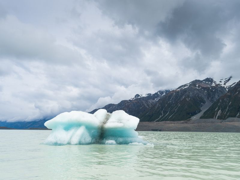
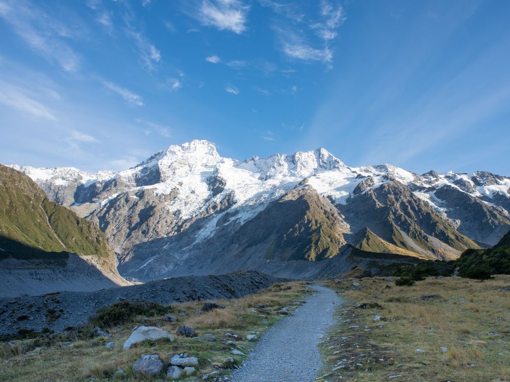
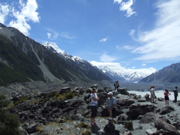
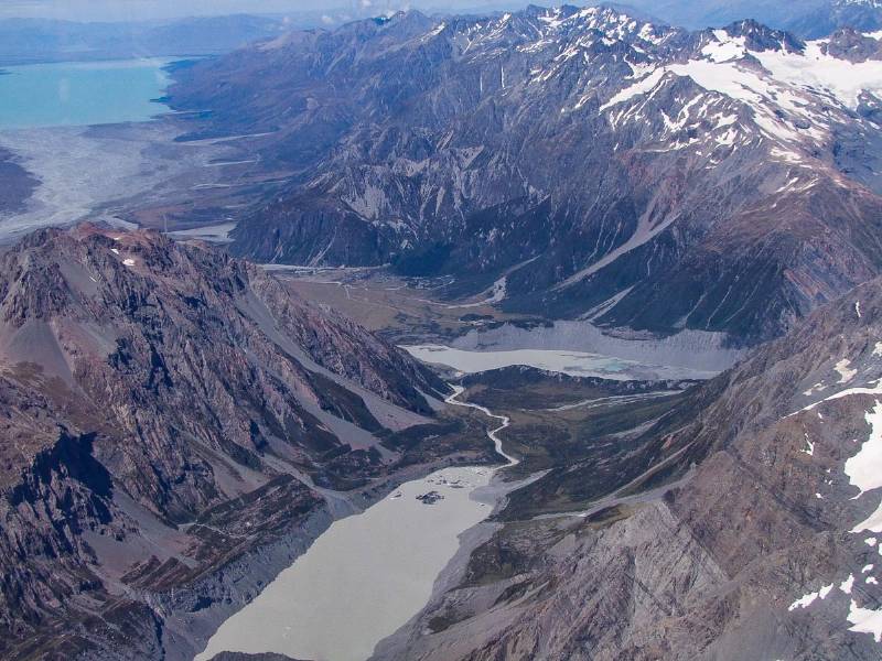
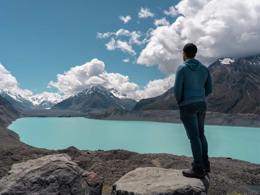
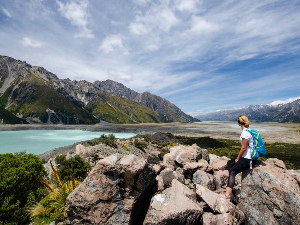
The Tasman Lake Track is a flat easy walk that starts just past the Blue Lakes shelter

Access: The track’s starting point is accessible by road from the village of Mount Cook. The car park is at the Blue Lakes. Keep in mind that weather conditions can change rapidly in the alpine environment, so it’s a good idea to check the weather forecast and be prepared with appropriate clothing and gear.

Quick Facts about this walk

  • Location: Tasman Lake Track is situated within Aoraki / Mount Cook National Park on the South Island of New Zealand
  • Time needed: 50 mins to 1 hour walk return
  • Distance: 2.5 km
  • Difficulty: Very easy
  • Bikes allowed: No
  • Wet Feet: No
  • Toilets: There are toilets at the start of the walk.
  • Dogs: No, dogs are not allowed in the national park.
  • Mobile Coverage: Yes, very good
Awesome iceberg floating around in the Tasman Lake

Description of my walk on the Tasman Lake Track

You start at the same car park for both this walk and the Blue Lakes and Tasman Glacier View Track & Lookout.

The track divides into two, but as it is a short walk, it is easy to do both sides of the track. Whichever side of the track you choose, you will be rewarded with views of the mountains and the lake.

This track will lead you downwards to the base of the lake. The descent is gradual and does not prove to be a difficult incline for your return.

From the base of the lake, you will be able to see where the lake turns into the Tasman River. Even at such a distance from the glacier, you may find icebergs floating at the edge of the lake. No promises, however! 

Best time to visit:

The track can be walked year-round, but the best time to visit is during the warmer, summer months of November to April. Keep in mind in winter it won’t be as nice, it’s really cold!

Summary points about this walk

See more of my walks nearby in Mt Cook

Hooker Valley Track in front with snow capped mountains in the background, just beautiful

Hooker Valley Track, Mount Cook

As we hiked the Hooker Valley Track, we saw snow-capped mountains, crossed three swing bridges, and marveled at a glacier lake with floating icebergs!
Walk details →
Tasman Glacier Lake lookout point with lots of other people

The Tasman Glacier Lake Lookout Track

0.7 km • 40 mins round trip • Medium • A popular hiking trail located in Aoraki/Mount Cook National Park on the South Island of ...
Walk details →
Bowen Bush Walk - Mt Cook

Bowen Bush Walk

0.2 km • 10-15 minutes • Very easy
Walk details →
Glencoe Walk in Mt Cook National Park - South Island - New Zealand - Copyright Freewalks.nz

Glencoe Walk

0.5 km • 30 minutes • Easy, though steep
Walk details →
Looking out over Mount Wakefield and Mount Cook, New Zealand Freewalks.nz

Governors Bush Walk

1.5 km • 1 hour • Easy
Walk details →
People walking along Kea Point Track at Mt Cook, New Zealand Freewalks.nz

Kea Point Track

2.8 km or 5.6 km • 1-2 hours • Easy
Walk details →
Reflection of Mt Cook on the Red Tarns track, New Zealand Freewalks.nz

Red Tarns Track

4 km • 2 hours • Medium
Walk details →
Stunning views over the Sealy Tarns Track at Mt Cook, New Zealand Freewalks.nz

Sealy Tarns Track

5.8 km • 4 hours • Difficult
Walk details →
Stunning view of Mueller Hut in Mt Cook

Mueller Hut Route

10.4 km • 8 hours • Difficult
Walk details →
The Ball Hut Route track takes you along the length of the Tasman Lake in New Zealand Freewalks.nz (1)

Ball Hut Route

15.6 km • 8 hours • Medium
Walk details →
Looking out over the Ball Pass Crossing in Mt Cook, New Zealand Freewalks.nz

Ball Pass Crossing

35 km • 3 days • Expert
Walk details →

Motorhome Rental Deals

specials

Save up to 75% off tours

specials