Gisborne walks: ancient kahikatea forest, hilltop bay views, a natural rockslide, and NZ's national arboretum. City walks to East Coast day trips. Full details on every track.
Gisborne sits on the East Coast of the North Island, facing Poverty Bay and the Pacific Ocean. It’s a compact city with a surprising range of walks on its doorstep, you can be into native bush, up on a clifftop lookout, or deep in the country’s largest arboretum within half an hour of town. Further up the coast, the walks get more remote and more spectacular.
Most of the walks in and around the city are short and easy. If you want something longer and more memorable, you’ll need to drive. Rere Falls and the Anaura Bay Walkway are the two standouts that are worth a decent detour.
Walks in Gisborne
Anaura Bay Walkway, Gisborne
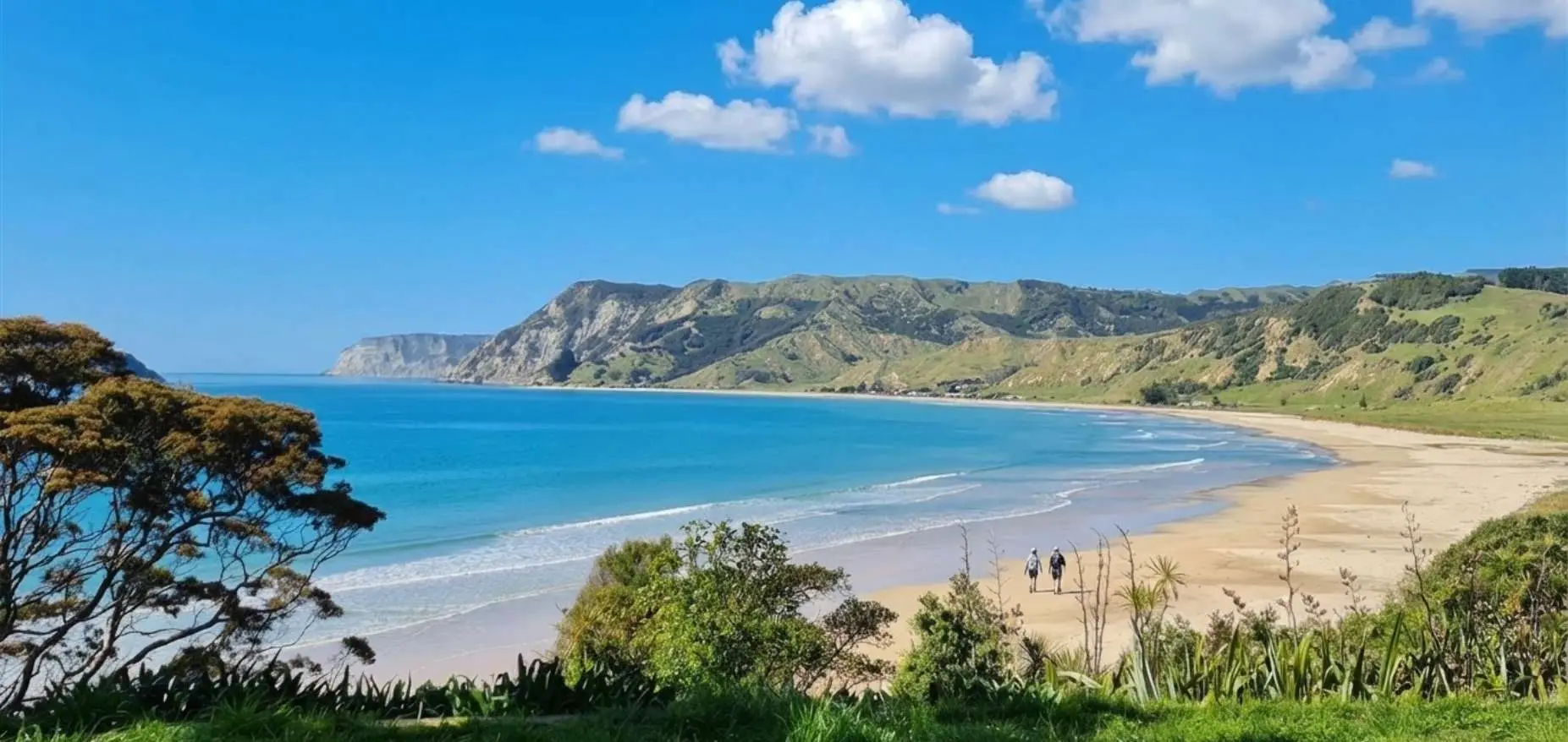
Anaura Bay Walkway: 4.5 km loop, currently partially closed due to storm damage. Stream crossings, ridge views over bay and Motuoroi Island. 80 km north ...
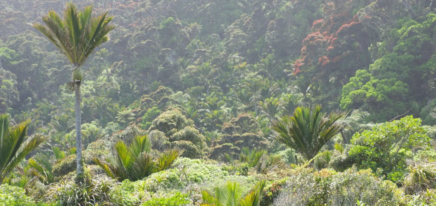
Gray's Bush: 400-500 year old kahikatea trees, flat easy tracks, wheelchair accessible short loop, 10 km from Gisborne. NZ's only remaining lowland forest of this ...
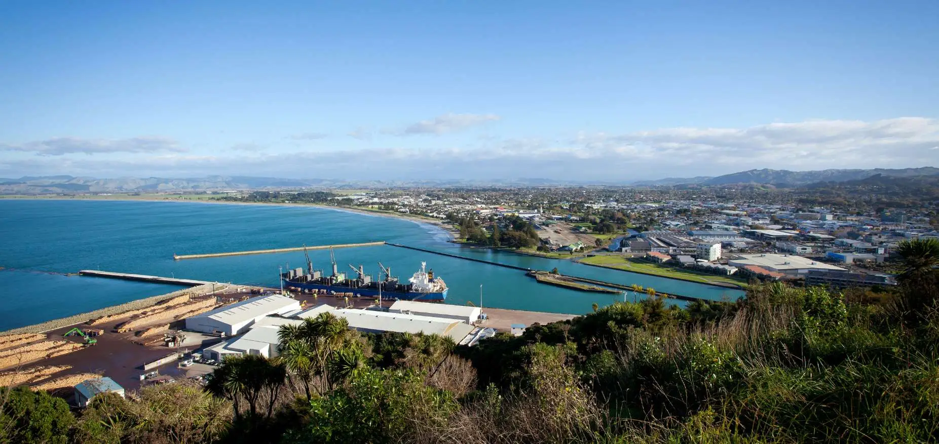
Titirangi / Kaiti Hill, Gisborne: summit views of Poverty Bay and three rivers, Cook landing history, steep stairs vs graded path option, drive-to-top parking. Everything ...