Why walking in the Waitakere Ranges is a must do
The Waitakere Ranges are Auckland’s green lung – a sprawling wilderness of ancient kauri, nikau palms and waterfalls that plunge into fern-draped gullies just 30 minutes west of the city. This isn’t manicured parkland; it’s proper bush where you’ll hear tūī before you see them and where the air smells of damp earth and wild ginger. The black sand beaches at the ranges’ feet add drama to every ridge-top view.
← Back to all walks in West Auckland
Walking Tracks in the Waitakere Ranges
| Walk Name | Distance | Duration | Difficulty | Highlights |
|---|---|---|---|---|
| Cascade Walkway | 2.4km | 1 hour | Easy | Kauri grove, stream crossings |
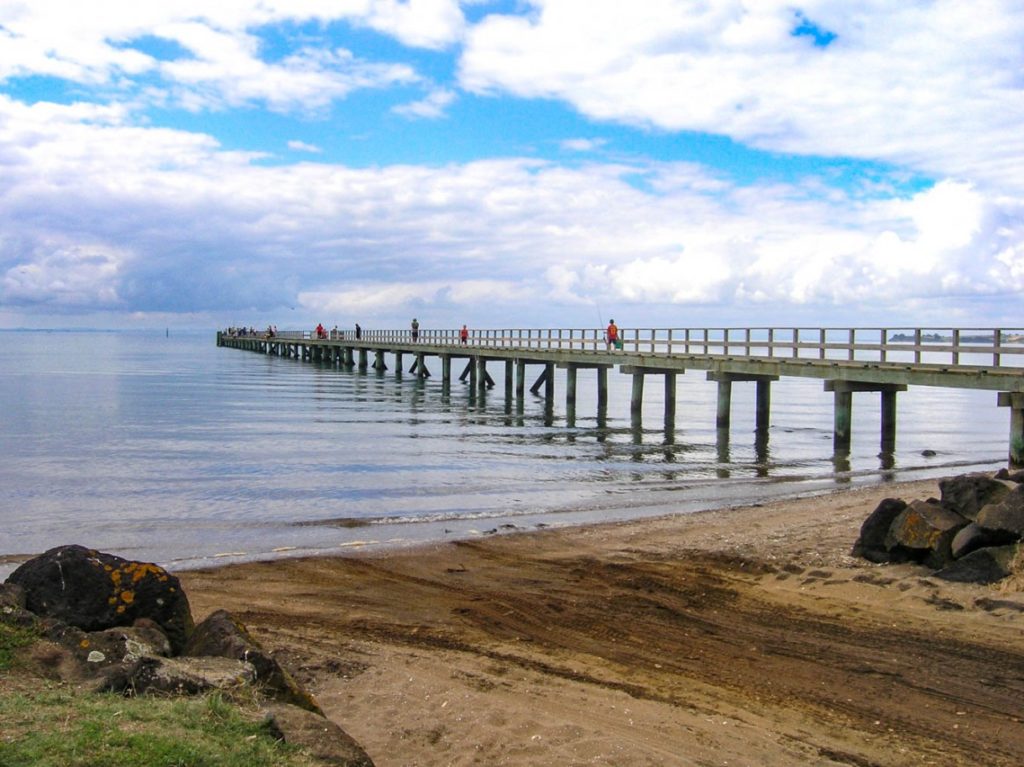
| Cornwallis Beach Walk | 3km | 1.5 hours | Easy | Coastal views, harbour outlook |
| Montana Heritage Trail | 1.8km | 45 minutes | Easy | Historic vineyard site, forest |
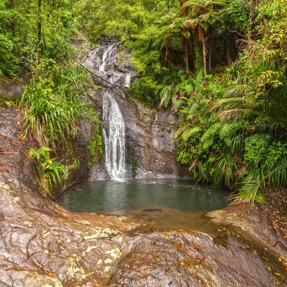
| Fairy Falls | 2km return | 1 hour | Easy-moderate | Waterfall, native bush |
| Gibbons Track | 3.5km | 1.5 hours | Moderate | Bush walking, birdlife |
| Upper Huia Reservoir Walk | 8km loop | 2-3 hours | Moderate | Reservoir views, mature forest |
| Waitakere Dam Tramline Track | 10km return | 3-4 hours | Moderate | Historic dam, engineering heritage |
| Kitekite Falls Track | 2.4km return | 1.5 hours | Moderate | Three-tier waterfall, swimming hole |
| Auckland City Walk | 16km one-way | 5-6 hours | Moderate-hard | Ridge views, multiple ecosystems |
| Mercer Bay Loop | 2.5km | 1-1.5 hours | Easy-moderate | Coastal cliffs, gannet colony |

Featured Walks
Cascade Walkway
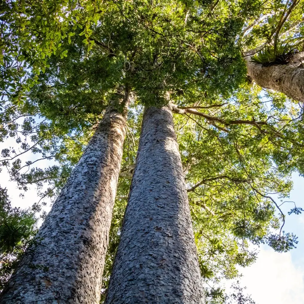
This gentle wander through second-growth forest offers an easy introduction to the Waitakeres. The track follows Cascade Stream through a recovering kauri grove where you’ll spot young kauri pushing skyward alongside towering puriri. Early morning visits often reward you with near-solitude and mist hanging in the canopy. The stream crossings are straightforward but can get slippery after rain – those stepping stones develop a thin algae film that’s more treacherous than it looks.
Cornwallis Beach Walk
Often overlooked in favour of flashier west coast walks, this coastal ramble along the Manukau Harbour offers something different. The mudflats attract godwits and oystercatchers while the pohutukawa-lined shore provides shade on hot days. Local knowledge: park at the Cornwallis Wharf rather than the beach carpark and you’ll start your walk with better harbour views. The tide dramatically changes the landscape here so check tide times if you want to see the flats teeming with wading birds.
Explore Cornwallis Beach Walk →
Montana Heritage Trail
This short loop through the Waitakere Ranges Regional Park carries whispers of the area’s winemaking past. The Corban family established vineyards here in the early 1900s and you’ll walk through regenerating bush that once grew grapes. It’s an excellent option for families with young kids or anyone wanting a taste of the ranges without committing to a longer tramp. The gentle gradient and well-maintained path make it accessible for most fitness levels.
Explore Montana Heritage Trail →
👉 👉 Freedom Camp Between Walks – Hire a Campervan – We’ve got the best deals
Fairy Falls Track
Despite the whimsical name this track delivers genuine rainforest atmosphere. The falls themselves drop about 15 metres into a pool that’s swimmable in summer though it’s always bracingly cold. Here’s what the tour groups won’t tell you: continue past the main falls viewing platform and scramble down to the pool level for a different perspective and usually fewer people. The track can get muddy and root-crossed so ankle support helps. Visit midweek to avoid the weekend crowds that can turn the viewing platform into a photo queue.

Gibbons Track
This lesser-known track provides a proper bush experience without the tourist hordes. The path winds through mature forest where supplejack vines create natural tangles and nikau palms mark the wetter gullies. Bird song dominates the soundscape here – bring binoculars if you’re into twitching. The track surface alternates between packed clay and exposed tree roots so watch your footing. It connects with several other tracks making it ideal for creating longer loop walks if you’re feeling adventurous.

Upper Huia Reservoir Walk
This loop around the reservoir showcases the ranges at their most serene. The track alternates between lakeside sections and forest climbs offering variety that keeps things interesting. Insider tip: walk it anticlockwise to get the steeper climbs done early while you’re fresh. The reservoir itself is part of Auckland’s water supply so swimming is prohibited but the reflections of surrounding bush in still water create magic for photographers. Pack a lunch and use one of the lakeside clearings for a proper tramping break.
Explore Upper Huia Reservoir Walk →

Waitakere Dam Tramline Track
This track follows the historic tramline that once hauled materials for dam construction. The engineering remnants scattered along the route add industrial archaeology interest to your bush walk. The track is well-graded thanks to its tramline heritage making it easier than the distance suggests. The dam itself is an impressive concrete structure that speaks to early 20th century ambition. Here’s the thing though – the return journey is all uphill so pace yourself accordingly. The forest here includes some magnificent old trees that survived the logging era.
Explore Waitakere Dam Tramline Track →
Additional Waitakere Ranges Walks Worth Your Boots
Kitekite Falls Track
Arguably the most spectacular waterfall in the ranges, Kitekite cascades in three tiers through a amphitheatre of rock and fern. The track descends through lush forest filled with the sound of running water long before you reach the falls. The swimming hole at the base draws crowds in summer but visiting in autumn or spring offers better solitude with the falls running fuller after rain. The climb back up will test your lungs – it’s steeper than you expect and takes longer than the descent. Start from Glen Esk Road for the standard route or tackle it as part of the longer Karamatura Valley walk.
See full walk details for Kitekite Falls Track
Auckland City Walk
This is the ranges’ signature multi-hour challenge stretching from Arataki Visitor Centre to the Waitakere Dam. The track traverses multiple ridgelines offering sweeping views across the bush canopy to the Tasman Sea. You’ll need to arrange transport for the one-way route or prepare for a very long day if walking it return. The elevation changes are significant and the exposed ridge sections can cop fierce winds. Pack layers because you’ll swing between sweating on climbs and cooling rapidly on exposed tops. This walk separates the casual strollers from the committed trampers.
👉 👉 Freedom Camp Between Walks – Hire a Campervan – We’ve got the best deals
Mercer Bay Loop
This coastal gem combines clifftop walking with beach access and gannet viewing opportunities. The loop takes you through coastal forest before emerging onto windswept headlands where the Tasman Sea hammers the rocks below. The gannet colony operates seasonally so time your visit between spring and autumn for the best bird action. The final descent to Mercer Bay beach is steep and involves steps but the black sand beach at the bottom makes a perfect lunch spot. Swimming here requires respect for the surf – rips are common and the beach is unpatrolled.
See full walk details for Mercer Bay Loop
Practical Information for Walking the Waitakeres
Essential Tips
- Kauri dieback protocol: Clean your boots before and after every walk using the cleaning stations at carparks. This fungal disease is devastating kauri forests and your footwear can spread it. No exceptions.
- Weather changes fast: The ranges create their own microclimate. Pack a rain jacket even on blue-sky days. Mist can roll in within minutes turning pleasant walks into damp slogs.
- Phone coverage is patchy: Don’t rely on your mobile for navigation. Download offline maps or carry a paper map. Several valleys have zero coverage.
- Water sources: Carry all the water you need. Stream water may look pristine but giardia exists here. A 1.5-litre bottle minimum for half-day walks.
- Sandflies and mosquitoes: The bush harbours both. Insect repellent isn’t optional it’s survival gear. The sandflies near streams are particularly vicious.
- Track conditions: Mud is standard after rain and roots become slip hazards. Boots with ankle support and decent grip outperform trainers every time.
- Start early: Carparks fill fast on weekends especially at popular spots like Fairy Falls and Kitekite Falls. Arriving by 8am usually secures parking.
- Tell someone your plans: Even on popular tracks things can go wrong. Leave details of your intended route and return time with someone reliable.
What to Bring
- Sturdy footwear with good tread (tramping boots preferred)
- Rain jacket and warm layer (fleece or merino)
- Plenty of water (1-2 litres depending on walk length)
- Snacks or lunch
- First aid kit including blister treatment
- Sunscreen and hat
- Insect repellent
- Phone for emergencies (but don’t rely on coverage)
- Small towel if visiting waterfall swimming holes
- Spare socks in a waterproof bag
- Head torch if there’s any chance you’ll finish in fading light
Safety Considerations
- Solo walkers: The main tracks are generally safe for solo walking during daylight hours. Stick to popular routes if you’re alone and always sign track intention books where available. Trust your instincts – if a track looks too challenging turn back.
- Fitness levels: Don’t underestimate elevation gain. A 5km walk with 300 metres of climbing is much harder than a flat 5km. Start with shorter walks to gauge your fitness.
- Emergency contacts: Save 111 in your phone. The Arataki Visitor Centre (09 817 0077) can provide track condition updates during opening hours.
- Weather risks: Heavy rain can cause streams to rise quickly and create flooding on low-lying tracks. Check forecasts and if there’s been prolonged rain consider postponing waterfall walks.
- Wildlife hazards: The ranges don’t have dangerous animals but wasps nest in the bush and their stings pack a punch. People with severe allergies should carry antihistamines or EpiPens.
Insider Knowledge for Range Regulars
Hidden Gems
The Waitakeres hide spots that don’t make the standard tourist route. The Pararaha Valley Track offers exceptional kauri forest without the crowds found elsewhere. From the same carpark as Upper Huia Reservoir you can access the Whatipu Caves Track which leads to dramatic sea caves and isolated beaches. The Kakamatua Inlet track near Cornwallis provides easy walking with excellent harbour views and almost no visitors midweek.
Best Time to Walk
Early morning walks reward you with the best light filtering through the canopy and the most active birdlife. Autumn offers the most stable weather with fewer downpours than winter and less humidity than summer. Spring brings flowing waterfalls and new growth but also more rain. Summer means warmer swimming holes but crowded carparks. Winter walking is underrated – fewer people, dramatic cloud formations and the rain-washed forest smells incredible.
👉 👉 Freedom Camp Between Walks – Hire a Campervan – We’ve got the best deals
Photography Tips
The forest canopy creates challenging light conditions. Shoot in RAW format to retain detail in shadows. Waterfalls look best with longer exposures (1-2 seconds) so bring a neutral density filter or shoot on overcast days when you can slow your shutter speed. The golden hour is shorter in the bush because the canopy blocks low-angle sun but when light does penetrate it creates spectacular rays through the trees. Mist rising from the valleys after rain offers moody atmospheric shots worth the soggy walk.
Bonus Tips That’ll Make You Look Like a Local
- The Arataki Visitor Centre: Stop here first for track updates toilet facilities and the best panoramic views in the ranges from the viewing platform. The carved pou (posts) at the entrance are stunning examples of Māori craftsmanship.
- Free shoe cleaning: Petrol stations near the ranges often have outdoor taps. Use them to rinse muddy boots before getting back in your car.
- Cellphone battery drain: Your phone burns battery searching for signal in the bush. Switch to airplane mode to conserve power for emergencies or photos.
- Regenerating forest: Most of the Waitakeres were logged extensively so the bush you’re walking through is second or third growth. The really old kauri are rare survivors worth pausing to appreciate.
- Bush breakfast: The Piha Cafe and Bethells Cafe both open early and make excellent pre or post-walk fuel stops. The coffee is surprisingly good for remote locations.
- Track combinations: Many walks interconnect allowing you to create custom loops. Carry a regional park map to spot opportunities for linking tracks.
- West coast beaches: After your walk extend your day with a beach visit. Piha Karekare and Bethells are all dramatic black sand beauties though the surf is dangerous for swimming.
- Parking security: Car break-ins happen occasionally at remote carparks. Take valuables with you or leave nothing visible in your vehicle.
- Toilet facilities: Limited at many trailheads. Use facilities at the Arataki Visitor Centre or nearby towns before starting walks.
- Track grades change: Maintenance levels vary and storms can damage tracks. Recent user reports on tramping forums provide more current intel than official gradings.
Understanding the Ecology
The Waitakere Ranges represent one of Auckland’s most significant ecological reserves. The forest here transitions from coastal broadleaf species through to mixed podocarp-broadleaf forest with kauri emerging as giants in suitable areas. You’ll walk past rimu totara and kahikatea alongside nikau palms that mark New Zealand’s northern palm limits. The understorey teems with ferns including the iconic ponga (silver fern) and delicate filmy ferns in the wettest gullies.
Birdlife includes tūī with their distinctive white throat tufts and melodious calls that carry through the canopy. Kererū (native wood pigeons) crash through branches with their heavy wingbeats often gorging on ripe fruit. Fantails will often follow walkers flitting about catching insects disturbed by your footfalls. At dawn and dusk you might hear morepork (ruru) calling their namesake sound.
The kauri dieback disease (Phytophthora agathidicida) poses the most serious threat to the ranges. This microscopic organism attacks kauri roots causing canopy decline and eventual death. It spreads through soil movement which is why boot cleaning is absolutely critical. Some tracks through kauri areas have been permanently closed to protect remaining trees. Respect these closures – they’re not suggestions.
Local Services and Facilities
Titirangi village sits at the ranges’ eastern edge and offers the closest town facilities including cafes supermarkets and petrol stations. The village has a bohemian artistic vibe and several good eateries for post-walk meals. Further west Piha has limited services – a general store cafe and surf shop but don’t expect full supermarket options. Fill your tank and stock up on supplies before heading into the ranges because service stations are scarce once you’re in the hills.
Accommodation options around the ranges include Piha and Karekare for beachside stays though booking ahead is essential during summer. Titirangi offers more conventional suburban accommodation. The nearest camping facilities are at Huia or further north at Muriwai though freedom camping is prohibited throughout most of the Waitakere Ranges Regional Park.
Common Questions and FAQ
Best time of year to visit?
Autumn (March to May) offers the most reliable weather with settled conditions and fewer crowds than summer. The tracks are generally drier and waterfalls still run well from earlier spring rains. Summer (December to February) is warmest for swimming holes but carparks overflow on weekends and the humidity can be oppressive. Winter brings more rain and mud but dramatic moody atmospheres and virtual solitude. Spring (September to November) showcases new growth and flowing waterfalls but weather is changeable. Honestly any season works if you pack appropriate gear and embrace the conditions you get.
Are dogs allowed on these walks?
Dogs are prohibited on most Waitakere Ranges walking tracks to protect native wildlife and reduce the spread of kauri dieback. A few specific tracks allow dogs on-leash but these are exceptions not the rule. Check Auckland Council’s regional parks website for the current list of dog-friendly tracks. The restrictions are strictly enforced and rangers do patrol popular areas. If you’re planning to bring your dog confirm track regulations before driving out – you’ll likely be disappointed.
Do I need to book anything?
No bookings or permits are required for day walks in the Waitakere Ranges. All tracks are free to access. Just turn up park and walk. The only exception might be if you’re joining a guided walk through a commercial operator but for independent tramping you’re good to go. Carparks can fill up on weekend mornings at popular spots so arriving early beats any parking hassles. The Arataki Visitor Centre has regular opening hours if you want information or facilities but the tracks themselves are accessible dawn to dusk year-round.
What is the best walk in West Auckland?
This depends entirely on what you’re after. Kitekite Falls wins for dramatic waterfall scenery and swim spots. The Upper Huia Reservoir Walk provides the best all-round bush experience with variety and length that feels like a proper tramp. Fairy Falls offers the best reward-to-effort ratio for time-poor visitors. The Auckland City Walk challenges experienced trampers wanting distance and ridge views. For coastal drama the Mercer Bay Loop can’t be beaten. First-time visitors should probably start with Fairy Falls or Kitekite Falls to get that “wow” factor that makes you want to explore further.
Can I do multiple walks in one day?
Absolutely and it’s a great way to experience different aspects of the ranges. Pair a morning waterfall walk like Fairy Falls with an afternoon coastal track like Mercer Bay Loop. The shorter walks like Montana Heritage Trail and Cascade Walkway can easily be combined. Upper Huia Reservoir Walk will consume most of a day by itself. Factor in driving time between trailheads – the ranges cover a large area and winding roads mean 15km might take 25 minutes. Start early to maximise daylight hours and remember your energy levels will drop after the first walk so plan easier options for later in the day. Pack sufficient food and water for extended outings.