The Upper Huia Dam Walk in the Waitakere Rangers is a medium 17km walk taking around 4 hours 30 minutes round trip.
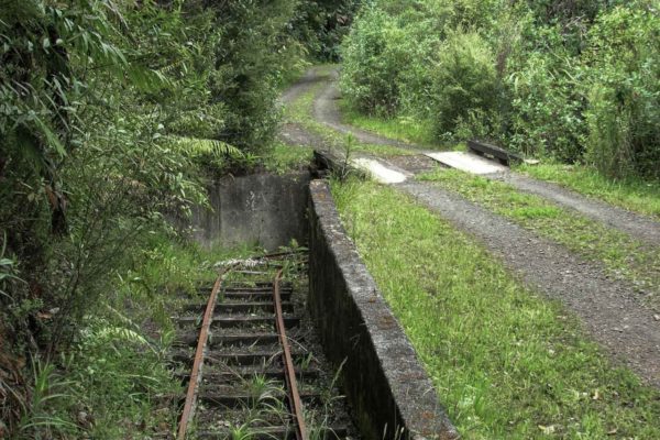
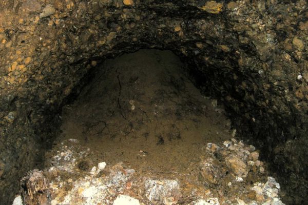
There are two dams to walk across and one abandon old mine which has collapsed and a road tunnel to walk through. There is no shortage of Nikau palms and native NZ trees. You will see deep rough gully’s with high waterfalls and fresh running creeks, this is Auckland’s main water supply.
The Upper Huia Dam Track was closed by Auckland Council due to Kauri Dieback – but it’s now open again. For further information on this terrible disease please refer to this website: www.kauridieback.co.nz
Quick Facts about this walk
- Location: Auckland City
- Distance: 17 kms
- Time needed: 4 Hours 30 Minutes Round Trip
- Difficulty: Medium
- Wheelchair Access: No
- Route: Round Trip
- Elevation: 310m
- Wet Feet: No
- Toilets: Yes
- Dogs: No
- Mobile Coverage: Yes
- Last Updated: November, 2019
We’ve partnered with Macpac outdoor walking & hiking gear to bring you the very best products designed exclusively for our New Zealand climate. They’ll ship for FREE within NZ on orders over $100 (if under $100 it’s only $5). Worldwide international shipping is available except to the USA. Bulky orders will be $20.
Summary points about this walk
Walk Highlights
Track Quality
Hazards
Transport
Water
Driving Instructions
Shops & Restaurants Nearby
Area & Trail History
Map Location
Points of interest along the walk
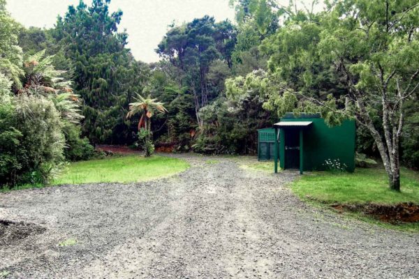
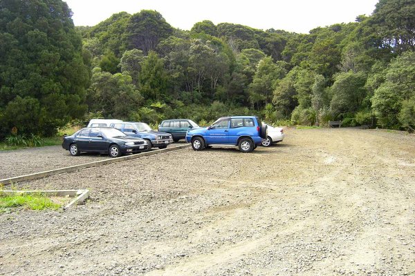
Point 1: Huia Car Park
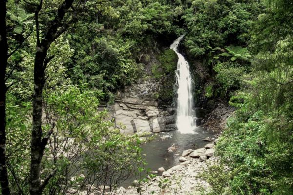
Piha main road to upper Nihotupu Dam 35 minutes. A few minutes down the road is a toilet and a shed for something. Another few minutes, on your right is a series of waterfalls.
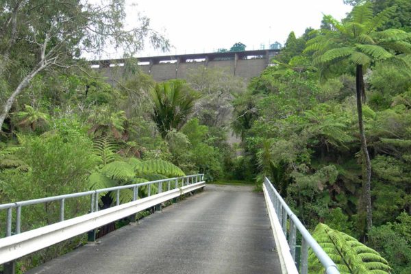
Point 2: Christies Track
The walk down to the dam is a stroll in the park. You follow a well used gravel road all the way to the dam. At the dam there is an information board to read. The sign to Christies track is a little confusing. Walk across the dam to the other side, till you hit the wall. Now turn right and squeeze between the bank and the post to get on to the goat track. Climb up for a few minutes, around to the left and there is the next Turn off. Go right onto Christies track and onto Huia dam road, not left on to the Summit Track.
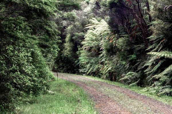
Point 3: Road To Huia Dam
1 hour. A very very muddy track. It will be bad news in the winter with a lot of rain. The track is mostly down hill all the way to a creek. The bush is very rough, at the creek crossing you are only 10 mins away from the Dam road, no you will not get your feet wet if you rock hop.
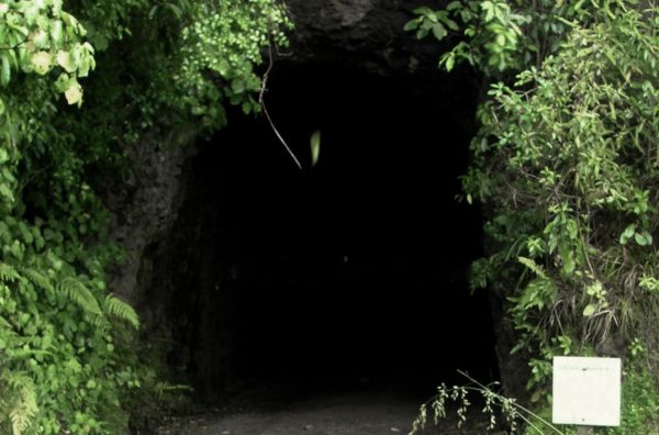
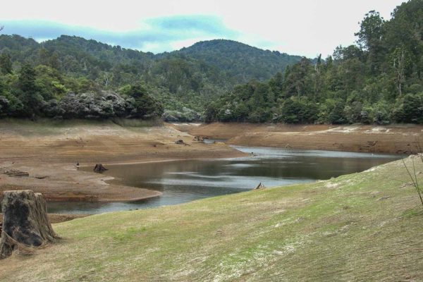
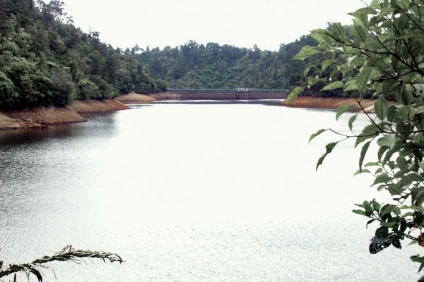
Point 4: Huia Dam
Huia Dam 30 minutes, an easy walk along the gravel road. Nothing to look at till you arrive at the 170m tunnel. You can see the light at the other end of this tunnel so you don’t need a touch. Keep walking along the road till you reach the top of the dam. Do not cross the dam. To your hard right is the start of the next section of the walk.
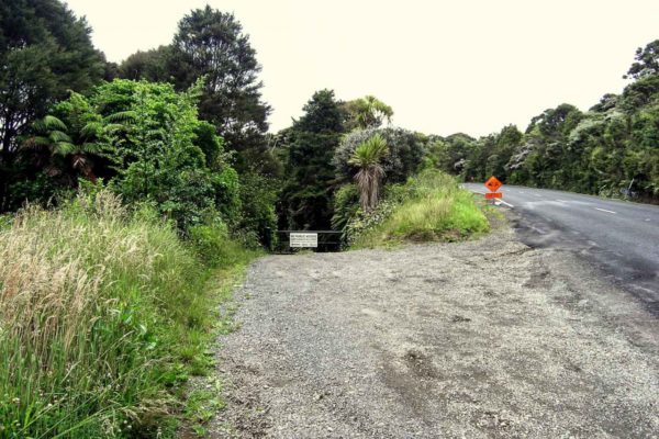
Point 5: Piha Road
Again mud, mud & mud. This must have been a very good road in is time. There are a few deep cuttings through the hills. Keep an eye out for the old wood remains of framing for the road and bridges. On the right pasted the second creek, look out for a cutting on your right that looks a little to wide to be a dried up stream, it is an old entrance to a drive, (tunnel). Third and last creek, from here it is a good climb up to Piha road. This section is very trying especially after a day or two of rain. The mud and a lot of tree roots just for you to slip on, it was quite a taxing day.
