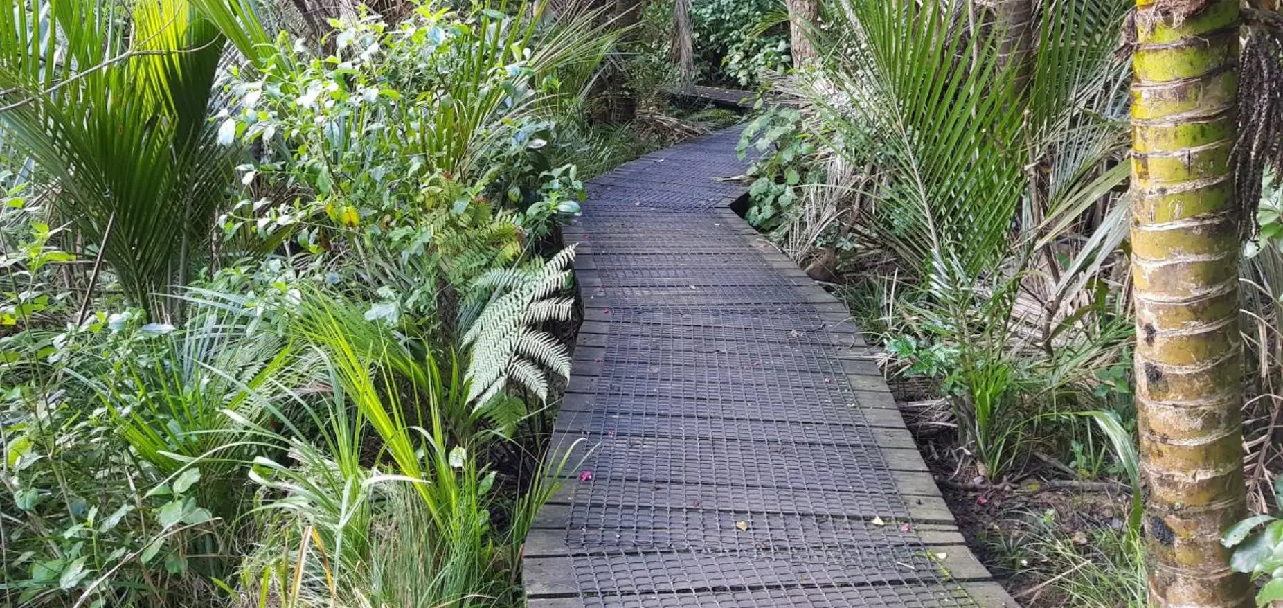
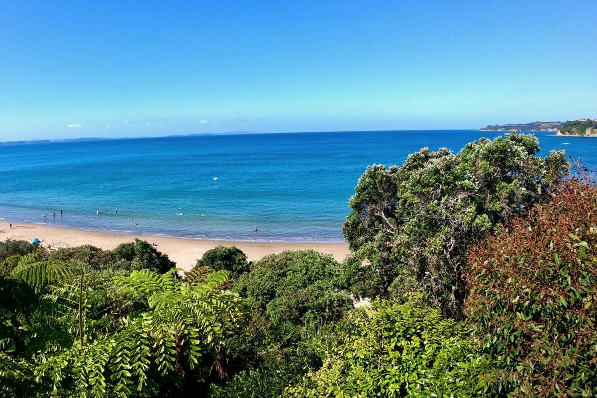
Long Bay Nature Trail
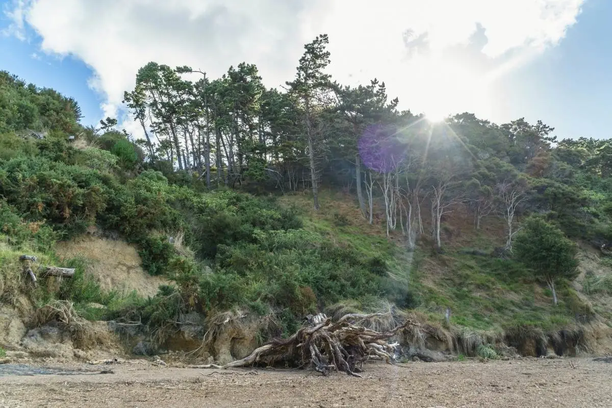
My guide to the Long Bay Nature Trail: 800 m loop near the Vaughan Homestead, 30 minutes, easy, yellow markers. Check it’s open before you go, no dogs, no prams.
My guide to the Long Bay Nature Trail: 800 m loop near the Vaughan Homestead, 30 minutes, easy, yellow markers. Check it’s open before you go, no dogs, no prams.
Everything you need to walk Wainui Reserve near Raglan, which tracks to take, how to get to the beach, where to park, and whether you can bring the dog.
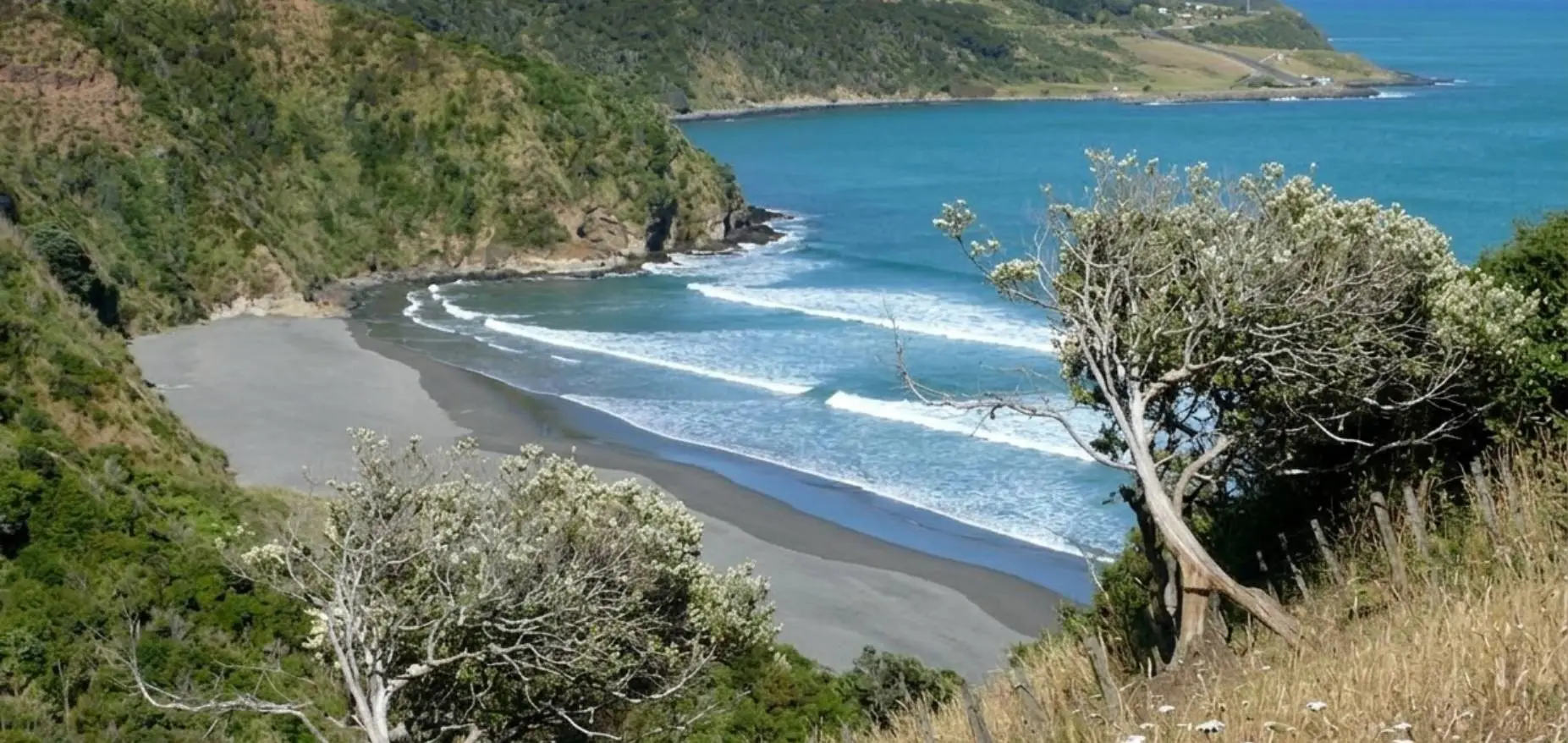
Everything you need to walk the Ngarunui Track near Raglan: where to park, what the track is like, where it comes out, and what to do if the car park is full.
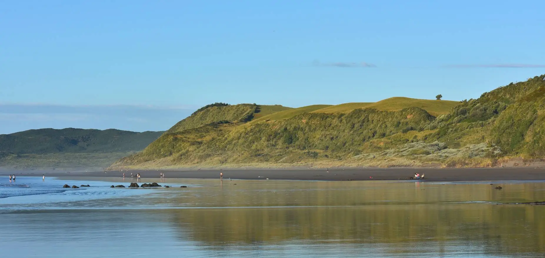
Everything you need to walk the Kaitoke Walkway in Raglan: which end to start from, when to go for the best views, and whether you can bring the dog.
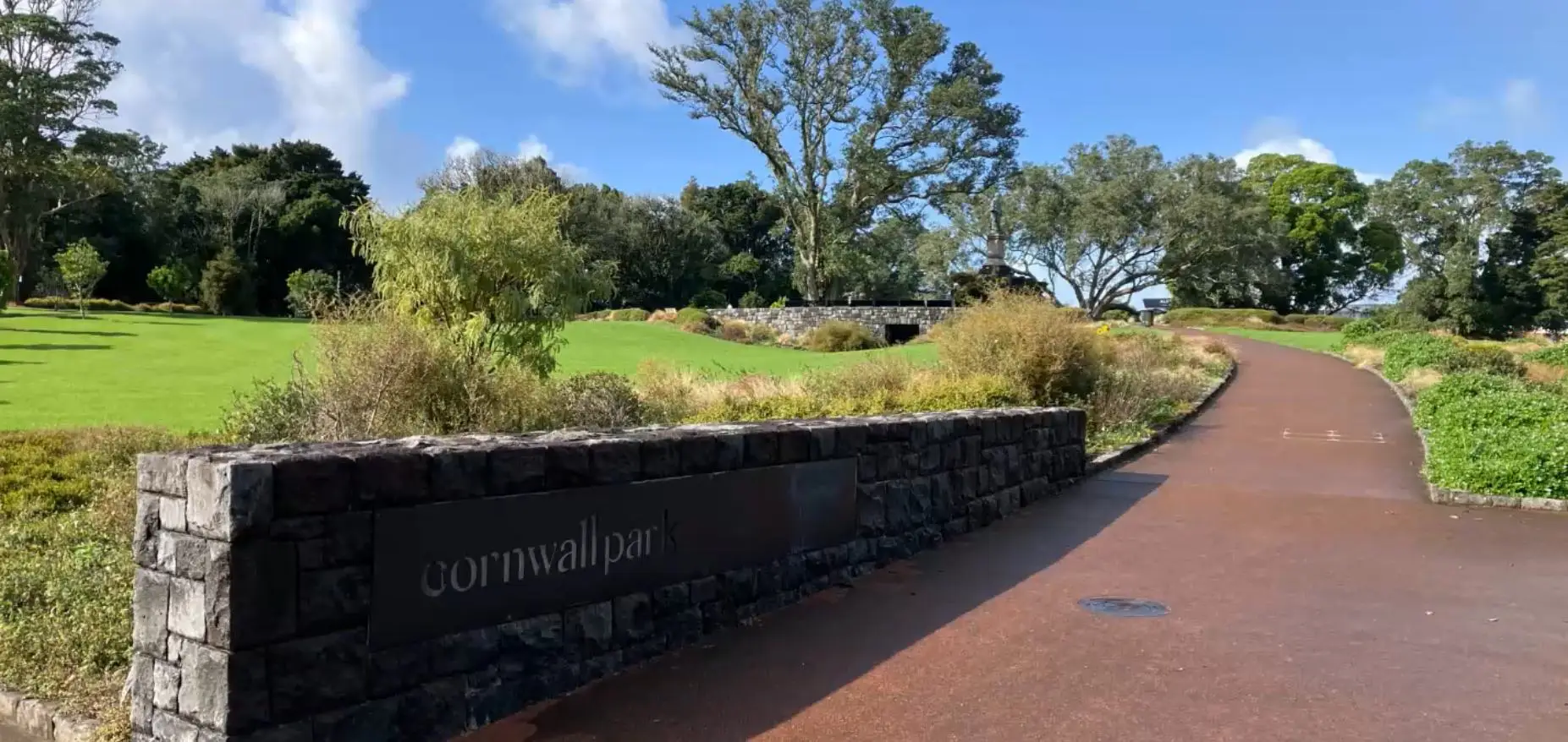
Complete guide to Logan Campbell’s Gift Loop: start point, historic panels, café stop, full route map. Everything you need to walk Cornwall Park.
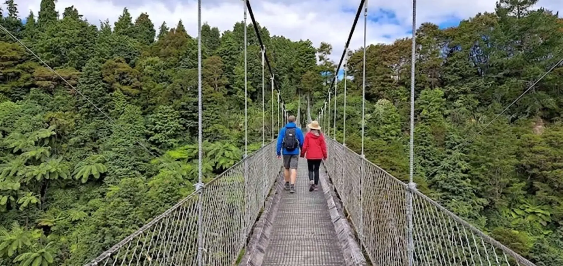
Walk the historic Arapuni Suspension Bridge, 152m long and 54m above the Waikato River. Free entry, 15 minutes return, steep steps, great gorge views. Built in 1925.
Jim Barnett Reserve near Putaruru, 13 tracks through native bush, 45 minutes, easy walking. 1000-year-old totara tree, basic camping on site, 20km from Putaruru.
Whangaparaoa town centre to Stanmore Bay Beach via the Rata Road walkway. 3km one way, mostly paved, dogs on leash, family friendly. Playground and splash pad at the beach end.
Fishermans Rock Reserve at Army Bay, rocky headland with cave, rock pools and cliff jumping at high tide. End point of the Gulf Harbour Coast to Coast path. Dogs on leash, tide tips included.
Walk coast to coast across the Whangaparaoa Peninsula from Gulf Harbour Marina to Fishermans Rock Reserve. 3.5km, easy, dogs on leash, two playgrounds, ferry access on weekdays.
Five walks in Shakespear Regional Park, from the 2.5km Lookout Track to the coastal Tiritiri Track with Pink Beach. Camping, facilities, no dogs, kauri dieback info all covered.
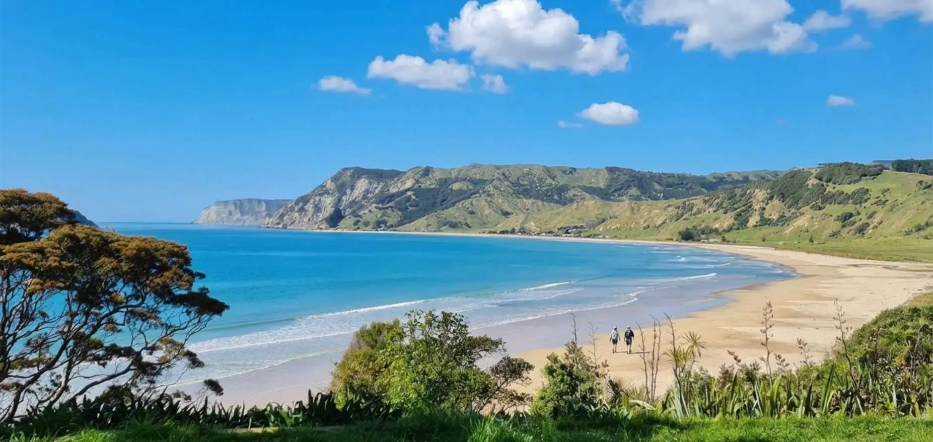
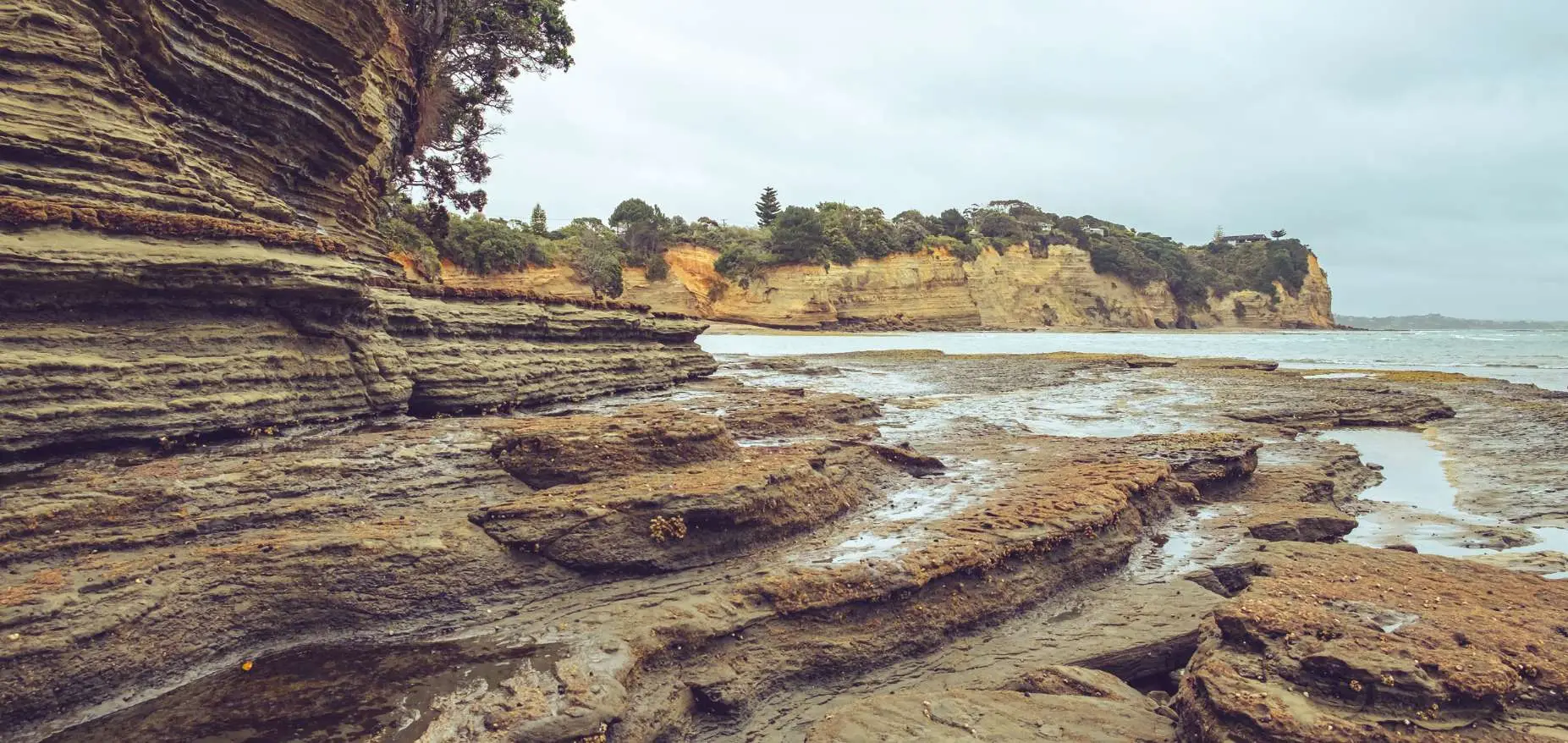
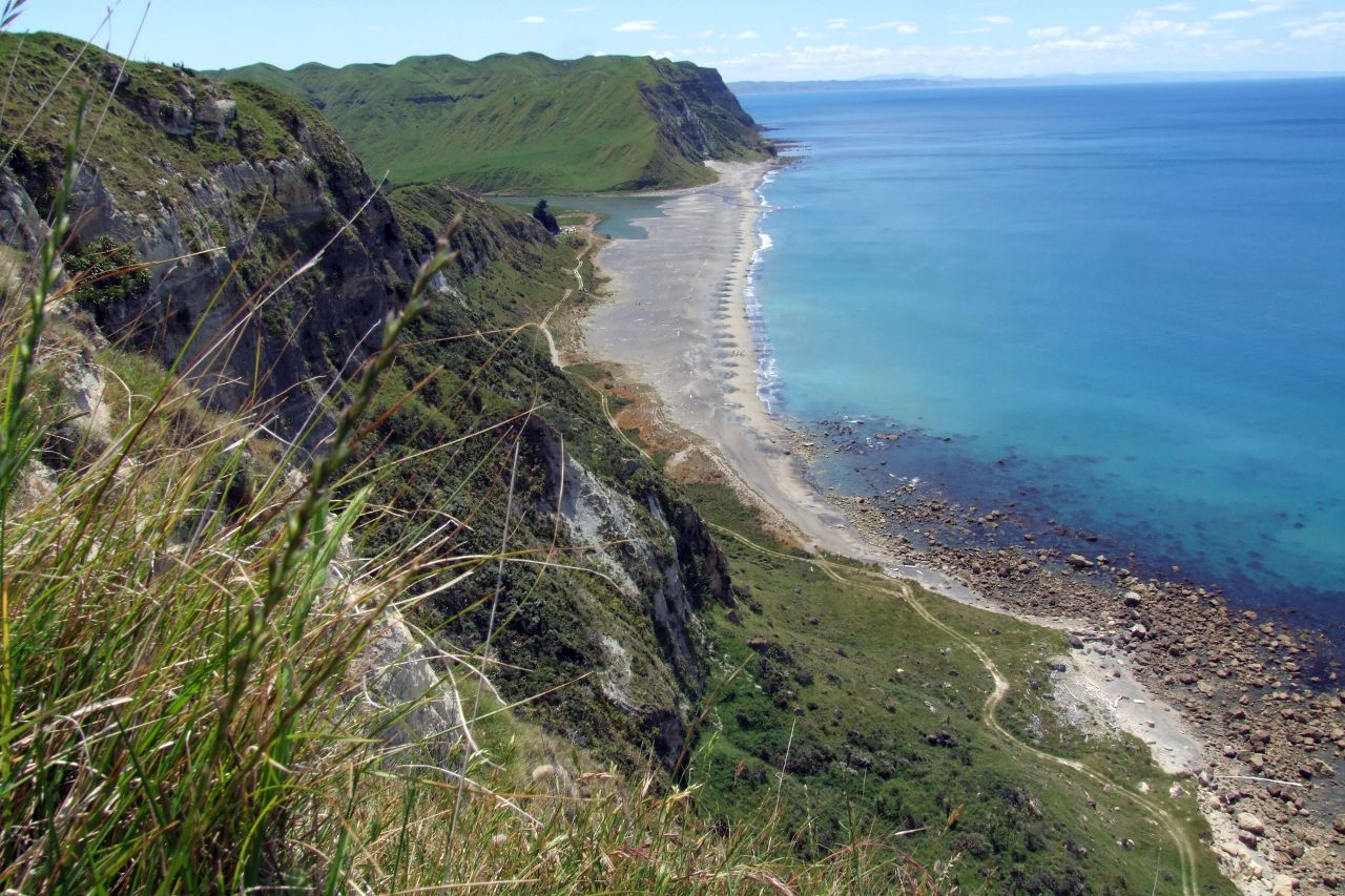
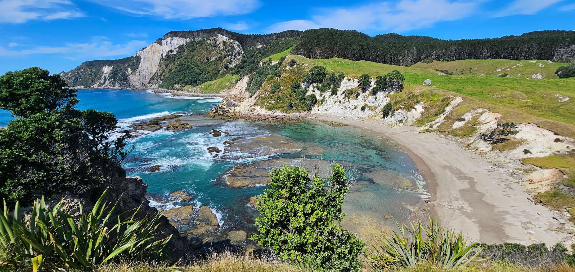
Anaura Bay Walkway: 4.5 km loop, currently partially closed due to storm damage. Stream crossings, ridge views over bay and Motuoroi Island. 80 km north of Gisborne on SH35. No dogs.
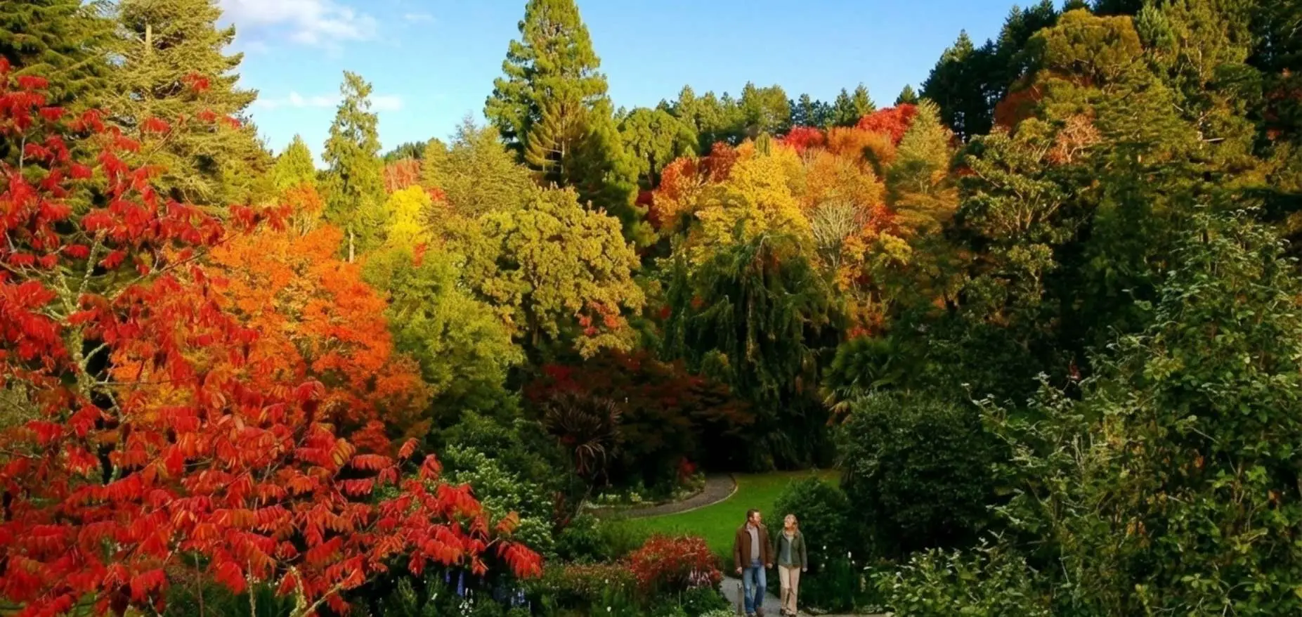
Eastwoodhill Arboretum: 6 colour-coded walks from 1.7-5.1 km, entry fees, exact track times, autumn colour timing, muddy track warning. 30 minutes from Gisborne.
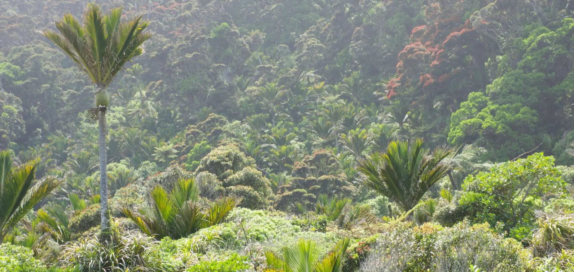
Gray’s Bush: 400-500 year old kahikatea trees, flat easy tracks, wheelchair accessible short loop, 10 km from Gisborne. NZ’s only remaining lowland forest of this type. No dogs.
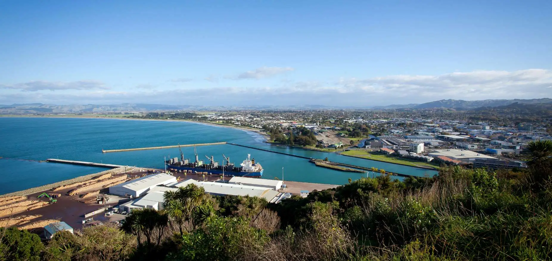
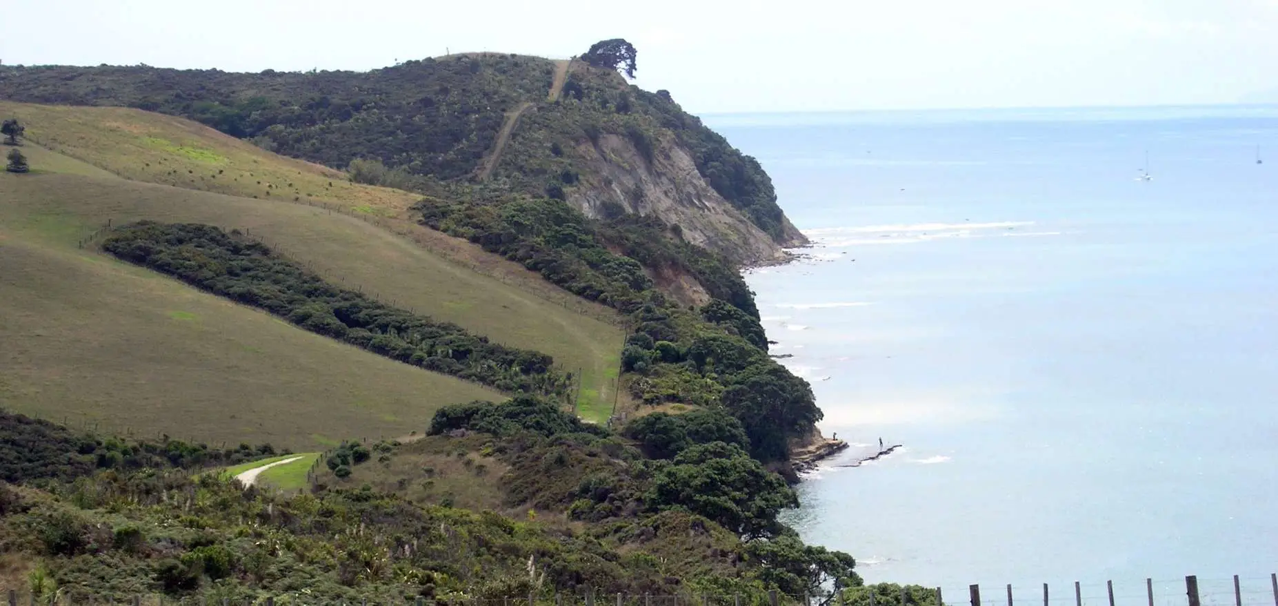
Titirangi / Kaiti Hill, Gisborne: summit views of Poverty Bay and three rivers, Cook landing history, steep stairs vs graded path option, drive-to-top parking. Everything you need.
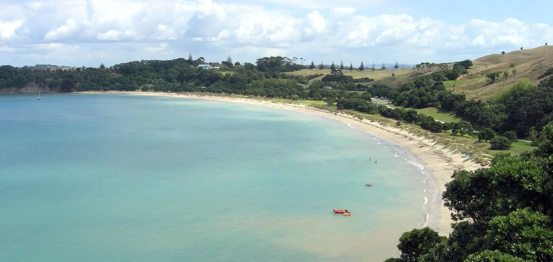
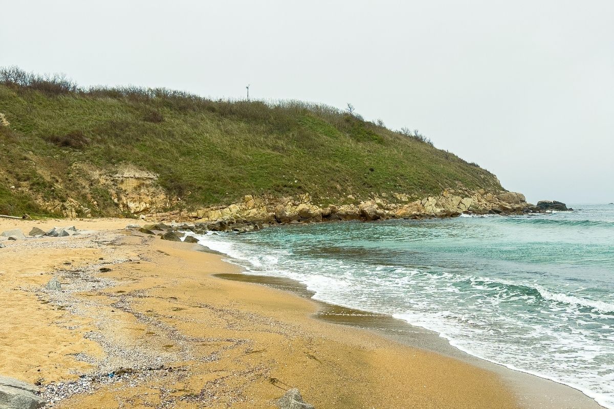
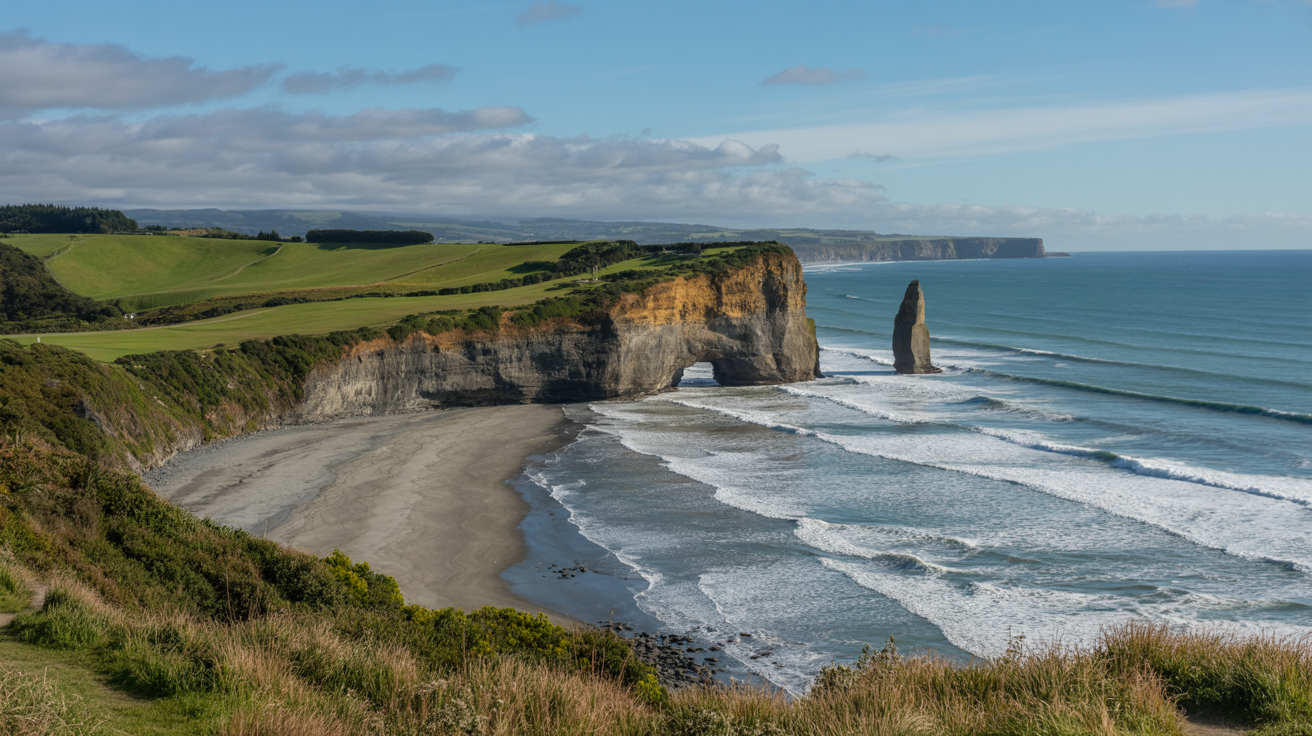
My guide to the Waipatiki Beach coastal walk north of Napier: cliff track to Aropaoanui Beach, the longer ridge loop, Maori land access, swimming, kahikatea forest, and what to bring.
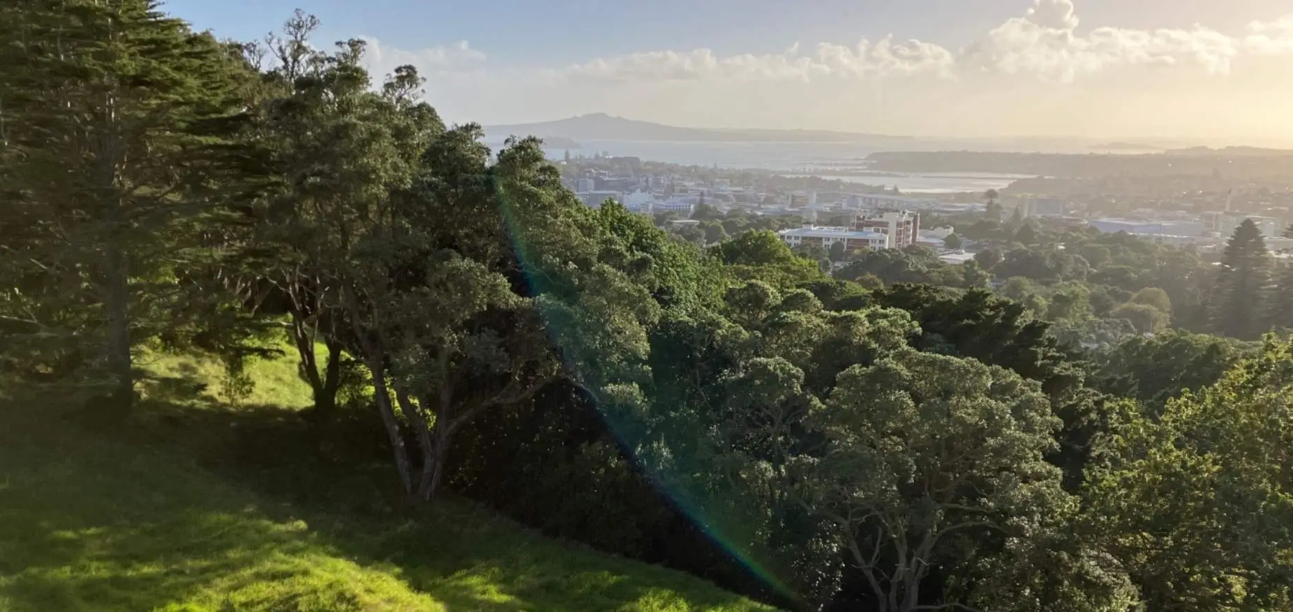
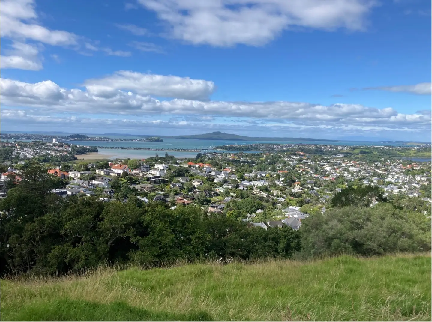
Complete guide to the Epsom Village & Mt Eden Volcano Loop: historic suburbs, Melville Park, crater views. Download the full walking map with directions.
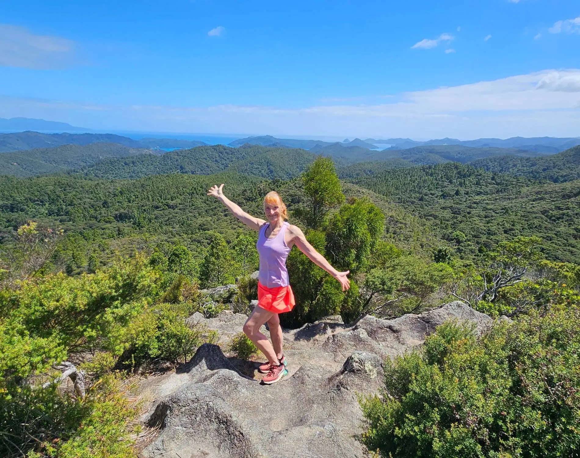
Boat access only, no marked tracks, just stunning beaches and a working farm. Complete guide to walking Great Mercury Island with photos.
Boat-access only. Complete guide: dinghy landing tips, high-tide timing, overgrown start, river crossing, 327m summit views. Everything you need for Maungapiko.
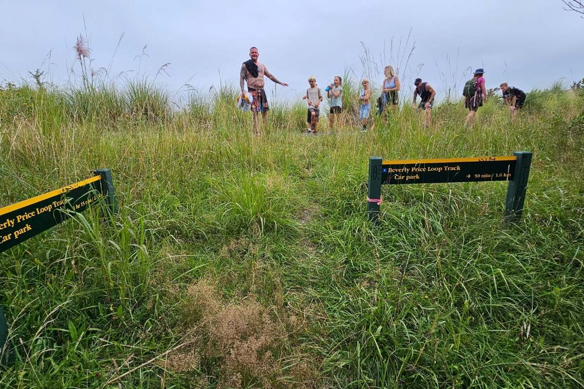
Planning to walk the Beverly Price Loop Track? Discover essential track info, including hiking times, elevation, and how to find the best lookout points.
Everything you need: exact start point, GPS coordinates, 150-step descent tips, motorway bridge crossing, crater rim route, MASH hospital plaque location.
Looking for a solid bush walk near Auckland? You’ll climb through native forest on the Slip Track, then loop back via Pipeline Track. Great views, good workout, all the details here.
Fancy a peaceful walk on Motuihe Island? The Eastern Beaches Track takes you through native bush to stunning secluded coves. Get the full route details here.
Walk the Headland Heritage path on Motuihe Island and you’ll find WWII gun emplacements, native bush, and stunning gulf views. It’s an easy 2km loop with real history to touch.
Climb to the highest point on Motuihe Island for stunning 360-degree views across the Hauraki Gulf. You’ll pass through regenerating bush and spot native birds along the way.

You’ll love the Pukapuka Track Loop in Hunua Ranges – a peaceful 2-hour forest walk through native bush and past streams. Get all the details on parking, track conditions and what to bring.
You’ll love this easy 3.5km loop through native bush in the Hunua Ranges. Expect waterfalls, swimming holes, and tall kauri trees. Perfect for families and beginners.
You’ll find stunning waterfalls and native bush on this easy 30-minute loop walk in the Hunua Ranges. Perfect for families and photos. Get directions and tips here.
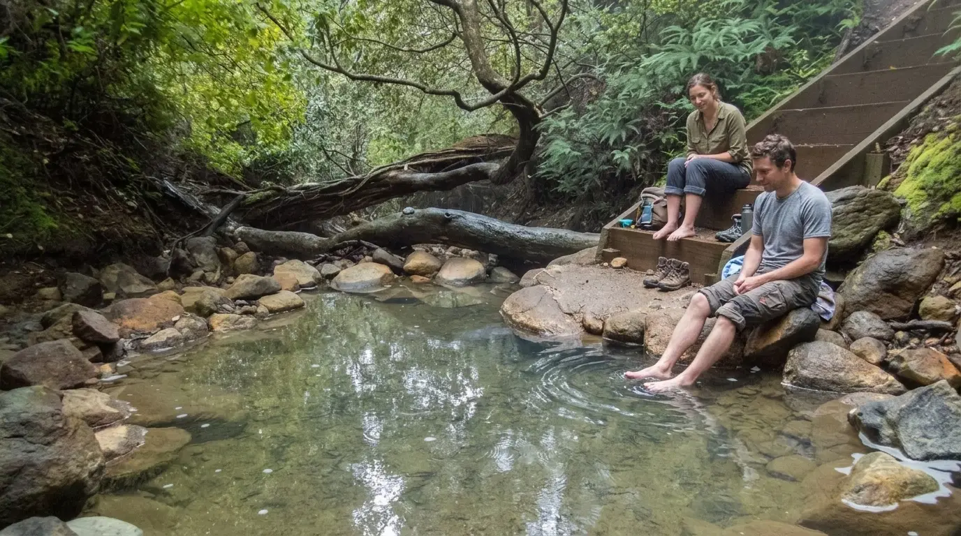
Everything you need to walk to Kaitoke Hot Springs on Great Barrier Island: where to park, how long it takes, what the pools are like, and why you can’t bring the dog.
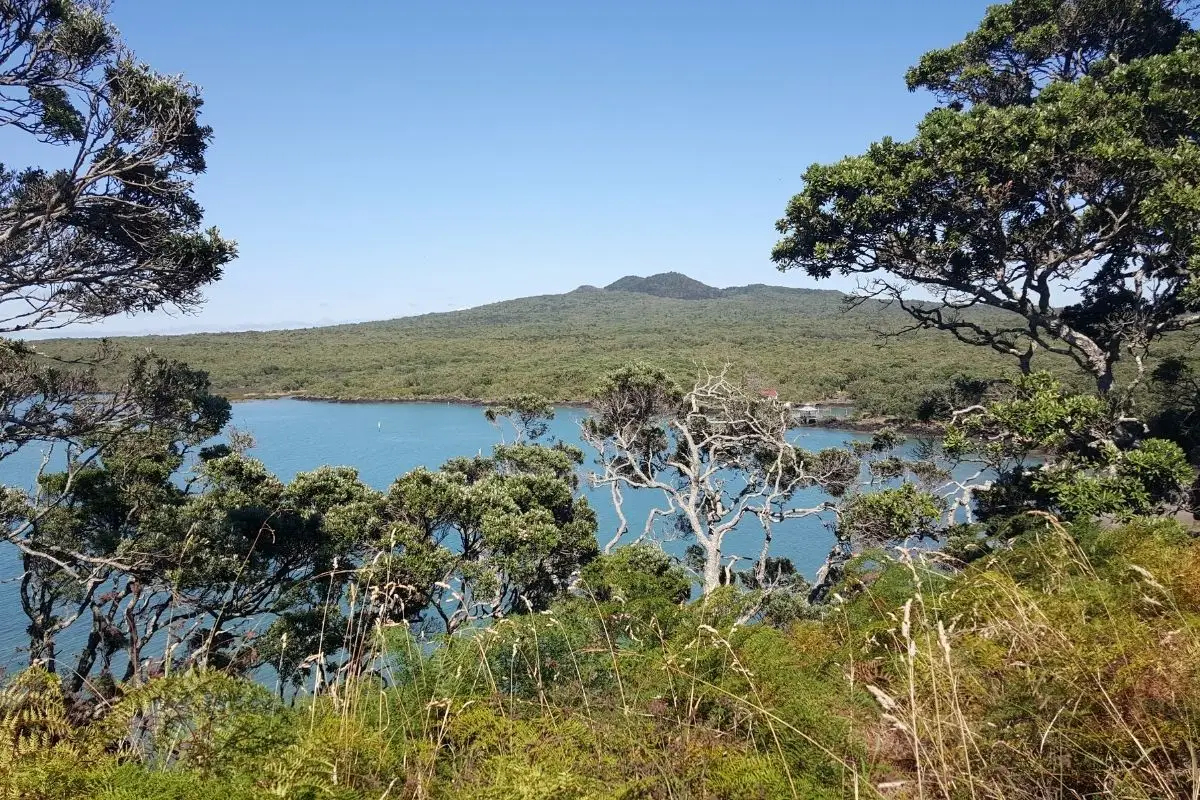
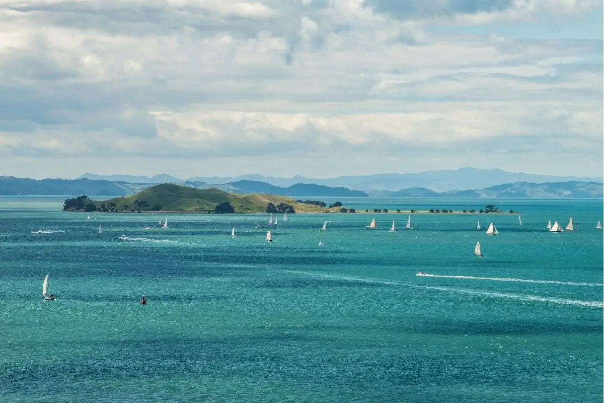
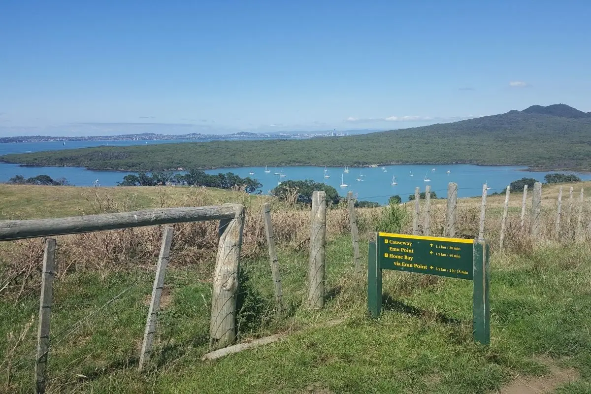
You’ll love this stunning coastal route linking two volcanic islands in the Hauraki Gulf. Get practical tips, track notes, and what to expect on this memorable Rangitoto-Motutapu adventure.
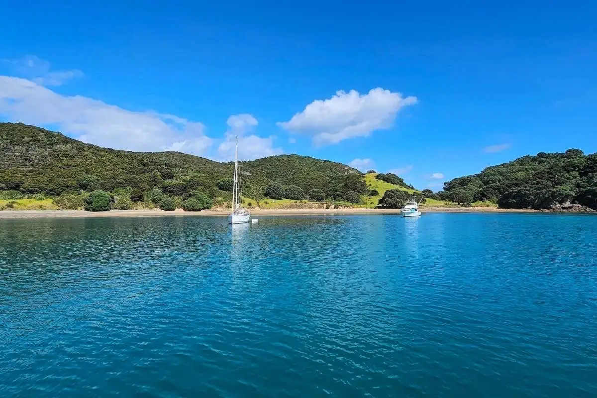
Easy walk to NZ’s first Christian mission site with stunning bay views. Exact route, beach access, coastal track details. Rangihoua Heritage Park guide.
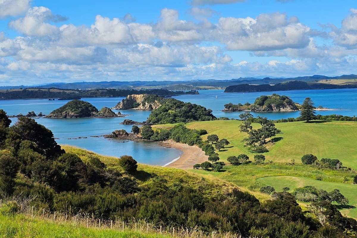
Walk 5km around Moturua Island in the Bay of Islands. Easy loop through beaches, forest, and WW2 bunkers. Pest-free sanctuary with kiwi and native birds. Boat access only.
alk pest-free Motuora Island in the Hauraki Gulf. Multiple tracks through regenerating bush, coastal viewpoints, and beaches. Camping available with excellent kiwi spotting at night. Water taxi from Sandspit Wharf.
Walk the Motutapu Island Walkway and you’ll find volcanic coastlines, WWII history, and stunning Gulf views. This 4-hour loop takes you through farmland to beaches.
You’ll love this easy coastal walk on Motuihe Island with stunning Hauraki Gulf views, native bush, and historic sites. Perfect for families seeking a peaceful island escape.
You’ll find a beautiful waterfall hiding in Lucas Creek that’s perfect for a quick nature escape. This easy forest walk takes about 45 minutes return and feels worlds away from the city.
Paddle down the Puhoi River then tackle coastal rocks and road walking to Orewa Beach. This Te Araroa section needs two tide windows and gives your legs a break. Here’s what you need to know.
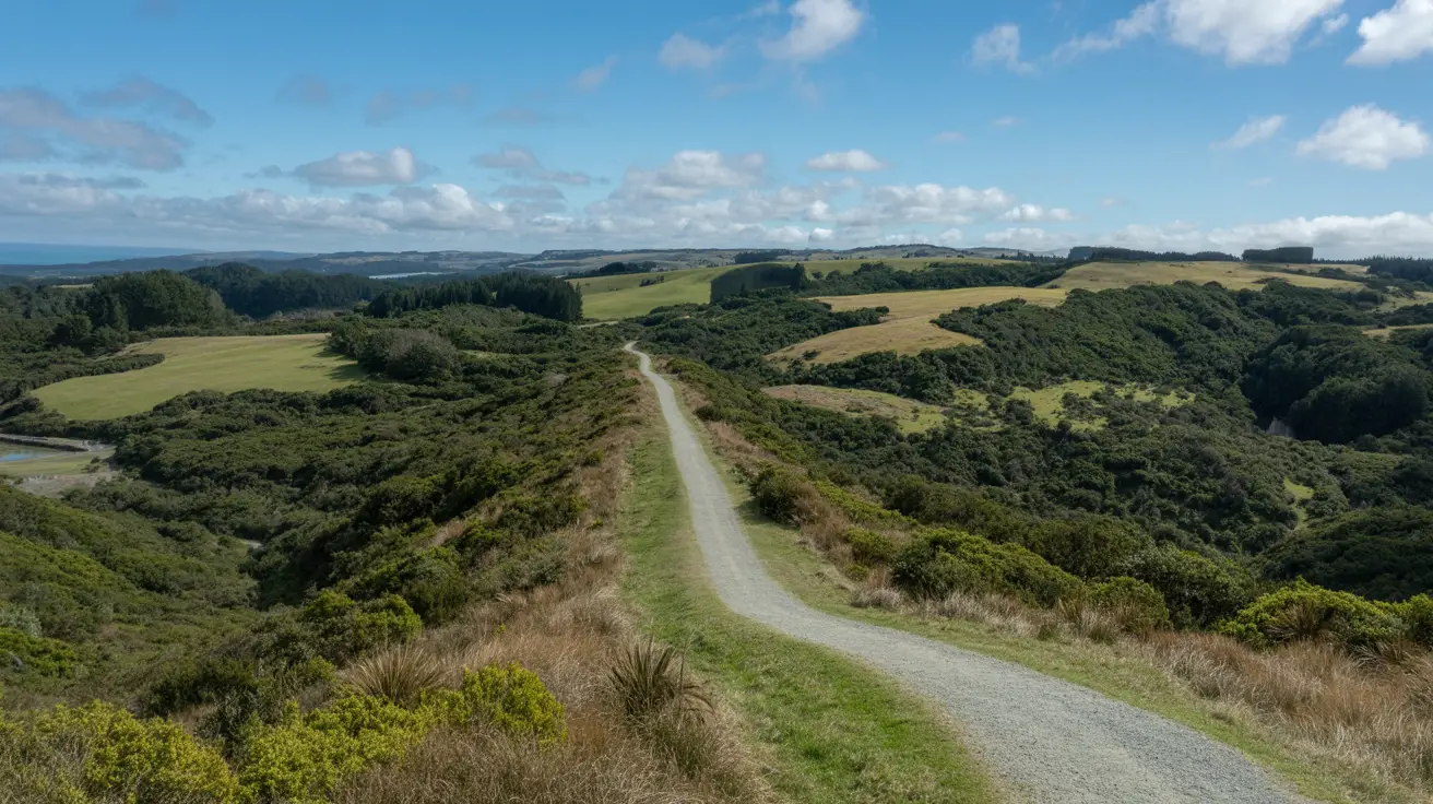
Climb the Dome Forest Summit Track near Warkworth for stunning 360° views across Rodney. This 2-hour return walk takes you through native bush to a ridge-top lookout. Get the details you need here.

Mt Tamahunga near Matakana is the highest accessible summit between Auckland and Whangarei at 437m. This steep 3-hour return track climbs through farmland and native bush with coastal views along the way.
White sandy beaches, sheltered quarry swimming, and coastal headland views at Te Ārai Point near Mangawhai. Track details, gravel road access, and endangered fairy tern habitat – 90km from Auckland.
The Pūweto Loop is easily our favorite walk in Waitawa. It’s a bit of a workout, but the 360-degree Hauraki Gulf views are totally worth it. We’ve got the lowdown on track conditions, how to find the old pā sites and more.
You’ll love this easy 2km loop through native bush in Waitawa Regional Park, East Auckland. Watch for pīwakawaka (fantails) flitting through the trees. Perfect for families.
The Kōtare Loop was officially renamed in 2025. Don’t get lost, check our updated 2026 guide for the new track colours, dog rules, and birdwatching tips at Waitawa.
You’ll love this easy 2km loop through native bush in Waitawa Regional Park, Clevedon. Perfect for families and packed with birdlife. Find out about parking, facilities and what to expect.
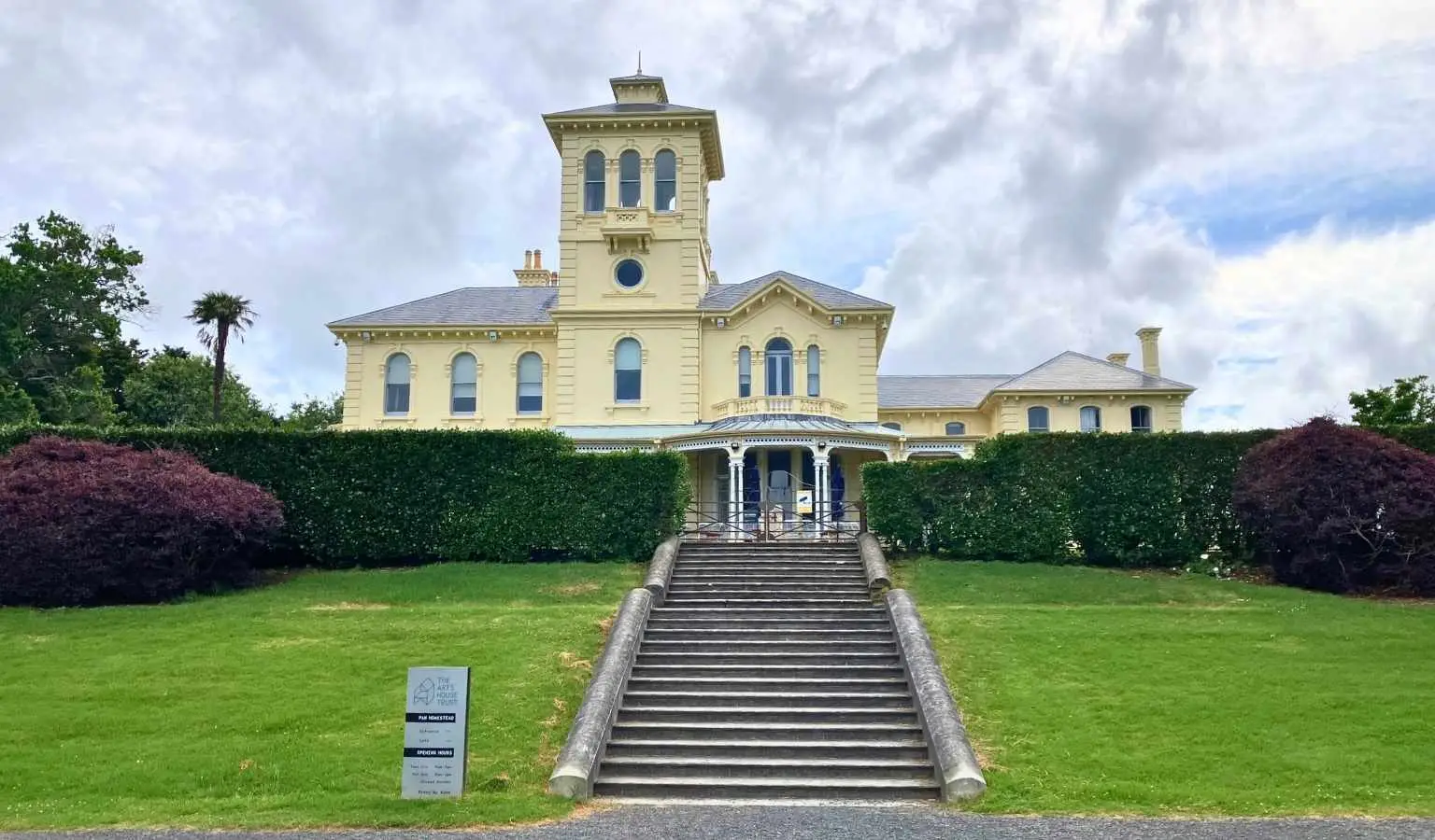
You’ll walk from Onehunga’s waterfront through Waikaraka Park to the historic Pah Homestead. It’s an easy urban route mixing harbour views with green spaces and art.
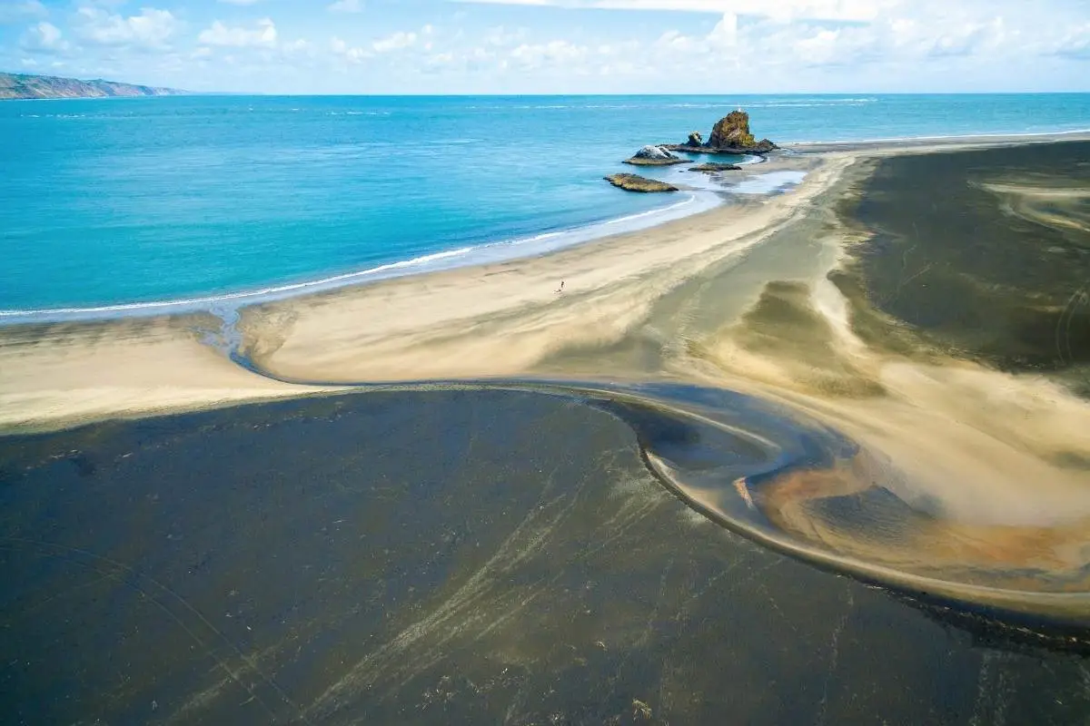
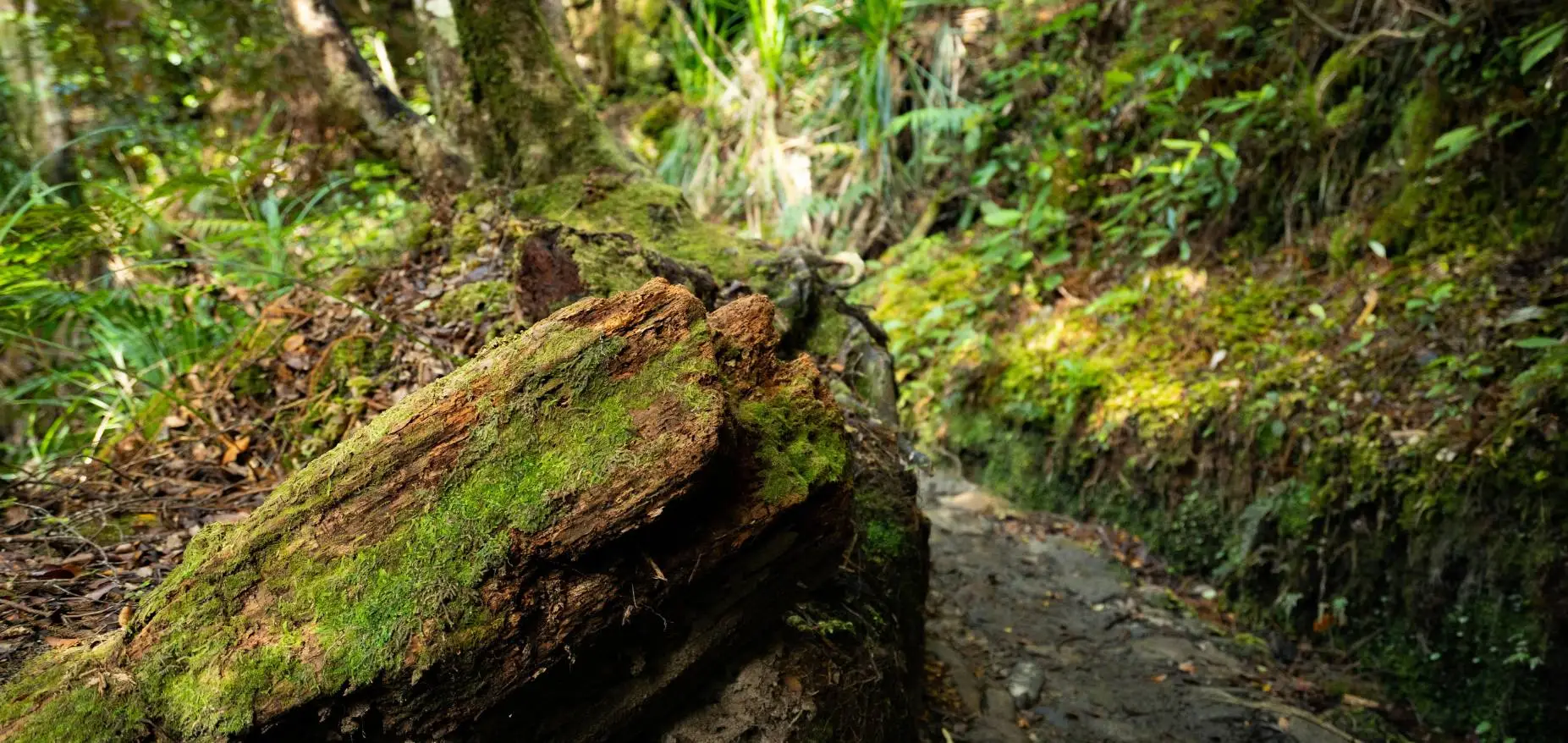
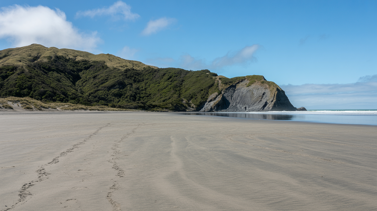
Whatipū is spectacular but dangerous if you miss the tides. This guide covers the 8km beach walk, the sea caves, and how to navigate the gravel road and tide windows safely
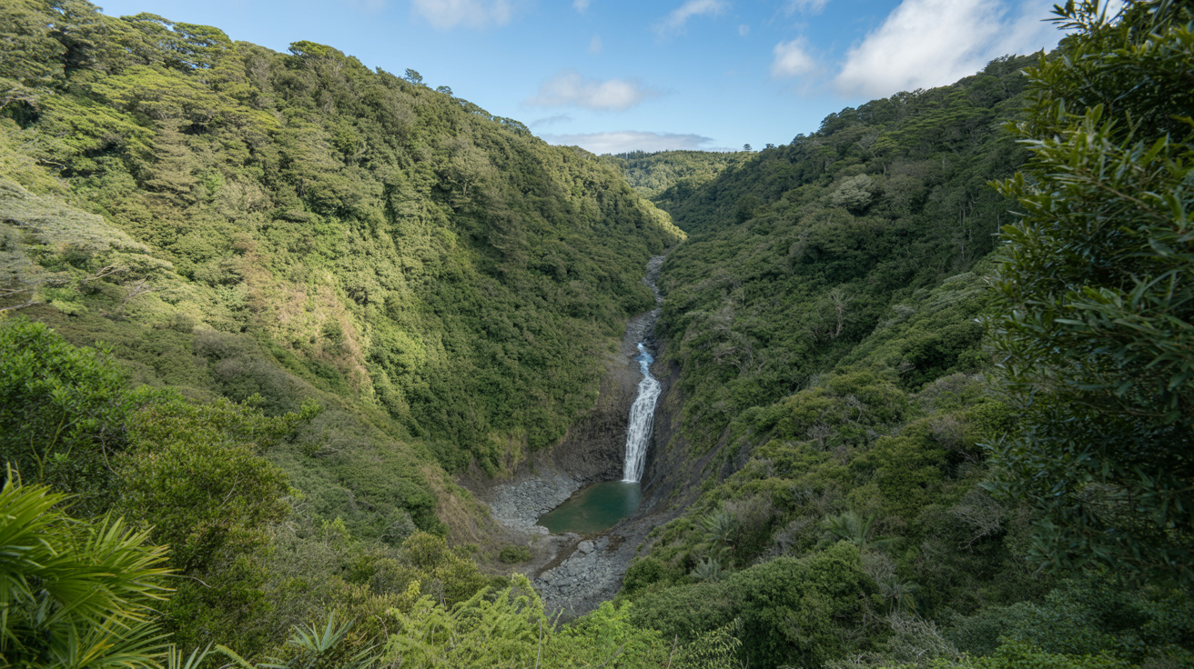
You’ll love this scenic bush walk to Karamatura Falls in Huia. It’s an easy 2-hour return through native forest with a beautiful waterfall reward. Get track details here.
You’ll love the Muriwai Cliff Top Walk for its stunning gannet colony views and dramatic black sand coastline. This easy 45-minute loop is perfect for families and photographers.
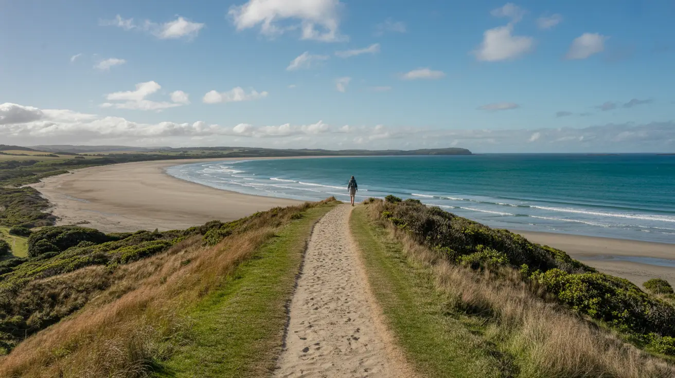
You’ll hike 10km of wild West Auckland coastline from Bethells Beach to Muriwai. Expect black sand, dramatic cliffs, and gannet colonies. Get the full route details here.
You’ll hike through native bush to stunning Wainamu Falls, then trek across dramatic black sand dunes to the coast. This 2-3 hour loop near Bethells Beach packs beaches, waterfalls and dunes into one epic walk.