Walk Straight Off the Waiheke Ferry to Stunning Coastal Views
The Matiatia Owhanake Coastal Loop is perfect if you want to walk straight off the Waiheke ferry without needing any extra transport. This loop takes you along the northern coastline with stunning Hauraki Gulf views, through regenerating native bush, past vineyards, down to beautiful beaches, and back to catch your ferry home.
Wow, Waiheke walks are truly amazing and the Matiatia Owhanake track did not disappoint. We couldn’t have asked for better weather – a perfect NZ summer’s day at 28 degrees. Good job we decided to start early, it was already hot at 9am!
SAVE 28% on last minute deals with Premium Full Day Waiheke Wine Tour
Quick Facts
| What | Details |
|---|---|
| Where | Matiatia Bay, northern Waiheke Island |
| Start/Finish | Matiatia Ferry Terminal |
| Distance | 7.7-9 km loop (depending on route options) |
| Time | 2.5-3 hours |
| Difficulty | Moderate |
| Elevation | Around 186m gain – lots of ups and downs! |
| Dogs | Allowed on leash |
| Prams/Wheelchairs | No – steep sections, steps, uneven terrain |
| Parking | Not needed – starts at ferry terminal |
| Best for | Anyone visiting Waiheke without a car, coastal views, day trippers |
Why This Walk is Brilliant
No Transport Needed: Walk straight off the ferry. No buses, taxis, or car hire required. Perfect for day trips.

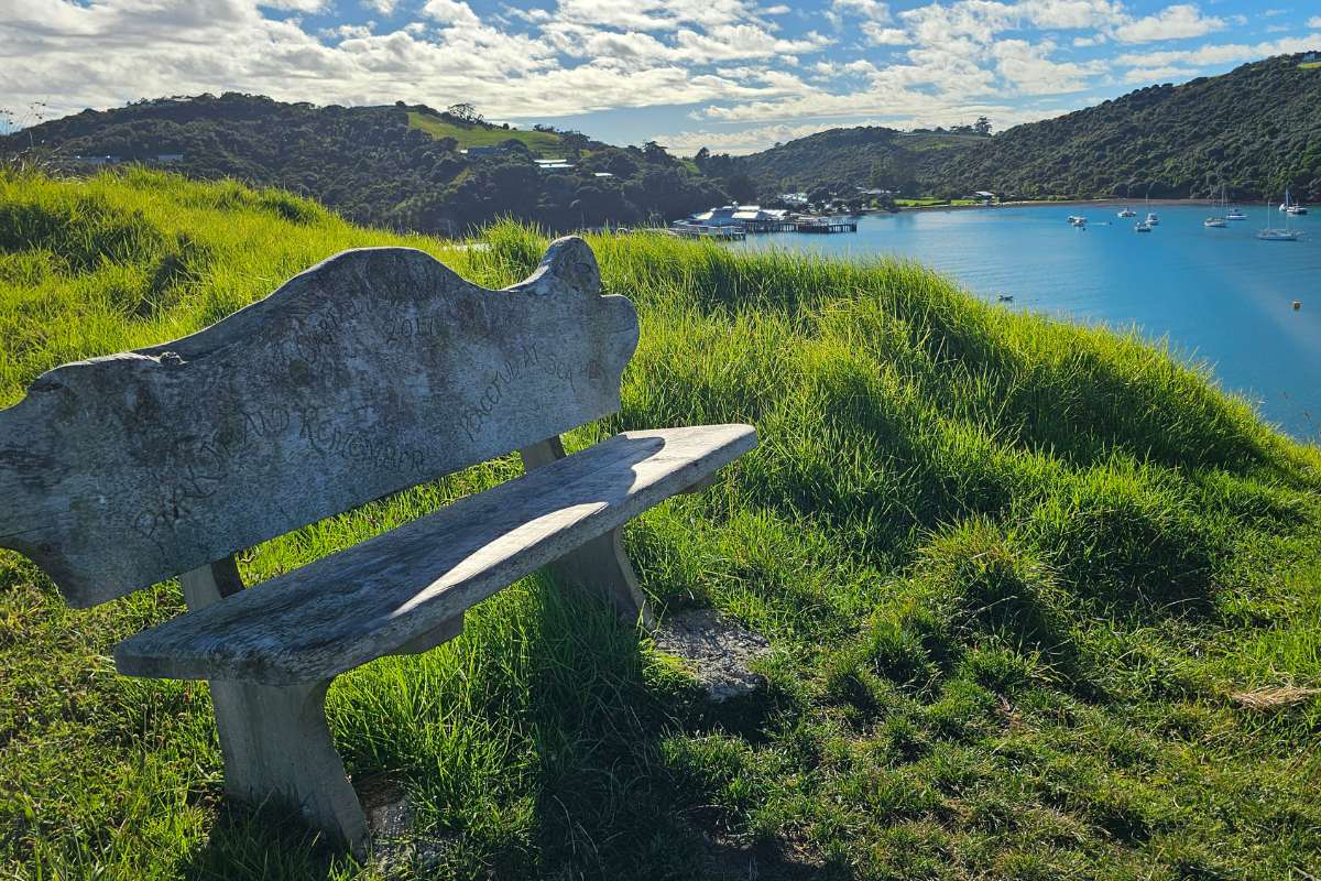
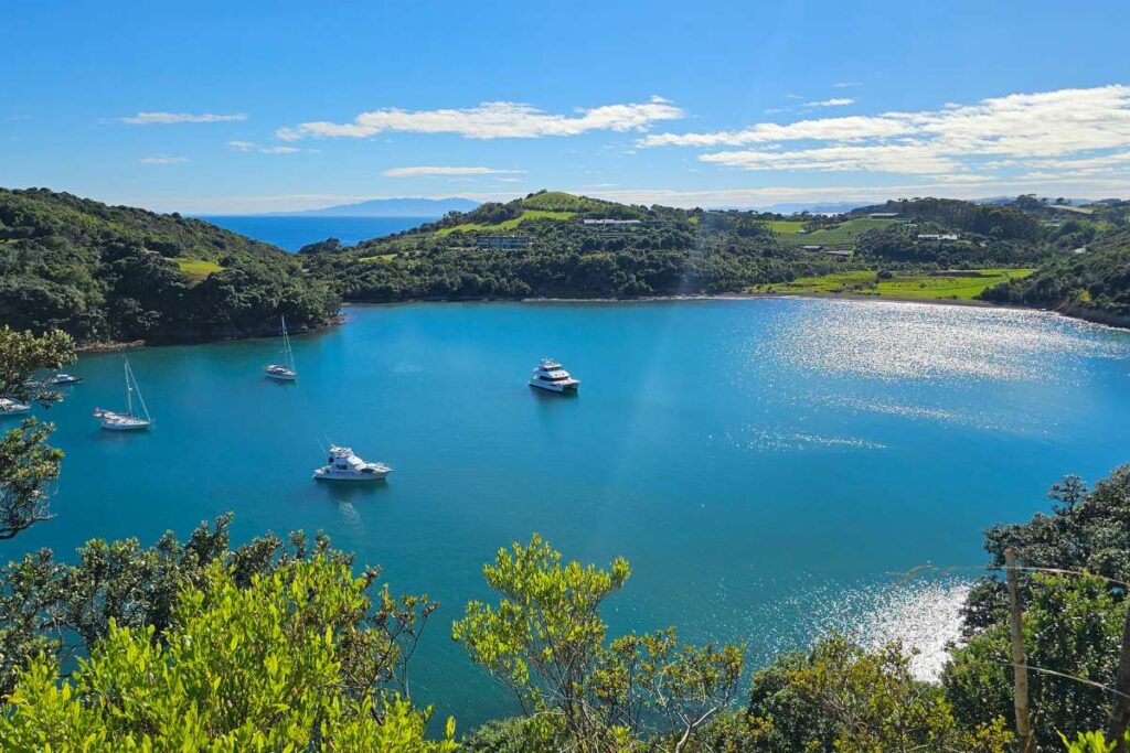
Stunning Coastal Views: You’ll get epic views across the Hauraki Gulf to Little Barrier Island, Great Barrier Island, the Coromandel Peninsula, and back to Auckland.
Multiple Beach Options: Cable Bay, Island Bay, Owhanake Bay – all beautiful spots for a swim.
Variety: Coastal paths, native bush, vineyards, residential areas, historic sites. You’re constantly seeing something different.
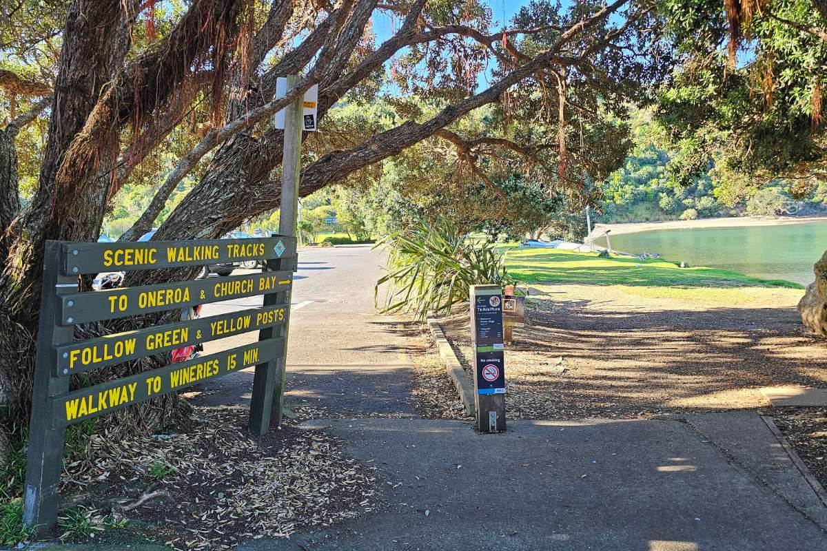
Finish in Oneroa: Optional route to finish in Waiheke’s main village for lunch before catching the ferry back.
WWII History: Old pillboxes and bunkers along the route (though skip the “viewpoint” bunker – not worth it, as I’ll explain).
Real Workout: There are a lot of uphill steps to climb. You don’t need to be an “experienced walker” as the signs say, just a fitter one! This walk will give you a really good workout.
The Route – Step by Step
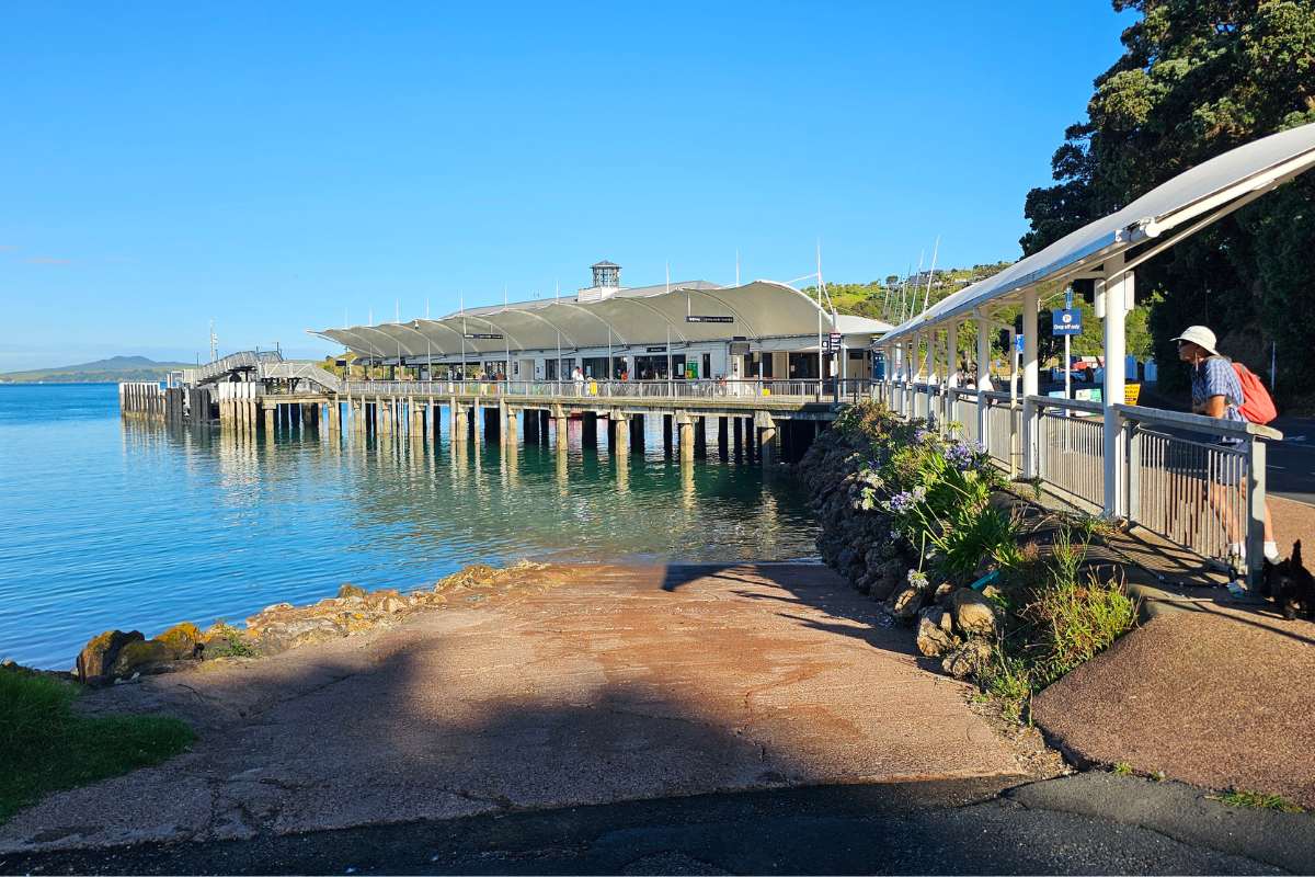
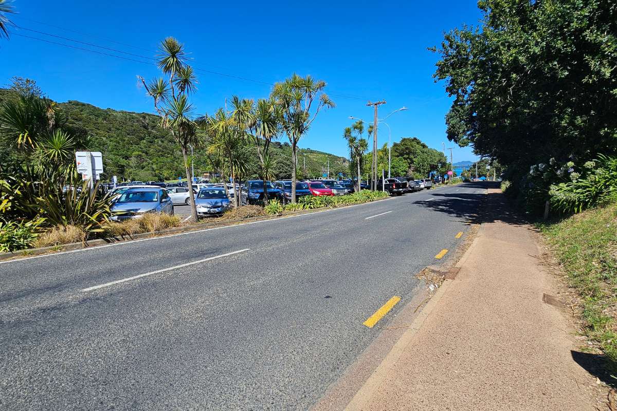
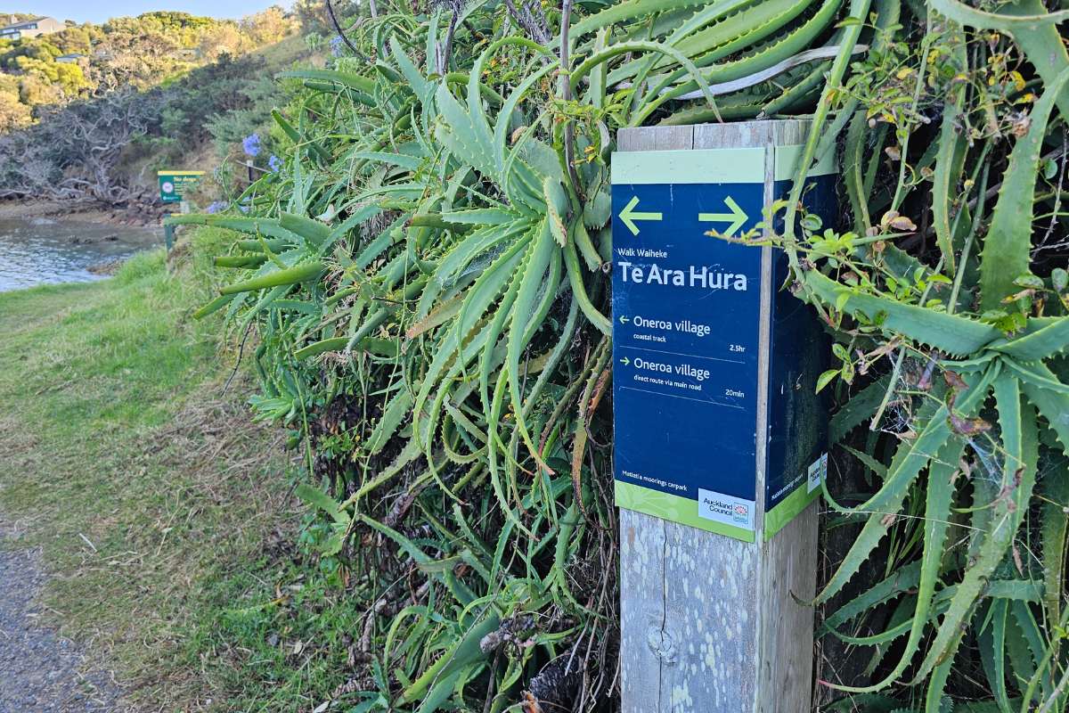
Starting from Matiatia Ferry Terminal
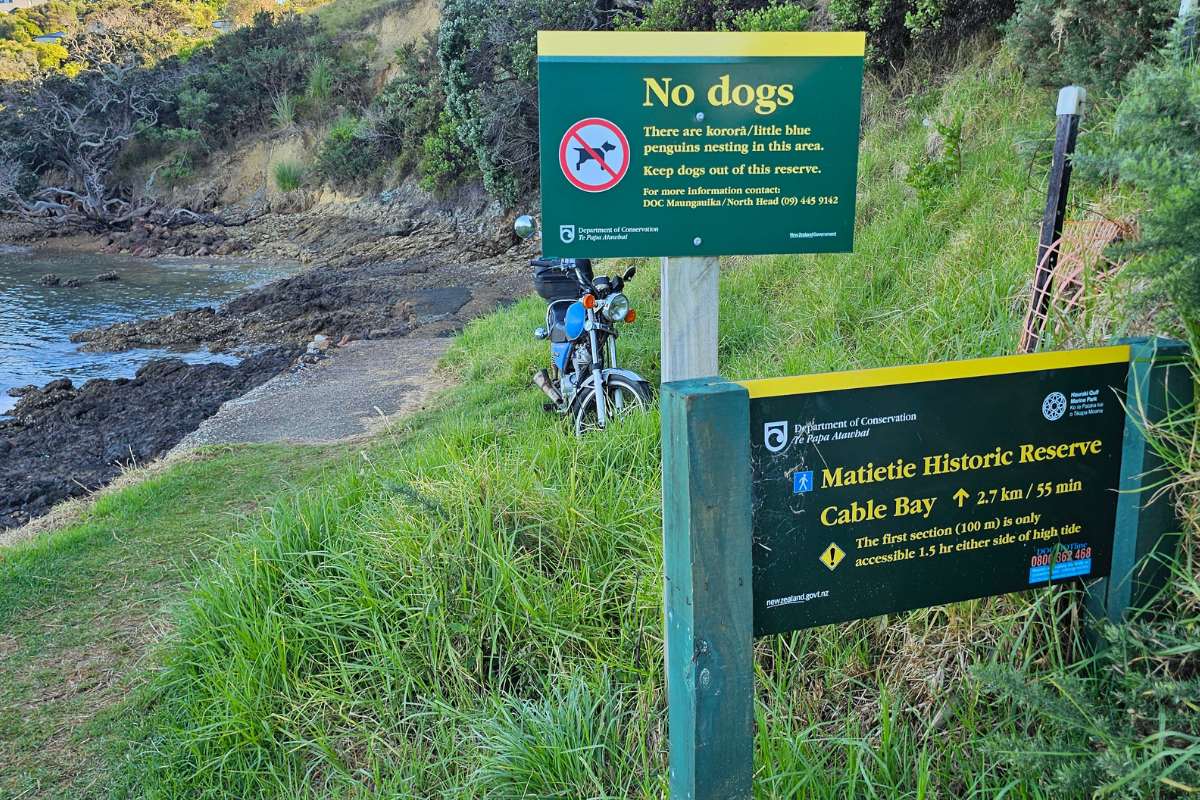
1. Head North from the Ferry Turn right from the ferry terminal and walk through the Matietie Historic Reserve around the waterfront. The track starts beside the beach on the north side.
2. Low Tide Option At low tide, you can take a shortcut around the first beach following along the coastline. It was low tide when we went, so we took this option. Note: The coastal track section between Owhanake Bay and Matiatia Bay is only accessible 1.5 hours either side of high tide. Check tide times if you’re worried.
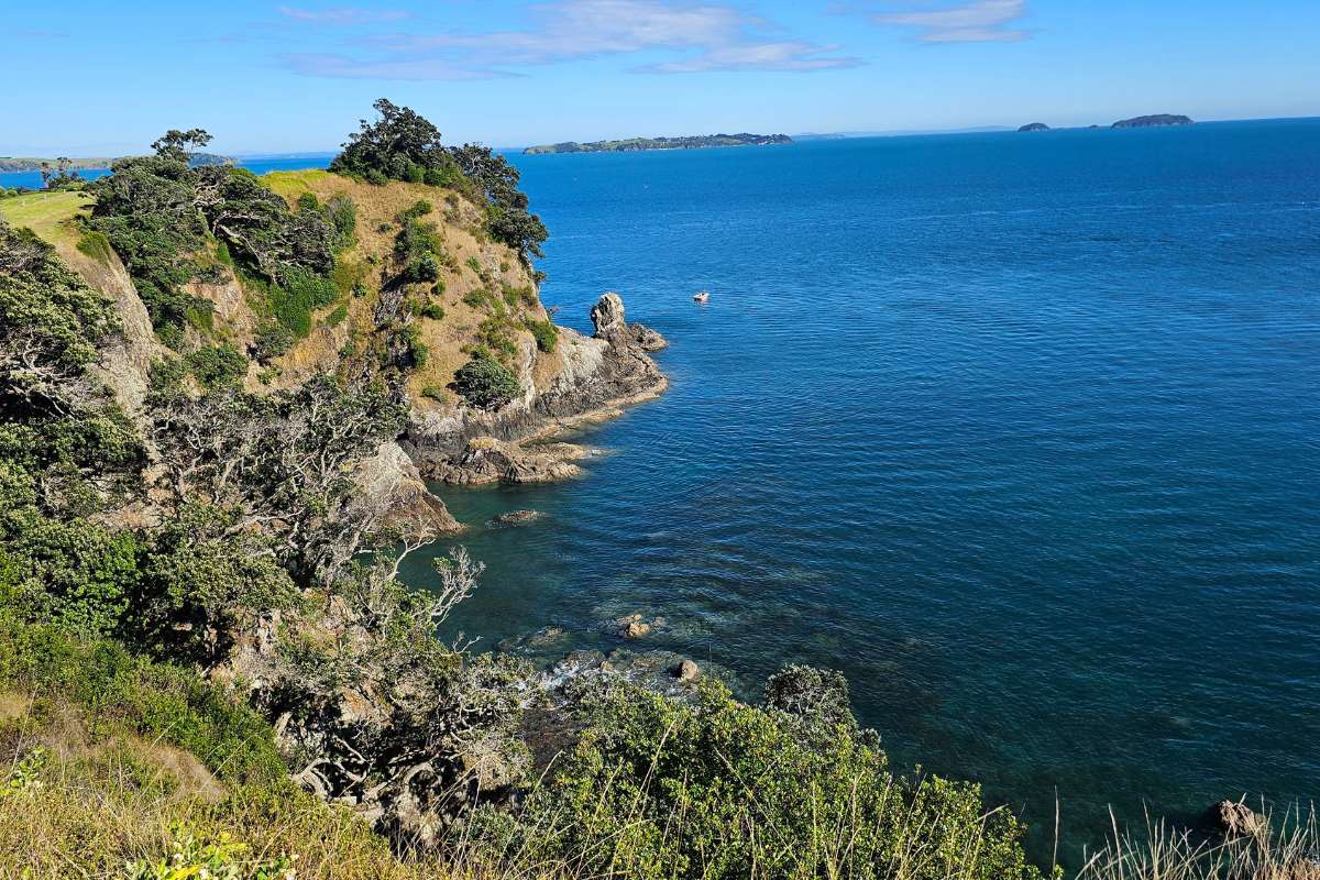
3. To Cable Bay Continue on the track around to Cable Bay. Uphill and down, the walking is quite challenging in parts with lots of steps. The views make up for the effort though.
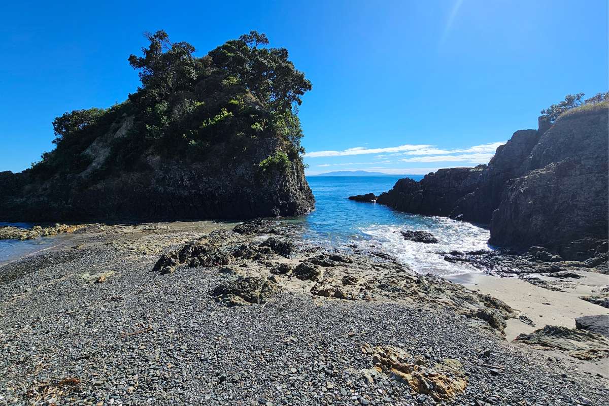
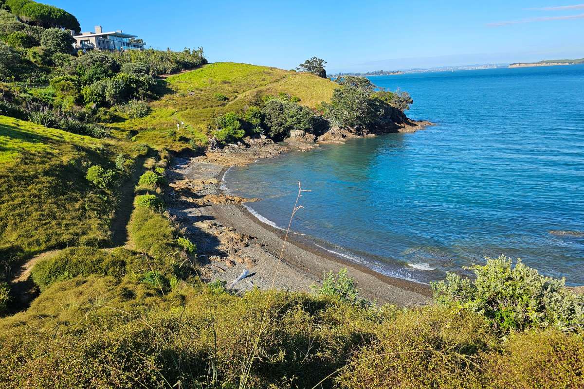
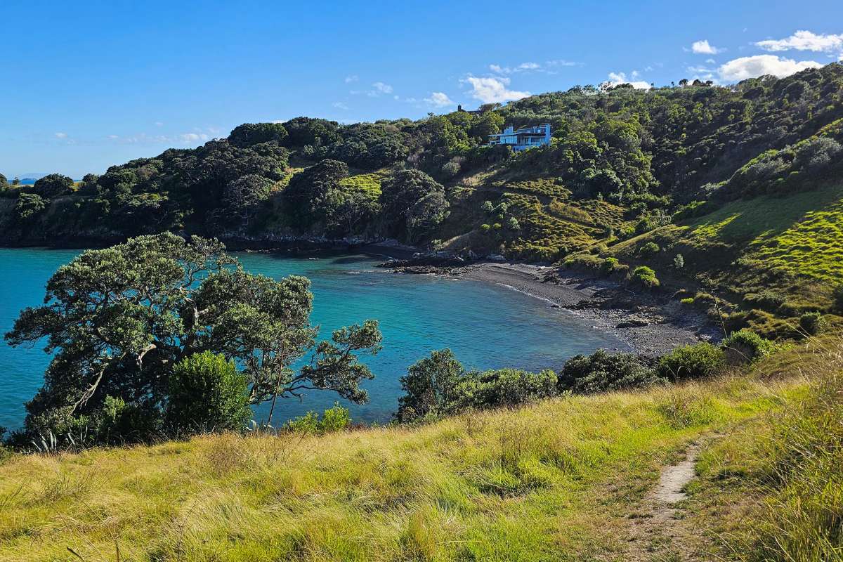
4. Coastal Track to Island Bay Keep following the coastal track. So many beautiful views along the way – I must have taken 100 photos or more. The track takes you above cliffs with crystal clear waters and interesting little coves below.
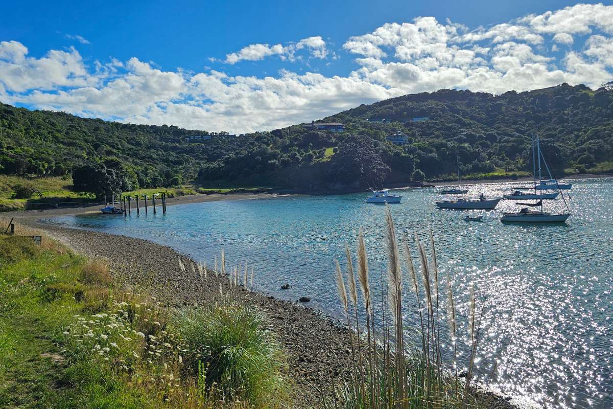
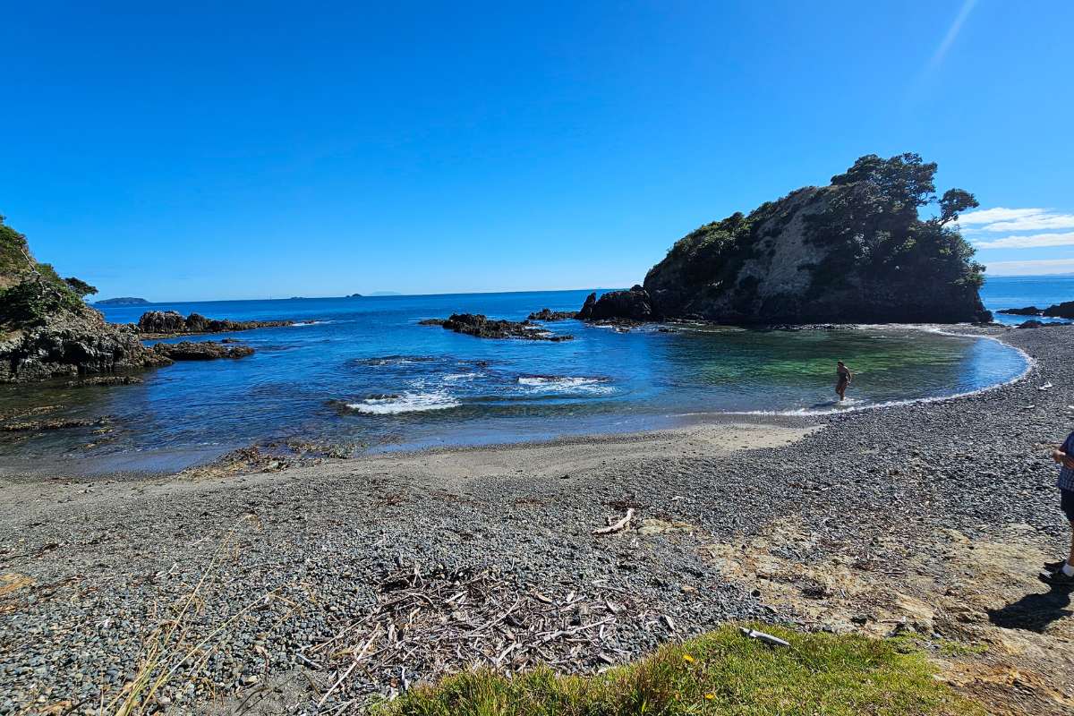
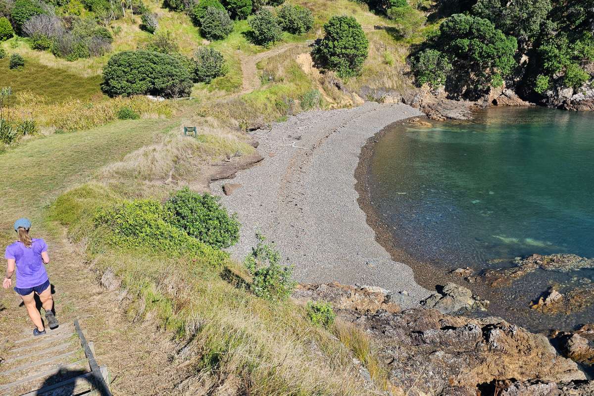
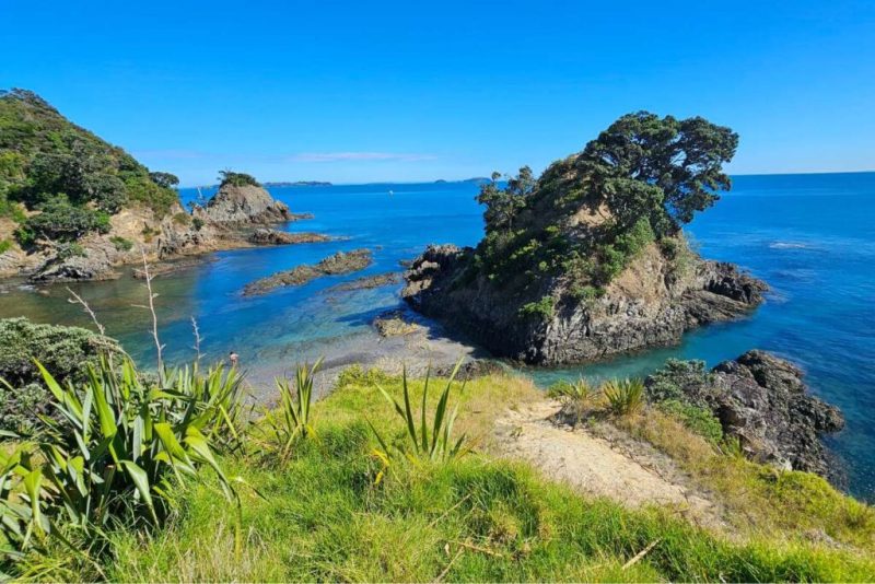
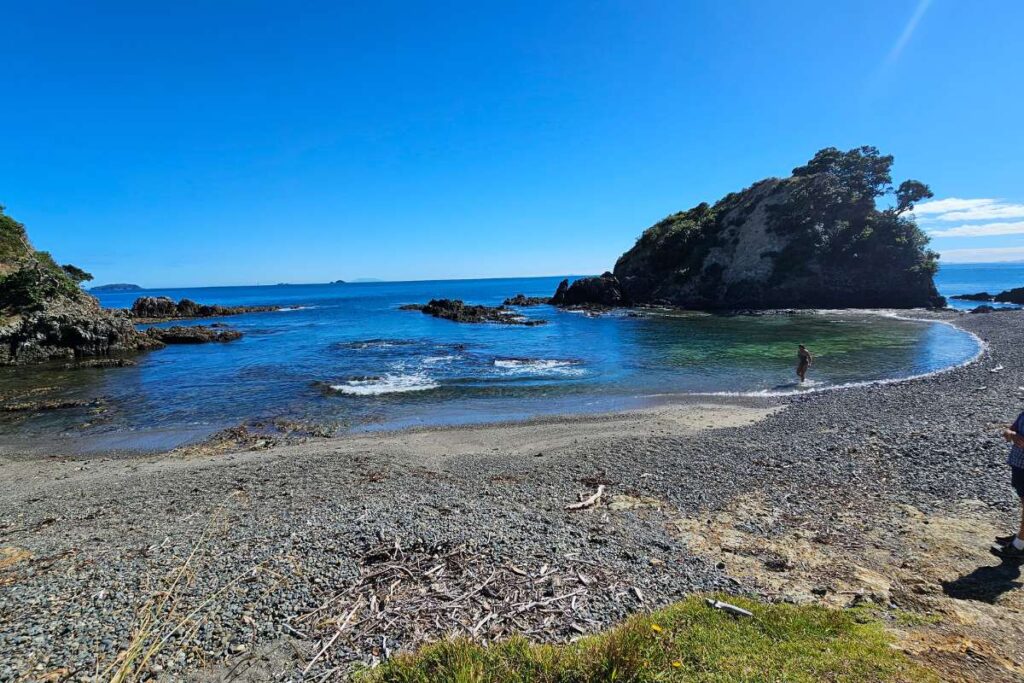
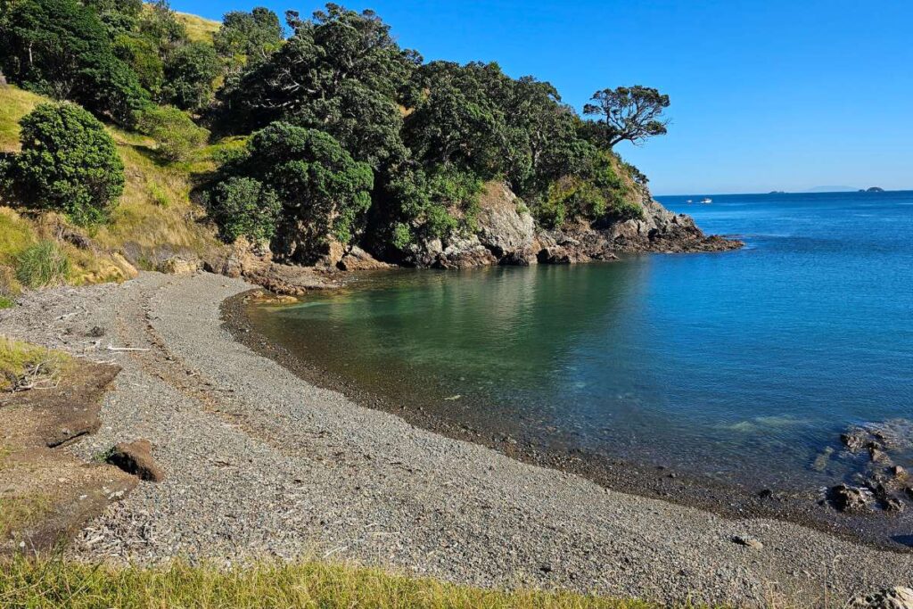
5. Island Bay ★ My Favorite Spot I think I enjoyed little Island Bay the best. The water was so clear and inviting. This is a gorgeous sheltered spot – perfect for a swim if you have time.
6. Green and Yellow Markers From Island Bay, follow the green and yellow marker posts to Korora Road. These markers guide you inland from the coast.
7. Through Pohutukawa Sanctuary You’ll pass through privately owned bush (public access) in the Pohutukawa Sanctuary. Beautiful regenerating native forest.
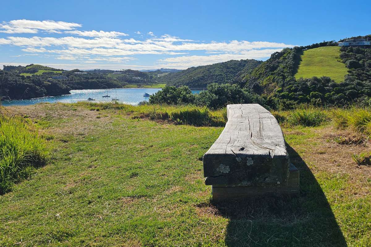
8. Owhanake Bay Decision Point When you reach Owhanake Bay, you have options:
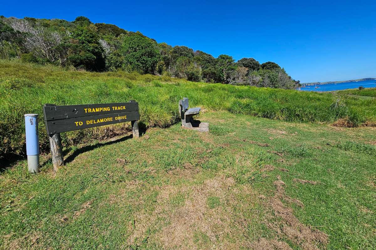
Option A (Shorter): Head up to Delamore Drive and return directly to Matiatia Option B (Longer): Follow the mowed track around Owhanake Bay to Korora Road
9. Past Fossil Bay Farm If you took Option B, walk up Korora Road past Fossil Bay Farm. You’ll see steps on the right leading to another track through bush.
10. Ridge Views The track climbs to a ridge with awesome views out to Little Barrier and Great Barrier Islands. Worth the climb!
11. The “Viewpoint” to Skip Just before heading back down toward the end of the walk, there’s a sign saying there’s a viewpoint 5 minutes up the road. Don’t bother – there isn’t much view and you’d need to somehow jump on top of a WWII bunker to see anything. Skip it.
12. Return to Matiatia Follow the track back down to Matiatia Ferry Terminal. You can return via Ocean View Road or take the Atawhai Whenua Reserve pathway along the wetland edge (prettier option).
Optional Extension to Oneroa
Instead of returning directly to Matiatia, you can continue to Oneroa Beach and village:
- Distance: Adds about 1-2 km
- Time: Adds 30-45 minutes
- Why: Heaps of cafes and restaurants for lunch
- Return: Walk back via Ocean View Road or catch a bus to the ferry
What You’ll Actually See
Coastal Scenery
- Hauraki Gulf views: Stunning ocean vistas the whole way
- Islands: Little Barrier Island, Great Barrier Island prominent on clear days
- Coromandel Peninsula: Views across to the mainland
- Auckland City: Look back toward the city from various points
- Crystal clear waters: Beautiful coves and bays below the cliffs
- Sea caves: Accessible only by boat or paddleboard (makes you want to come back with a kayak!)
Beaches and Bays
- Matiatia Bay: Where you start and finish
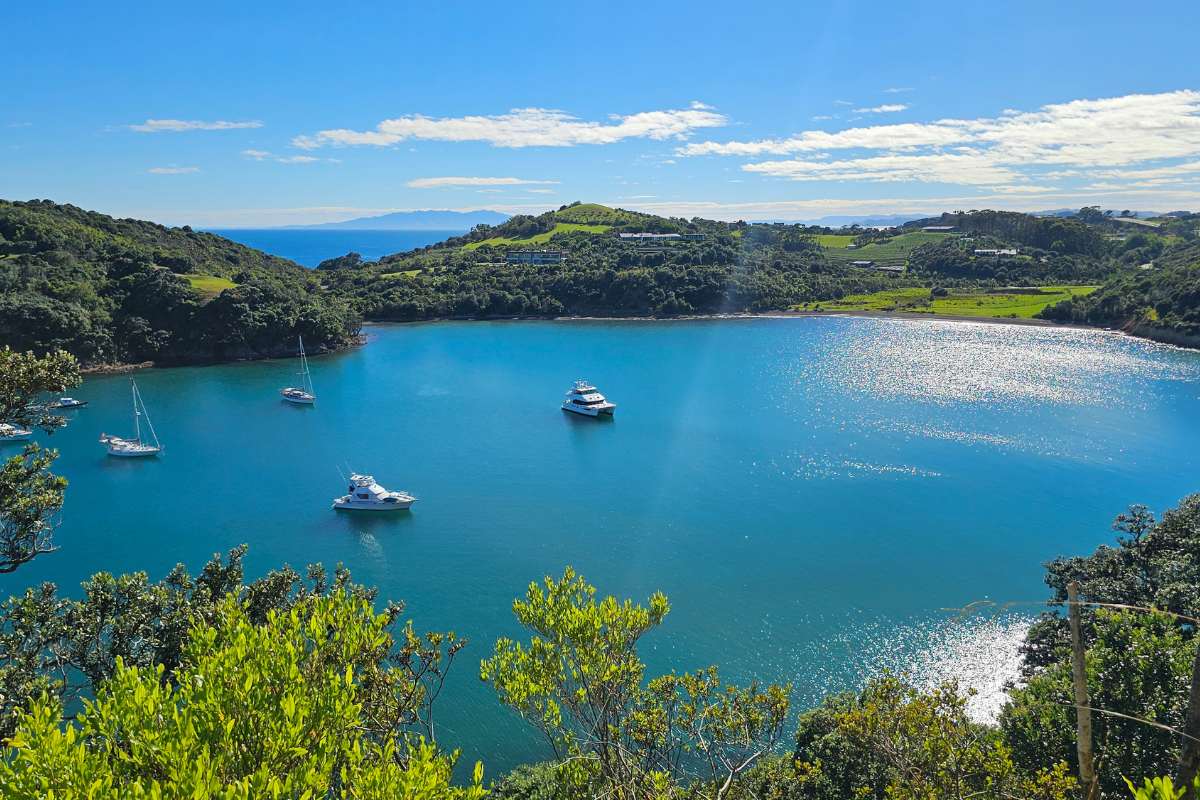
- Cable Bay: Nice beach, vineyards nearby
- Island Bay: My favorite – crystal clear water, sheltered
- Owhanake Bay: Former shingle mining site (they mined pebbles here in the 1880s – half of Auckland was supposedly built with shingles from Waiheke!)
Native Bush
- Regenerating native forest in reserves
- Birds: Listen for tūī, bellbirds (korimako), and kererū (wood pigeons)
- Pohutukawa Sanctuary with beautiful trees
Vineyards
You’ll pass by or near several vineyards:
- Cable Bay Vineyards (worth a stop)
- Fossil Bay Farm vineyard (Auckland University uses it for research)
Historical Sites
- WWII pillboxes: Old military defensive positions along the coast
- Bunker at Delamore Drive: Can see it but not worth the climb for the “viewpoint”
- Ancient pā terraces: On the headland near Delamore Drive
- Matietie Historic Reserve: Where you start the walk
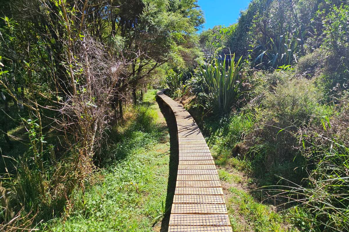
Track Surface and Conditions
Mixed surfaces: Coastal paths, bush tracks, some residential streets, gravel roads.
Lots of steps: Be prepared for heaps of uphill climbing. Your legs will know they’ve done a workout!
Steep sections: Particularly steep in places. Take your time and use any handrails.
Rocky sections: Some rocky terrain, especially near the coast.
Can be slippery: After rain or near cliff edges. Watch your footing.
Clifftop paths: Some sections are close to cliff edges. Great views but be careful, especially with kids or dogs.
Tide Information – Important!
The coastal track section between Owhanake Bay and Matiatia Bay is only accessible 1.5 hours either side of high tide.
Check tide times before you go:
- Low tide: You can take the beach shortcut at the start
- High tide: Stick to the upper paths
- Mid tide: Best of both worlds – coastal access available
Tide tables: Check MetService or tide apps for Waiheke Island/Matiatia Bay.
When to Go
Best seasons:
- Spring (Sep-Nov): Perfect weather, wildflowers, not too busy
- Summer (Dec-Feb): Best for swimming but hot on exposed sections (we went in summer at 28 degrees – start early!)
- Autumn (Mar-May): Beautiful light, comfortable temps
- Winter (Jun-Aug): Still doable but cooler and potentially wetter
Best times of day:
- Early morning: Beat the heat (by 9am it was already hot when we went)
- Weekdays: Fewer people
- Check ferry times: Make sure you finish in time for your ferry back
What to avoid:
- Middle of hot summer days (no shade on exposed sections)
- High winds (clifftop sections can be breezy)
- After heavy rain (steps and paths get slippery)
What to Pack
Must Have
- Good walking shoes: Proper grip needed for steep sections and steps
- Water: 1.5-2 liters – it gets hot and there are no refill spots
- Sunscreen, hat, sunglasses: Lots of exposed walking
- Snacks: No food stops along the coastal sections
Good to Have
- Swimwear and towel: Island Bay is so inviting!
- Camera or phone: You’ll want to take 100 photos like I did
- Light rain jacket: Just in case
- Cash/card: For Cable Bay Vineyards or Oneroa cafes
- Tide table: Check accessibility of coastal sections
Facilities
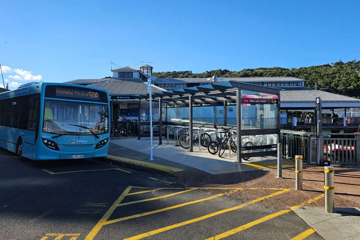
At Matiatia Ferry Terminal:
- Toilets
- Kiosk/cafe
- Information boards
- Water
Along the way:
- Picnic tables at Owhanake Bay
- No toilets between Matiatia and Oneroa
- Cable Bay Vineyards (food and wine)
At Oneroa (if you extend):
- Toilets
- Heaps of shops, cafes, restaurants
- Beach facilities
Dogs
Dogs are allowed on leash throughout. Keep them under control, especially on steep sections and near cliff edges. Bring water for them. The beaches are great for a dog swim (on leash).

Swimming
Several beautiful swimming spots:
- Island Bay: My favorite – crystal clear water, sheltered
- Cable Bay: Good beach
- Owhanake Bay: Historic shingle beach
- Matiatia Bay: Right at the start/finish
Bring your togs (swimwear) and towel!
History and Culture
Matietie Historic Reserve
The start point has historical significance with evidence of early Māori and European settlement.
WWII Defenses
The pillboxes and bunkers along the coast were built during World War II to defend Auckland from potential attack. The strategic headlands offered good defensive positions.
Ancient Pā
The terraces near Delamore Drive are remnants of an ancient fortified pā (Māori settlement).
Owhanake Bay Shingle Mining
In the 1880s, Owhanake Bay was a large shingle bed that was mined extensively. It’s said that half the city of Auckland was built with pebbles from shingle beds from Waiheke Island. The mining gradually stripped the shorelines, exposing them to erosion.
Te Huruhi
Owhanake was one of the last areas of Māori (Ngāti Paoa) owned land on Waiheke, gradually sold in the 1900s.
Track Closures – Important Note
Ignore the sign about track closure! When we walked it, there was still a sign saying part of the track was closed. It most definitely was not and was well worth continuing on with the walk. The closed section has been reopened but the old sign remains. Don’t let it put you off.
That said, always check for kauri dieback closures before you go: aucklandcouncil.govt.nz
Who’s This Walk For?
Perfect for:
- Day trippers from Auckland who don’t want to arrange transport
- Anyone visiting Waiheke without a car
- Reasonably fit walkers (those steps!)
- Coastal view enthusiasts
- Photographers
- People wanting a proper workout
- Dog walkers (on leash)
Not ideal for:
- Young kids (too long and steep)
- Prams or wheelchairs
- People wanting a flat, easy walk
- Anyone not comfortable with heights/cliff edges
- Very hot days if you’re not fit (no shade on exposed bits)
Fitness needed: Moderate to moderately challenging. You need to be comfortable with 2.5-3 hours of walking including heaps of uphill steps and steep sections. It’s a proper workout!
Safety
Generally safe but keep these in mind:
- Steep sections with steps: Take your time, use handrails where provided
- Clifftop paths: Watch your footing, keep kids and dogs close
- Slippery when wet: Be extra careful after rain
- Exposed to sun: Bring plenty of water and sun protection
- Tide dependent: Check tide times for coastal sections
- Cell reception: Usually okay but can be patchy
- Tell someone: Let people know your plans
Emergency contacts:
- Emergency: 111
- Ferry terminal staff can help
- Oneroa has services if needed
After Your Walk
At Matiatia
- Catch your ferry back to Auckland
- Grab a coffee at the kiosk while waiting
Oneroa Option
If you extended to Oneroa:
- Restaurants and cafes: Loads of options
- Shops: Browse local stores
- Beach: Relax on Oneroa Beach
- Bus or walk back: To Matiatia Ferry Terminal
Vineyards
- Cable Bay Vineyards: Right on the route – wine tasting and restaurant
- Book ahead for restaurant, especially weekends
Nearby Walks
- Church Bay Circuit – Southern coastal loop from the ferry, can be combined
- Matiatia to Church Bay – The southern equivalent of this walk
More Waiheke Walks
Check out my other Waiheke walks:
- Onetangi Beach to Man O’ War Bay – Epic 14.3 km eastern end adventure
- Whakanewha Loop – Beautiful bush and cascades
- Church Bay Circuit – Western peninsula coastal walk
- Stony Batter Walkway – WWII tunnels and views
- Te Toki Reserve Loop – Native bush
- Park Point Headland Loop – Clifftop walking
- See all my Waiheke Island walks
Getting There
- From Auckland: Fullers360 ferry from downtown Auckland to Waiheke Island (40 minutes). Regular services throughout the day. Book ahead on weekends and peak times.
- Starting the Walk: Walk straight off the ferry at Matiatia – the track starts right there. No transport needed!
- Returning: Walk back to Matiatia Ferry Terminal and catch the ferry back to Auckland. Check ferry times before you start so you don’t miss the last one.

My Honest Take
This is hands-down the best walk on Waiheke if you don’t have a car or don’t want the hassle of arranging transport. You literally walk off the ferry and you’re on the track. Can’t get easier than that.
The views are stunning – I wasn’t kidding about taking 100+ photos. Island Bay is gorgeous, seriously crystal clear water. I wanted to stay there all day.
But be warned – those steps! Uphill and down, over and over. My legs definitely felt it the next day. It’s not a gentle coastal stroll, it’s a proper workout. But that’s what makes it so satisfying.
Definitely start early if you’re going in summer. By 9am it was already 28 degrees and there’s not much shade on the exposed sections. We were glad we caught the early ferry.
Skip that viewpoint near the WWII bunker – honestly not worth the detour. The views along the main track are way better.
And ignore that old “track closed” sign if it’s still there. The track is open and it’s the best part of the walk. Don’t let it put you off.
If you’ve got time, extend to Oneroa for lunch. Heaps of good cafes and you can catch a bus or walk back to the ferry afterward.
This walk gives you everything – coastal views, beaches, bush, history, workout – all without needing to hire a car or book a bus. Perfect Waiheke day trip from Auckland.
Done this walk? Did you swim at Island Bay? How many photos did you take?
Walk info updated 2025. Check tide times before you go and always verify track status for any kauri dieback closures.
Want more Waiheke walks? Check out all my Waiheke Island walks
See my photos of the Matiatia Owhanake Coastal Loop Walk