Home » North Island » Auckland Region » South Auckland » Mt Hobson & Mt Saint John Loop Walk
Two volcanic summits, one brilliant urban loop. Climb Mt Hobson for 360° harbour views that’ll knock your socks off, cross the Southern Motorway on a pedestrian bridge, then explore Mt St John’s remarkably preserved crater with ancient kumara pits. It’s a proper Auckland adventure that most locals don’t even know about.
| Distance | 4.5km |
|---|---|
| Time | 1 hour 10 mins walking (Allow 2+ hours to stop and take in the views) |
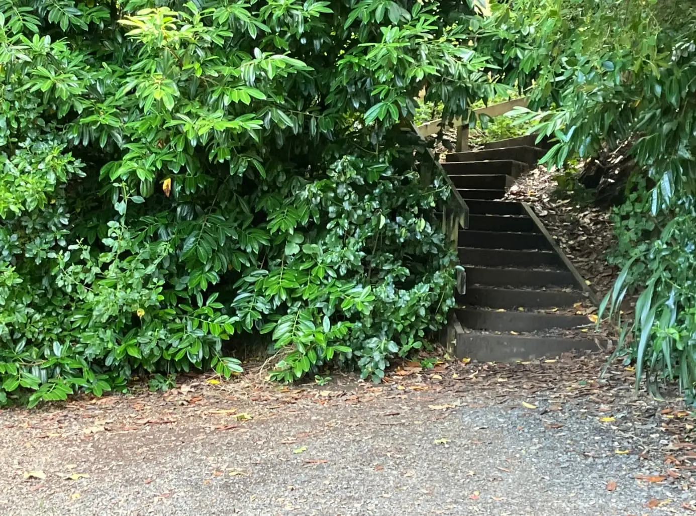
| Difficulty | Mostly easy with steep access and exits at both summits |
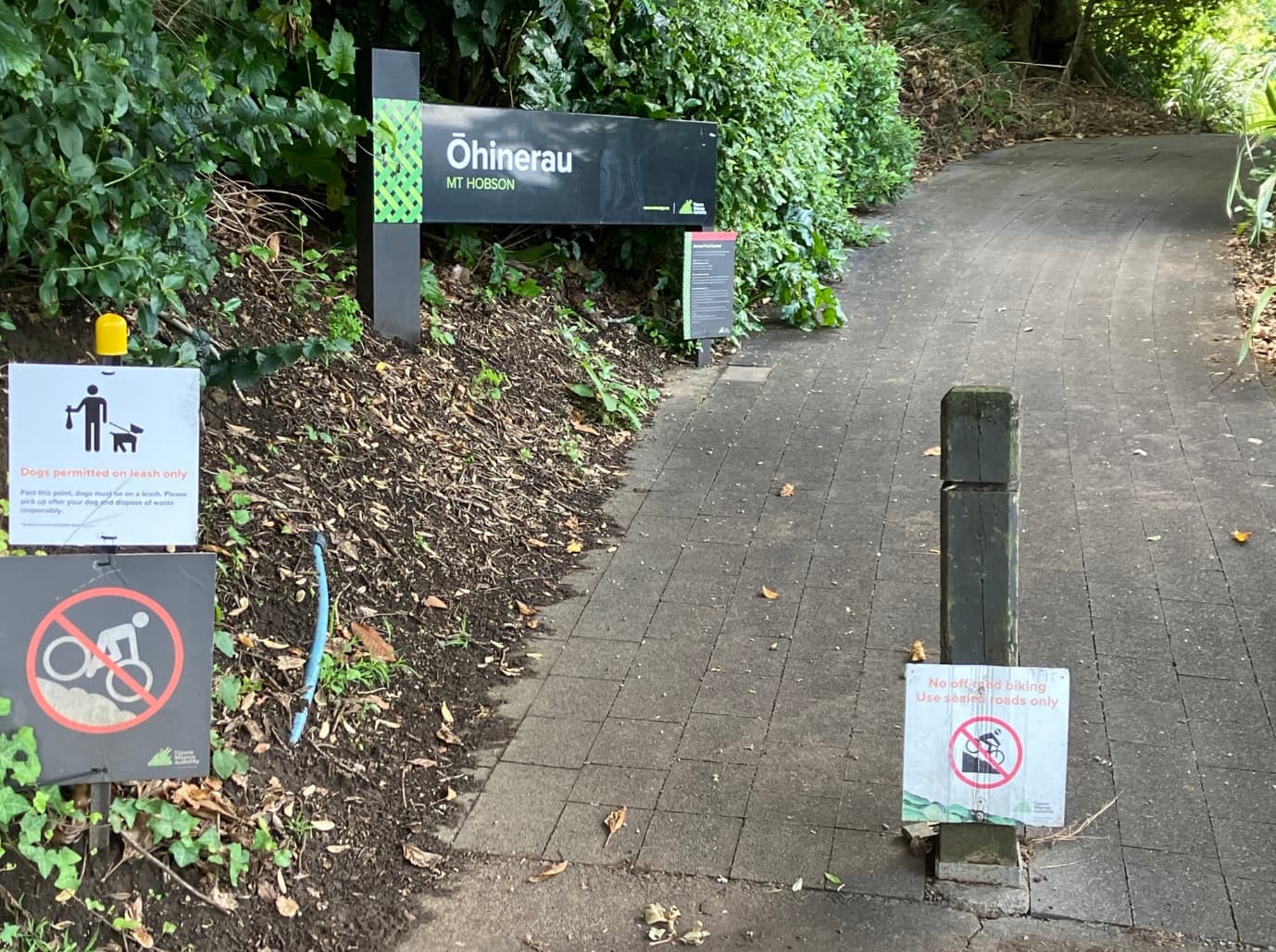
| Start Point | Ohinerau entrance, Remuera Road (50m from Market Road junction) |
| GPS Coordinates | -36.8933, 174.8133 |
| Parking | Street parking within 125m – observe parking signs |
| Public Transport | Buses 75, 751, 781 to Market Road stop | Southern Line train to Market Road Station |
| Public Toilets | Cafes at Great South Rd/Market Rd, Clonbern Rd (700m), Epsom Library (400m from direction 19) |
| Cafes | Friends and Allies Cafe & other eateries at Great South Road/Market Road intersection |
| Facilities | Plenty of seats and picnic spots along the route |
| Dogs | On leash at all times |
| Best Time | Year-round, but best in autumn/spring. Summer – go early or late. Check forecast for clear views. |
| What to Bring | Water, sun protection, good walking shoes, camera |
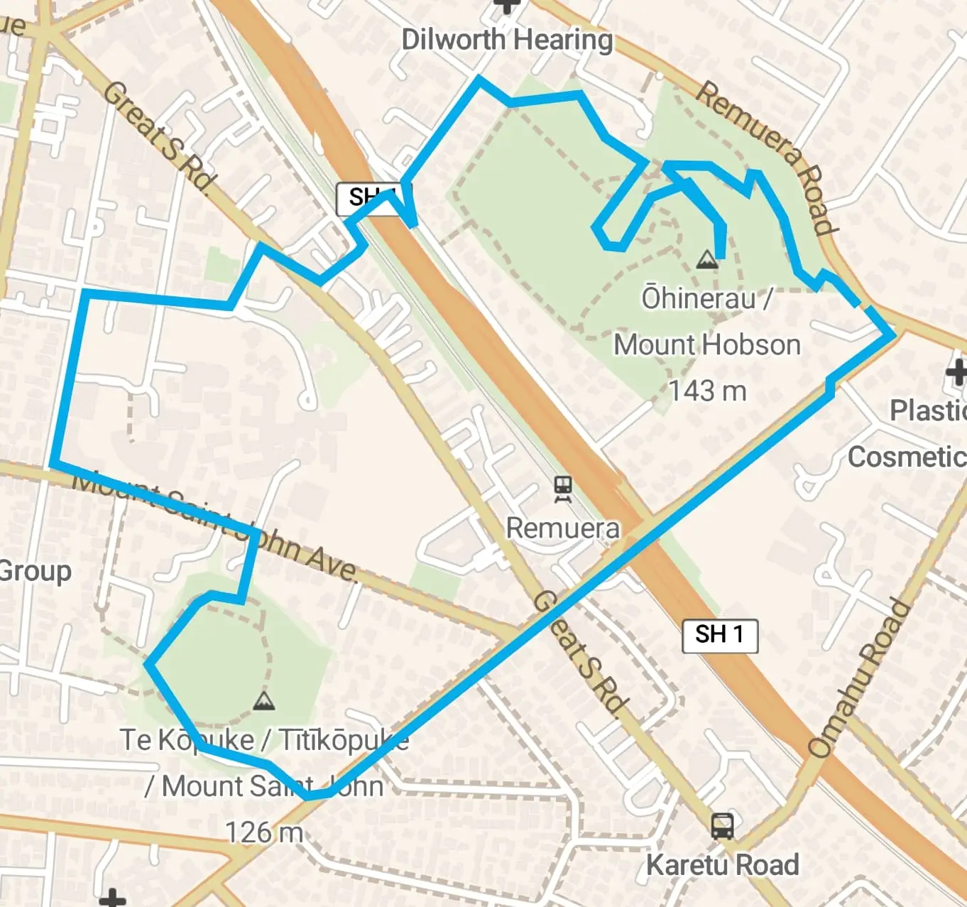
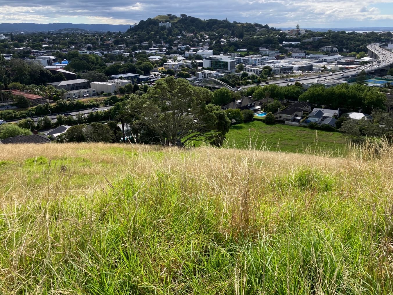
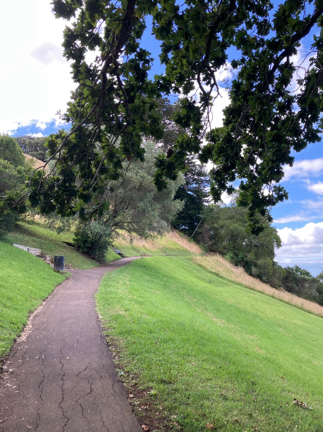
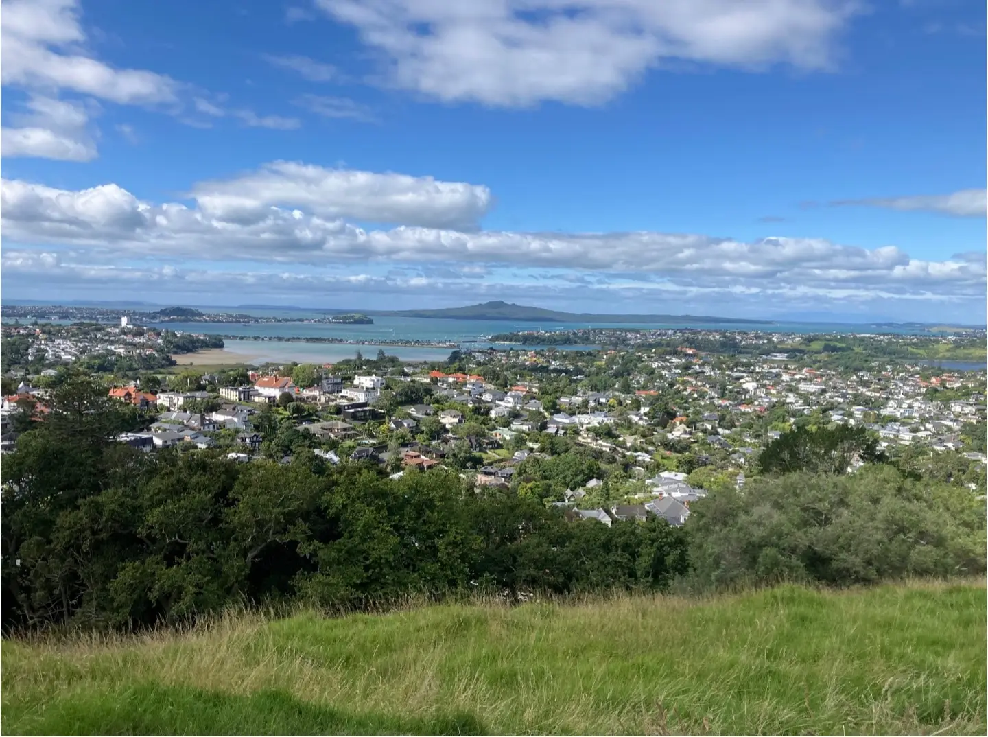
Most Aucklanders rush past Mt Hobson on the motorway without giving it a second thought, but they’re missing out. This 4.5km loop walk connects two of Auckland’s volcanic cones right in the heart of the city, and the views are absolutely stunning.
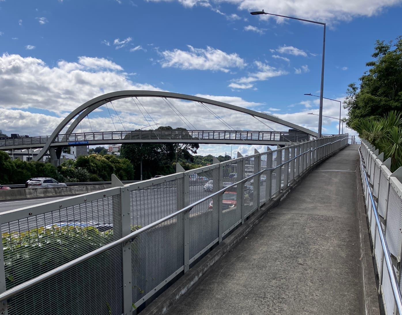
You’ll start at Mt Hobson (Ohinerangi) where the 360° harbour views really do “knock Naples into a cocked hat” as John Logan Campbell reckoned back in 1840. Then you’ll cross the Southern Motorway on a pedestrian bridge – it’s like being a miniature human crossing arteries in a full-sized body – before climbing Mt St John (Te Kopuke) with its remarkably well-preserved crater and food storage pits.
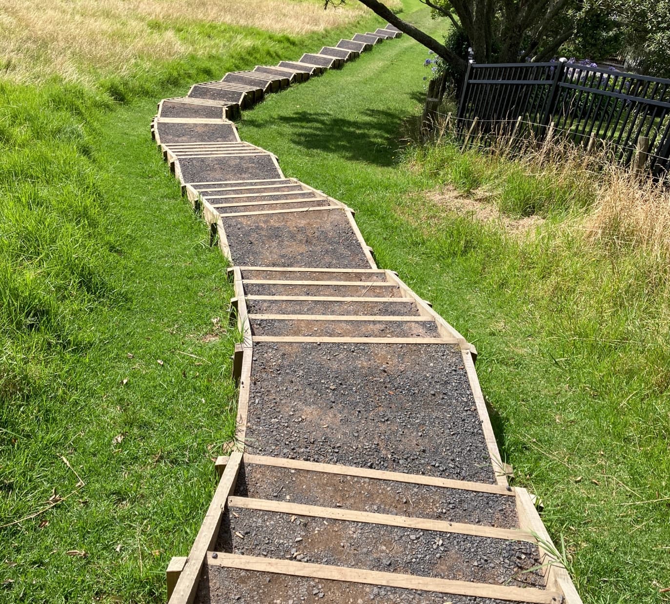
It doesn’t get the attention that One Tree Hill or Mt Eden get, but that’s part of the appeal. You’ll have the place mostly to yourself, especially mid-week. The walk’s mostly easy going with well-maintained paths, though you’ll work for it on the steep climbs to both summits.
This walk was mapped and documented by Barry Stafford from Joy of Walking and Rotary Club of Maungakiekie.
Want the full turn-by-turn directions? Download our detailed walk map with all 29 steps, landmarks, and exact GPS coordinates.
Named after William Hobson, NZ’s first Governor and founder of Auckland. He climbed this volcanic cone first in 1841. The ancient Maori name is Ohinerangi, meaning “the dwelling place of Hinerangi”. It’s a moderately large scoria cone with a central crater breached by a lava flow to the southwest. The western slopes, visible from Newmarket Viaduct, were once extensive hillside kumara gardens. The domain was gazetted in 1880.
“Climbing up over the crest, gaze northwards and there was Auckland’s best view, of harbour and gulf, the one that in 1840 John Logan Campbell reckoned could knock Naples into a cocked hat.”
— Author Tessa Duder, 1999
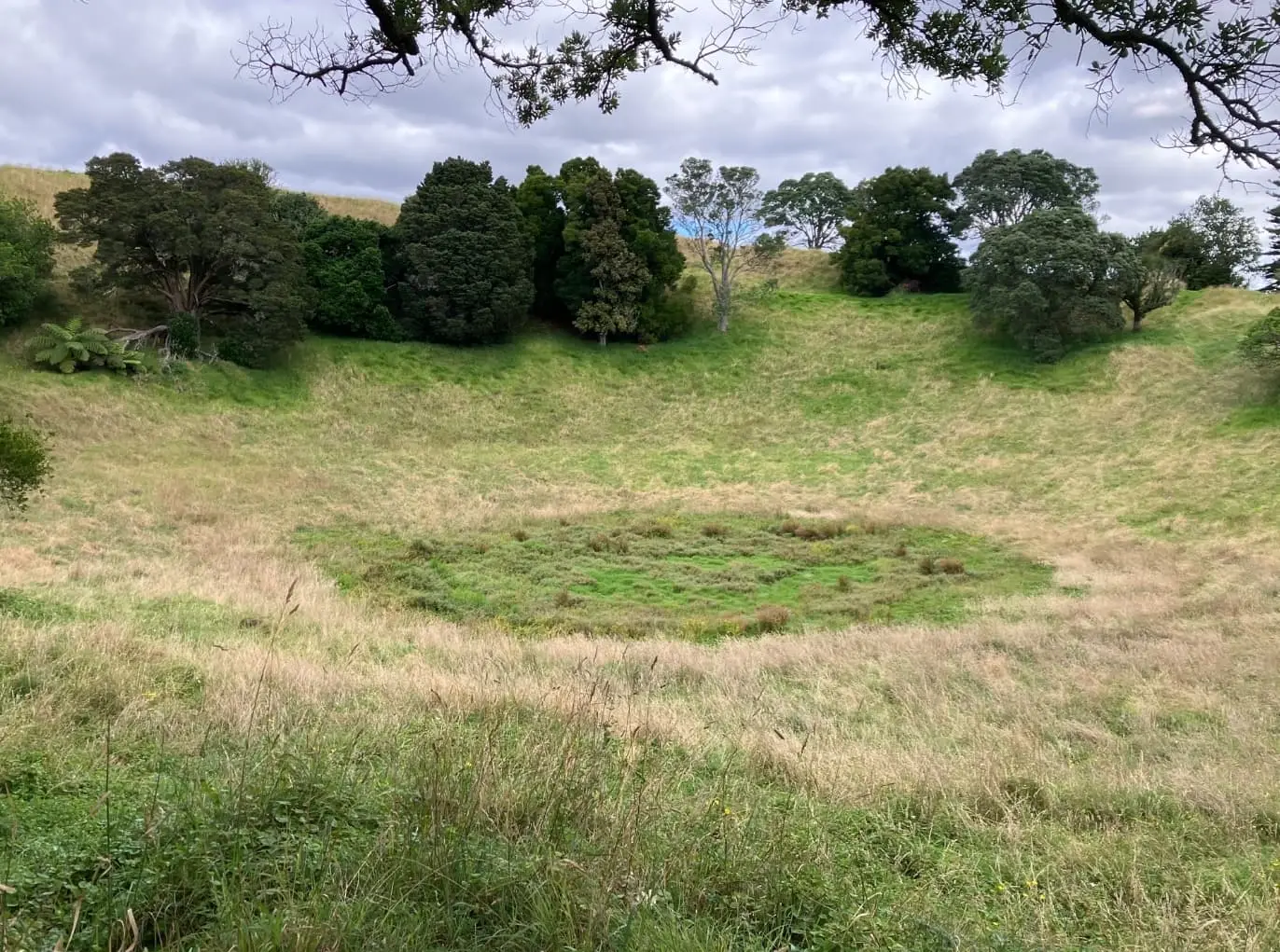
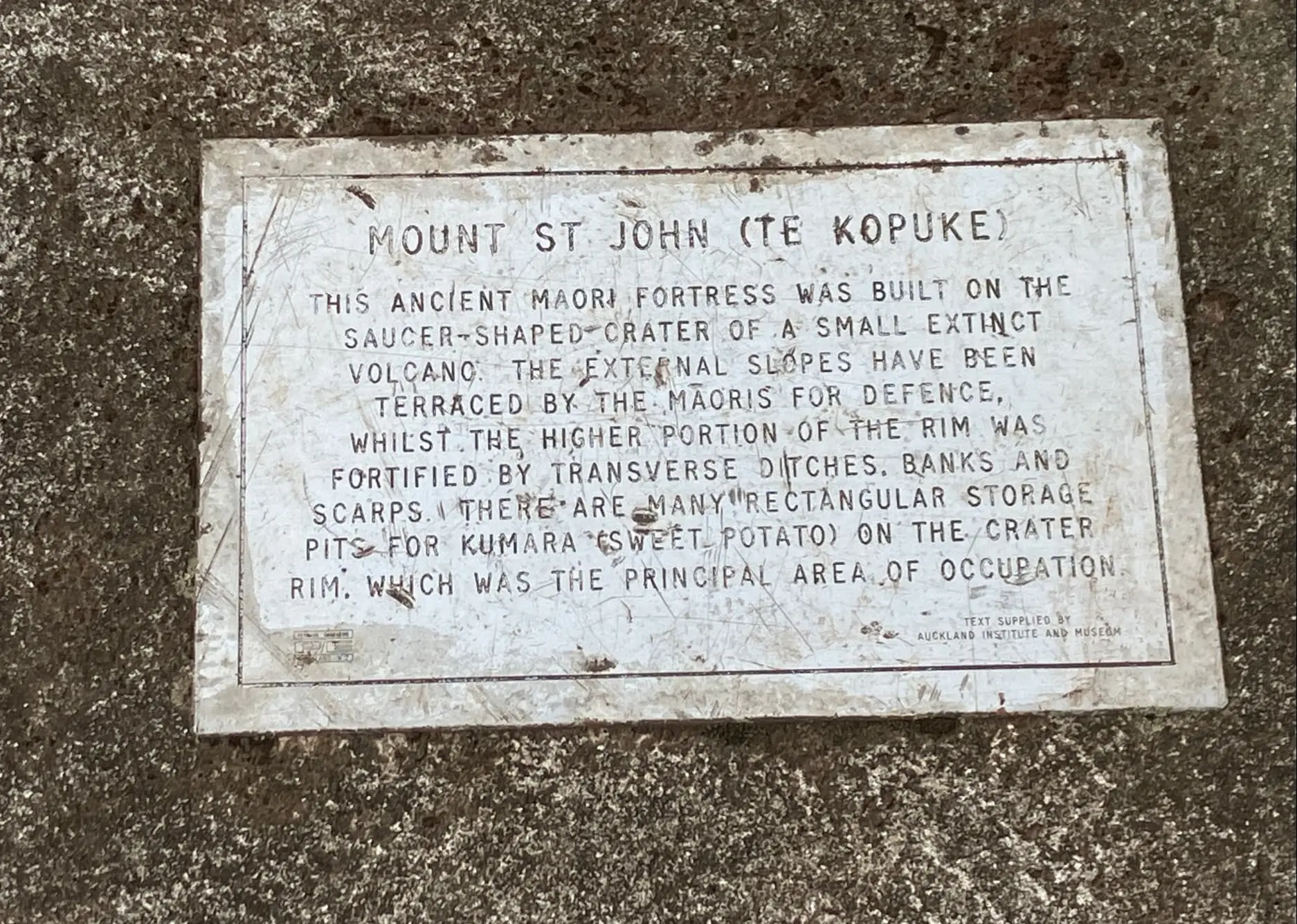
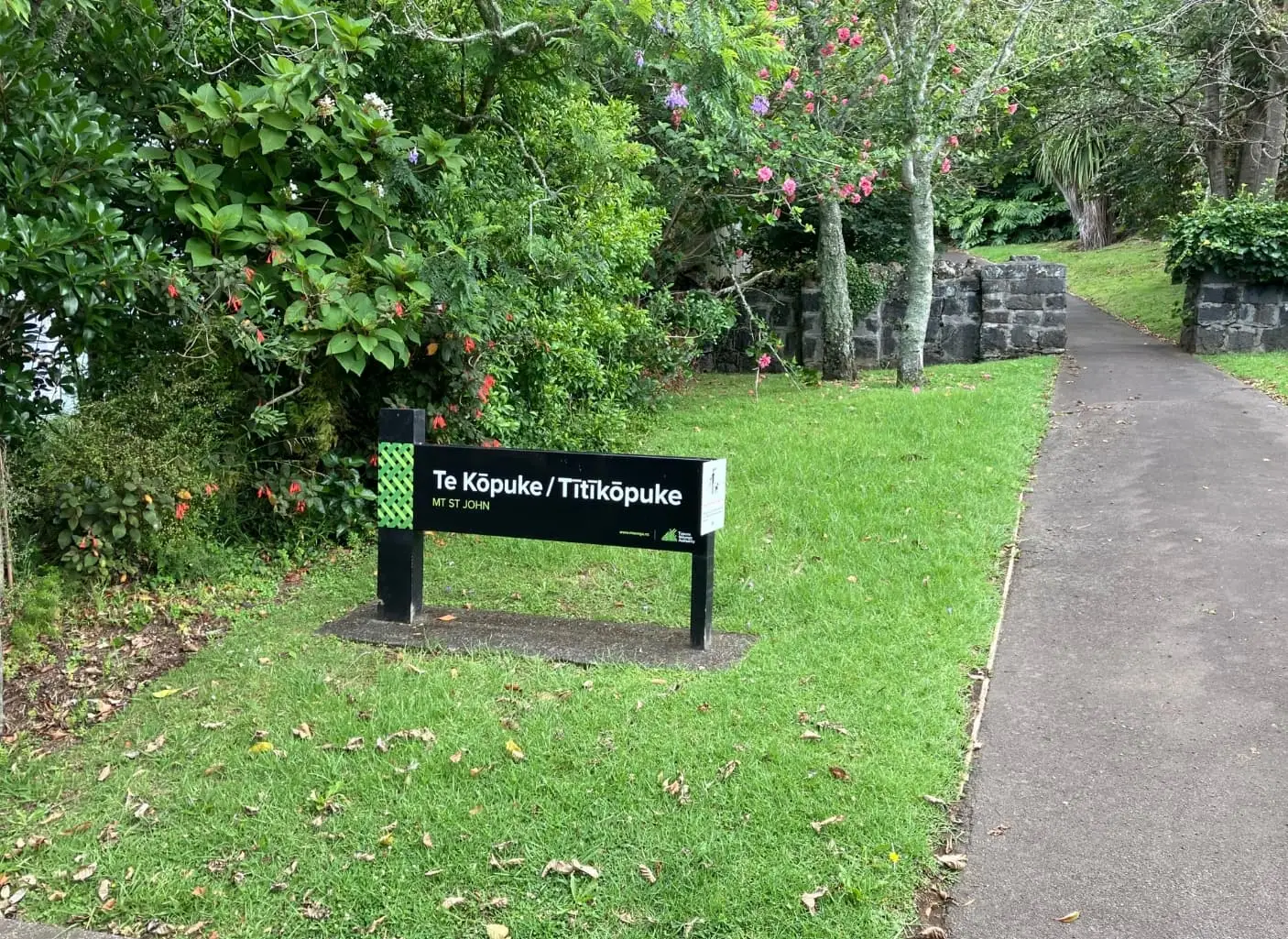
The Maori name means “the prominent mound”. The European name comes from St John the Evangelist, patron saint of early clerics. It’s one of the older Auckland volcanoes with many food storage pits and terraces from the pre-European pa. The cone is blanketed in ash from the Three Kings eruption (28,500 years ago), which lined the crater – it briefly retains a pond after heavy rain. Lava flow from this crater has the same chemistry as Meola Reef. The reserve was established in 1872. It’s remarkably well-preserved, barely 2km from Auckland’s CBD.
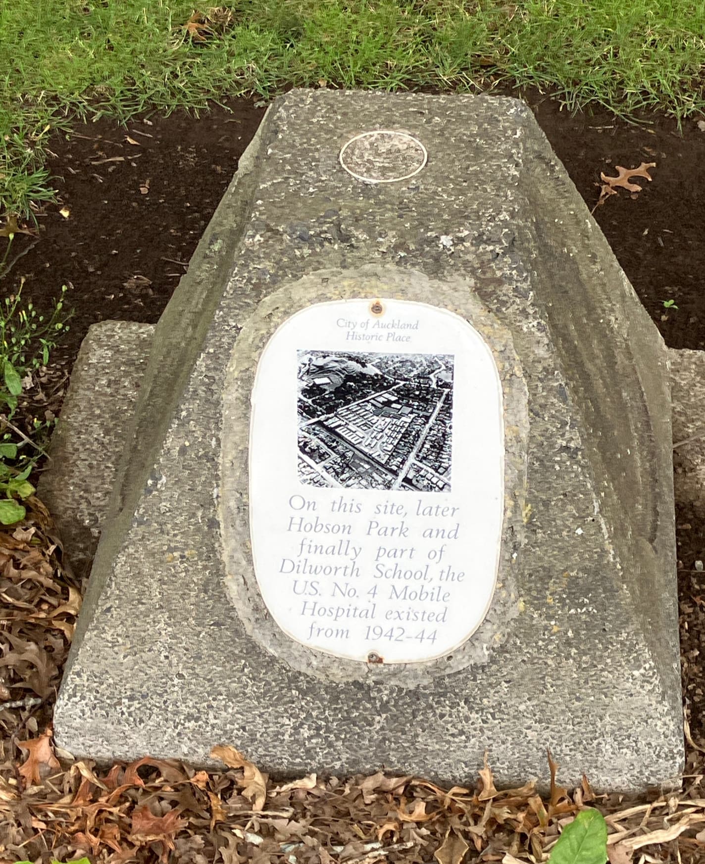
On the return route, you’ll pass a small white plaque marking the site of the US No. 4 Mobile Hospital that existed from 1942-44 in what’s now the Dilworth Junior School grounds. It was later transferred to Cornwall Park and expanded. This was one of the MASH hospitals like those featured in the famous TV series.