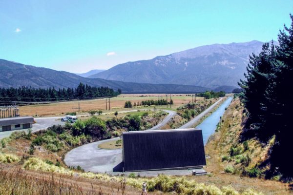
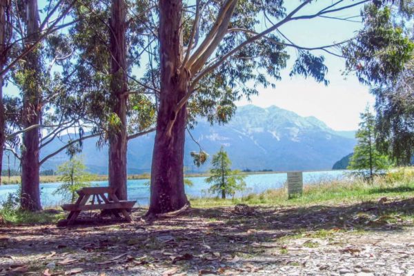
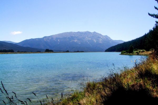
The Argyle Pond camp area is located in the Marlborough area.
Turn off State Highway 63 and drive for around 3-minutes up to the Argyle Powerhouse. Opposite the powerhouse is a small uphill climb. There you will find the Argyle Pond camping area where you will experience a big open space with plenty of room to camp; nice and quiet.
Explore the Local Area
This area of New Zealand is known for its high-quality wines, and what better way to enjoy one of the sunniest regions of New Zealand than through a winery tour! Relax and marvel at the amazing scenery as you are driven through this stunning area.
Quick Facts about this walk
- Location: Off State Highway 63, Marlborough region, near St Arnaud
- Access: 3 mins to Argyle Powerhouse, then drive over the dam to the camp spot
- Cost: Free (self-contained vehicles only)
- Facilities: Toilets reportedly now closed due to vandalism — check before going
- Features: Boat ramp, open grassy space, shady spots by the trees
- Heads up: Rough gravel road, sandfly central, no firewood available onsite
Summary points about this walk
Walk Highlights
Track Quality
Water
Driving Instructions
Area & Trail History
Map Location
Points of interest along the walk
Argyle Pond Camping Area
Camping type: It’s a shady camping area for self-contained campervans — so freedom camping rules apply and you’ll need a certified self-contained vehicle.
Facilities: Toilets and water (not drinkable) are in the middle of the camp area. However, due to ongoing vandalism, the toilet block is now permanently closed according to more recent reviews, so check before you go.
Setting: It’s a big open space with plenty of room to camp, nice and quiet. There’s also a boat ramp onsite, and it’s peaceful and idyllic when waterskiers aren’t practising.
Other notes: There’s no wood there suitable for firewood, so bring your own if you want a fire. It’s ground-zero for sandflies, so pack repellent. The road in is quite rough gravel with some very large puddle-craters, and two small concrete fords have steep entry and exit ramps that may challenge low-slung vehicles.
Cost: The site is now free to stay for self-contained campers.
Walks Nearby
Argyle Pond is about 36 km from St Arnaud, so the walks in Nelson Lakes National Park at Lake Rotoiti are the closest options. Here’s what’s nearby:
Short walks at Lake Rotoiti (St Arnaud)
- Bellbird Walk — wheelchair-friendly, starts at Kerr Bay
- Honeydew Walk — easy loop through beech forest, part of the Rotoiti Nature Recovery area
- Loop Track — 1.5 hours, climbs through beech forest with lake and mountain views
- Brunner Peninsula Nature Walk — follows the shoreline between Kerr Bay and West Bay
- Black Hill Walk — climbs through beech forest onto Black Hill with views of St Arnaud village
Longer day walks
- St Arnaud Range Track — 5-6 hours return, climbs to over 1650m with spectacular views from Parachute Rocks
- Mount Robert Circuit — 2.5-4 hours, 7.5 km
- Whisky Falls Walk — starts from Mt Robert Road carpark, goes to a 40m waterfall
Multi-day options
- Lake Rotoiti Circuit — 5-7 hours around the entire lake
- Travers-Sabine Circuit — popular multi-day backcountry tramp including Blue Lake


