Last Updated on: 21 May 2025

Tauranga Loop Track Guide 2025: Insider Tips, Maps & Planning

Why walk the Tauranga Loop Track?

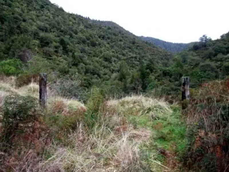
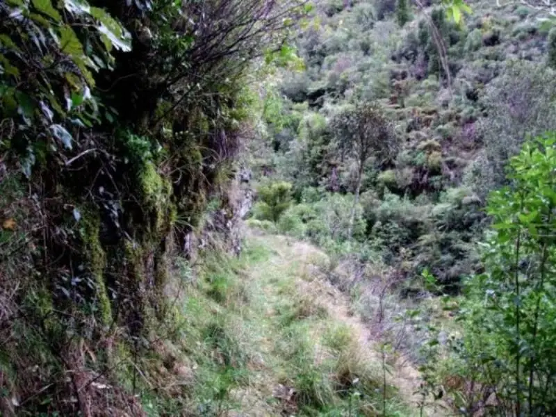
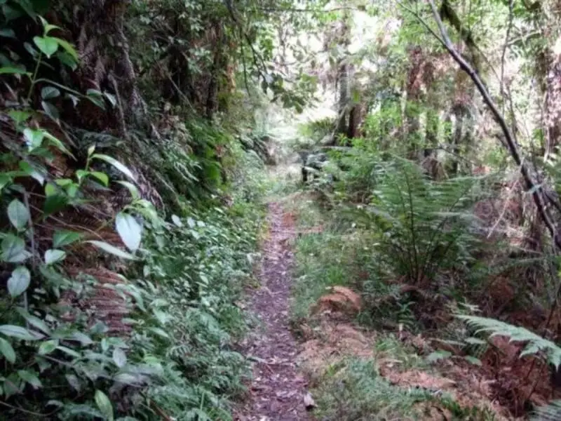
I still remember the moment I lost one of my boots to the mud just fifteen minutes into the Tauranga Loop Track. A loud schlop!, and suddenly I was hopping like a one-legged tūī, trying to retrieve my shoe without face-planting into the bush. But you know what? That’s exactly what makes this track special—it’s raw, untamed, and utterly immersive.

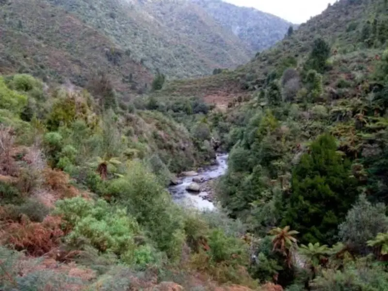
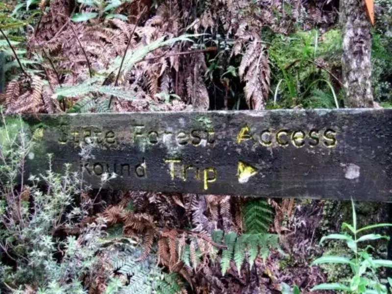
Nestled in the often-overlooked Waiōweka Gorge Scenic Reserve, this loop is one of the East Coast’s best-kept secrets. If you’ve ever driven through the gorge between Ōpōtiki and Gisborne and thought, “I wonder what’s out there?”, this track is your invitation to find out.

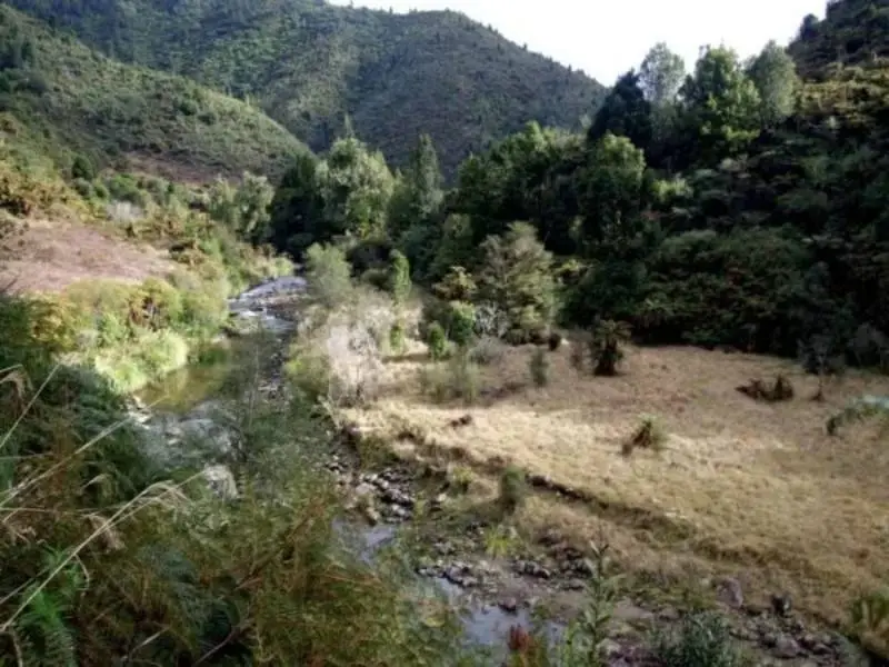
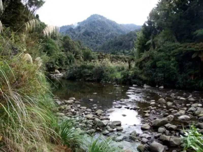
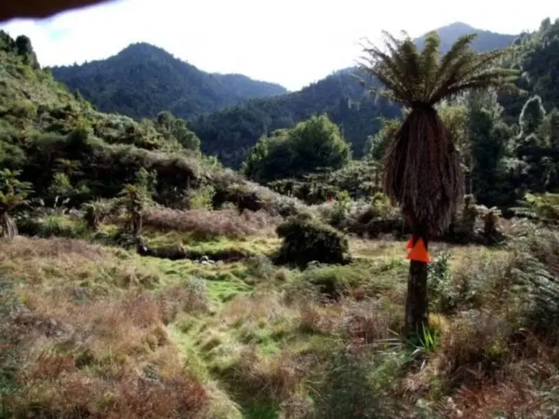
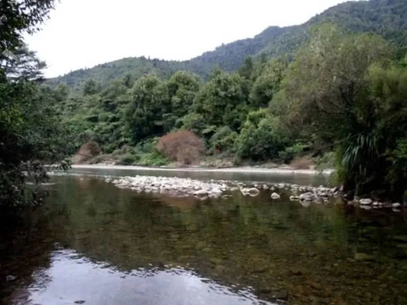
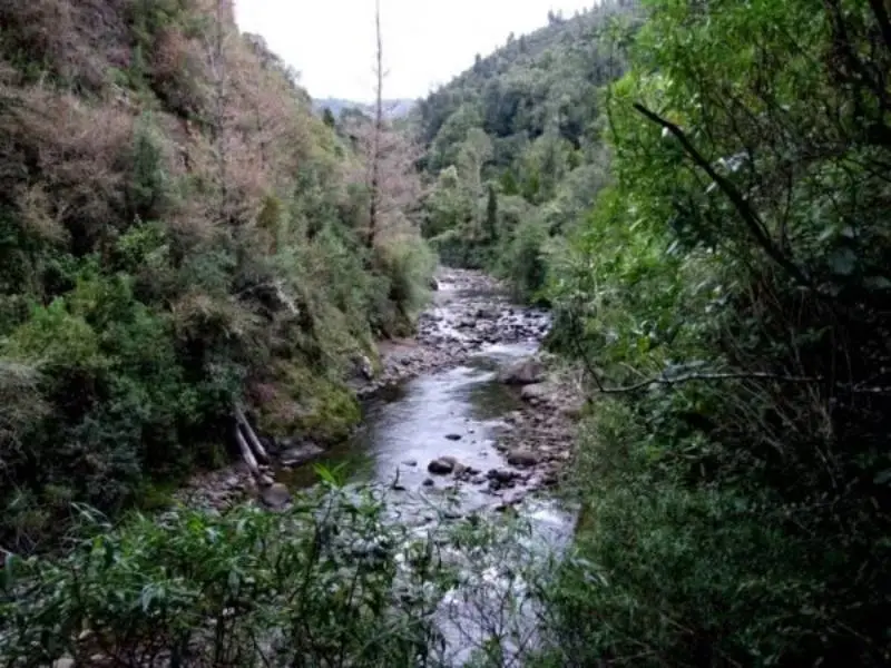
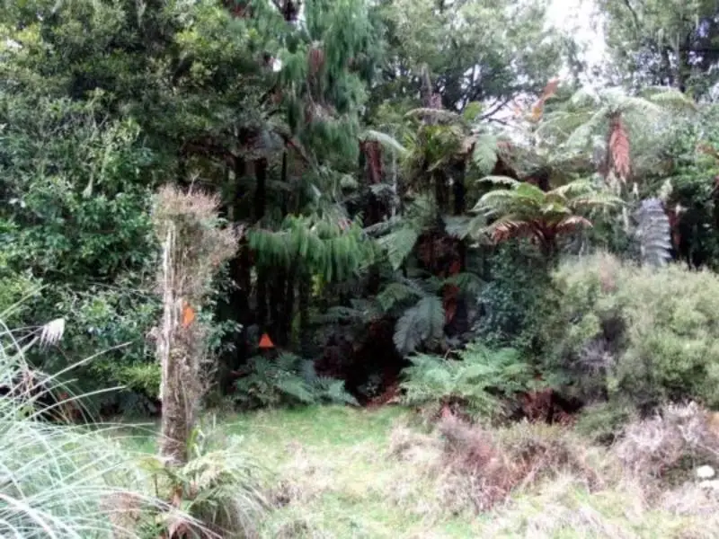
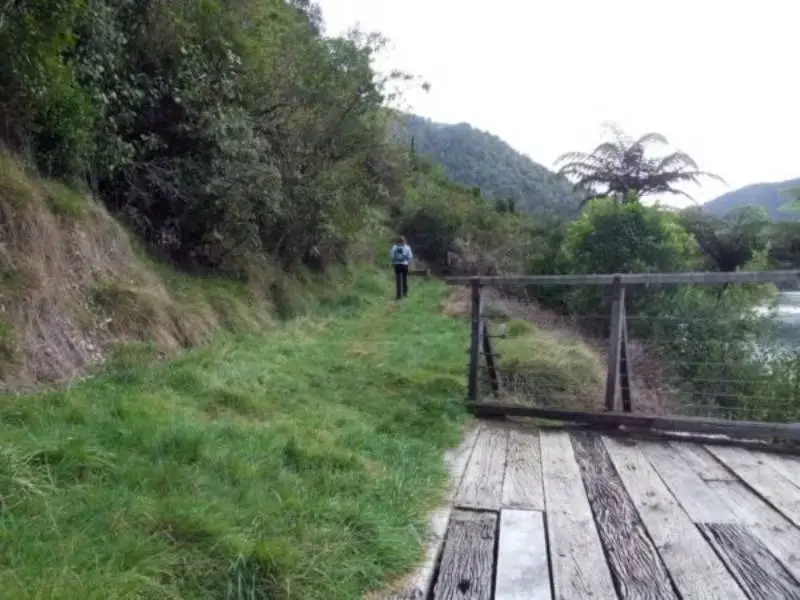
Winding through dense native forest, with glimpses of towering rimu and sneaky peeks of the river far below, it’s a walk that gets your heart going—in every sense. The reward? Solitude, birdsong, and the chance to experience a slice of wild Aotearoa with almost no one else around.

“The Tauranga Loop Track is perfect for walkers who want a genuine back-to-nature experience without committing to a full-day tramp. It’s a real hidden gem.” — Sandra , Walking Specialist at Freewalks

🥾 Walk Overview

Location: Waiōweka Gorge Scenic Reserve, SH2, Bay of Plenty
Nearest town/region: Ōpōtiki (20–25 mins drive)
Distance: 6.5 km loop
Time required: 2 hours
Difficulty Level: Moderate
Track type: Loop
Dog-friendly: No
Kid-friendly: Older kids with tramping experience
Wheelchair accessible: No
Toilets nearby: Yes – at the carpark picnic area
Best time to go: Spring or Autumn; go early morning to avoid heat and for best birdlife
Are drones allowed: No – DOC reserve
Are bikes allowed: No

Map location and directions

🚗 Getting There

  • Car park location: Tauranga Bridge carpark, off State Highway 2 in Waiōweka Gorge 
  • Parking availability: Room for ~8–10 cars, unshaded, free 
  • Public transport options: None – you’ll need a car 
  • Google Maps link: Tauranga Bridge Carpark 
  • Entry fees / permits required: Free; no permits needed 
  • Signage to the start of the walk: Well-marked from SH2 and clearly signposted at the bridge

🥾 Track Details

  • Track surface: Primarily benched dirt track cut into the hillside by early settlers back in 1906—a real piece of tramping history. Expect bush underfoot, with sections of gravel, roots, and a couple of stream crossings.
  • Track condition: The track is generally easy-going, but parts are overgrown, especially in summer when ferns and supplejack explode in every direction. Long pants are a must unless you enjoy that tingly feeling of bush lawyer and prickly gorse against your shins.
  • Elevation gain: Around 250m, steady rather than steep Estimated pace / fitness level: Moderate fitness; the overgrown bits and slippery descents slow you down more than the gradient does Alternative routes or extensions: If the creek crossings are too high, you can always walk to the Suspension Bridge, turn right onto the bench track, and simply return the same way.
  • Hazard warning: The two creek crossings—one near the suspension bridge, the other at the far end of the valley—can become impassable in flood conditions. Don’t try to cross if the water’s up. Play it safe and stick to the bench track out-and-back.

🌿 What You'll See

  • Beautiful swingbridge over the Tauranga River
  • Dense native bush: rimu, tawa, nikau palms
  • Fantails, kererū, and tui aplenty
  • Mossy ridgelines and lush forest canopy
  • Sections of old logging history (keep an eye out for remnants)
  • Stream crossings and photo-worthy light through the trees

Walk directions:

  1. From the carpark, head across the Tauranga Bridge—a lovely swingbridge with river views.
  2. The track forks just after the bridge. Start clockwise (right), taking the Tauranga Loop Track uphill.
  3. Continue through forest, steadily climbing to the ridgeline. Some stairs and steeper sections here.
  4. At the top, follow the loop as it weaves along the ridge—expect birdsong and zero cellphone coverage!
  5. Begin descending slowly back down via the other side of the loop.
  6. Cross a couple of minor streams—bring dry socks!
  7. Return to the swingbridge to complete the loop.

🧽 Navigation & Safety

  • Phone reception: Patchy to none 
  • Map needed?: Helpful, but the orange DOC markers keep you mostly on track 
  • Any confusing parts?: Just past the bridge, some walkers miss the low track. Head down first to check the river level—then decide whether to continue the full loop. 
  • Weather tips: It gets cold and damp in the Tauranga Stream valley—especially in early morning or after rain. Layers and waterproofs will be your best mates here.
  • Bonus Tip: Even in summer, the valley holds onto cold air like a chillybox. A light thermal or windbreaker makes all the difference, especially if you stop for a snack.

🧲 What to Bring

  • Footwear: Sturdy hiking boots with good grip
  • Water: 1–1.5 litres
  • Snacks/lunch: Great picnic spot at the ridgeline
  • Sun/rain protection: Hat, sunscreen, and light raincoat
  • Insect repellent: Yes – sandflies near the streams
  • Optional extras: Camera (for that bridge shot), dry socks, walking poles if you have dodgy knees

🍽 Nearby Facilities

  • Closest café: Try Two Fish Café in Ōpōtiki (great coffee and pies)
  • Picnic tables or shelters: Yes – at the carpark near the swingbridge
  • Playgrounds/family extras: None nearby; this one’s more about nature
  • Accommodation: Motels in Ōpōtiki or basic DOC campsites further in the Gorge

Insider Tips

  • Walk clockwise – easier gradients and the best views are on the descent
  • After the walk, dip your toes in the Tauranga River near the bridge
  • The swingbridge is a great drone photo spot – but drones aren’t allowed, so just enjoy it the old-school way

📍 Useful Links

👤 My Experience on This Walk

  • Date of walk: March 2024 
  • Weather and track conditions: Dry but humid; track slightly muddy in shady areas 
  • What I personally loved: The solitude—didn’t see a single other walker the whole loop! 
  • Unexpected moments: Startled a goat halfway up the ridge. It stared me down, then vanished. 
  • Tips I’d give: Bring gaiters, take your time on the descent, and have lunch at the highest point—it’s peaceful and worth the haul.


“I was surprised how lush and untouched the bush felt. Like stepping back in time. It’s not an easy stroll, but it’s incredibly rewarding.” — Derek L., Wellington, March 2024

❓ Frequently Asked Questions (FAQs)

Photos of my walk

See more of my walks in Wellington