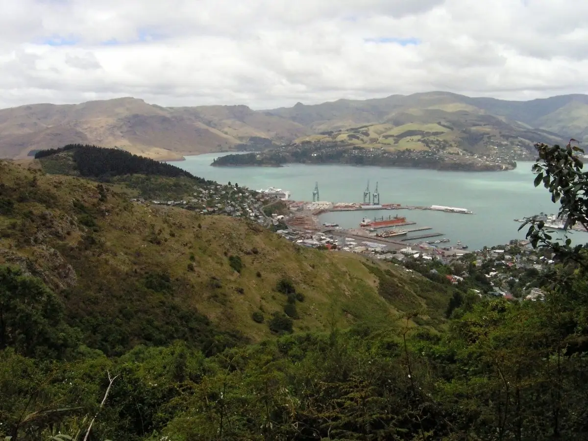
The Bridle Path is one of the oldest tracks in Canterbury, and still one of the best walks in the Christchurch area. It’s steep, there’s no getting around that, but the views from the top make every bit of the climb worthwhile. On a clear day you get Lyttelton Harbour on one side and the Canterbury Plains, Pegasus Bay, and the Southern Alps on the other. It’s a genuine two-for-one viewpoint.
I walked it from the Heathcote end and came down into Lyttelton, which is the best way to do it if you’re happy using the bus to get back. Coming down into town with the harbour spread out in front of you is a great way to finish a walk.
The track is shared with mountain bikers, so keep an ear out on the descent especially. 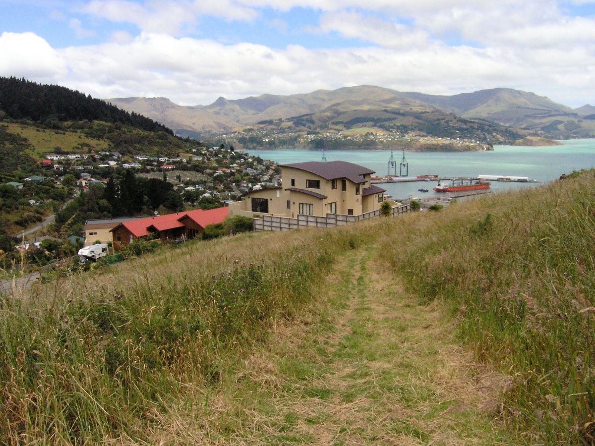
Quick Facts
| Distance | 3 km one way / 6 km return |
| Time | 90 minutes to 2 hours one way |
| Difficulty | Hard |
| Route type | One way or return |
| Elevation gain | 333 m |
| Surface | Wide gravel track |
| Dogs | Yes, on lead |
| Bikes | Yes, shared use track |
| Toilets | Gondola car park (Heathcote end) |
| Water | No |
| Mobile coverage | Yes |
| Parking | Gondola car park, Bridle Path Road, Heathcote |
| Start GPS (Heathcote) | -43.5756, 172.6581 |
| Start GPS (Lyttelton) | -43.6038, 172.7197 |
Getting There
- From Heathcote (recommended start): The car park is at the base of the Christchurch Gondola on Bridle Path Road in Heathcote Valley. There are toilets here. This is the most popular starting point and gives you the option of walking one way down to Lyttelton and catching the bus back.
- From Lyttelton: Walk up London Street from the main street to where it becomes Bridle Path Road, just past the tunnel entrance. The track is well signposted.
- By bus: Bus 28 runs regularly to both ends of the walk. If you’re catching it to the gondola station, note it doesn’t stop there before the gondola’s opening hours, so take the stop before if you’re heading out early. Bus 28 also runs back through the road tunnel from Lyttelton to Heathcote, making the one-way option very straightforward.
Walking the Track
From the Gondola Car Park to the Summit
The track starts at the gondola car park and is well signposted. It’s a wide gravel path and well maintained throughout. Don’t be fooled by how it looks at the bottom. It gets steep quickly and stays that way.
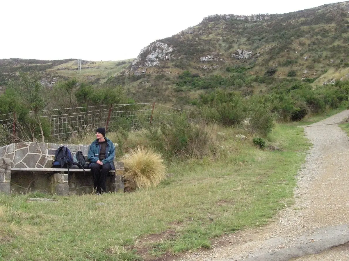
There’s an information board at the start worth reading before you head off. About halfway up there are bench seats where you can stop, catch your breath, and take in the views back over Heathcote Valley. The higher you climb, the better the harbour views get, especially on a fine day. To the west you’ll see what remains of Castle Rock, and the massive boulders scattered down the hillside from the Christchurch earthquakes are hard to miss.
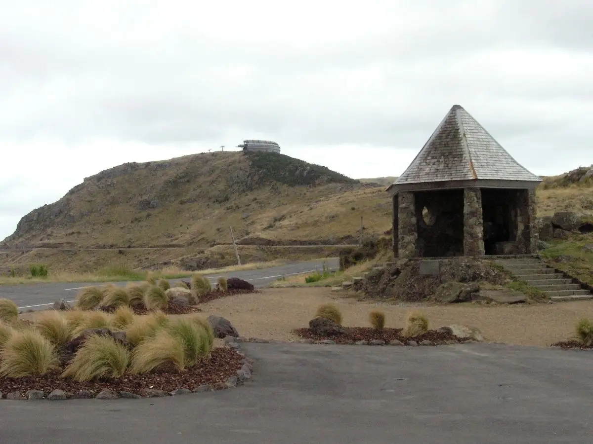
Near the top there’s an old concrete building. When we visited we were lucky enough to spot a nest of baby birds sheltering in one of the corners. Keep an eye out.
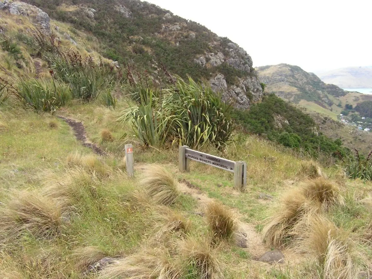
At the very top, next to Summit Road, there’s a stone shelter with covered seats. This is a 1940 New Zealand centennial memorial to the Pioneer Women of Canterbury, and there are seven commemorative stone seats placed along the path built for the 1950 Canterbury centenary celebrations. It’s worth stopping to read the boards and take in the full panorama.
The Views at the Top
The summit is one of the great viewpoints in the South Island. On a clear day you get Lyttelton Harbour, Diamond Harbour, Banks Peninsula and the open sea on one side, and the Canterbury Plains, Pegasus Bay, and the snow-covered Southern Alps on the other. Take your time up here.
Down into Lyttelton
The descent into Lyttelton is steep but straightforward. The track drops steadily before joining Bridle Path Road and coming out near the top of London Street. From there it’s a short walk down into town.
If it’s a Saturday, the Lyttelton Farmers Market runs from 10am to 1pm on London Street. Stock up on fresh produce or treat yourself to lunch there. Then catch the bus back through the tunnel to Heathcote. Once you’re back, you’ve well and truly earned a flat white.
The Gondola Option
If you want a longer day, the Christchurch Gondola is a short walk from the summit along Summit Road. You can have a coffee at the top and take the gondola back down to the Heathcote car park. It gets busy on weekends and in peak season, so expect a wait.
Good to Know
- Steep throughout: This is a genuinely hard climb with no flat section to ease you in. Take it steady and use the bench seats on the way up.
- Shared use: The track is used by mountain bikers as well as walkers. Keep left and listen for bikes coming from behind on the descent.
- Slippery when wet: The gravel surface can get slippery after rain or if fresh shingle has been laid. Decent footwear makes a real difference.
- Wind and cold at the top: The ridge is very exposed. Even on a fine day in the valley it can be cold and windy at the summit. Bring a layer.
- Dogs: Welcome on lead throughout.
- No water on track: Bring your own.
A Bit of History
The Bridle Path is the oldest track in Canterbury. When the first settlers arrived in Lyttelton Harbour in 1850, this was the most direct route to the Canterbury Plains. It became known as the Bridle Path because the track was so steep that riders had to dismount and lead their horses by the bridle. A daily cart and pack horse service ran over it from 1857. Goods too heavy or bulky for pack horses were shipped by small sailing vessels the 13 km around the coast to Ferrymead instead.
The railway tunnel through the Port Hills opened in 1867, and the road tunnel followed in 1964. The Bridle Path is still here, still just as steep, and still connecting the same two places it always has.
