A brand new 4.4km sealed path along Wellington Harbour’s eastern shore, open from April 2026. Flat, smooth, and right on the water.
Quick Facts
| Distance | 4.4km one way (8.8km return) |
| Time walking | 1 to 1.5 hours one way |
| Time cycling | 30 to 45 minutes one way |
| Difficulty | Easy |
| Track Surface | Sealed, flat |
| Dogs | Yes, on lead |
| Bikes | Yes, shared path |
| Toilets | Days Bay, Eastbourne |
| Parking | Point Howard, Days Bay, Eastbourne |
| Opened | April 18, 2026 |
About the Walk
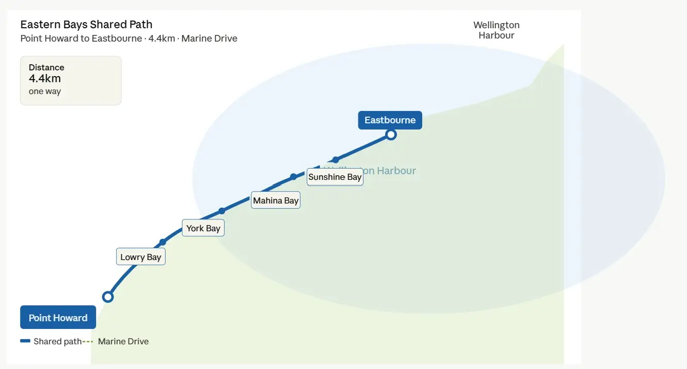
The Eastern Bays Shared Path runs 4.4km along Marine Drive between Point Howard and Eastbourne, on Wellington Harbour’s eastern shore. It’s a shared path for walkers, cyclists, runners, and families, built on top of a new seawall that also protects Marine Drive from storms and sea level rise.
It’s a point-to-point path, so most people walk one way and either double back or arrange transport at one end. Because the route is flat and relatively short, it’s accessible to a wide range of people including families and those after a gentle coastal stroll.
The path threads through several bays, each a bit different:
- Lowry Bay is the opening stretch, calm and open with boats moored offshore
- York Bay has a bit more activity, locals launching kayaks and using the beach
- Mahina Bay is the standout. The harbour opens right up and on a clear day you’re looking straight across to Wellington city
- Sunshine Bay has native plantings softening the seawall edges
Four bird protection areas were established along the path to safeguard nesting little blue penguins and oystercatchers, with more than 300 penguin nesting boxes installed. Worth knowing if you’re out early morning.
The seawall features textured concrete surfaces and purpose-built tidal pools designed to support intertidal life. The engineering is more interesting than it sounds.
Arriving in Eastbourne, the path leads straight into the village. Cafes, beaches, and grassy reserves make it easy to turn the outing into a longer half-day, grab a coffee, wander the waterfront, or sit and watch the harbour.
One Thing to Know
As of May 2026, there’s still a short gap in the path at the Days Bay corner between Sunshine Bay and Eastbourne. Days Bay was not included in the original path plans, and next steps are still being discussed. It’s a brief section along the road and doesn’t spoil the walk, but the path isn’t fully continuous through Days Bay.
Getting There
- Metlink routes 81 and 83 run from Wellington city through Lower Hutt to Eastbourne, stopping at Point Howard. Get off at Point Howard, walk to Eastbourne, catch the bus back, or do it in reverse.
- East by West Ferries runs a roughly 25-minute crossing from Queens Wharf to Days Bay Wharf, with up to seven sailings a day. Bikes need to be booked in advance. From Days Bay the path is right there.
- Parking is available at Point Howard, Days Bay, and Eastbourne village. Days Bay fills up fast on weekends and in summer.
- If driving, the easiest option is to park at Eastbourne and bus or ferry back from Days Bay or Point Howard.
Getting Back
The path is point-to-point so you need a plan:
- Walk or ride back the way you came, the most straightforward option
- Bus from Eastbourne or Point Howard back toward Lower Hutt or Wellington (routes 81/83)
- Ferry from Days Bay to Queens Wharf for a scenic return across the harbour. Days Bay is about 2km from Eastbourne village along Muritai Road
- Car shuttle between the two ends if you’re in a group
When to Go
The path is fully exposed to the harbour. Wind is the main factor, a southerly makes it hard work. Calm mornings in summer and autumn are ideal. It’s walkable year-round but check the forecast before you go.
Weekends are already busy since opening. Weekdays are quieter.
Background
The Eastern Bays had been defended by aging concrete seawalls since the early 1900s, and by the 2010s many were well beyond serviceable life. Marine Drive, the only road in and out of Eastbourne, was increasingly vulnerable to flooding and closure from storm surges. The community had sought a continuous shared path along the shoreline for over 30 years.
The total cost came to $81.87 million, funded by the Government ($30 million), NZTA ($25.47 million), and Hutt City Council ($26.4 million). Construction progressed bay by bay from August 2022, with the full path opening April 18, 2026.
The Eastern Bays Shared Path is also part of a wider regional push to improve walking and cycling connections around Wellington Harbour. The Ngauranga to Petone shared path is due to open later in 2026, and together the two routes will make it possible to walk or cycle from Wellington city to Eastbourne around the harbour edge.
