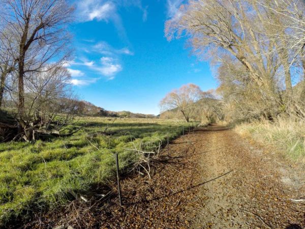
Clutha Gold Trail was opened in October 2013 to give cyclists the opportunity to cycle 73 Km down the picturesque Clutha River, from Roxburgh to Lawrence.
The Clutha Gold Trail is open all year round, but during the winter you could freeze.
Quick Facts about this walk
- Location: South Island NZ
- Distance: 74 kms
- Time needed: 2 Days
- Difficulty: Medium
- Wheelchair Access: No
- Route: One Way
- Elevation: 180m
- Wet Feet: No
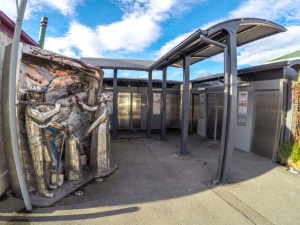
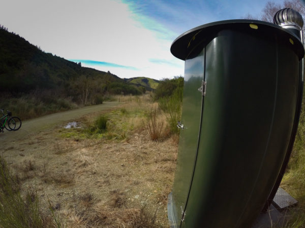
- Toilets: Yes
- Dogs: No
- Mobile Coverage: Yes
- Last Updated: November, 2019
We’ve partnered with Macpac outdoor walking & hiking gear to bring you the very best products designed exclusively for our New Zealand climate. They’ll ship for FREE within NZ on orders over $100 (if under $100 it’s only $5). Worldwide international shipping is available except to the USA. Bulky orders will be $20.
Summary points about this walk
Walk Highlights
Track Quality
Hazards
Transport
Water
Driving Instructions
Shops & Restaurants Nearby
Area & Trail History
Map Location
Points of interest along the walk

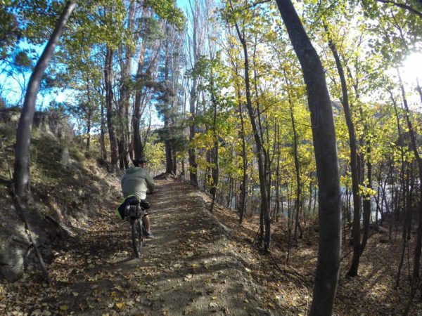
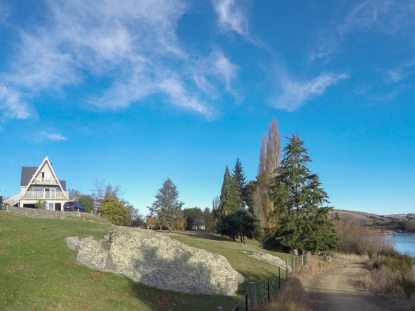
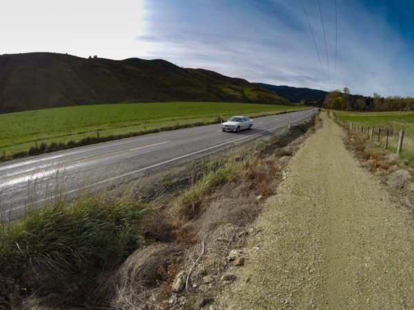
The Start of the Clutha Gold Cycling & Walking Trail
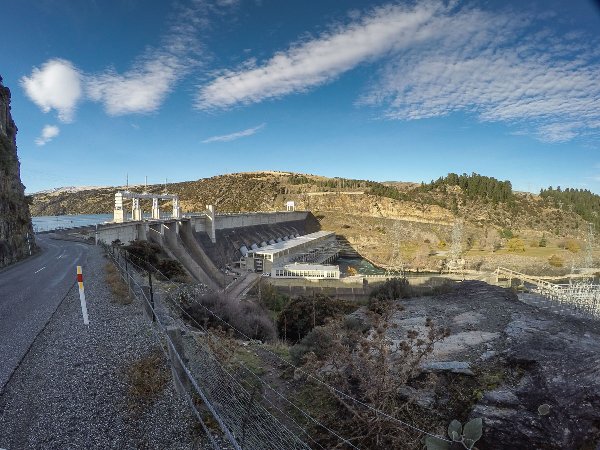
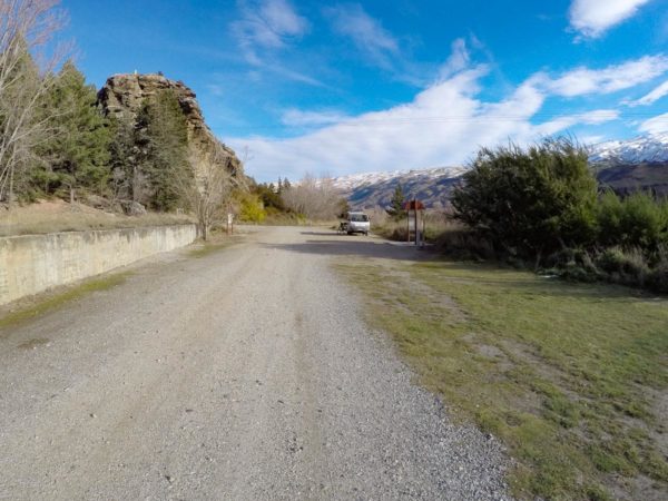
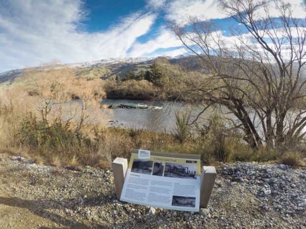
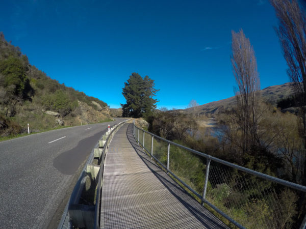
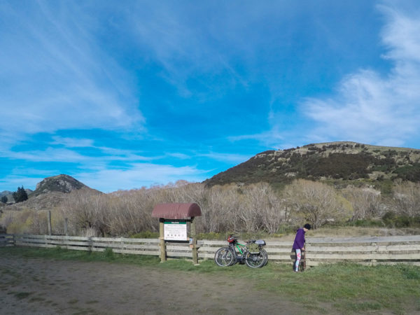
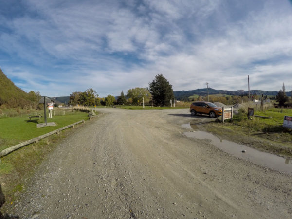
The start of the Clutha Gold Cycling and walking trail is not that well sign posted. There is one large sign out on the main road then it turn to custard. You have to look very hard to see the tiny, plain signs, no wonder it is not a very popular cycling trail. So from the highway to Alexandra make your way to Lake Roxburgh Village then cross over the Roxburgh Dam and stop at 500mt in Commissioner Flat car park, or what was a railway siding many years ago. Again, see if you can find the Clutha Gold sign.
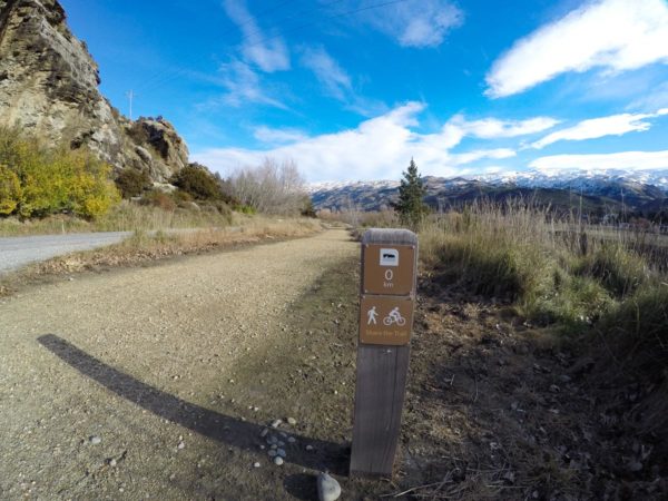
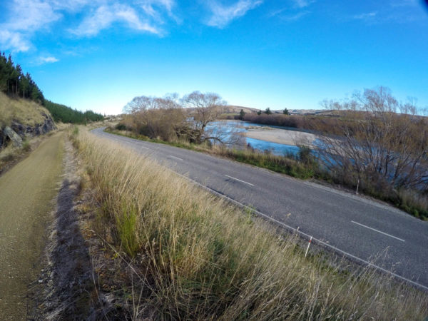
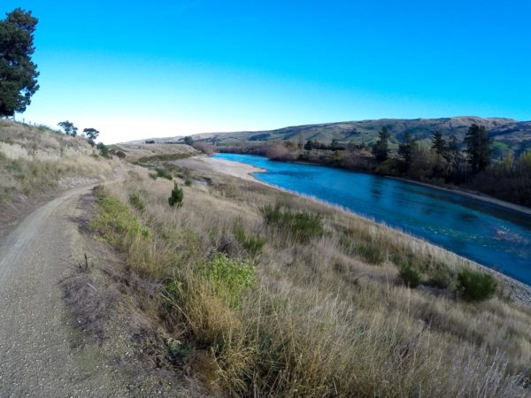
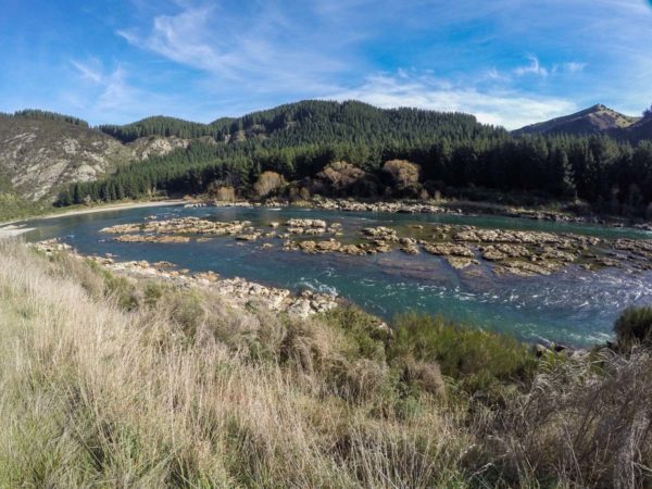
Don’t make the mistake and ride into the start of Commissioners Flat walkway. You make your way to the bottom of the car park and you will see the tiny sign which is only the 0 Km marker post. The only interesting place on this 9.4Km section for me was the old Gold Dredge sitting in the Clutha River. The ride took me forty minutes to ride into Roxburgh town for a hot coffee, but I was stopping to take photos. When you cross the first road bridge after leaving the dam, look up into the hills above the bridge. You will see a house quite high up in the hills. That is not a house, but the Teviot Power Station. You will ride past another small power station before you reach Beaumont.


Roxburgh to Pinders Pond
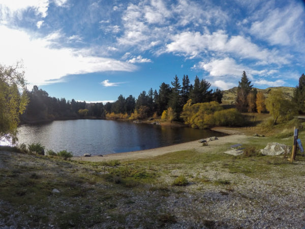
After your morning tea in Roxburgh, cycle back over the historic Roxburgh Bridge and continue cycling down the Clutha Gold Trail. This section is quite fast, my partner and I cycle into Roxburgh from Millers flat at least twice a week to stock up with food etc and we always have a tail wind pushing us home in just under 1 Hour and 20 minutes. To Pinders Pond takes us 30 minutes. This is the last chance for a toilet stop till you arrive at Millers Flat. When you arrive at Pinders Pond you will find the toilet at the top end of the pond, to your right, follow the road out for 100 Mt.

Millers Flat
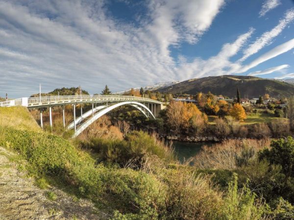
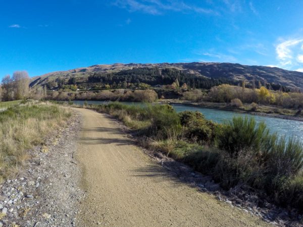
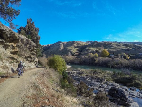
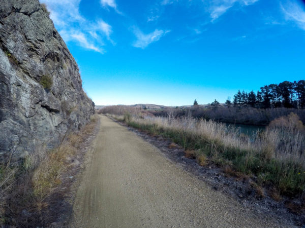
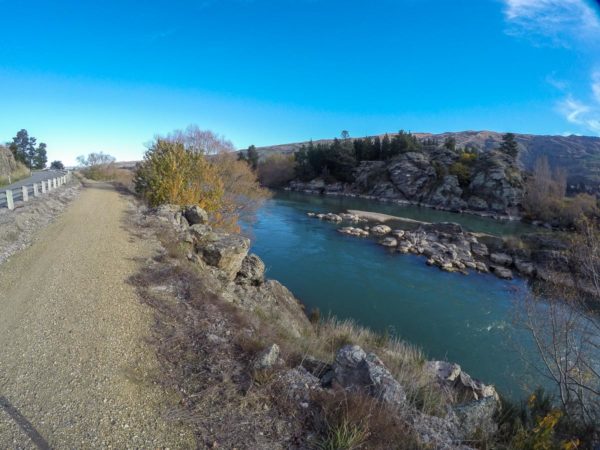
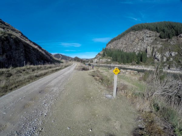
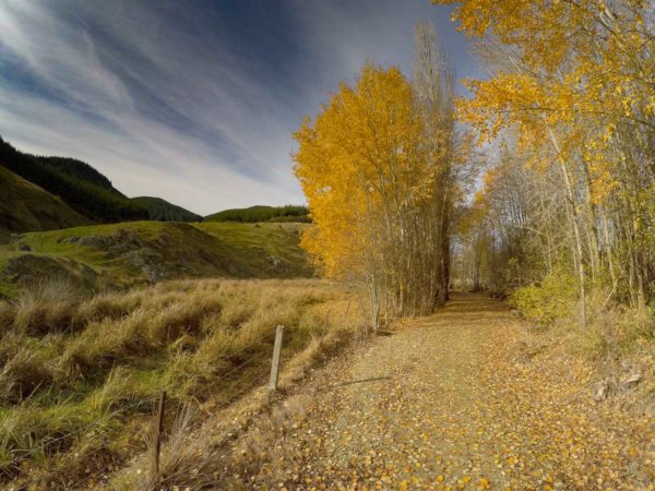
From Roxburgh to Millers Flat is our favourite section of the Clutha Gold Trail. You can look down into the mighty Clutha River or stop and just walk a couple of meters down to the water’s edge. There are a few tight corners in this section so don’t take the corners to wide, and you will cross the Roxburgh East Road three times before reaching Millers Flat. The public toilet is on your right as you cycle into Millers Flat and the cafe another 100 mt down the road on your left. To get to the Tavern you need to cycle across the historic blue Bridge. Millers Flat is a small Central Otago farming village sitting on the banks of the Clutha River. If you peddle around the village you might come up with a total of 51 homes.


Horseshoe Bend
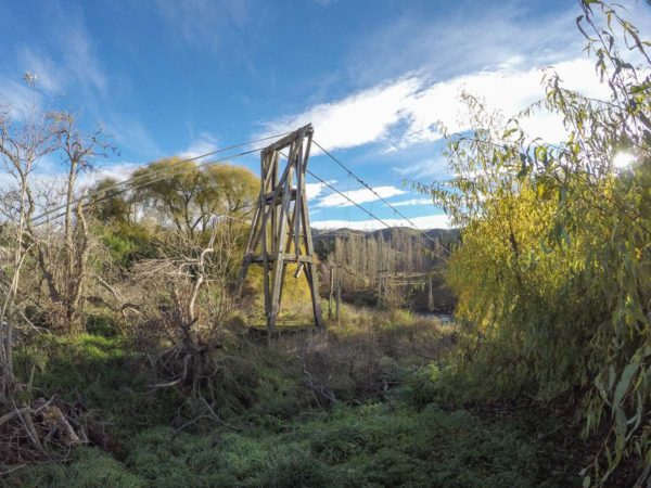
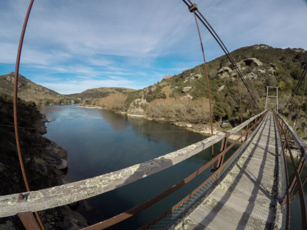
When you have finished you fantastic coffee at Faigans Cafe and step outside, you look left across the T section to Millers Flat park, ride into the car park and continue down the track to the river and the start of the next leg of the Clutha Gold Trail. The 38 minute ride to Horseshoe Bend was straightforward with not a lot to see. When we stopped opposite the parking for the horseshoe bend walk there was no gate through the fence so we carried the bikes over the fence and cross the road to the start of the walk to the Horseshoe Bend Bridge. The eight minute walk to the Bridge was well worth the effort. We did not have a bike lock with us so we did not spend too much time at the bridge. When I arrived back at the bikes, I looked 30 Meters up the road and there was the new gate, thanks guys.
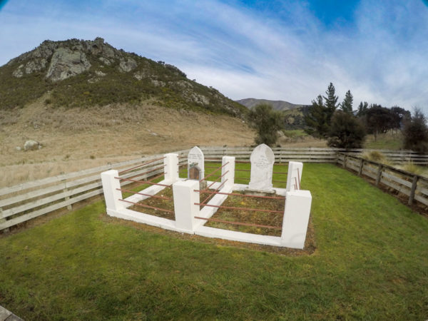
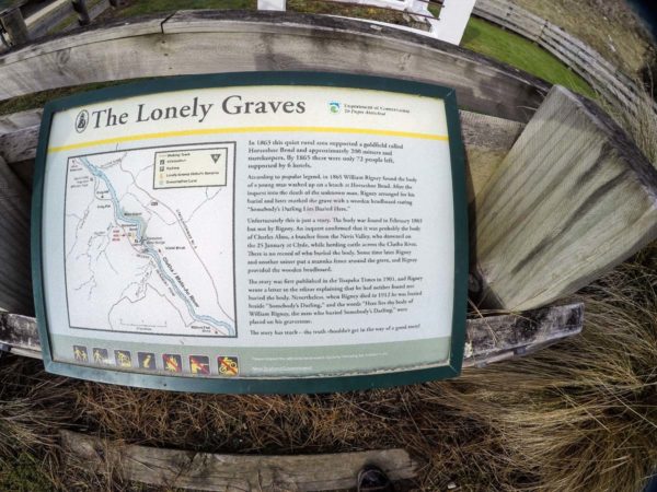
The Lonely Graves
The Lonely Graves is Charles Alms who was buried here in 1865. You still have 15 Km to cycle to Beaumont. If your legs are still feeling strong, you can take the uphill climb to the lonely grave, followed by a downhill race back onto the Clutha Gold Trail. When you leave Horseshoe Bend Bridge stay on the back road, do not get back onto the trail. Ride past the entrance back onto the trail and climb to the top of the hill and the grave. This should take you five minutes. Do not double back, keep cycling down the hill till you meet up with the Gold Trail in a few minutes. You could stay on this back road all the way to Beaumont, but it is a rough road and it is a longer ride.

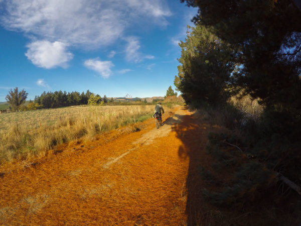
To Beaumont
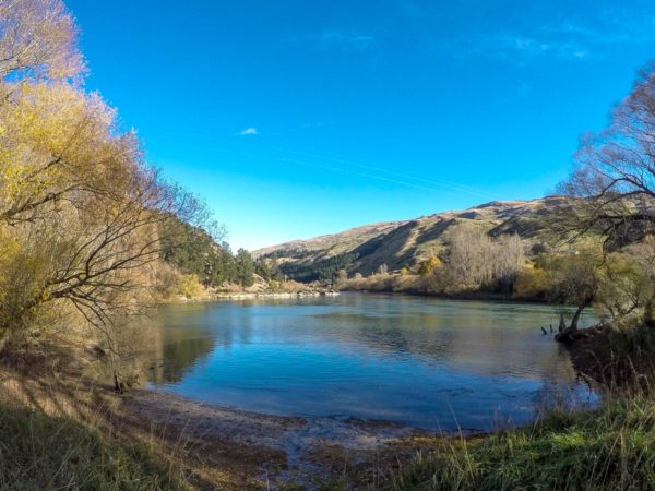
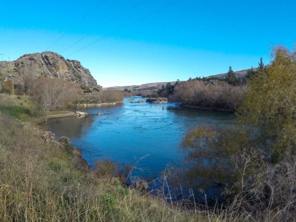
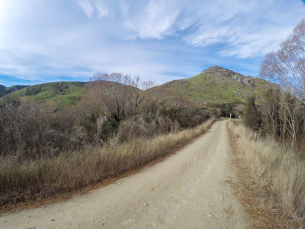
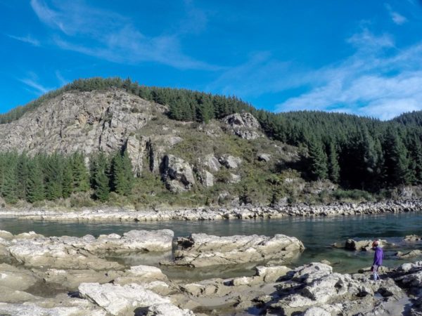
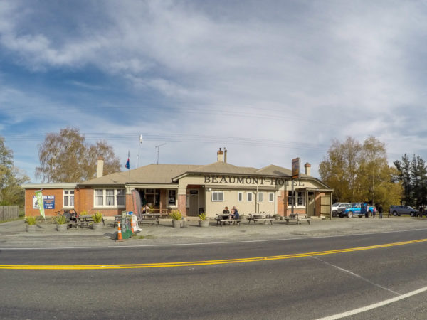
Heading to Beaumont. Again if you need the toilet give the Lonely Grave a miss, or visit the grave and double back to the start of the Clutha Gold Trail. This section of the trail is a little more interesting. You will see my old 1956 vanguard sitting in a paddock across from a shelter that was used many years ago to wait out of the rain till the next train to come along. There is another mini power station to see, but at this one you can hear the turbines spinning away producing power for the locals farmers. And last of all, the Beaumont Gorge. I was looking forward to seeing a fantastic gorge, like the Sawcut gorge or the Whanganui River Gorge not just a couple of rapids. It didn’t come close to beating the Roxburgh Gorge.
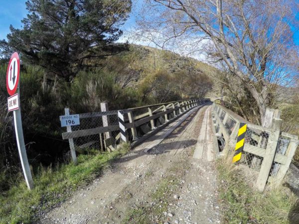
The ride was easy and fast 55 minutes. We called into the Beaumont Tavern to buy some lunch before cycling back to Miller’s Flat but someone forgot the $$$. Luckily I like a hot coffee and biscuits on my rides so we finished off the coffee and a biscuit and headed for home. To get across the Beaumont one way Bridge, which is controlled by traffic lights, there is a cyclist cross button you have to push to get a green light, or you could try the very narrow pedestrian walkway.
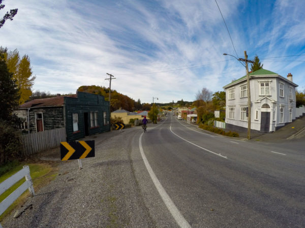


The last section to Lawrence
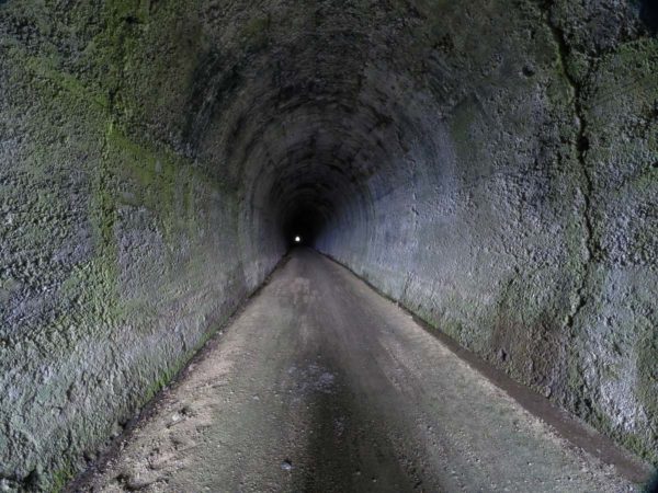
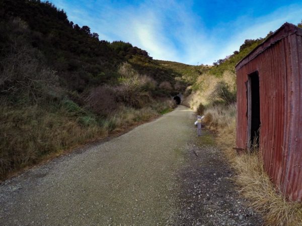
Today I am going to cycle from Millers Flat to Lawrence, it is a cold day, with a light tail wind to push me down the trail. My partner will drive the van down to Lawrence and cycle up to Beaumont, so we should meet somewhere? With no photo stops it took me 1 Hour and 15 minutes to reach Beaumont bridge. I did stop to enjoy a hot coffee to warm up but my toes were still cold after the five minutes break. The trail crosses the highway then ducks down two side streets. I cycle past the Beaumont community hall, past a farmer’s back yard full of collectables and a very old cottage before meeting up with the noisy main highway, this would have taken five minutes. Within 35 minutes I was at the Big Hill Tunnel. When I looked down the 434 Mt tunnel I could just see the light at the end of the tunnel, but it was moving. The light turned out to be my partner cycling through the tunnel to meet up with me, good timing. She had trouble finding the Lawrence end of the Clutha Gold Trail and had to put up with a head wind, hence she was running late. There is a toilet at the Lawrence end of the Big Hill tunnel but it is tucked away to the right, you could miss the toilet if you were powering down the hill.
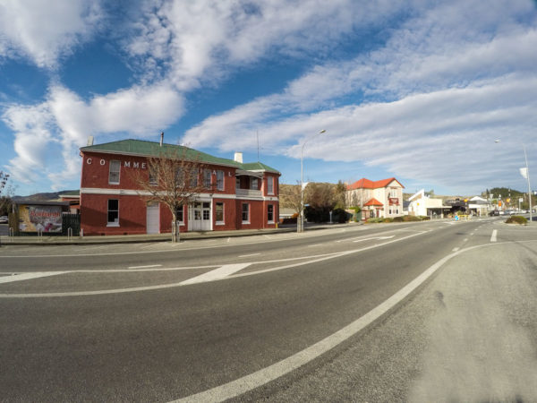
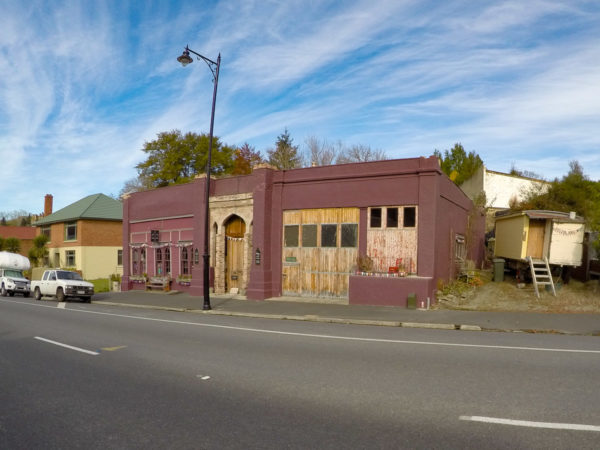
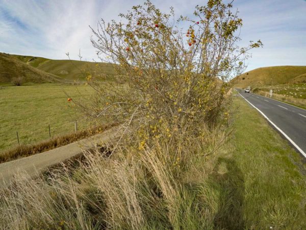
There was more to see in the last five minutes then there was in the whole 55 minutes ride into Lawrence. When I rounded the corner into Lawrance and saw all the old retail shops and the banks, I couldn’t wait to walk the full length of town and inspect all the old buildings. But that can wait, first on the list is a coffee. There were four cafes to pick from so we found a cafe with a fireplace and enjoyed hot chicken broth. Do take a walk around the back streets in Lawrence, there are so many old buildings to look at as well as nick nack shops to go browsing through. This last section took me 1H 55 Minutes. This included stopping for photos and stopping to pick apples off a tree right alongside the trail.
