Why Walk the Te Akeake Track?
It was one of those late-summer afternoons where the sun hit just right — low in the sky, golden, and not a whisper of wind. I’d ducked out of the city with nothing more than a banana, a camera, and a pair of worn-in trail shoes.
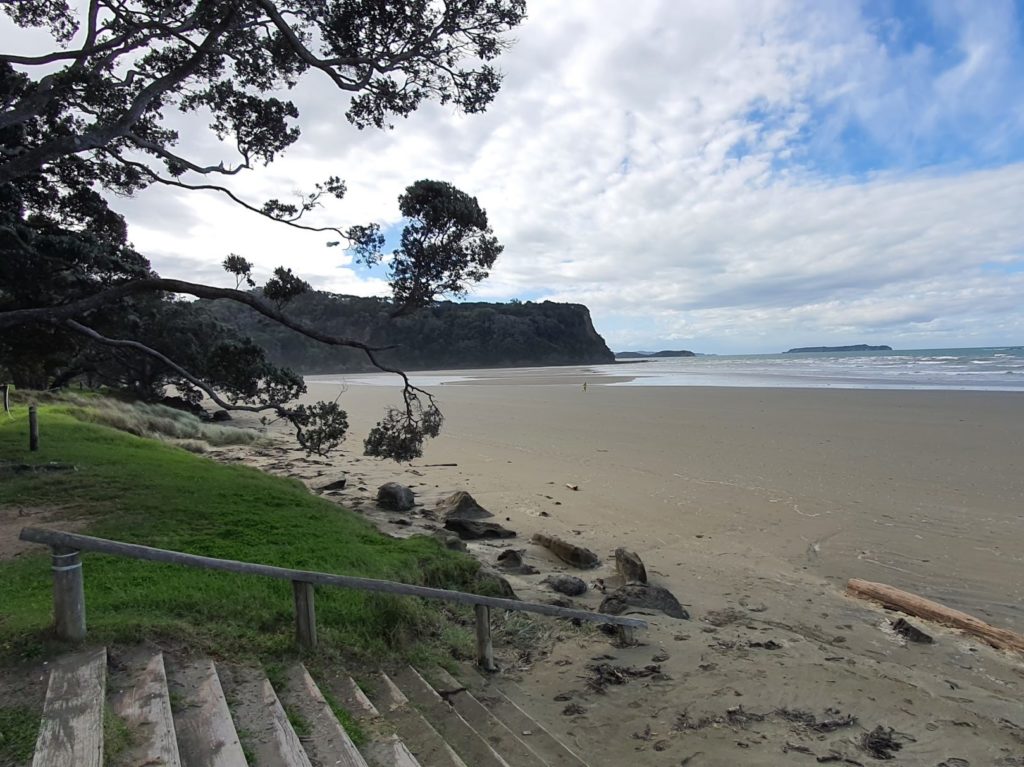
Te Akeake isn’t the most famous walk in Wenderholm Regional Park — but maybe that’s the charm. It feels like a secret whispered by the sea. You won’t find signs pointing to it, and you might even doubt you’re on a “track” at all. But follow your nose north along the beach and you’ll uncover one of Auckland’s most soulful strolls.
“Te Akeake is where land, river, and sea blur into one peaceful moment,” says Sandra, our resident walking specialist. “It’s perfect for reflection, and for skipping stones if you’re still a kid at heart.”
My 3d video map of Wenderholm Te Akeake Path
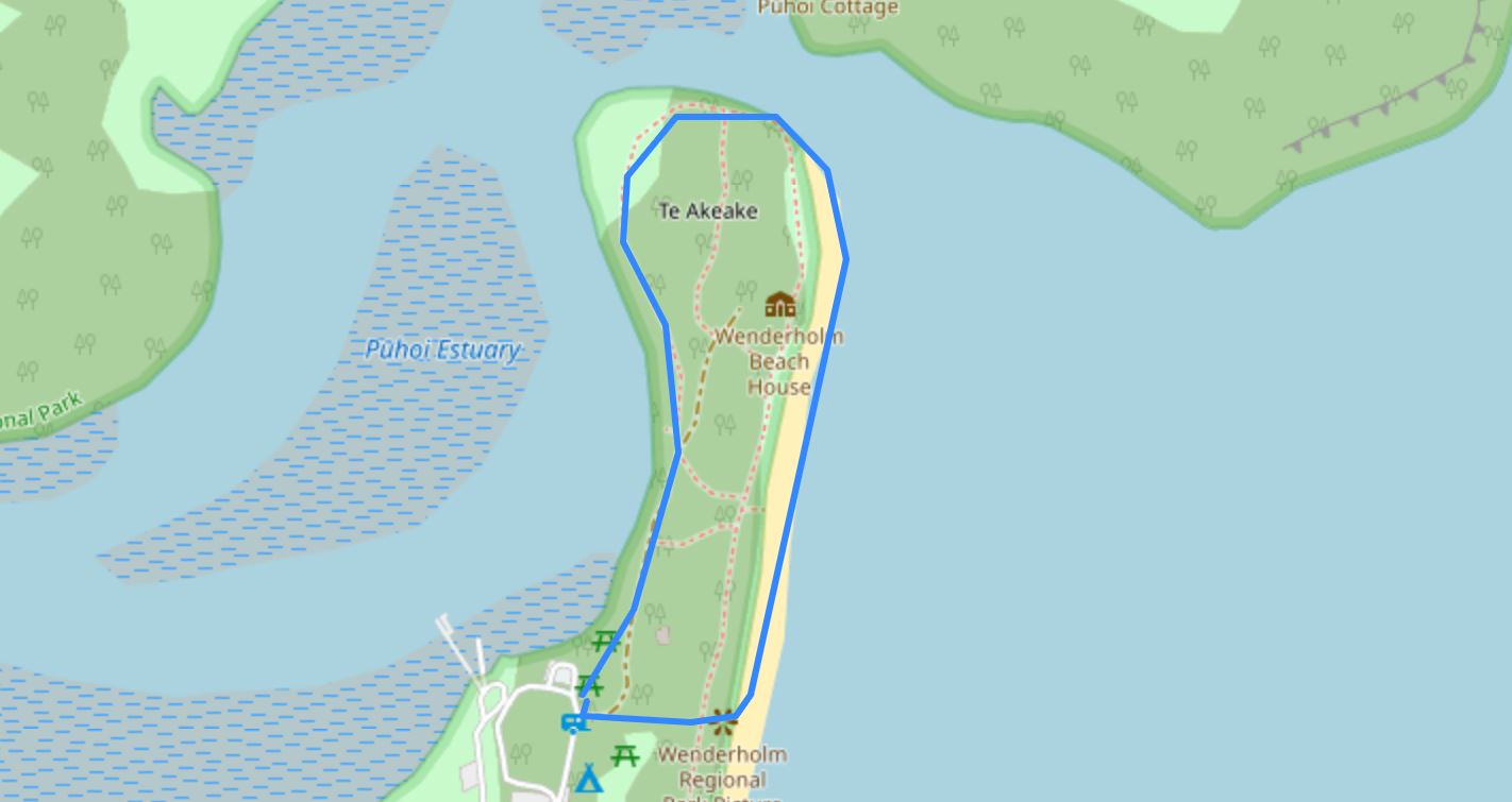
🥾 Walk Overview
- Location: Wenderholm Regional Park, North Shore, Auckland, North Island, New Zealand
- Time needed: 30 minute walk
- Distance: 1.8 km
- Difficulty: Easy
- Bikes allowed: No
- Route: Loop
- Elevation: None
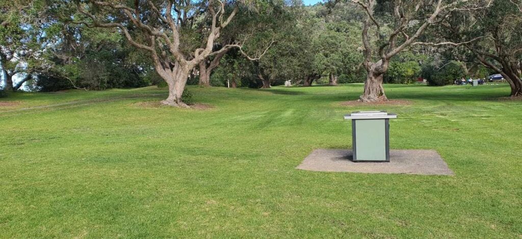
- Toilets: There are toilets at the main car park and more along the walk.
- Dogs: No
- Mobile Coverage: Excellent
- Wheelchair Accessible: No
- Are drones allowed: 🚫 No – restricted due to birdlife
- Are bikes allowed: No
🚗 Getting There
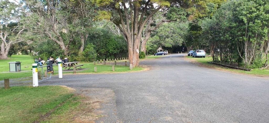
- Car park location: Main Wenderholm car park, just off SH17
- Parking availability: Space for approx. 60 cars, some shade, free parking
- Public transport: Bus to Waiwera, then walk 10 mins over the bridge
- Entry fees: Free!
- Signage: None for this walk — it’s unmarked, but easy to follow
🥾 Track Details
- Track surface: Sand, estuary edge, grassy margin
- Track condition: Natural terrain; no formal path. Best at low to mid tide
- Elevation gain: Essentially flat — no hills or steps
- Fitness level: All levels
- Alternative routes: Walk back along the estuary edge for a different vibe
Walk directions:
- From the main car park, head straight toward the beach.
- Once you reach the sand, turn left (north).
- Follow the shoreline to the end of the headland (Te Akeake).
- Loop back along the riverbank for a quieter return stroll.
🌿 What You’ll See
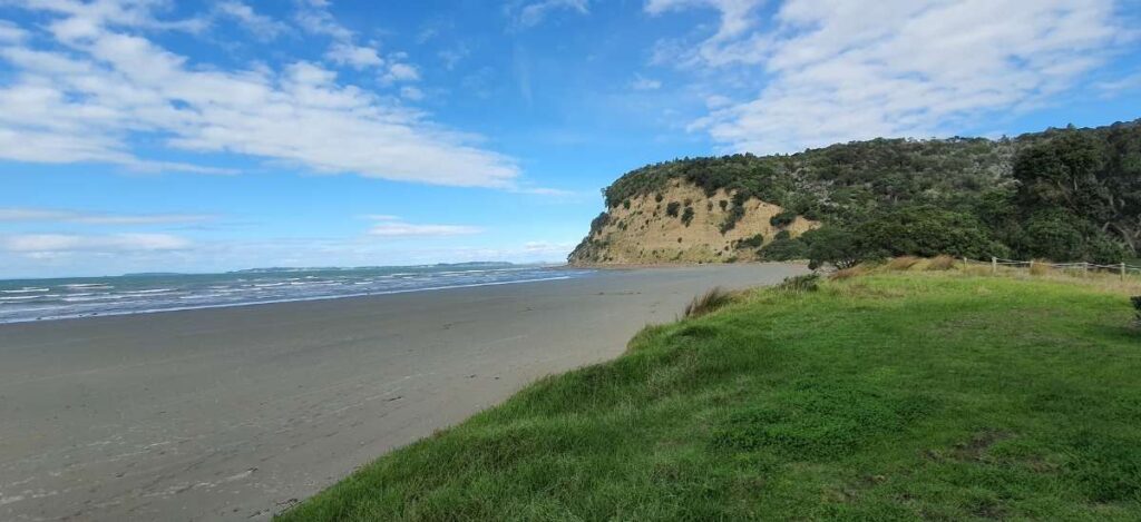
- 🏖️ Stunning beach views across the Hauraki Gulf
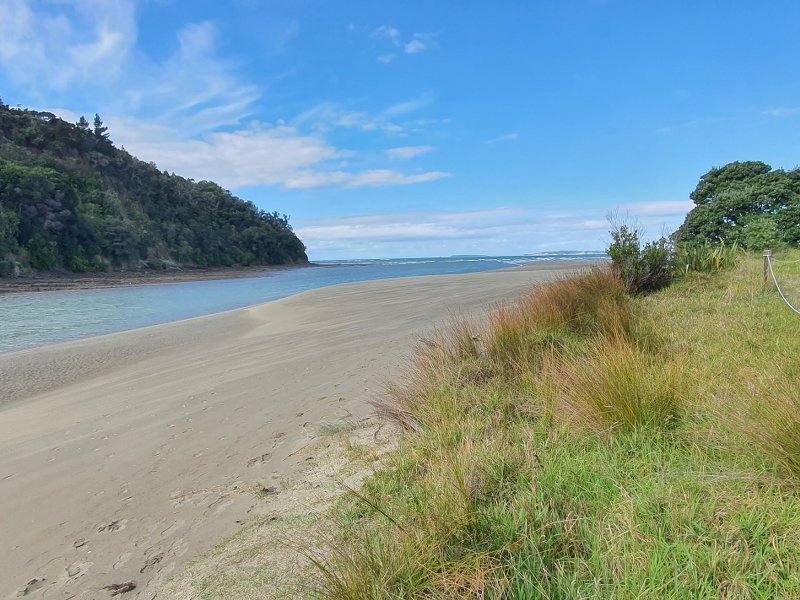
- 🌊 Pūhoi River mouth merging with sea
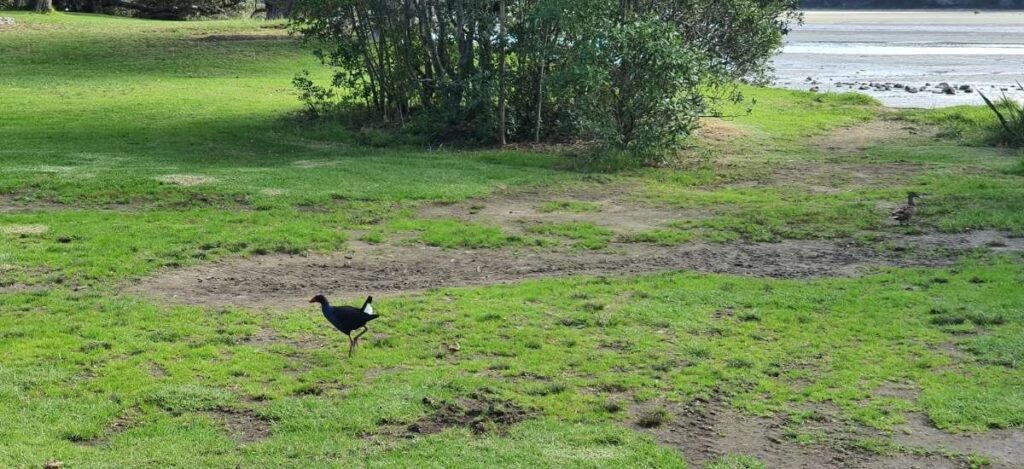
- 🐦 Tui, kūkupa (wood pigeon), and shorebirds
- 🌾 Old growth pōhutukawa and sand-dwelling flora
- 📸 Gorgeous photo spot at the end of the sandspit
🍽 Nearby Facilities
- Closest café: Sugarloaf Beach Bar (10-min walk) — or Mahurangi West Café (15-min drive)
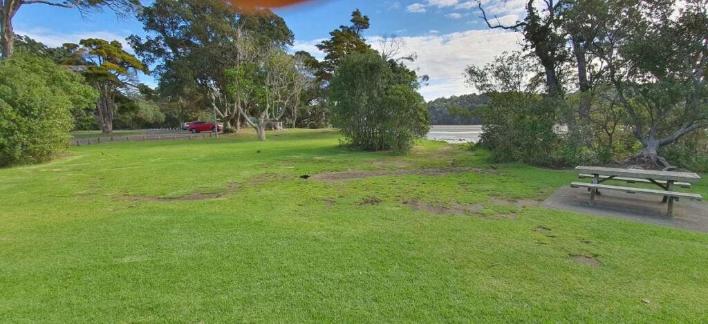
- Picnic spots: Plenty near the main carpark and riverside lawn
- Playgrounds: None in-park, but beachside trees make fun climbing spots
- Accommodation: Schischka Campground (1.5km inland), Wenderholm Beach House
Bonus Tips
- 🌊 Go at low tide for the most enjoyable beach walk — you’ll get more shoreline to explore and firmer footing.
- 🕊️ Look for the pou whenua carving near the start of the track — it’s a spiritual welcome to the land and a great orientation marker.
- 📷 Best photo spot: From the very tip of the spit, looking back toward the headland as the tide comes in — magic.
📍 Useful Links
- Wenderholm Park Map – Auckland Council
- Nearby Walk 1: Perimeter Track
- Nearby Walk 2: Vin’s Track
- Nearby Walk 4: Couldrey House Lookout
- Nearby Walk 5: Schischka Camp Loop Track
👤 My Experience on This Walk
- Date of walk: 22 February 2025
- Weather: Hot, dry, light nor’easter
- Track conditions: Firm, some soft sand at the point
- What I loved: The simplicity — no signs, no expectations. Just walk and breathe.
- Unexpected moment: A kingfisher dove into the estuary just metres away — not something you see in a shopping mall!
- My tips: Go barefoot, bring a snack, and walk it slow. It’s not about distance, it’s about peace.
🖋️ Final Thoughts
What stood out most was how untouched Te Akeake feels. It’s not the track you do for Instagram glory — it’s the one you remember months later when you need to calm your mind.
- Who I’d recommend it for: Families, solo wanderers, or couples needing a mini-escape from Auckland.
- Would I do it again? Absolutely.
- Next time I’d: Bring a small thermos of coffee and watch the sunrise from the end of the sandspit.
Common Questions Asked About This Walk
- Can I swim there? Yes, the beach is swimmable, but take care near the river mouth due to currents.
- Is it safe to go alone? Yes, but let someone know if you’re heading off the grid, especially if it’s quiet.
- Are there tides to worry about? Yes, best at low to mid tide. Parts of the estuary edge are narrow or muddy at high tide.
- Is there shade? Very little on the track itself, bring a hat!
- Can I camp overnight? Not on the walk itself, but the Schischka Campground nearby is lovely.
My track path map of Wenderholm Te Akeake Path walk
🌿 A Little History of Te Akeake and Wenderholm
Long before Wenderholm became a beloved Auckland day trip destination, it was a thriving settlement for Māori who lived here for nearly a thousand years, drawn by the fertile land, sheltered estuary, and abundant seafood. The flat sandy spit at the mouth of the Pūhoi River was called Te Akeake, while the forested headland was called Maungatauhoro, which was part of a wider cultural and spiritual landscape, nestled between the Pūhoi and Waiwera Rivers.
In the late 1700s, the area played host to a significant peace-making event (mihirau) between the Kawerau and Hauraki tribes, a moment that echoes through the whenua (land) even today.
Then came the Europeans. In 1868, politician and entrepreneur Robert Graham bought the land and built a holiday homestead he called Wenderholm, literally meaning “winter home.” The estate was his retreat from the bustle of Auckland, and also conveniently close to his nearby hot spring resort in Waiwera. The house, now known as Couldrey House, still stands and is open to the public.
The track itself — the Te Akeake Walk, remains unofficial and unformed, much like how early Māori and settlers would have experienced the land: by following the natural contours of coast and river. “Te Akeake” refers to a native tree species, but it’s also tied to the traditional name for this part of the sandspit.
It wasn’t until 1965 that Wenderholm became Auckland’s first regional park, protecting the area’s lush coastal forest, important wetlands, and historic grounds for future generations.
Today, as you walk barefoot along the beach to Te Akeake, you’re quite literally retracing the footprints of centuries, where peace was made, birds still call, and tides keep time better than any wristwatch ever could.