Mt Thomas Forest Walk is a short 59 k drive from the city of Christchurch.
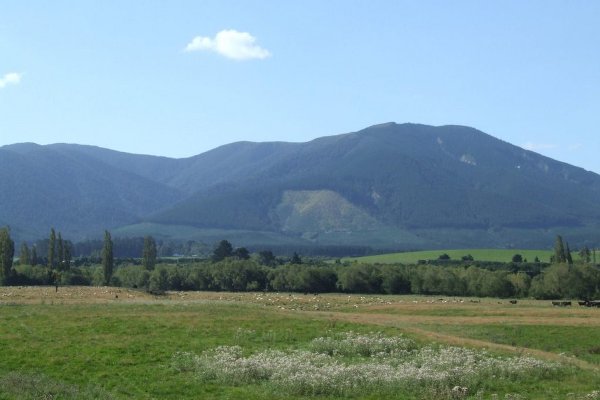
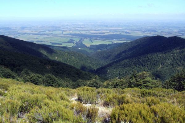
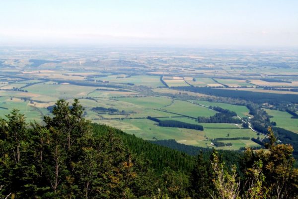
Enjoy the walk through the peaceful beach forest, when you reach the 1023m summit, sit down and enjoy the fantastic views out over the Canterbury plans.
Quick Facts about this walk
- Location: South Island NZ
- Distance: 9 kms
- Time needed: A good 5 hours
- Difficulty: Medium
- Wheelchair Access: No
- Route: Round Trip
- Elevation: 1023m
- Wet Feet: No
- Toilets: Yes
- Dogs: No
- Mobile Coverage: Yes
- Last Updated: November, 2019
We’ve partnered with Macpac outdoor walking & hiking gear to bring you the very best products designed exclusively for our New Zealand climate. They’ll ship for FREE within NZ on orders over $100 (if under $100 it’s only $5). Worldwide international shipping is available except to the USA. Bulky orders will be $20.
Summary points about this walk
Walk Highlights
Track Quality
Hazards
Transport
Water
Driving Instructions
Shops & Restaurants Nearby
Area & Trail History
Map Location
Points of interest along the walk
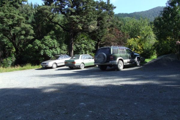
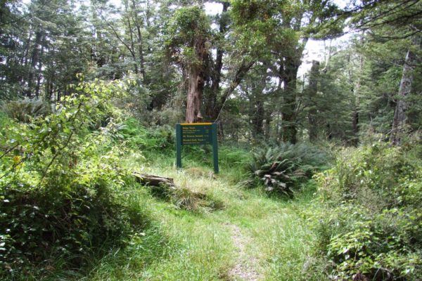
Point 1: Mt Thomas Car Park
The car park is a small one, there is an information board just in front of the cars. And the start of the track is on the far side of the picnic ground
Drive on a further 50 Mt, cross a bridge and up a slight hill to get to the main camping area, the toilets and a water tap are at the top of the rise.
At the far end of the camping area you can get a great view of the Canterbury plains below.

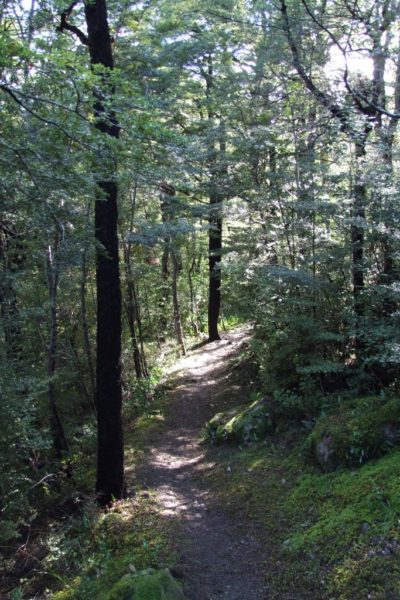
Point 2: Red pine Track
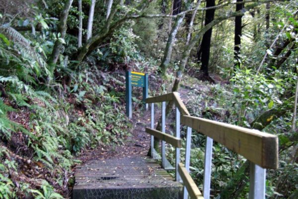
Walk to the far side of the picnic area to get to the start of the track.
Two choices.
After sitting in the car for one hour we were going to start with the easy section first, give our poor legs time to loosen up.
The second option is the hardest one, turn to the right and walk for 3 hours straight to the top of Mt Thomson.
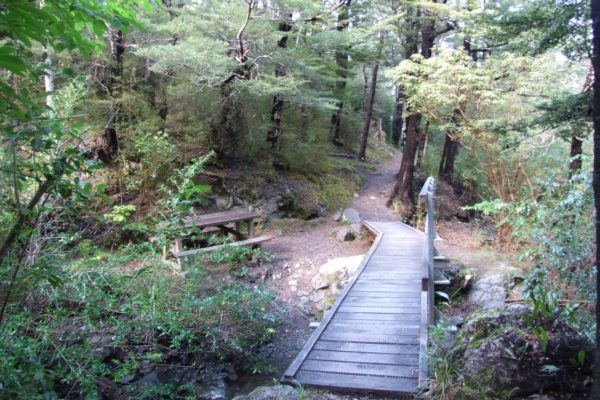
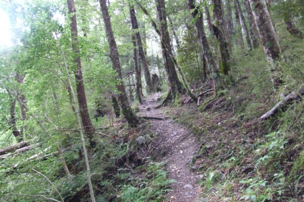
The first 17 minutes was little rough to start off with, But once across the first bridge, the track started to pick up,
The bell birds were singing their hearts out this morning, it been a long time since I have heard so many bell birds singing in one short stretch of bush. We slowed the pace down a little just to hear them sing. The table and chairs at the bridge would have made a fantastic place for a coffee stop, but just a little too early in the walk,
20 Minutes from the start is the first turn off on the left to the Red pine track. You keep to the right. You will meet up with Red pine walk track later on.
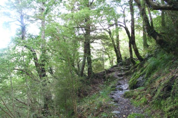
Point 3: Wooden Gully track
From here on the walk is slightly up hill, nothing to sweat over, the track is east to walk along, a little rocky in places but firm under foot.
Mountain beach trees give the bush a relaxing feeling, even with the hum of the honey bees flying around look for honey dew.
1 Hour
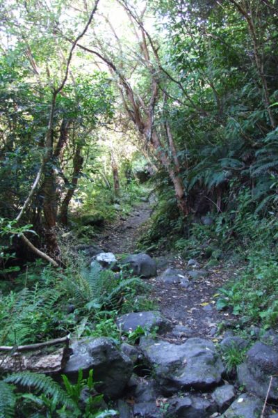
You should meet up with the top end of the Red pine track. The track climbs a little as it works its way around the valley and then drops down in to the creek crossing.

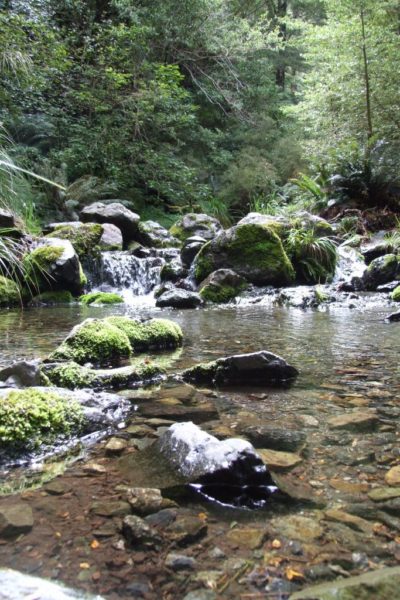
Point 4: Creek Crossing
1 Hour 40 Minutes
No problems with this crossing, unless it has been raining.
We hopped across without getting our fleet wet.
Before climbing up and out of the creek, We empty out the water bottles that were filled with town water and refill then with cool fresh mountain water, town water is only good for one thing, the vegetable garden.
Point 5: Wooded Gully Saddle
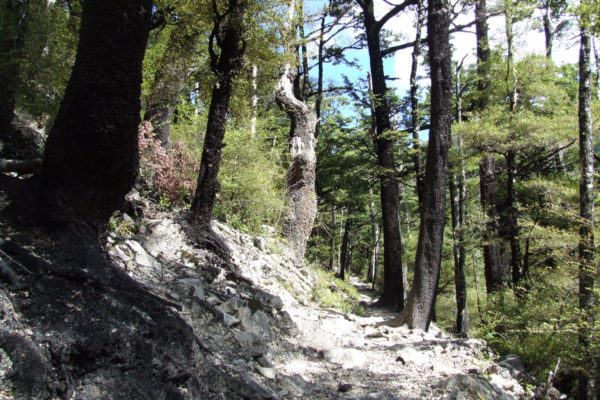
Now the work starts. 307 Mt climb to the saddle.
Great bush, even with the 300 Mt climb I really enjoyed the walk to the saddle. There was a marked difference in the colour and size of the trees.
You will notice the abundance of native ferns along this section of track.
2 Hours 40 minutes to the saddle.
Time to sit in the sun and enjoy a cup of coffee, no problem finding a soft green grassy spot to sit down
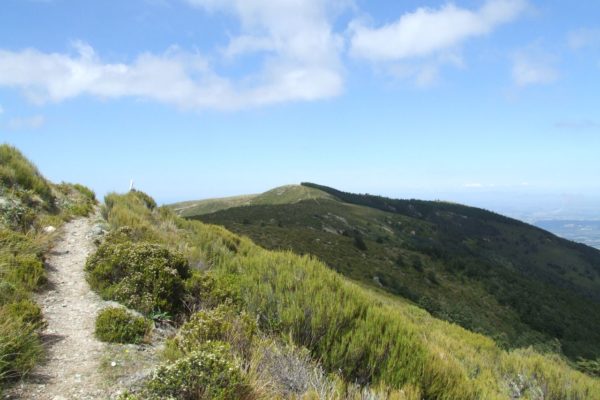
Point 6: Mt Thomas summit
3 Hours 5 Minutes to the top.
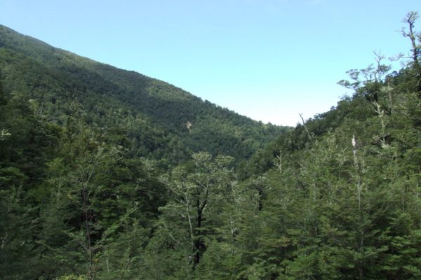
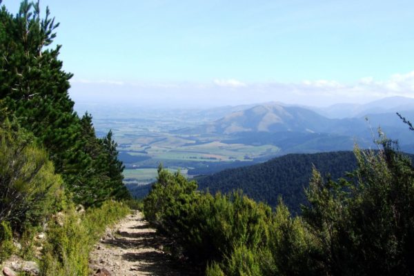
From the saddle it was a short 100 Mt climb up through the bush to the tree line, then an easy amble to the top of Mt Thomas, with great views over to the east and the west.
There was a cold wind blowing across the top of Mt Thomas so lunch with a view was out of the question.
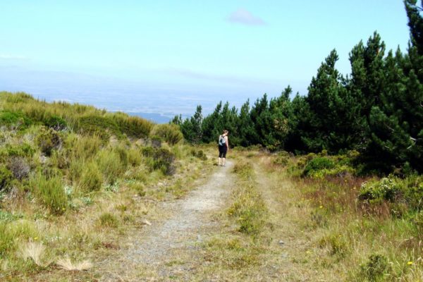
But the sent from the young pine trees made a great change from the car pollution off the CHCH CBD.
When you get to within 20 Mt of the top, the road turns off to the right, look for the sign over to your right


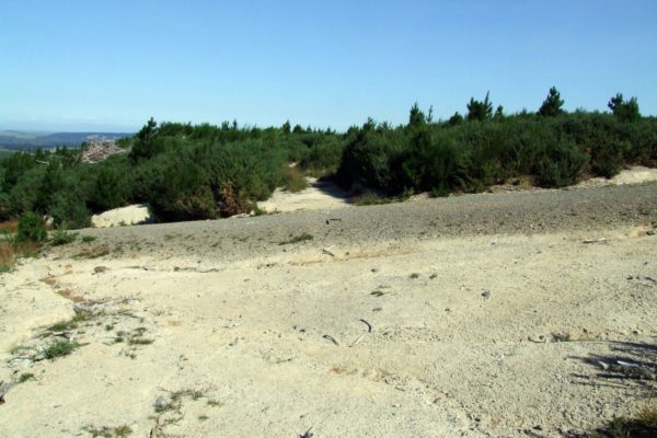
Point 7: Gorse Plantation
From here on it is downhill all the way to the car.
5 minutes down this forestry road you turn off to the right.
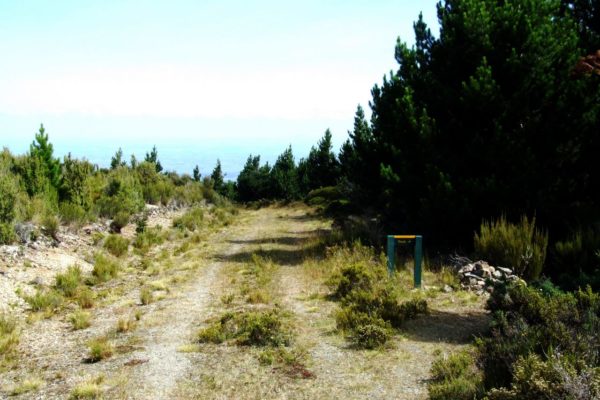
Look for the famous green sign with TRACK? Painted in yellow.
Good surface to walk on, some water on the track, if you look out to the right you can look down to the wooded gully track and back up to the saddle, then along to MT Thomas.
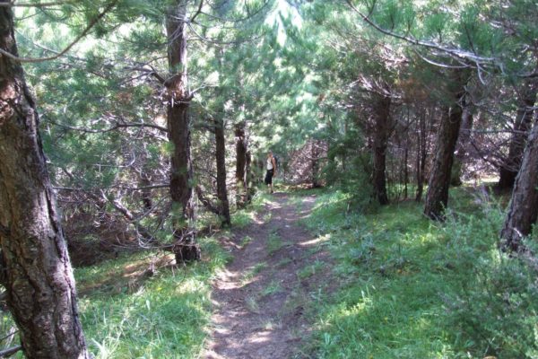
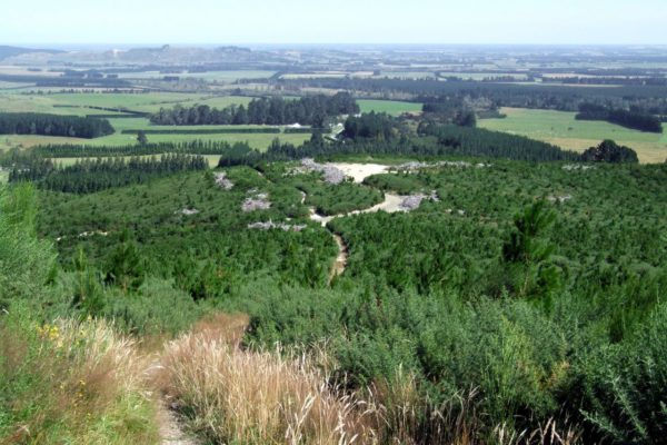
15 minutes down this track you start walking in to the pines.
In a coupled of places the pin trees have fallen over the track. The pines forest must be the ideal condition for toadstools to grow in. I didn’t count how many toadstools we saw but it would be around 50 or so for sure.
1 Hour 10 minutes from the top we walked out on to a forestry road. To see the famous green sign pointing to the ground
Point 8: Back to Mt Thomas Car Park
Only 15 minutes to go.
We cut across the track and head for the old skids, but now We have to walk through acres and acres of gorse.
Another road to cross don’t turn left or right? we just follow the track through the gorse plantation.
2 Minutes and you will meet up with a gravel road; now don’t walk on to the road.
We turn to the right and walked through the jungle till we came across another track, no sign. Then another track, no sign. With good luck on our side we found the car 10 minutes later
