As this is a loop walk, you have the option to start in either direction
However, it is highly recommended to follow the track clockwise. It is the best way to get the hard climb out of the way and fully enjoy the rest of the walk and leisurely meander on the lakeshore part of the walk. You get better views this way as well.
Assuming you choose the clockwise route: climb through larch forest for about 45 minutes before reaching the open tussock grassland fields. The track continues to climb until you reach the junction at the top of the hill.
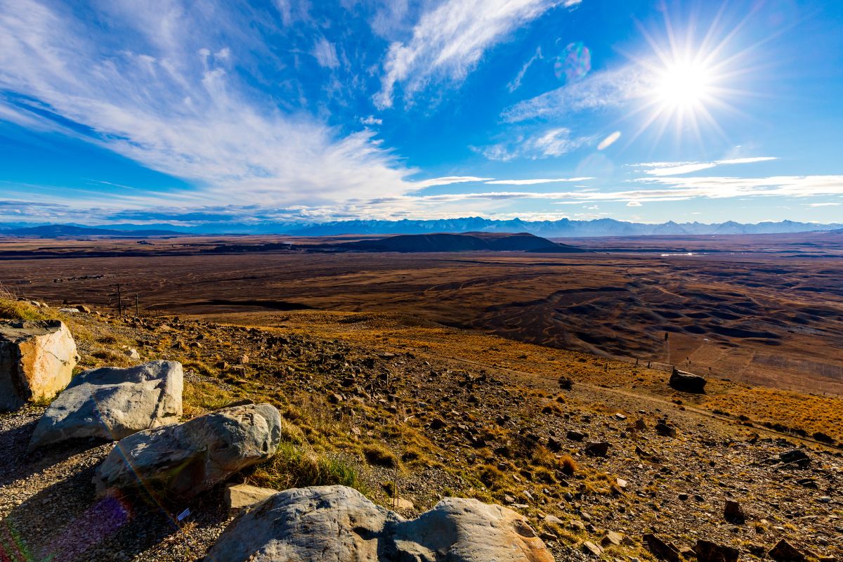
Detour left for the Astro café for a bite to eat or continue right for the South Summit loop track. After you are done enjoying the views from the summit, descend from the observatory on a zig-zagged track towards the lake.
This small track is about 50 m above the lakeshore until you land on a gravel road that leads you back to Tekapo Hot Springs. The walk along the lakeshore is nothing but views of Lake Tekapo and the mountains – wow.
The majority of this walk is exposed to the elements (wind, rain, sun) so it is best to come equipped with a hat and warm jacket.
Enjoy the Tekapo hot pools after your walk
Especially wonderful in winter, but any time of the year is good, finish off your hike or walk in Tekapo with a soak in the hot springs. If you don’t mind what time you go you can get cheaper entry tickets to the hot pools on this link. The pools are open every day except Christmas day. There is a great day spa and cafe, bar to enjoy as well. The hot pools overlook stunning Lake Tekapo.
Quick Facts about this walk
- Location: Lake Tekapo, South Island, New Zealand
- Time needed: 3 hours + 20 mins if you start from Tekapo town
- Distance: 8.5 km (or 13 km from town)
- Difficulty: Medium
- Bikes allowed: Only on the 4WD track on the lakeshore.
- Route: Loop
- Elevation: 413 m
- Wet Feet: No
- Toilets: There are toilets in Lake Tekapo township and at the cafe at the summit.
- Dogs: No
- Mobile Coverage: Yes, very good
Summary points about this walk
Walk Highlights
Track Quality
Transport
Water
Driving Instructions
Shops & Restaurants Nearby
Area & Trail History
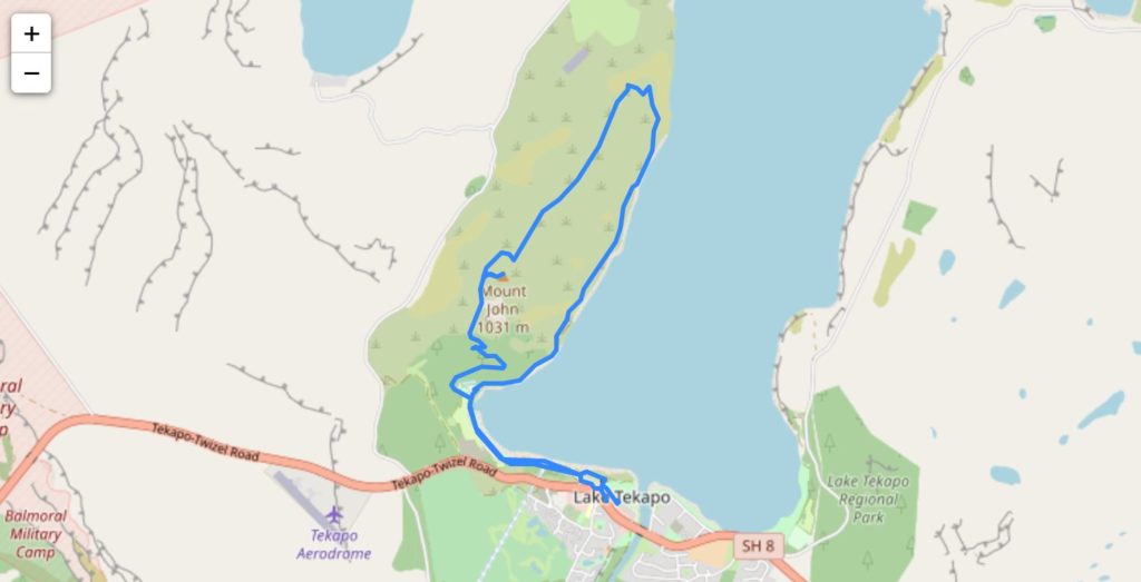
Map showing the full trail
My friend Sally, very kindly shared her walk from Relive where she recorded it. While she was in Tekapo she did the St Johns walk and the Cowan Hill walk, you can see her 3d video of this walk below. She started from town so this is the longer walk.
If this walk is too long for you, then do the much smaller Mt John Summit track.