Quick Facts
| Distance | Time | Difficulty | Dogs | Parking |
|---|---|---|---|---|
| 2-3.2km (depending on route) | 60-90 mins | Moderate | Off/On leash areas | Mangere Memorial Hall |
Why You’ll Love This Walk
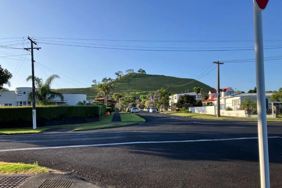
Most Aucklanders rush past Mangere Mountain on the motorway without giving it a second thought, but they’re missing out. You’ll find three volcanic craters, stunning 360-degree views across the city and harbour, and loads of Maori history – all without the crowds you’d get at One Tree Hill or Mt Eden. Plus there’s a brilliant recreation park at the base with sports fields, a playground, and skatepark that the kids will love.
It doesn’t get the attention that One Tree Hill or Mt Eden get, but that’s part of the appeal. The summit views are absolutely cracking, and wandering past the old kumera pits and terracing really brings the mountain’s history to life.
Download the Mangere Mountain Walk Map PDF
Getting There
Address: Mangere Memorial Hall, Domain Road, Mangere Bridge
Click here to open the Google Map
By Car: Head to Mangere Bridge village and turn into Domain Road. The carpark is right by the Memorial Hall. There’s plenty of parking.
By Bus: Catch a bus to Coronation Road, Mangere Bridge, then it’s a short walk to Domain Road.
The Route – Two Options
I’m giving you the full loop here, which takes you around the eastern edge of the main crater, up to the summit, then back down. You’ve got two choices at the end – visit the Mangere Education Centre (worth it if you’ve got time), or loop back through Mangere Bridge village.
Getting Started
- From the Mangere Memorial Hall carpark, climb the steps on the southern side into the recreation area
- Go left across the park towards the toilets and take the stairs to their right
- Turn right on the road overlooking the playing fields and follow it down
- Enter through the gate marked “Mangere Mountain”
- Follow the broad path around the eastern edge of the main crater
The Climb
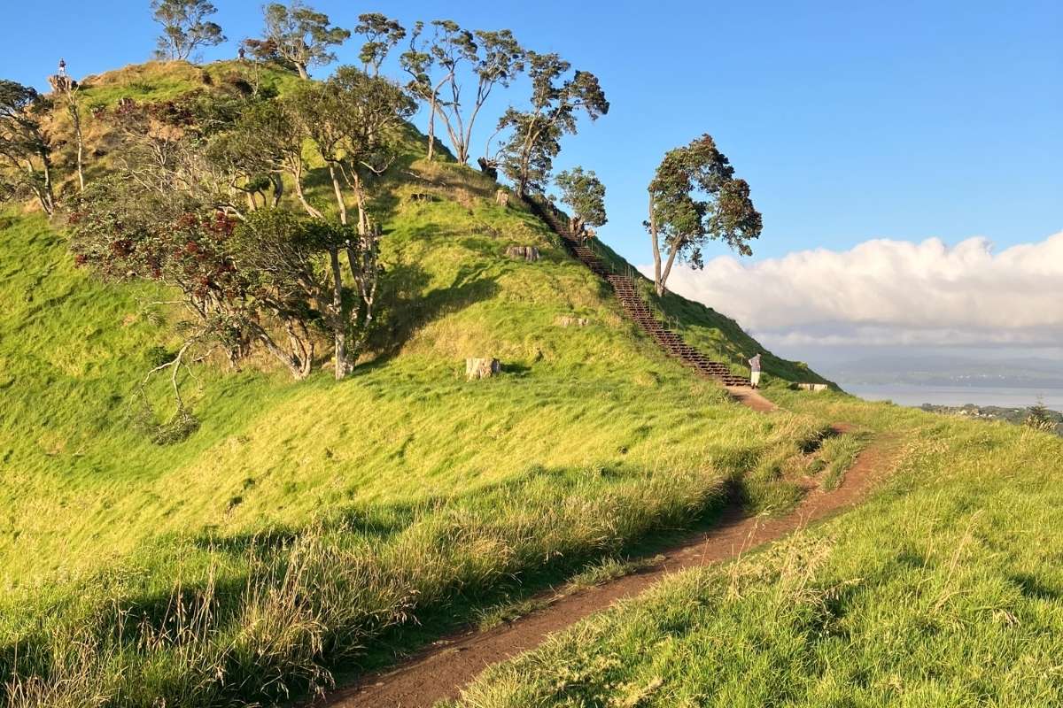
- When you reach the detour, take the steps up to the summit
This is where it gets steep – the track narrows and climbs sharply. Take your time. The views get better with every step.
If you’re just here for an out-and-back summit walk with a buggy, turn around here and head back the way you came. The clockwise route to the summit is gradual and buggy-friendly.
Coming Down – Choose Your Adventure
- From the summit, descend the steps to your right (not the way you came up)
- Watch out here – the next 50 metres can be a bit tricky underfoot, especially if it’s been wet
- As the path levels out, it splits:
- Right fork takes you back to the gate where you entered
- Left fork takes you to the top of the stairs back into the recreation area
Option A – Visit the Education Centre (add 1-2 hours):
- Cross the road to the path on the other side
- Follow this track to reach the Mangere Education Centre
The Education Centre is brilliant if you want to dive deeper into the mountain’s Maori history. There’s a lot of stairs to get there, though.
Option B – Loop Through Mangere Village (my pick for the full experience):
- Descend the steps back into the recreation area
- Exit at the western end, just beyond the skate park
- Follow the grass track as it dips then climbs
- Exit onto Scott Street
- Follow Scott Street down, crossing Taylor Road and McIntyre Road
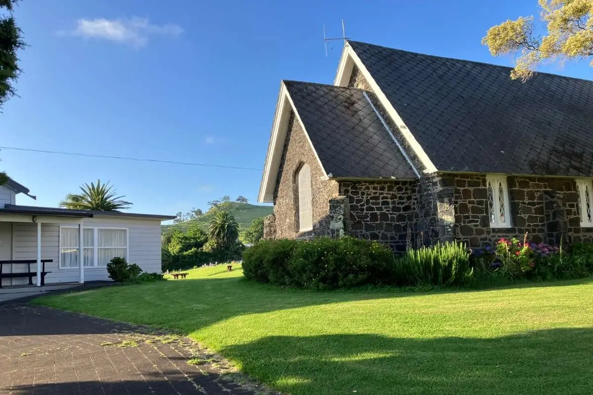
- At Church Road, turn right
- Walk past St James Anglican Church to the roundabout at Mangere Bridge centre
- Turn right up Coronation Road, recrossing McIntyre and Taylor Roads
- Turn right into Domain Road and you’re back at the carpark
What You’ll Actually See
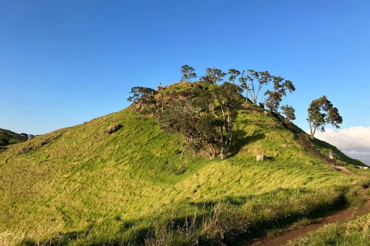
- The Craters: There are three volcanic craters here. The main one you walk around is impressive, the second one you pass on the way up, and the third was quarried – that’s where the sports fields and Education Centre sit now.
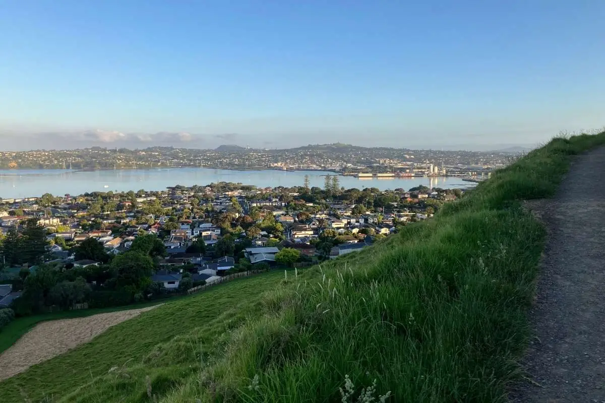
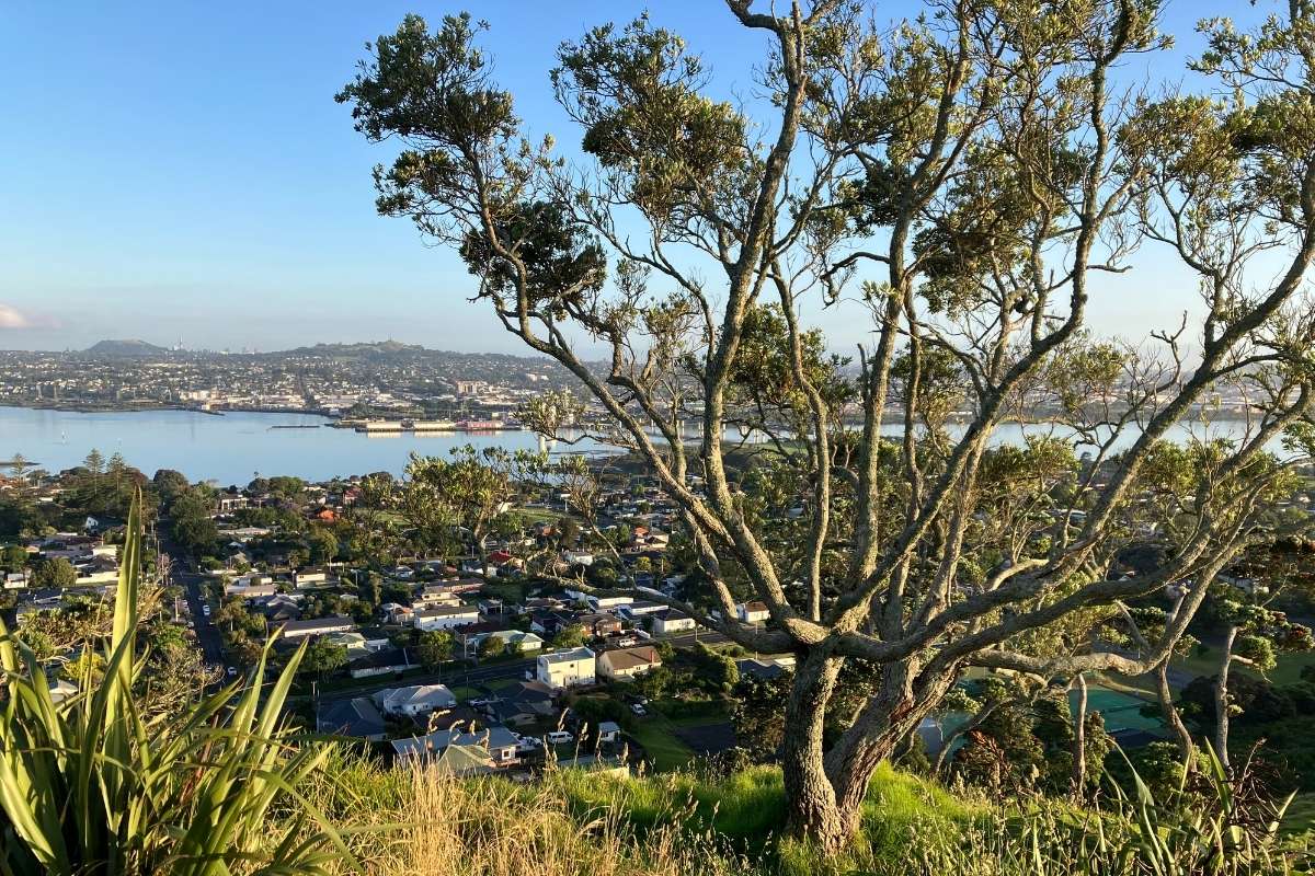
- The Views: From the summit, you’ll get 360-degree views. Sky Tower, Rangitoto, One Tree Hill, the Manukau Harbour – it’s all there. On a clear day, it’s absolutely stunning.
- Maori Heritage: As you walk the upper rim, you’ll pass kumera pits (ancient food storage), terracing, and palisades. This was a significant pa site, and you can really see how the natural crater walls would’ve provided defence.
- The Recreation Area: At the base, there’s heaps going on – football fields, softball fields, playground, skatepark. It’s a proper community hub.
Who It’s For
This walk suits anyone with reasonable fitness. The summit climb is steep in sections, so you need to be comfortable with that.
- Families: Kids who can handle a decent hill will love this. The playground at the bottom is a great reward after the walk.
- Buggies: The clockwise route to the summit works for off-road buggies – it’s a gradual climb on wide paths. But you’ll miss the interesting stuff around the rim. The Education Centre route has too many stairs for buggies.
- Walking Clubs: This is perfect for groups. The loop via Mangere village gives you a proper walk, and there’s enough space at the base for everyone to gather.
When to Go
- Best Time: Early morning for the clearest views and to beat any heat. The summit can be quite exposed.
- Avoid: Windy days – the summit gets absolutely hammered when the wind’s up.
- Seasons: Lovely year-round. Winter can be muddy in spots, but nothing too bad.
Important Stuff
- Dogs: There are both off-leash and on-leash areas. Check the signs when you arrive.
- Toilets: Available at the Mangere Mountain Sports Club and in Mangere Bridge village.
- Tables: Available at the bottom of the mountain by the children’s playground.
- Water: Bring your own – there’s no drinking water on the track.
What to Bring:
- Good shoes with grip (some sections are slippery when wet)
- Water
- Sun protection (summit is exposed)
- Camera for those views
Safety: The 50 metres after you descend from the summit can be tricky – uneven ground and a bit steep. Just take it slow. Mobile coverage is generally fine.
My Honest Take
I think this walk offers way more than most people expect. The combination of volcanic features, Maori history, and those views makes it really special. The fact it’s not overrun with tourists is a bonus.
The steep section up to the summit will get your heart rate up, but it’s short. And honestly, the views are worth it.
If you’ve got time, do the full loop through Mangere village. It’s a proper walk, and you get a feel for the local area. If you’re short on time, the out-and-back to the summit is still worthwhile.
The Education Centre is fantastic if you’re keen on Maori history and culture, but be prepared for all those stairs.
Would I do it again? Absolutely. I reckon I’d bring a picnic next time and hang out at those tables by the playground after the walk.
Other Walks Nearby
Looking for more walks in the area? Check out these:
- Mangere Bridge Loop Walk – Easy harbour-edge walk, great for families
- Ambury Park Farm Walk – Coastal farm walk with animals
- Onehunga Foreshore – Flat waterfront path
- One Tree Hill Circuit Walk – Another volcanic cone for comparison
- Mt Eden Circuit – Auckland’s highest volcanic cone

2 Responses
This makes me appreciate Auckland even more. I have passed this great mountain many times, but only recently decided to check it out with a group of like-minded walkers. Just takes my breath away the views from the top. Fantastic playground alongside the maunga too. Thanks as always Sandra for taking the guesswork out for the rest of us who want to walk these paths and trails.
Hi Theresa, thanks so much for the feedback. I’m so glad you enjoyed the walk and found something new to see in Auckland.
Thanks
Sandra