Getting There
Moturiki Island is at the southern end of Mt Maunganui’s main beach, right next to the base of Mauao (the Mount). You can’t drive to it, you walk from the beach.
- By car: Head to Marine Parade, Mt Maunganui. Free on-street parking is available along Marine Parade and Maunganui Road. From there, walk south along the main beach until you reach the sand bridge connecting the island to the beach. GPS start point: -37.6538, 176.1773.
- By foot from town: From the main shopping area on Maunganui Road, it’s about a 10-minute walk south along the beachfront to reach the island.
- By bus: Bay Hopper services run to Mt Maunganui. From the main bus stop on Maunganui Road it’s a short walk to the beach and then south to the island.
The Walk
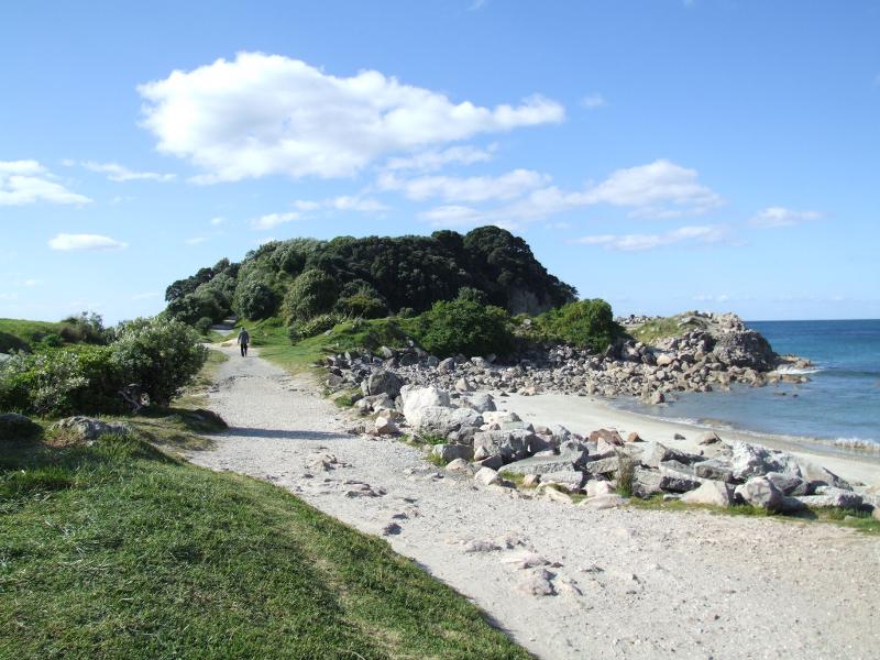
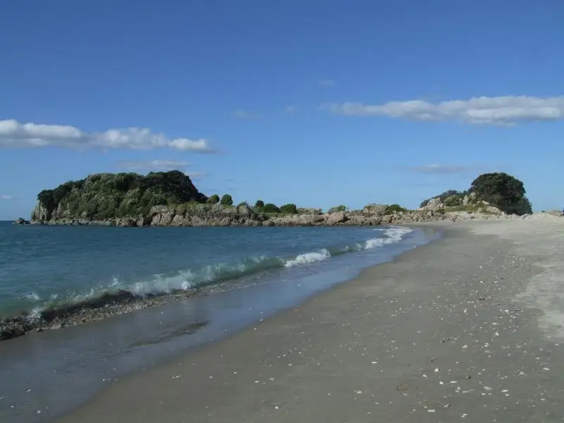
The track is straightforward, no confusing forks or decisions to make. Head to the southern end of the main beach and look for the wide sand bridge leading across to the island. It stays dry no matter what the tide is doing, so you won’t get wet feet.
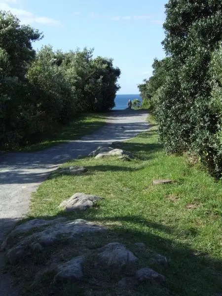
Once you cross onto the island, follow the main path through a section of low coastal scrub. It’s well-formed and easy underfoot, packed gravel and worn grass, wide enough to walk side-by-side.
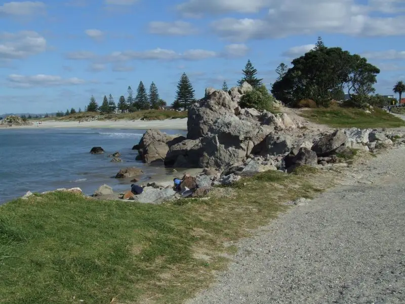
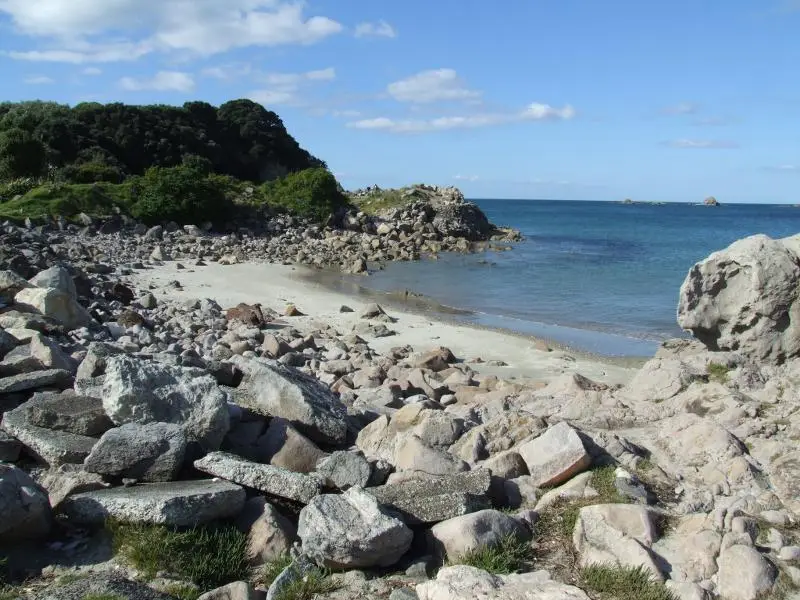
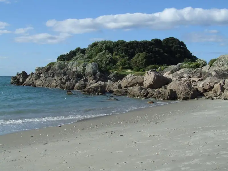
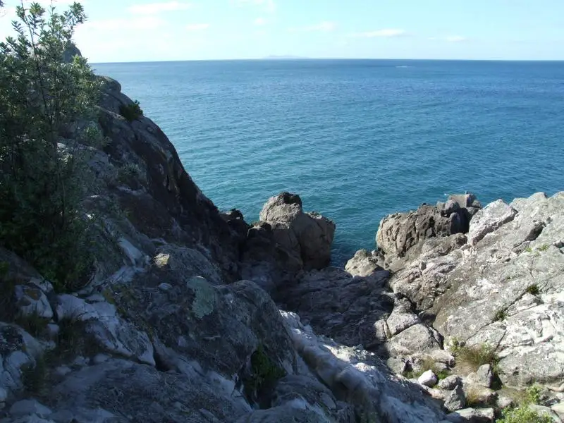
The path runs roughly through the middle of the island, bringing you out at the far southern end after about 500 metres. This is where most of the action is, a cluster of granite rocks, views out across the bay, and if the timing is right, the blowhole.
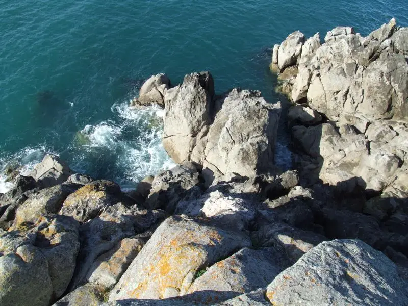
The blowhole is at the southern tip, below the rocks. It only goes off when there’s a decent swell running and the tide is coming in. On calm days with a low tide you might not see much. Come on a day with some wind and a good-sized swell and you’ll know when you’re in the right spot.
Once you’ve had a good look, head back the same way you came.
What You’ll See
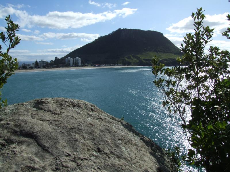
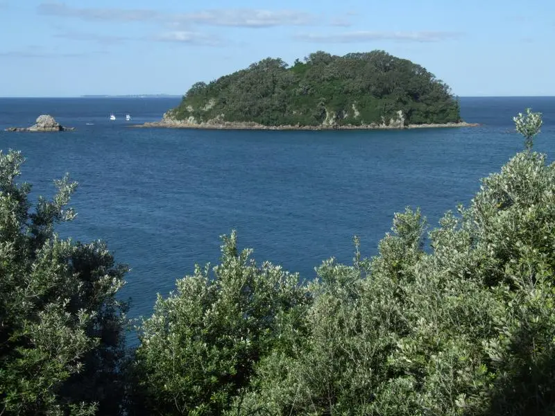
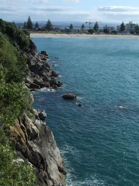
- Views: Standing at the end of the island, you get a great look back at Mauao, the whole cone framing the beach. It’s one of the better spots to photograph the Mount from a low angle. On a clear day you can also see across to Matakana Island and out toward Mayor Island.
- Rock pools: The granite boulders at the far end are worth a look at low tide. There are small rock pools with crabs, anemones, and small fish. Watch your footing on the rocks as they can be slippery with weed.
- The blowhole: Best on an incoming mid-to-high tide with a decent swell. On a calm day it’s not much to look at, so don’t plan your whole visit around it. On a rough day it’s great.
- Native bush: The path winds through coastal scrub, mostly native species that have regenerated since the quarrying stopped in the 1920s. It’s not dense bush but it’s genuinely native and home to small birds.
- Fishing: The rocks at the far end are a good fishing spot. You’ll usually find a few people casting from them, going for snapper and kahawai. Fishing is allowed, it’s a public reserve. Watch your footing on wet rocks.
History, What Was Leisure Island?
The island was quarried for granite from 1911, the stone used to ballast railway lines across the Bay of Plenty. The quarrying actually created the blowhole when the rock was blasted away.
In 1966 it was turned into a fun park called Marineland, later renamed Leisure Island. The park had saltwater swimming pools, a water slide, bumper boats, animals, fish tanks, and a shop. I remember going there as a kid and it was really cool. It ran until 1981 then closed, and the whole site was cleared and grassed over in 2011. There’s not much left to see now, though if you look carefully at the ground on the western side you can make out where the pools used to be.
Who It’s For
This walk is suitable for everyone. The path is easy, it’s short, and there are no steep sections. Kids will enjoy the rock pools and the novelty of walking to an island. It’s also a good short leg-stretch after a swim or a meal in town.
No dogs, $300 fine, it’s enforced.
When to Go
- For the blowhole: Visit on a day with a 1.5m+ swell (check MetService or Magic Seaweed for Tauranga) and aim for an incoming mid-tide. Morning tends to have cleaner conditions.
- For fishing: Dusk and dawn are prime. Incoming tide is better. Kahawai and snapper are the main targets from the rocks.
- For crowds: Busiest in summer on weekends. Come early morning or mid-week if you want it quieter. In winter it’s almost always quiet.
- For rock pools: Low tide is the best time to explore the rocks at the far end.
My Honest Take
It’s short. You won’t be worn out by it. But it’s the kind of walk you add to a morning at the beach and end up glad you did. The views back to Mauao from the far end are really good, better than looking at the Mount from the beach because you’ve got some distance and a proper framing.
I remember going to Marineland there as a kid and it was great fun. Standing on what’s now a quiet nature reserve knowing what used to be there is a weird feeling. Nothing left of it. I loved visiting my grandparents who used to own a house at the mount.

4 Responses
Are we allowed for fishing in this Island?
Hi, yes you can fish from the island, it’s a public space.
We came to do this walk with our dog, only to find that dogs aren’t allowed and there is a $300 fine. Disappointed not see this beautiful walk.
Hi Dave, thanks so much for the update, I didn’t know that. I’ve changed the website now to show this.