The walk to the Tama Lakes on Mt Tongariro will take you around 2.5 hours to reach Upper Tama Lakes.
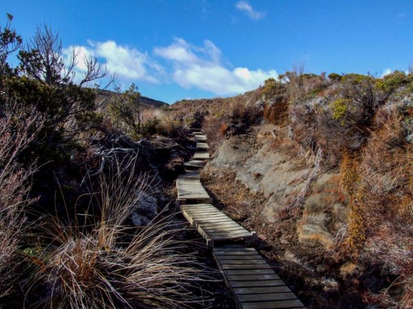
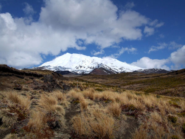
This is a medium grade walk. The Tama Lakes are stunning with views out to Mt Ruapehu. There is a well formed track with board walks as required and fully metalled track until the lower Tama Lake. From the lower lake to the upper lake there is an obvious track marked with poles. This is an excellent day walk on a well maintained track that provides both a lowland forest walk and an amazing alpine experience.
Quick Facts about this walk
- Location: Tongariro National Park. Central North Island
- Distance: 17 kms
- Time needed: 2 hours 30 minutes to Upper Tama Lake
- Difficulty: Medium
- Wheelchair Access: No
- Route: Double back
- Elevation: 1430m
- Wet Feet: No
- Toilets: There are 2 toilets available.
- Dogs: No
- Mobile Coverage: Yes
- Last Updated: Jan 2022
We’ve partnered with Macpac outdoor walking & hiking gear to bring you the very best products designed exclusively for our New Zealand climate. They’ll ship for FREE within NZ on orders over $100 (if under $100 it’s only $5). Worldwide international shipping is available except to the USA. Bulky orders will be $20.
Summary points about this walk
Walk Highlights
Track Quality
Hazards
Transport
Water
Driving Instructions
Shops & Restaurants Nearby
Area & Trail History
Map Location for the Tama Lakes
Points of interest along the walk
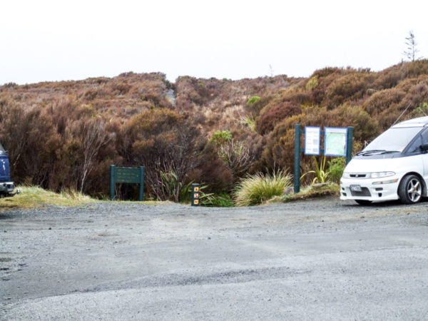
Point 1: Tama Lakes Walk, Tongariro – Start
Drive up past the Chateau and take the next turn to the left on Ngauruhoe Place. Drive to the end of the road. Three minute drive, all up. Again, there is information for you to read before you get under way.
Point 2: Tama Lakes Walk, Tongariro
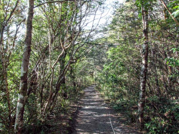
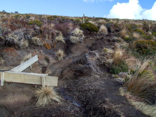
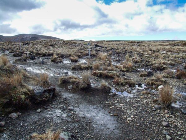
This was the Waihohonu horse track many years ago. The walk starts with red tussock and small patches of Manuka. Then into alpine shrub. The track is a very comfortable uphill walk to the falls with four small gullies’s to cross. When I first did this walk a few years ago there were a couple of places it can be a bit sticky, but it’s all been fixed now with an excellent track. You will enjoy the short walk through the mountain beech at the beginning of the track so walk slowly the rest of the walk is in the open.
Point 3: Tama Lakes Walk, Tongariro
Pick your day for this walk. The weather can change from sunny with unlimited visibility to a white out in 30 minutes. If you get caught out on a whiteout, head back there is no point going any further.
Point 4: Tama Lakes Walk, Taranaki Falls
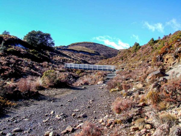
(1 Hour ) Cross over the Wairere Stream bridge and turn to the left and walk over to the edge of the water fall. BE CAREFUL. It is a long way down to the bottom of the falls. The rocks will be very slippery with the slightest amount of moisture on them. Refer to the Taranaki Falls walk for photos and description.
Point 5: Tama Lakes Walk, Tongariro
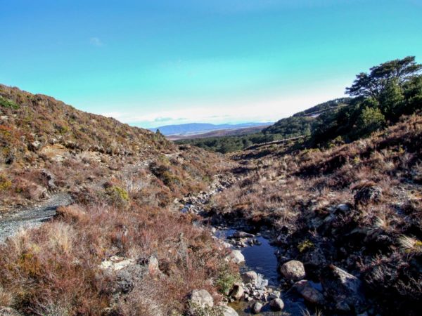
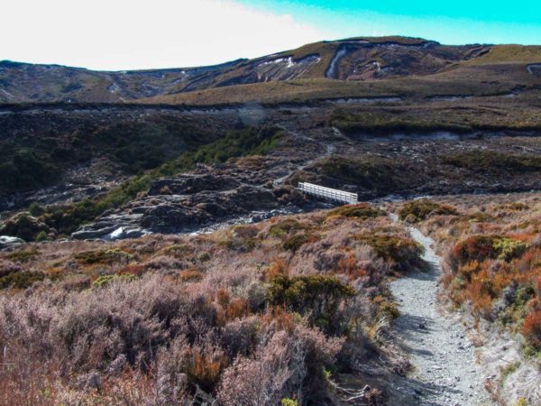
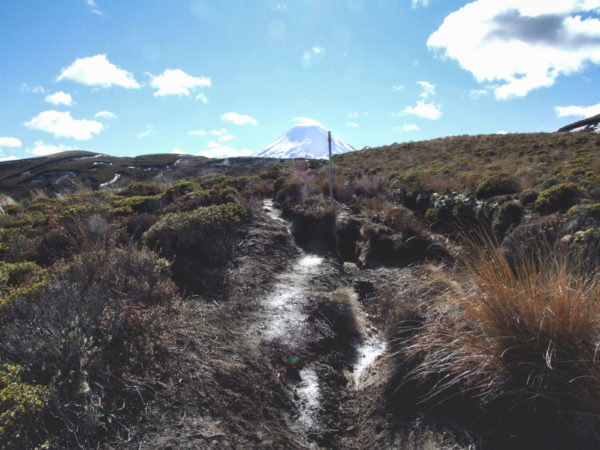
Cross over the bridge and walk up the gentle hill to the signpost, then turn to the right. From here it is up hill for the next 15mins. You can see the track wind it’s way up the hill from the signpost.
Point 6: Tama Lakes Walk, Tongariro
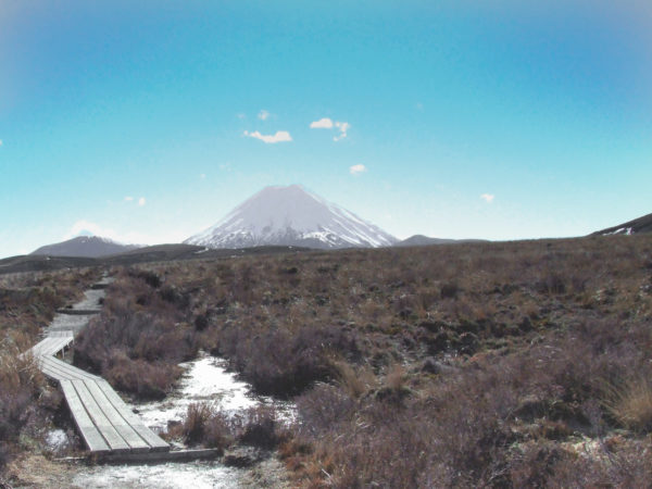
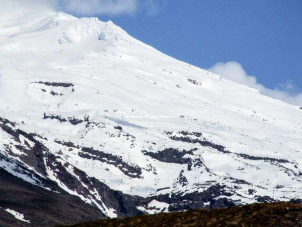
At the top, you can see out 3.6ks to the ridge you have to walk along to reach upper Tama Lake. 7.8ks to the south is Mt Ruapehu.
Point 7: Tama Lakes Walk, Tongariro
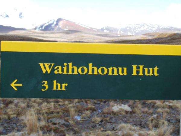
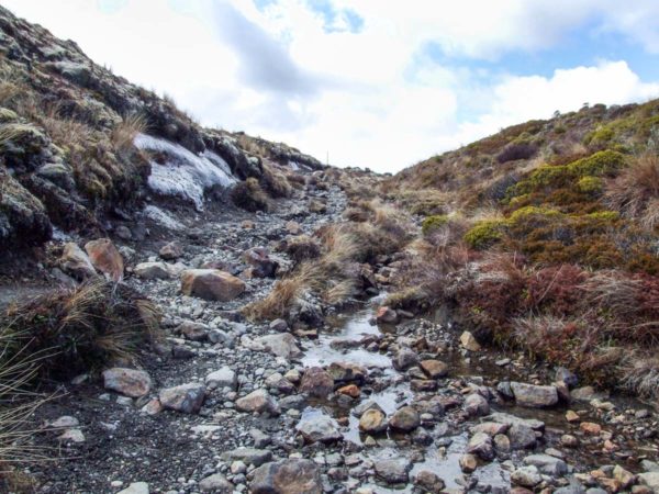
Almost there, just a short walk up the dry rocky creek to the turn off to the Tama Lakes (2h 20 min) or walk another (2h 30m) to Waihohonu Hut.

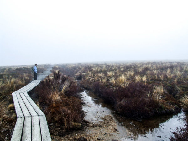
Point 8: Tama Lakes Walk, At the top
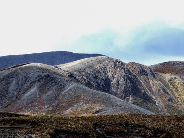
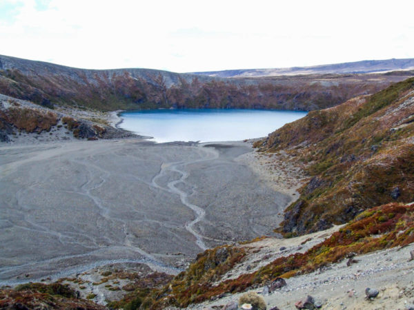
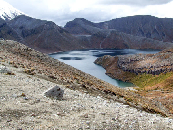
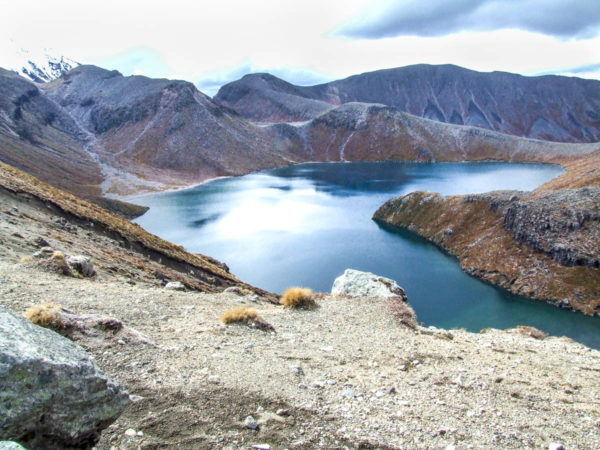
From here on, the wind can chill you to your bones, even on a clear day. There were no track poles to follow, just follow the ridge to the top knoll. You will have no trouble seeing the upper Tama lake from there. Or just before the little climb to the knoll, (50 m) cut over onto the ridge on the left and walk 100m along this ridge to great views of the upper Tama Lake. From the knoll, you will see fantastic views of Mt Ruapehu 11.3ks to the south. And to Mt Ngauruhoe 3.4ks to the north, on a fine day of course.
Point 9: Tama Lakes Walk, Tongariro
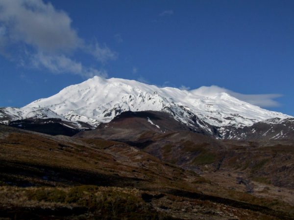
The Tama Lake is 1314m and over your left shoulder, Mt Ngauruhoe at 2287m and to the right Mt Ruapehu at 2797m and not forgetting the crater lake which has being throwing black ash over the ski fields, 2525m. Just in case you get caught out in bad weather, there is a 1m high circular rock shelter with no roof for you to sit beside, not as good as a hut, but enough to get out of the freezing wind. DO NOT rely on this shelter to get you out of trouble; you should not be there in the first place, watch the weather forecast.

2 Responses
This info is well out of date. There is a well formed track with board walks as required and fully metalled track until the lower Tama Lake. From the lower lake to the upper lake there is an obvious track marked with poles. There are 2 toilets. This is an excellent day walk on a well maintained track provides both a lowland forest walk and a alpine experience. Thoroughly recommended.
Hi Grant, thanks so much for the update, it’s very much appreciated. I’ve made some changes to the details of the Tama Lakes walk so it should be more accurate now.