From Queenstown, drive along Glenorchy-Queenstown Road heading west. After about 6km, turn right onto Moke Lake Road, there’s a sign for it. The first stretch is sealed and steep, then it turns to unsealed gravel for about 8km. You’ll pass the smaller Lake Kirkpatrick on the way. Drive time from the turnoff is around 10-15 minutes.
The road is fine for regular cars in good conditions. In winter though, it can get icy and slippery, 4WD is recommended after snowfall. Large motorhomes can make it, just take it slow as it’s narrow in places.
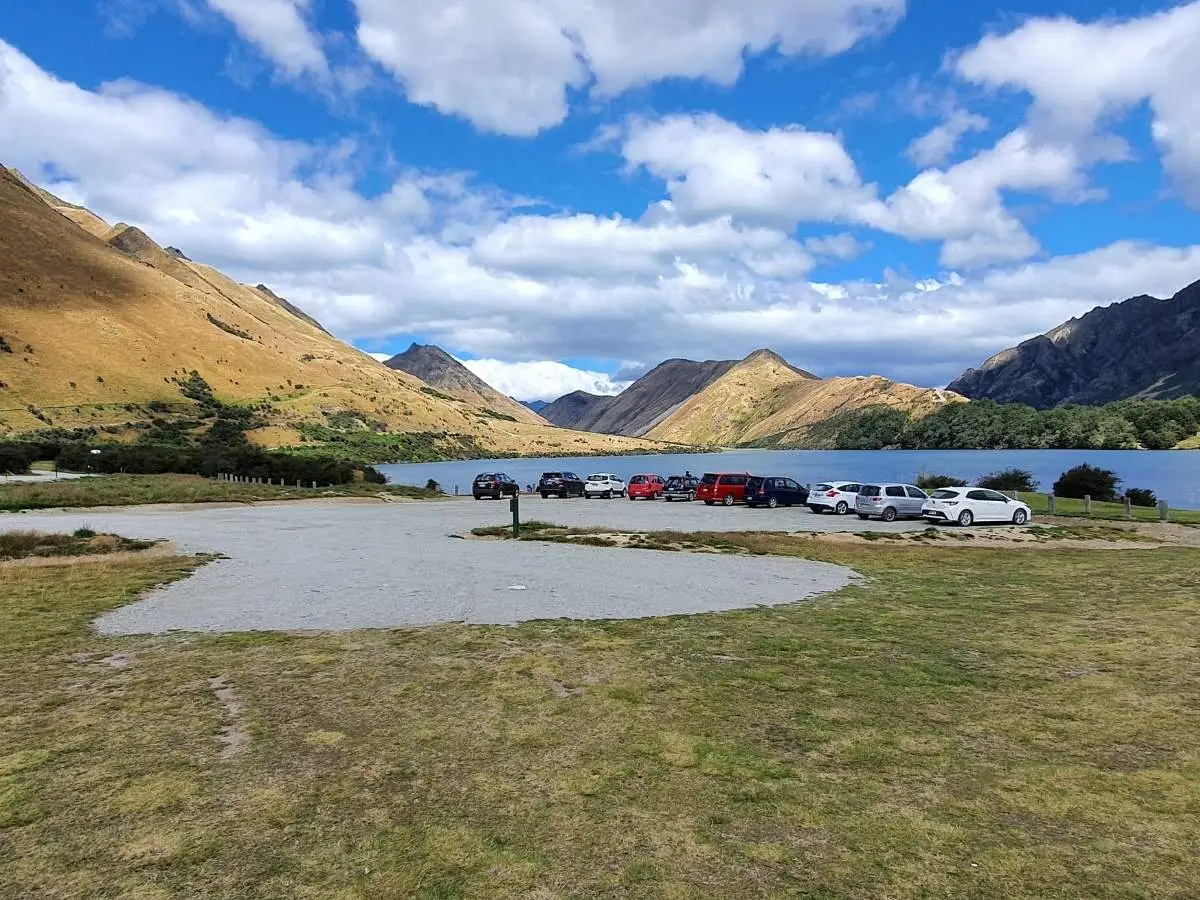
Starting point GPS: -44.9981°S, 168.5731°E (Moke Lake Reserve car park)
There’s no public transport out here. If you don’t have a car, the easiest option is a guided kayak or SUP tour that includes transport from Queenstown, check GetYourGuide for current options.
I rode anti-clockwise, which is also a popular walking direction. Either way works, the track is well-marked and you’re never far from the lake, so you won’t get lost.
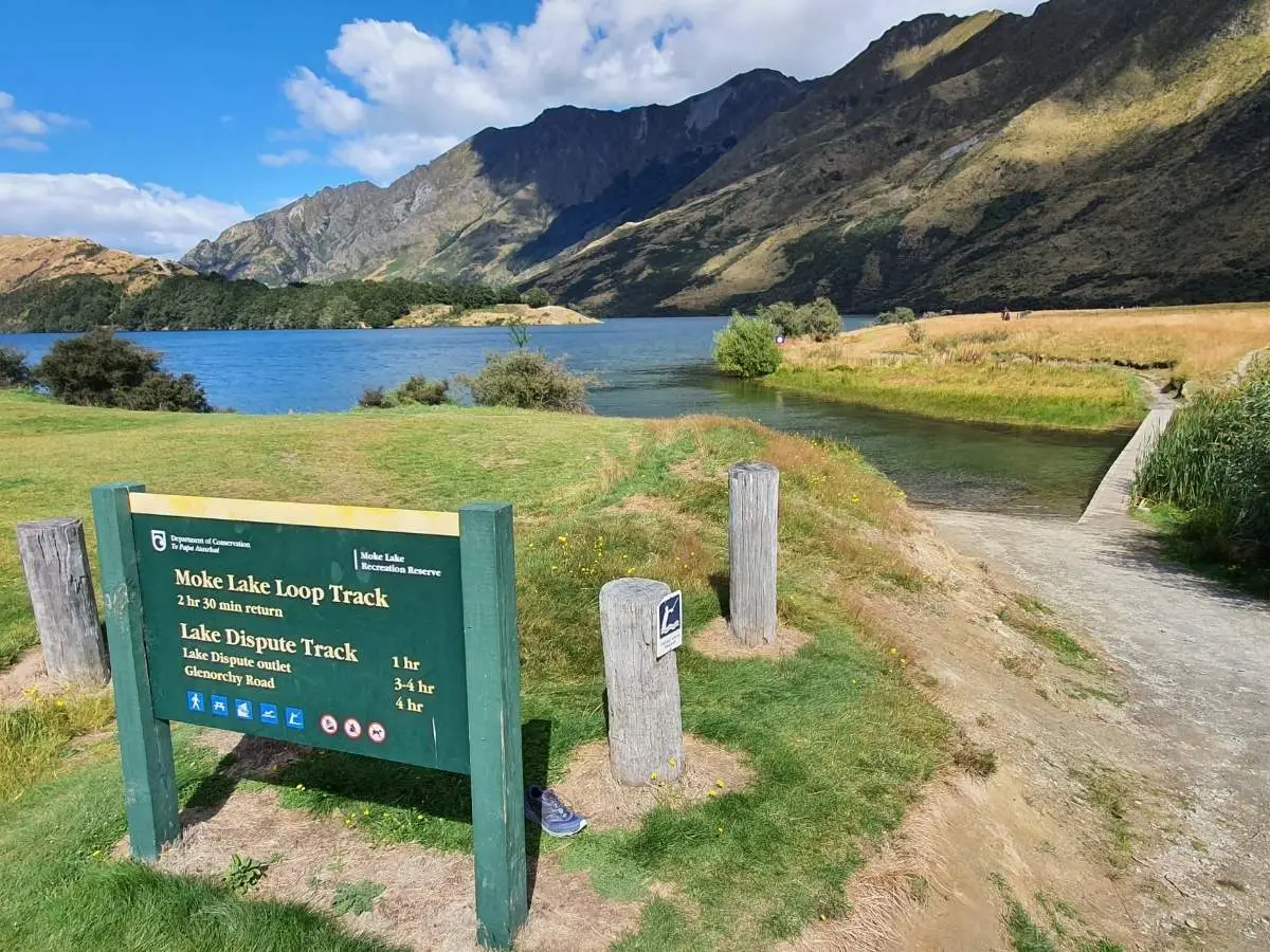
From the car park, head through the reserve past the campsite. The track is obvious from the lakeshore.
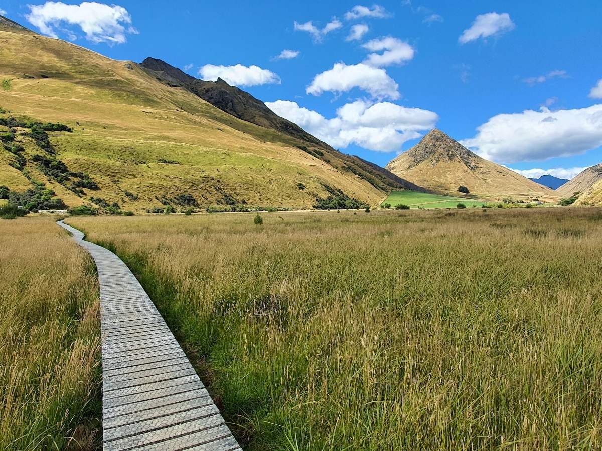
Western side: The first stretch follows the western edge of the lake through open grassland with big mountain views. This is the flat, easy section, great views across the water and a good place to catch the morning mirror reflections if you’re out early.
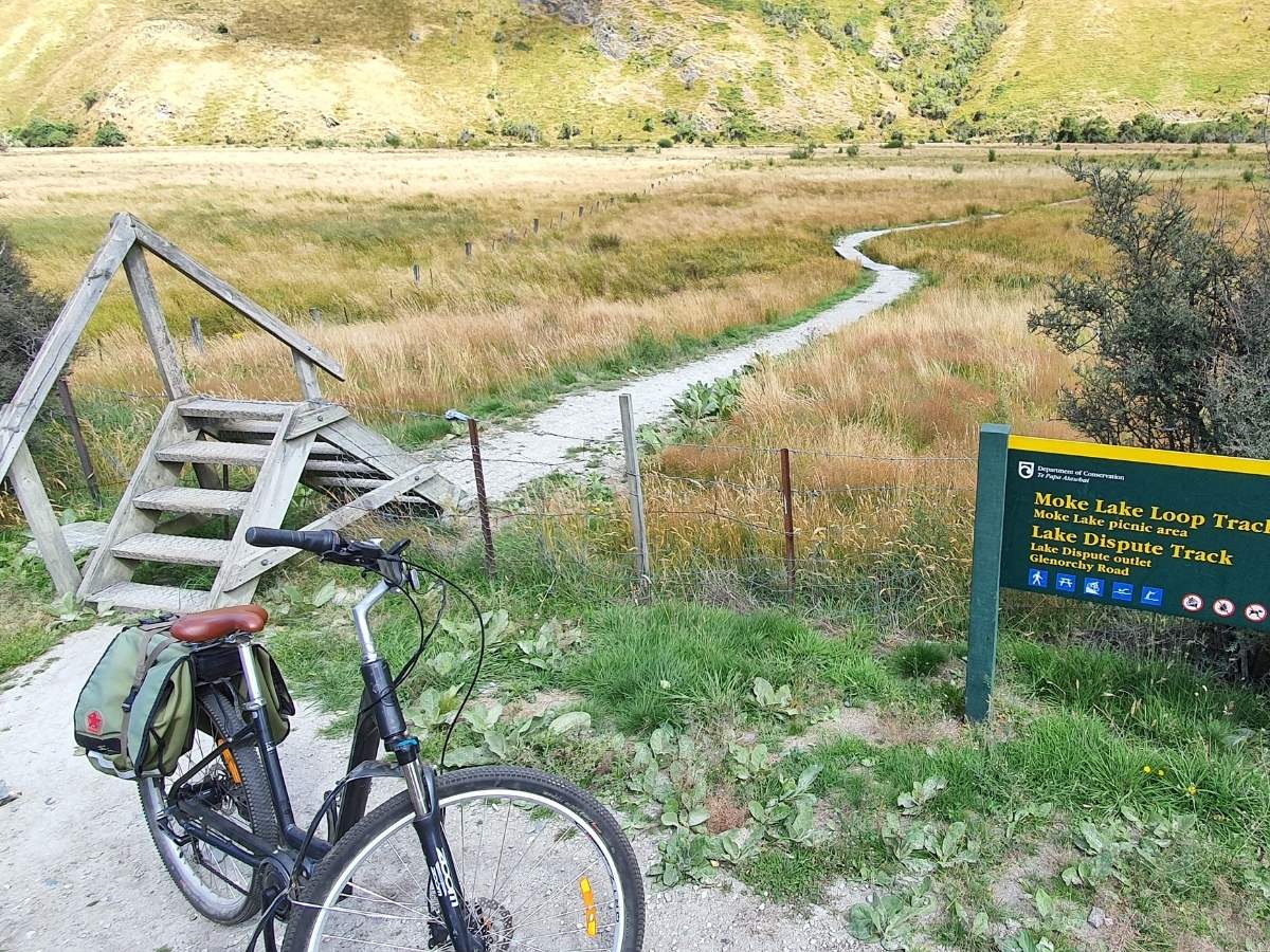
Southern end: You’ll hit three sets of boardwalks that cross over a small protected wetland, a bit narrow, and they can be slippery when wet. There are also stiles (wooden fence steps) at a few points along this section. Fine for walkers; a genuine mission if you’re carrying a heavy e-bike solo, as I discovered.
Note on biking: DOC has restricted bikes on the peninsula section and the track either side of it on the far side of the lake, due to erosion. Bikers should stay on the western side only. If you’re planning to ride the full loop like I did, check the current DOC restrictions before you go, as these have tightened since the track was first documented here.
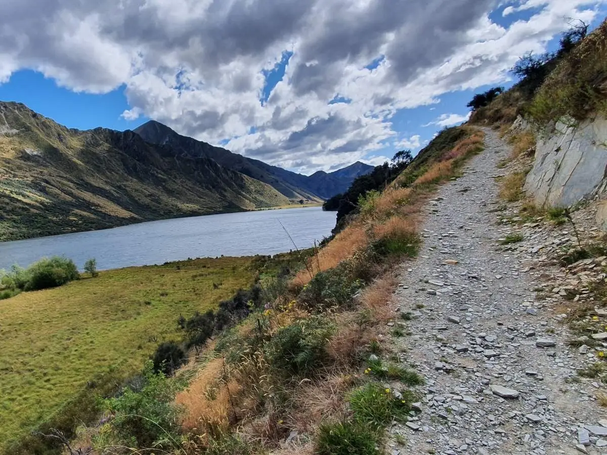
Eastern side: The track comes back along the eastern edge past the horse paddock, you’ll likely get some curious looks from the horses. This side has a bit more variety in terrain and some steeper short sections.
Back to the car park: The loop finishes back at the reserve, passing through or around the campsite area.
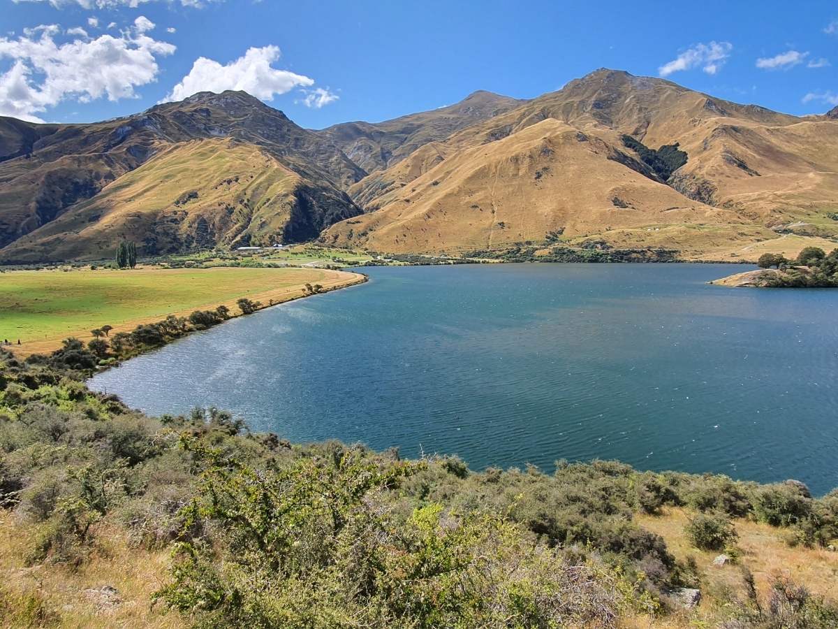
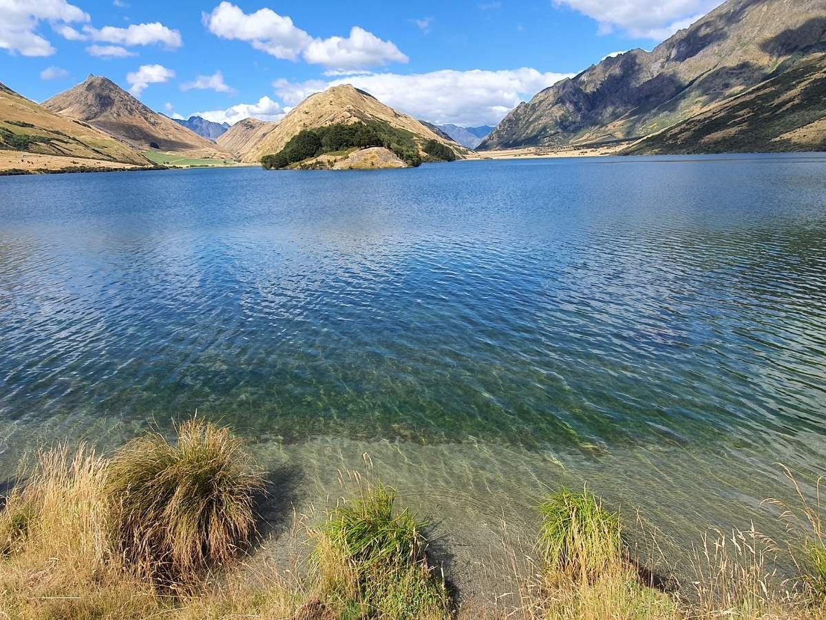
The lake itself is the star. On a calm morning, the reflections of the surrounding mountains are genuinely stunning, think glass-flat water mirroring the tussock hills and peaks. Come too late in the day and the wind picks up, which kills the reflections. I made that mistake on my first visit.
After rain, expect some muddy patches and small waterfalls trickling down the hillsides beside the track. Ducks hang around the campsite area and are completely unfazed by people. In winter with snow on the peaks, the whole place looks incredible, just dress for it, as it gets cold fast.
There’s also a secret viewpoint locals know about, an unmarked, steep track up the hill on the far side of the lake that gives you a full aerial view of the lake. It’s not signposted, involves some serious climbing, and is dangerous when wet. Don’t attempt it in winter or after rain.
You can swim in Moke Lake and the water is generally clean and clear. It’s cold even in summer, this is an alpine lake, but very bearable on a warm day, and a lot of people cool off here after the walk. The best months are January and February. Always check for any blue-green algae signs posted at the reserve before getting in.
This is worth knowing about before you go, especially in summer.
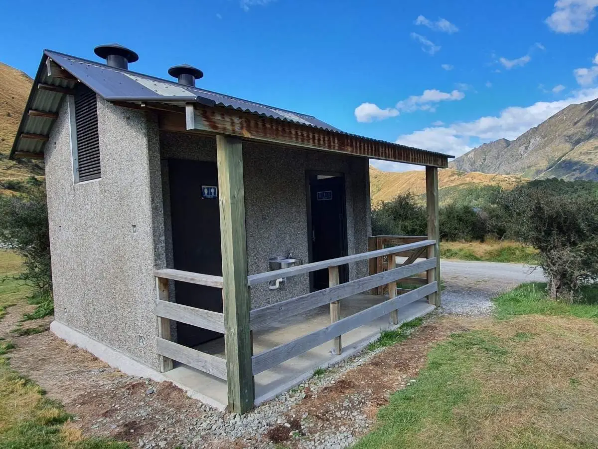
Moke Lake has a DOC campsite right at the reserve, around 50 sites, both tent and campervan. It’s a beautiful spot to stay overnight. Facilities include long-drop toilets, a cooking shelter, and untreated tap water (turned off in winter when the pipes freeze).
Booking is now required in summer. Book online through the DOC website before you go, there’s a camp manager on-site during peak season. Walk-up bookings incur a $10 service fee and space isn’t guaranteed. The DOC Campsite Pass is accepted here.
Cost: $15 per adult per night, $7.50 for children (5-17), under 5s free.
If Moke Lake is full, Twelve Mile Delta Campsite on the Queenstown-Glenorchy Road is a walk-up alternative.
Moke Lake is also part of the Queenstown Dark Sky area, no light pollution and very little noise makes it excellent for stargazing.
Moke Lake sits in an area with a proper gold rush story behind it. In 1862, Australian prospector George Moonlight struck gold nearby and a rush kicked off. At its peak, over 2,000 people were living in the area, a tent village called Sefferstown sprang up where Moonlight and Moke Creeks meet.
In 1863, copper was found in Moke Creek, and by 1869 a major gold seam was struck. The area was heavily sluiced through the 1890s and early 1900s, with an estimated $4 million worth of gold won before miners eventually moved on.
The name “Moke” comes from an old English word for donkey or old horse, the name used by the early European goldminers in the area.
I think Moke Lake is genuinely underrated. It’s 20 minutes from one of New Zealand’s busiest tourist towns, and yet on the day I went it felt properly remote. The views are excellent the whole way around, not just at one or two spots.
Go early. I can’t stress this enough, the wind comes up by mid-morning and the mirror reflections disappear. If you want the photos everyone has of this place, you need to be there first thing.
The stiles are the one thing that catches people out. They’re easy enough on foot, but if you’re bringing bikes, factor in the new restrictions and the physical challenge of getting a heavy bike over them solo.
I’d recommend it to anyone, easy enough for most fitness levels, interesting enough to hold your attention the whole way around. Walking clubs will love it too, but book the campsite if you’re making a night of it.
