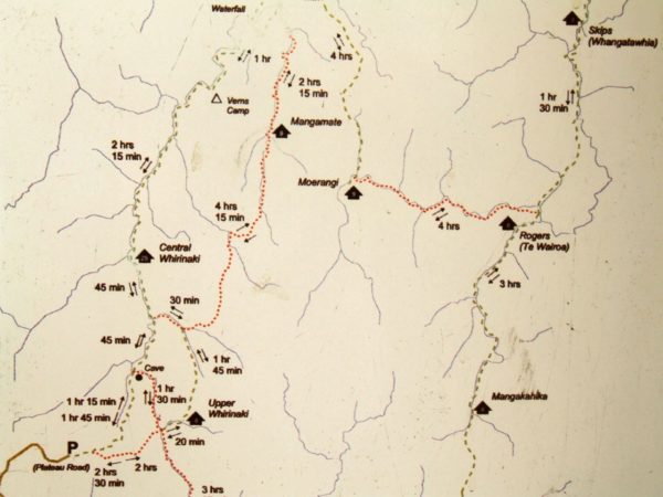
The Whirinaki Forest Walk is an easy 11 km walk that will take you around 3 hours 30mins to complete.
Whirinaki Forest is located between Rotorua and Taupo. The terrain varies from gentle river flats to narrow gorges, waterfalls, and heavily dissected uplands with a forest cover of dense podocarps and high altitude beech. The most striking feature of the forest is the density and size of the podocarp trees.
SAVE 51% on last-minute tickets to Waimangu Volcanic Valley – Walk and Boat Cruise
Quick Facts about this walk
- Location: Between Rotorua & Taupo, Central North island, NZ
- Distance: 11 km
- Time needed: 3 Hours 30 Minutes
- Difficulty: Easy
- Wheelchair Access: No
- Route: Loop
- Wet Feet: No
- Toilets: Yes
- Dogs: By permit only
- Mobile Coverage: No
Summary points about this walk
Walk Highlights
Track Quality
Hazards
Transport
Water
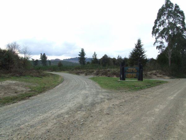
Driving Instructions
Area & Trail History
Map Location
Points of interest along the walk
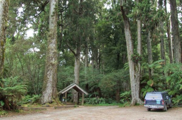
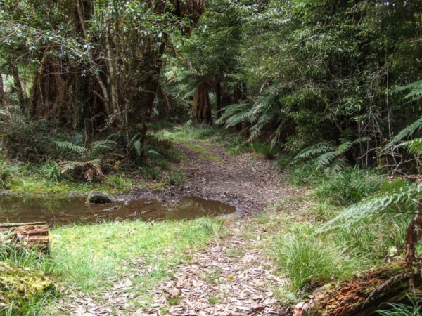
Whirinaki Forest Waterfall - Start
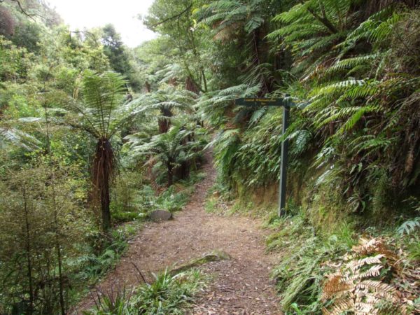
Look for this turn-off, and keep to the left. If you miss this turn-off, you will end up well past the black stump, and truly lost. There is plenty of room to park your car. The track starts from the shelter. Inside the shelter, there are lots of photos and maps for you to read. If you are looking for the toilet, it is over to the left-hand side of the shelter.

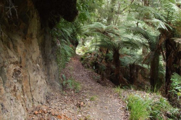
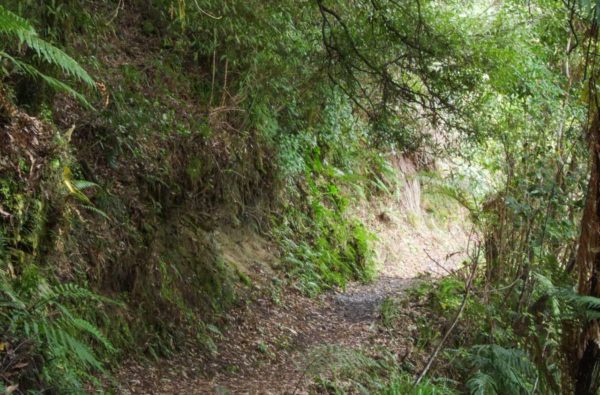
Cross the bridge 20 min. The track on your right is the way out from the waterfall. If you are running out of time, take this track it is about 1 h 30 min) The track is very easy to follow. Wide and well walked. Just follow the signs.

It is quite easy to let your imagination drift while walking through the Whirinaki Forest. The giant podocarp trees; kahikatea, totara, matai, rimu and miro are untouched by chainsaws.
30 years ago the Whirinaki was my favourite forest for hunting deer (well we didn’t have to hunt for them, we just walked on them.) The bush over to the east is so clear and open you could ride a bike along the ridge tops for miles. Then you could drop down into the creeks and catch a trout for dinner, just to have a break from venison stew.
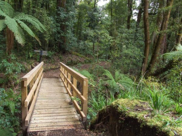
35 min. The turn off to the Mangamate Hut. 2 h 30 min. Lovely bridge. No more wet feet.
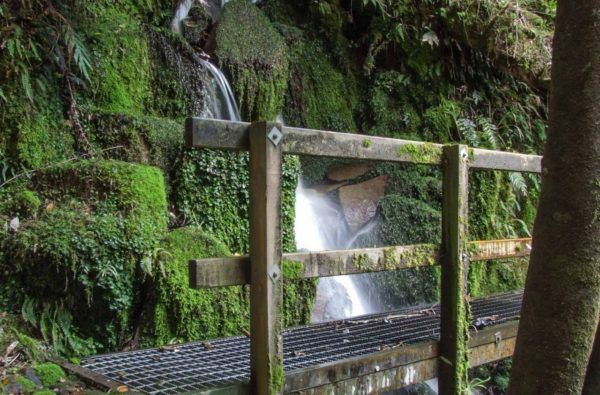
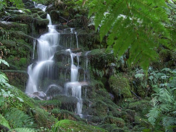
1 h 45 min. On this horseshoe bend, turn to the right for 5 min to go to the waterfall.
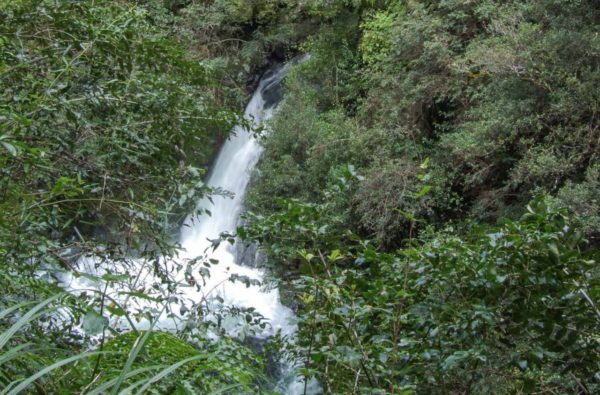
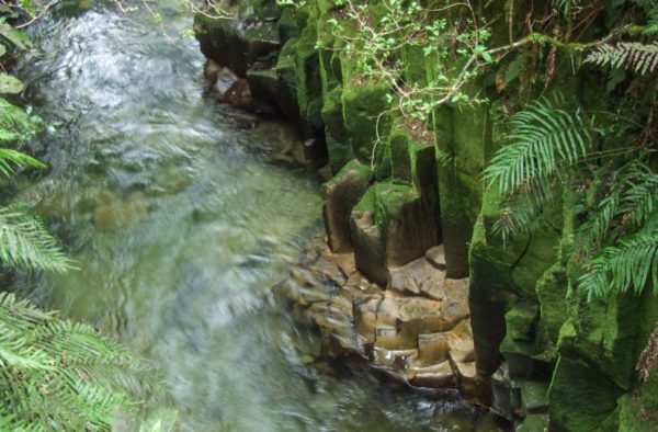
Whirinaki Waterfall
The track crosses over at the top of the falls before you cross the bridge, walk over to the edge turn to the right and walk up the hill.
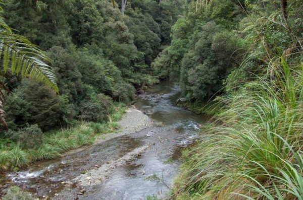
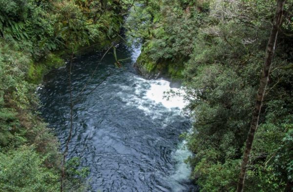
At the top, you will be able to look down the Whirinaki River for a few hundred metres. Once across the bridge, it is a 2 min walk uphill to the toilet and a picnic table.
20 min. From the waterfall, you walk on to a 4X4 track. Follow this track for 5 min as it starts to climb uphill, the track turn-off is to the right. There is a signpost on the bank to your left.
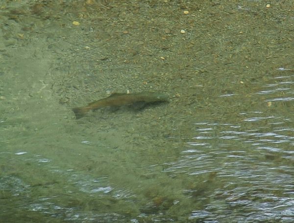
Keep an eye out for rainbow trout along the way, we spotted 7. It’s a good climb down to the river.

54 min from the waterfall. You are still following the river out to Minginui. No problems with drinking water around here.
1 h walk from the falls. The track opens out from here on, making for fast walking back to the car park. You will meet up with the main track just metres from the first bridge.
