My 4 day awesome hike review of the Tongariro Northern Circuit Great Walk
The Tongariro Northern Circuit is a must-do for any adventurous fit type of person. I walked through some of the North Island’s most stunning scenery, including volcanic peaks, alpine meadows and emerald lakes. It’s an unforgettable experience that will leave you with memories that last a lifetime – not to mention some pretty impressive bragging rights!
The highlights of this walk:
Definitely the Tongariro Alpine Crossing section because of the epic views, great challenge, and true grit that it takes to push through it in bad weather. A proper challenge!!
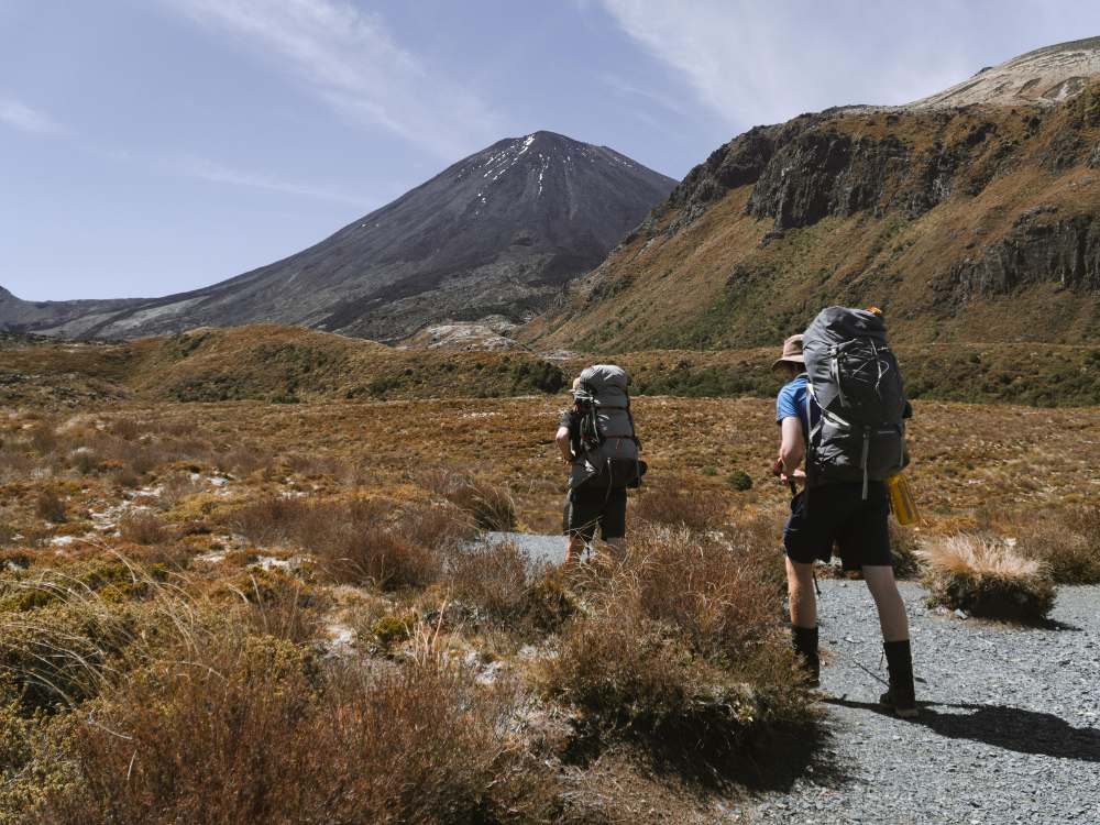
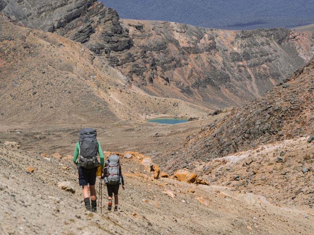
Walking through the Mangatepopo Valley is a humbling experience. Mt Ngauruhoe dwarfs hikers.
Quick Facts about this walk
Location: Tongariro National Park, North Island, New Zealand
Distance: 45 km full round trip
Time needed: 2-4 days
Difficulty: Medium
Wheelchair access: No
Route: Loop track
Elevation: 1590m at its highest point
Wet Feet: Most streams are bridged
Toilets: Yes. Toilets are available on the Tongariro Crossing section and at all 3 huts
Camping: Yes. Camping is allowed at all designated areas along the track. The best campsites are usually at the huts where tank water and toilets are available.
Dogs: Not allowed
Mobile Coverage: Yes on Vodafone and 2 Degrees, but nothing on Spark.
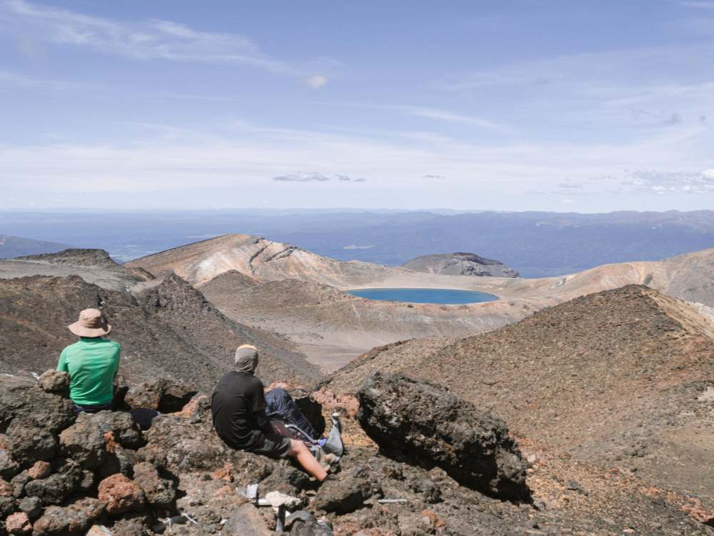
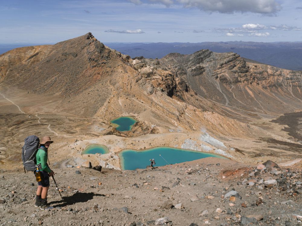
Taking in the view of Emerald Lake in the distance
Summary points about this walk
Track quality
Track quality on the Tongariro Northern Circuit is 4/5 in my opinion. Days 1 and 2 have some sections that are pretty marginal but overall, I think it's very managable for all hikers.
Transport to the start
No, but private shuttles can be arranged from National Park Village and Turangi.
No need to book a return time. Finish your walk and catch the next available bus back.
Driving instructions
From SH47, take the turnoff to Whakapapa Village or the Chateau Tongariro which is less than 50m walk from the starting point.
Hazards
Scree, weather, heightened rivers, cliff edges, scree, and mud are all common hazards on the Tongariro Northern Circuit. May to late October (winter season): Walking the track outside the Great Walks season should only be attempted if you have alpine skills, equipment and experience.
Bit of history
This walk crosses volcanic terrain and loops around and over 2 active volcanoes. Pyroclastic flows can be viewed from the track with signposted explanations. The Tongariro Northern Circuit is one of NZ's 9 walks with the "Great Walk" status.
Water
Bring your own water
Map Location of Tongariro Northern Circuit
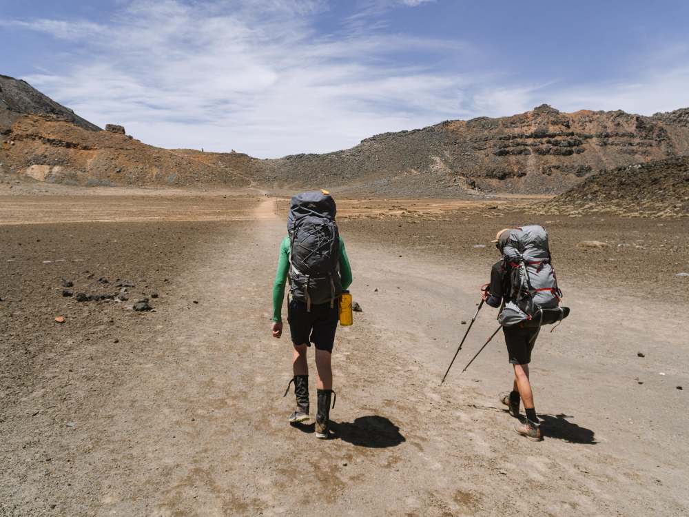
South crater after tackling the Devils staircase climb with 15+ kgs on our backs!
Full descripiton of the whole 4 day walk on the Tongariro Northern Circuit
Day 1 of 4 appropriately nicknamed “the ditch track”
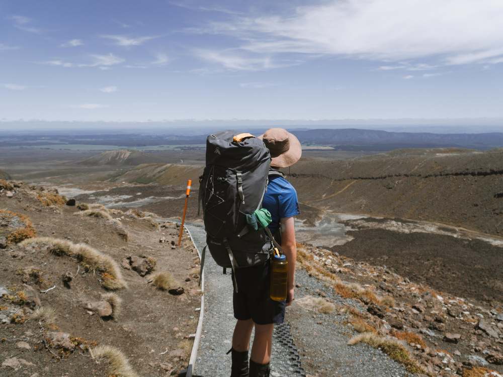
Is a 9 km trek to Mangatepopo hut where you will find 20 bunks, tank water, long drop toilets, a wood burner, and amazing views in good weather. Day 1 traverses through the lower volcanic valleys of Mt Ruapehu, Mt Ngaruhoe, and Mt Tongariro. The track is in very poor condition in some places but this is by far the worst section of the track of the whole trip. Ruts caused by water drainage issues get close to 2 meters deep in some spots. Despite this, they are easy to avoid with walkers being able to walk on the sides for most of the way.
Day 1 takes most walkers between 2.5-5 hrs to complete depending on the weather and fitness of the group. For reference, my group of 3 teenage boys took just over 2hrs in good weather.
No need to book a return time. Finish your walk and catch the next available bus back.
Stopped to take in the view
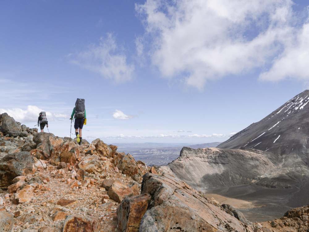
Day 2 is the most physically challenging for most people as walkers have to tackle 200m climbs, scree, and possibly terrible weather.
The 12km day includes a staggering 700m elevation gain which is split between 2 climbs; the Devil’s Staircase and South Crater to Red Crater. This rugged trek can have weather nice enough for a picnic, or bad enough to give you hypothermia in summer.
The weather literally changes in minutes on this section so always be prepared with warmer layers, a PLB, emergency blankets for all members, as well as a rain jacket even on a sunny day.
You will steadily climb from Mangatepopo hut to soda springs where the gigantic mountains will dwarf you from either side. Next up is the Devil’s staircase, a 300 meter climb, which consists of mostly steps and well graded track.
You will then reach South crater where you will be met with a sheltered spot for a rest before the 200 meter ascent to red crater. This climb can be very icy depending on the conditions and time of year you attempt this section in.
Once you reach red crater, you will be met with a steep scree decent down to the emerald lakes. This is the most famous section and also the section where most injuries occur. Keep you feet facing down slope and shuffle in small steps.
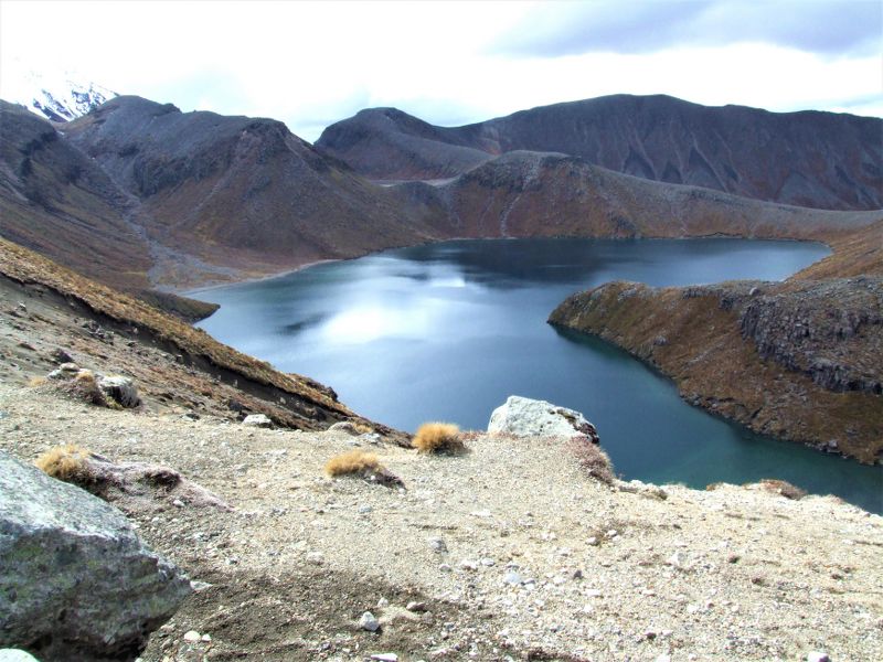
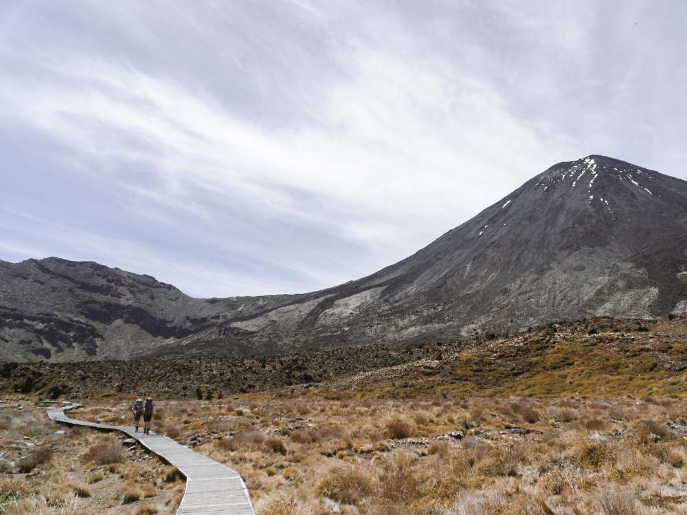
Once at the Emerald lakes, you will take a right turn before making a sudden decent to the Oturere stream where you will cut through the desert-like terrain to Oturere Hut.
Day 3 starts with a steep decent shortly after leaving the hut followed by rolling river valleys.
You cross and follow a couple ridges before making the decent down to cross one of the many Waihohonu stream tributary’s. It can get muddy here so be prepared to get your feet wet if there has been alot of rain in the past few days. After the bridge to cross the stream, you will be prompted with a lengthy up hill to a ridgetop and then a downhill towards Waihohonu hut where you will stay the night.
Day 4 starts off as well graded, mostly flat, gravel and board walk track.
This section of the circuit is the longest at 15.5km. Despite this, the track consists of no more than 350 meters of ascent (not much for the distance). The Tama Lakes turnoff marks the halfway point which can be easily spotted by looking out for a junction signpost.
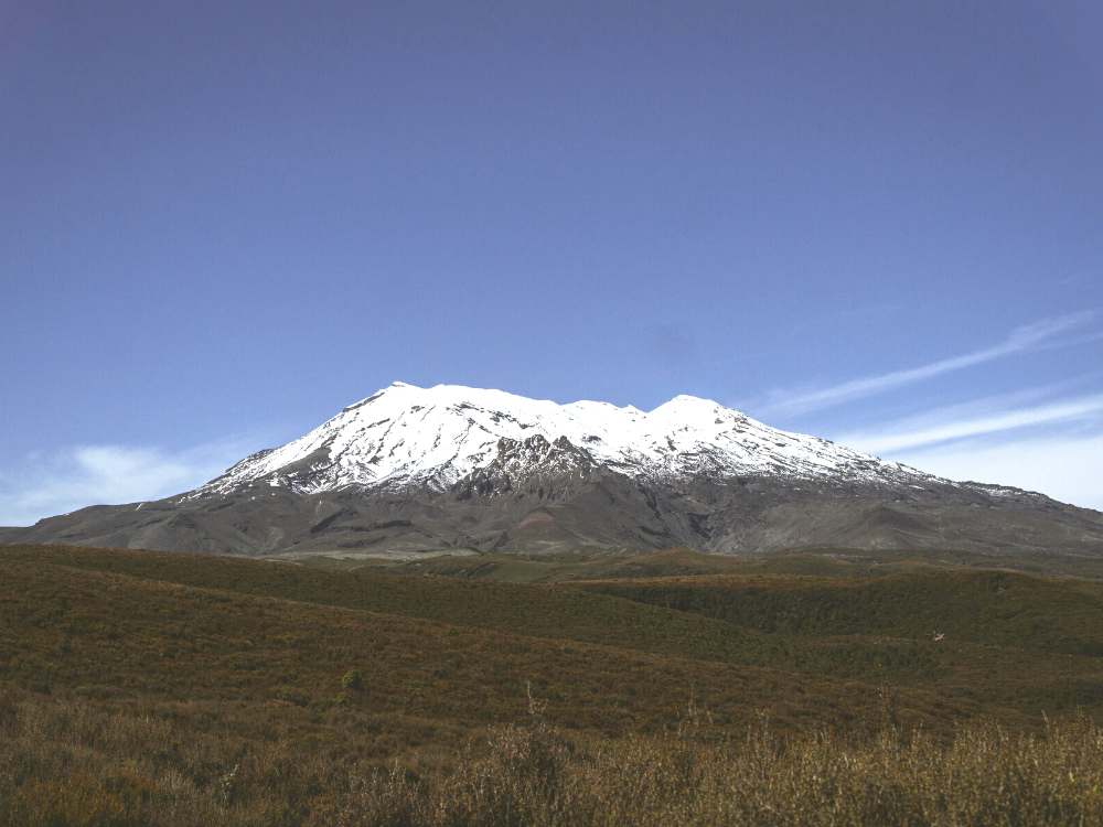
Lower Tama (10 min) is a very popular lunch/break spot for people walking this section of track as walkers can take in the spectacular view of the Lower Tama Lake and Mt Ruapehu whilst being able to sit in a fairly sheltered area.
Around 13kms in, you will pass by the incredible Taranaki falls which I highly reccomend as a great swimming spot, even in the winter if you can bear the cold! Shortly after, you will arrive at Whakapapa Village where you started a couple days back.
**This is written in the clockwise direction and based off of December conditions**
My photos of the Tongariro Northern Circuit Great Walk