Karangahaka Gorge To Wharawhara Road End is a three day walk In New Zealand’s kaimai Range.
This relaxing three day walk North along the Kaimai Range is filled with gold mining and Kauri logging history
Quick Facts about this walk
- Location: North Island NZ
- Distance: 38 kms
- Time needed: 18 Hours
- Difficulty: Medium
- Wheelchair Access: No
- Route: One Way
- Elevation: 740m
- Wet Feet: Yes
- Toilets: Yes
- Dogs: Leash only
- Mobile Coverage: No
- Last Updated: November, 2019
We’ve partnered with Macpac outdoor walking & hiking gear to bring you the very best products designed exclusively for our New Zealand climate. They’ll ship for FREE within NZ on orders over $100 (if under $100 it’s only $5). Worldwide international shipping is available except to the USA. Bulky orders will be $20.
Summary points about this walk
Walk Highlights
Track Quality
Hazards
Transport
Water
Driving Instructions
Shops & Restaurants Nearby
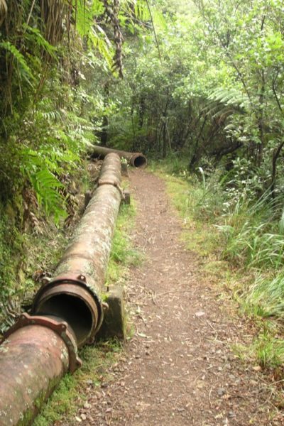
Area & Trail History
Map Location
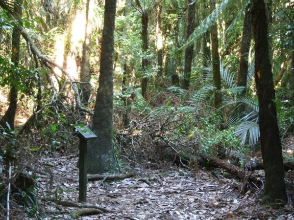
Points of interest along the walk
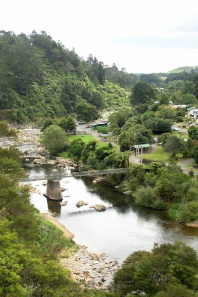
Point 1: Start At Karangahake Gorge
20 Minutes North of Waihi on the road to paeroa you should be driving through the Karangahake Gorge Rest area.
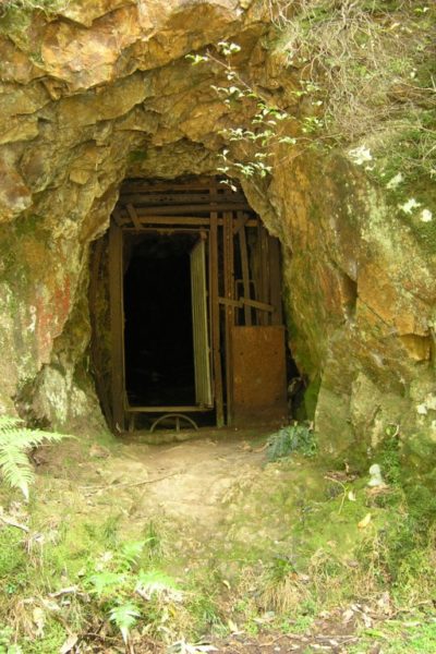
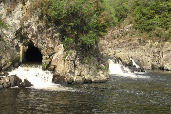
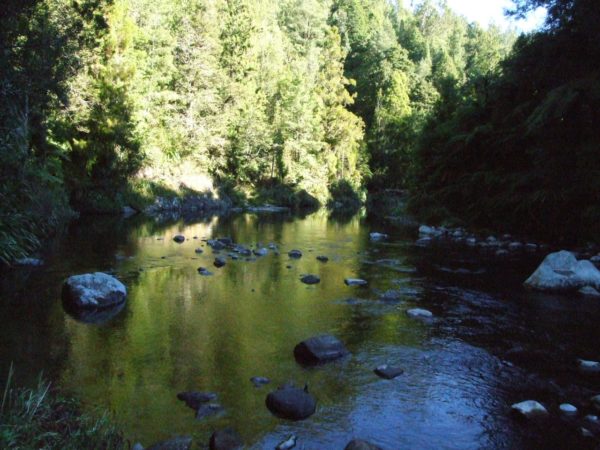
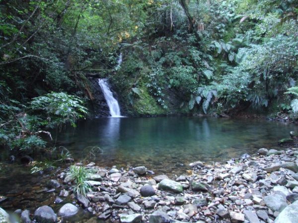
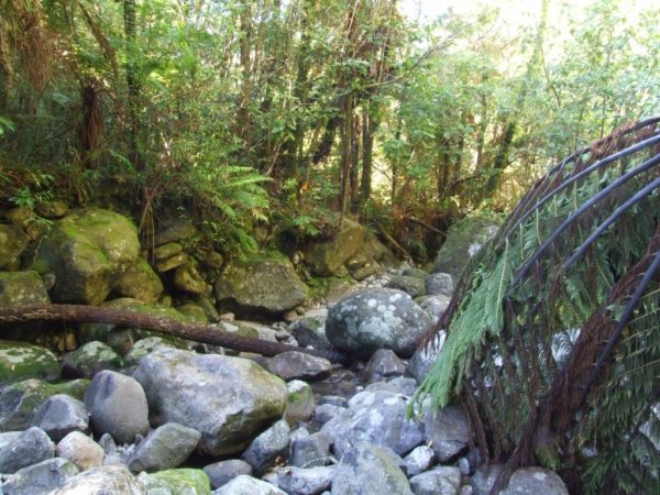
Looking down in to The Ohinemuri River you will see the Karangahake rail tunnel.
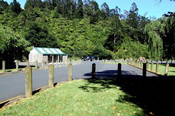
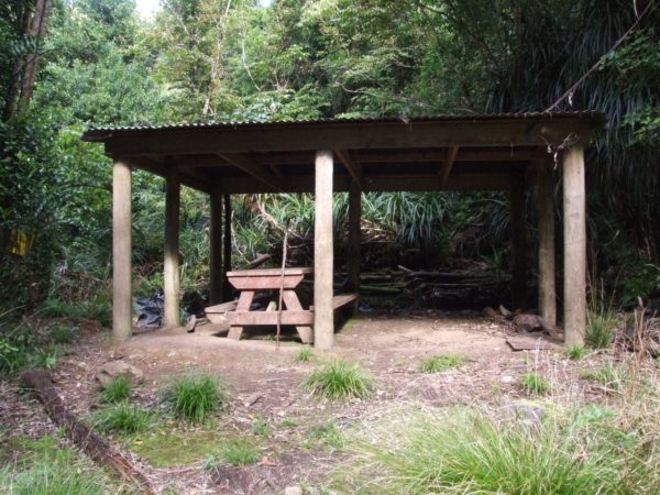
Now get ready to pull over to the left into the Karangahake Gorge car park. The car park has clean toilets.
Water on tap an excellent picnic grounds .At the top of the car park there is a excellent shelter were you can sit and have your lunch.
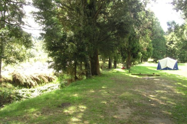
Point 2: Dickey Flats
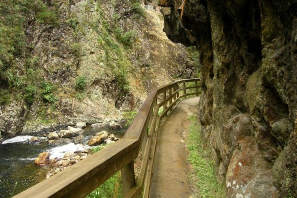
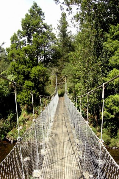
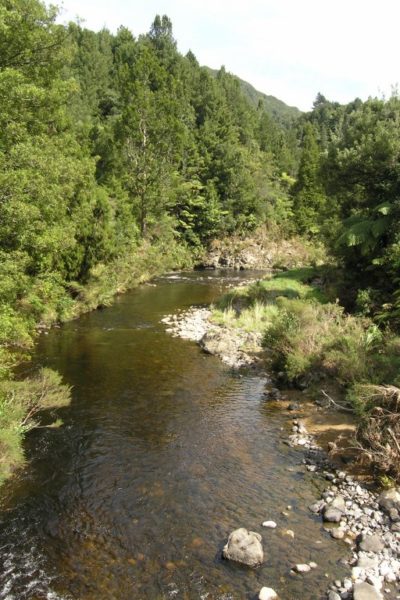
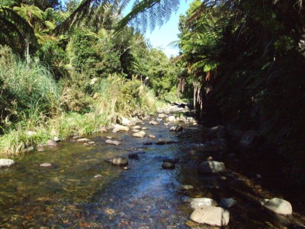
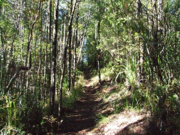
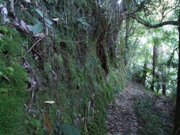
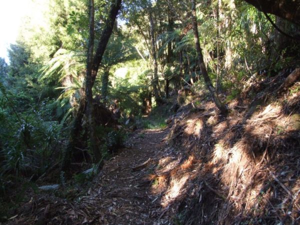
Cross over the Ohinemuri River bridge at the top end of the car park, or at the Waihi end of the car park. Keep an eye out for rain bow trout as you walk across the bridge. At the end of the bridge follow the track around to the left and walk up to the next DOC green track sign. Walk straight past this sign don’t turn to the left. follow the Karangahake Direct track. This section is very interesting lots of gold mine ect but do not wast time, came back another day you cross over the first fixed wooden bridge and walk through a short tunnel, a torch would come in handy. The Waitawheta swing bridge is next, the track on your right is the dubbo track, give it a miss and walk straight ahead. 5min before Dickey Flats is another bridge to cross Walk up to the end of Dickey Flats Road to the start of your big walk. this section of walk was quite boggy and rough. then we saw the Kauri trees, what a surprise to see them in such miserable bush. We were looking forward to see more kauri trees but instead we walk into a rather wide Waitawheta river crossing. When my partner saw the river she decided to let me get on with my three day walk and head back to the car and drive into Waihi for a hot Flat White. Well it was bloody cold and extremely slippery I almost went for a swim. If you want to save time you can either start the walk at Dickey Flats, camp the night and get in a early start the next morning.

Point 3: Dickey To Dalys Clearing Hut
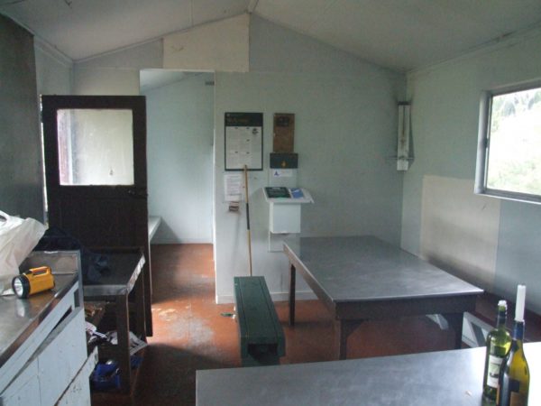
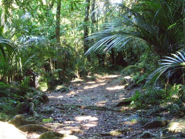
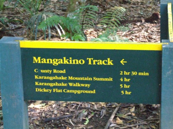
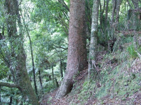
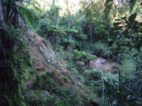
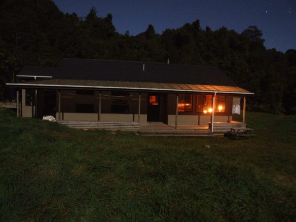
The 40m climb out of the river gave my feet time to warm up then just before the top I was met by a pleasant surprise, a grove of young kauri trees. what a change from the super jack and punga’s. From the top I was dropping back down in to damp dark bush, I was pleased to make it to the Mangakino stream and the start of the Mangakino Track. I had been walking for two hours so it was time to sit in the sun and put the billy on for a hot coffee and warm up’ This creek crossing was very easy, no wet feet, just a slow up hill amble along the Mangakino track to Dalys hut, what a breezy to day. Now it is a six foot wide track all the way to Days Hut, but you could see nothing but bush, no good views looking of out to the Kaimai Rangers. all I saw was mountain bike tracks and boot prints. I passed a sign saying Deans Track to the left and Days Hut straight ahead just 1 hour 15 minutes away. Time to find a spot in the sun and have lunch, after 5 hours on the track it was time for a good break. It took me one hour to reach the turn off to Days Hut and another 15 minutes to the hut. To top up with fresh water I walked 50m down the track passed the hut to a small creek to fill my 2 liter bottle then headed back to make a hot coffee and sit in the sun before dinner. well the sun disappeared behind the hills just as I sat down on the veranda to enjoy my coffee and cake at 1520H. Even the hot sweet coffee could not keep me warm. Dalys Clearing Hut as hut go, was OK a little messy thanks to the last tramper. no fire place but it did have mattresses and a kitchen sink.

Point 4: Waiororgomai Saddle
The next morning there was a good freezing frost to make me walk faster up Mangakino Track.
I know it is going to be a very long day. 8H 30 M to Waitwheta Hut and from what I was told it is a bloody gut buster of a climb up to Waiororgomai Saddle so I was on the track by 0645 H.
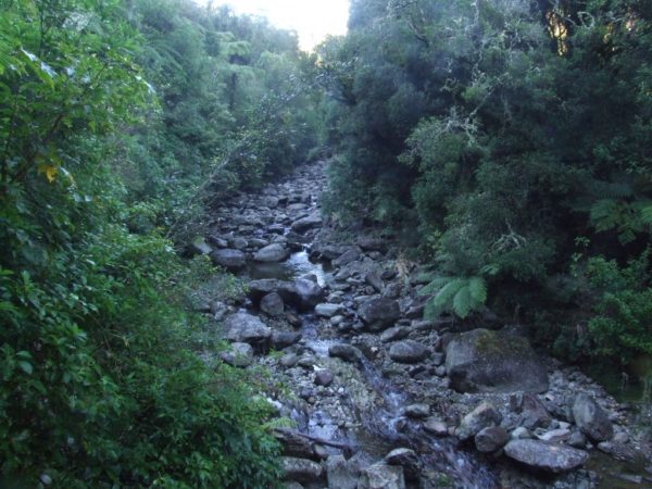
The walk up to Mangakino track was a little harder then yesterday. there are a lot of slips to crawl around and in particular at around 2H 20M there was a slip on a right hand bend that was tricky to find.
I saw boot marks going across the slip, so this must be the way to go.
Well is was a big mistake walking across the slip. After 30 min of pushing through supper jack with a heavy pack I found the track, but what a wast of energy and time.
To find the true track you walk up the washed out muddy creek for 10Mt then climb up the bank on to the Mangakino Track. Other wise this section of track is quite interesting.
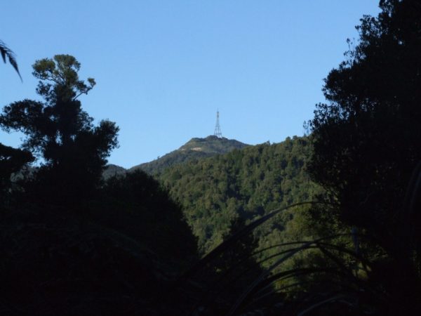
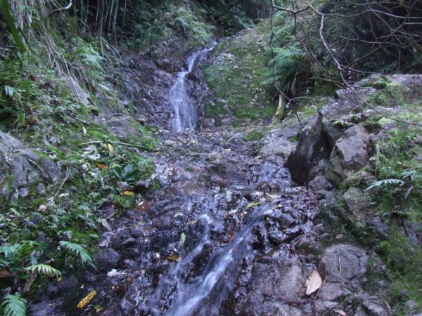
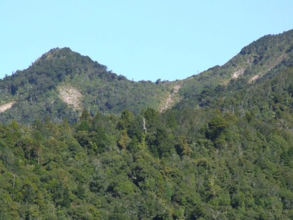
You walk around a lot of gully’s and cross a lot of creek so don’t carry a lot of water. I could also see the ridge over to my right and I got a good view Of Mt Te Aroha, this gave me a rough idea of were I was.
When you walk through a giant Rimu tree lying across the track you are just 30 min from the Mangakino shelter.
Mangakino shelter, this is the best time to top up with water there is no more water for 3H.
So to fill up with water walk past the shelter for another 5M.
It was only 1H 30M climb to the Waiorongomai Saddle and it was not that hard, the gold miners cut in a good steady track up to the top. there is a turn off 30M into the climb, To the right is to the Tui Mine and saddle, you need to take the left track to Waiororgomai Saddle.
Now it is a short climb to the top of Pukekohatu and down hill to Waitwheta Hut.
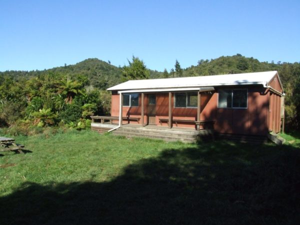
Point 5: Waitawheta Hut at last
At the Waiororgomai Saddle to the right is the Plutus Claim Track, 30 min away.
This will take you out to the road to Mt Te Aroha summit 953Mt where you can walk out to Te Aroha town ship.
You walk on to the Waitawheta and North South Track which is a very short 2 Minutes away and the last turn off for the day.
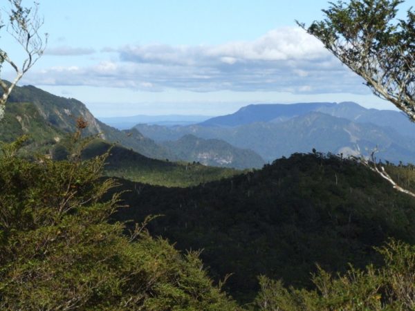
From here on you will be walking on the new track up to the old North South track, and a enjoyable down hill walk all the way to the Waitawheta Hut. On your right you can look down in to the Historic gold mining Waiorongomai Valley and way out into the mighty Waikato.
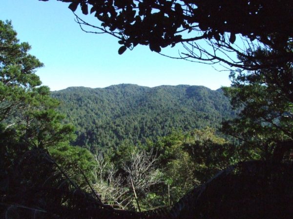
Around 35 minutes will see a good size slip were you can get a good view looking East along the Kaimai ranges.
The next 2H 30 minutes is spent walk around the sides of the main Kaimai Range on a very good track plus you are back into some decent native bush. The only place to top up with water after leaving Mt Aroha is one hour’s time. If this creek is dry there are a number of other small creeks along the way.
When you hit the old tram tracks you are only 20 minutes from Waitawheta Hut and a hot coffee. If you have time, take a walk around Waitawheta Hut you will see the remains of the old Waitawheta saw mill ECT. And don’t forget to have a look at the glowworms, the are at your last creek crossing 50Mt before the Waitawheta Hut
Point 6: Wharawhara Saddle
Today is an easy Three hour 20 minute walk.
It will take about one hours 40 minutes up to the Wharawhara Saddle and almost the same time out to the road end. 40 minutes into the walk you will see a post minis the sign on your right, this is a 10 minute walk up to the old Kauri dam, leave your pack on the main track,
Back on the main track, the climb up to the ridge is a little rough.
There has been a few trees blown over by strong winds rushing up the valley and every tree has very kindly falling over the track.
The creek crossing just past the dam could be a problem if there has been heavy rain, you might have to try and cross down by the main river.
On the ridge top the track is easy to follow, but slippery.
Point 7: Wharawhara Rd
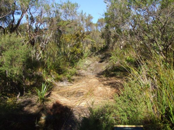
Turn right at the Cashmores Clearing sign. then within minutes you will pass the turnoff on your right to Cashmores Clearing.
I was going to walk up to Cashmores Clearing for a look see, but after 15 minutes I gave up, I didn’t fancy having my poor old legs and arms cut to pieces so I gave it a miss.
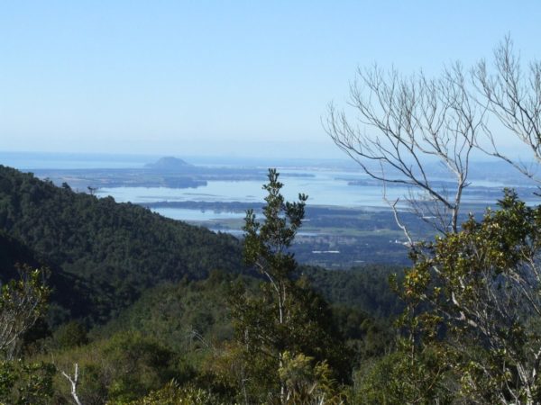
The last leg is down hill to Wharawhara Rd and until you drop down into Wharawhara stream you will get great views of Tauranga.
It is a little steep in places as you descend down to Wharawhara stream, then you have five creeks crossing which I crossed without getting my feet wet but as usual there is always one creek to spoil your fantastic day.
The weir was only ankle deep but to wide for me to jump across.
At least the weir is made of concrete and easy on my cold feet.
Once across the weir it is a easy 300Mt walk to Wharawhara Rd. Five minutes before the weir you will pass the turnoff to Te Rereatukaiha Hut, a 2hr 30min walk / climb.
