Deliverance Cove Track is an easy to medium 3.4 km walk that will take you around 1 hour and 30mins to complete in a round trip.
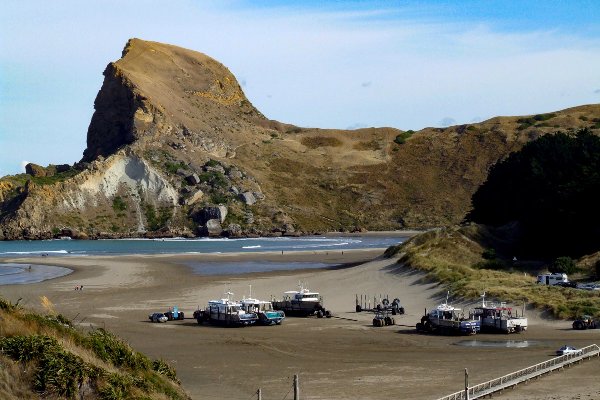
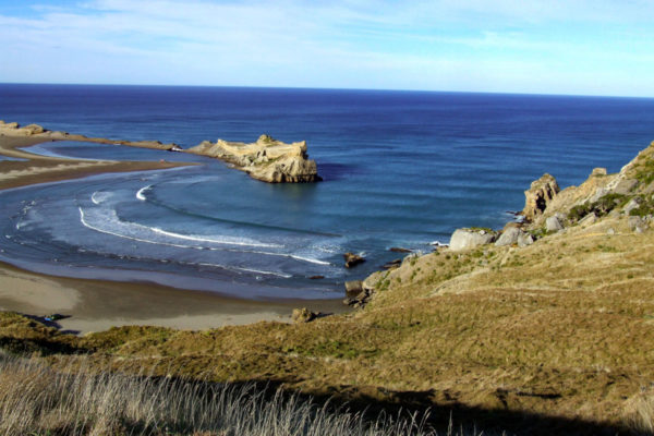
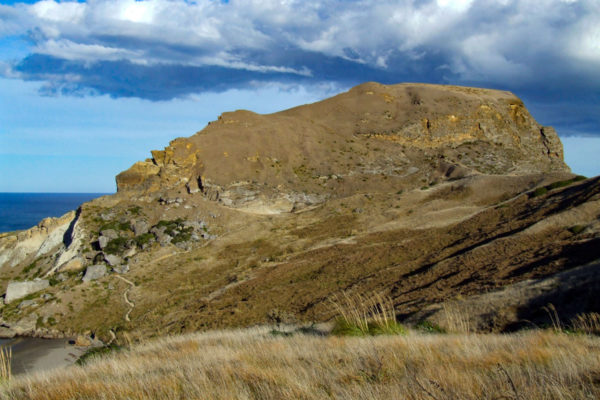
There are two ways to get to the top of Castle Rock on the Deliverance Cove Track, both offer spectacular views as you climb above the lagoon to the base of Castle Rock. This track is suitable for the whole family. Awesome views of the coastline on both sides from the top of Castle Rock. The track is medium to rough in parts. Good fishing as well!
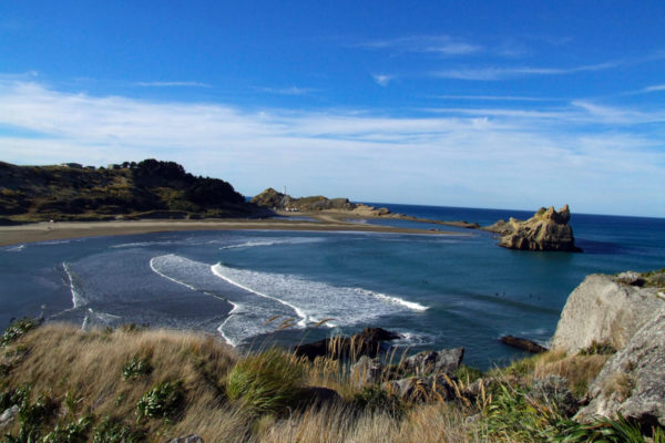
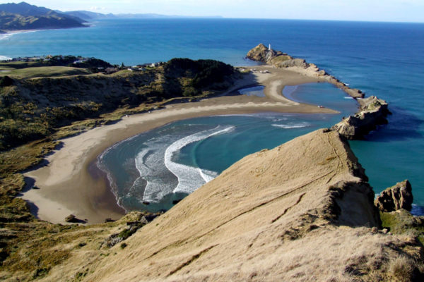
You’ll see the Castle Point Lighthouse walk very clearly from the top of Castle Rock. This is an excellent short walk if you don’t have so much time.
Quick Facts about the Deliverance Cove Track walk:
- Location: Castlepoint, East Coast, North Island, Wairarapa
- Distance: 3.40 kms
- Time needed: 1 Hour 30 Minutes
- Difficulty: Easy to medium with a steep climb
- Wheelchair Access: No
- Route: Round Trip
- Elevation: 162m
- Wet Feet: No
- Toilets: Yes
- Dogs: On a leash only
- Mobile Coverage: Yes
- Last Updated: July 2021
We’ve partnered with Macpac outdoor walking & hiking gear to bring you the very best products designed exclusively for our New Zealand climate. They’ll ship for FREE within NZ on orders over $100 (if under $100 it’s only $5). Worldwide international shipping is available except to the USA. Bulky orders will be $20.
Summary points about this walk
Walk Highlights
Track Quality
Hazards
Transport
Water
Driving Instructions
Shops & Restaurants Nearby
Area & Trail History
Read more about the Castle Point Lighthouse history here.
Map Location of Deliverance Cove Track walk in Castlepoint
Points of interest along the walk
Point 1: Deliverance Cove Track walk in Castlepoint - Start of the walk
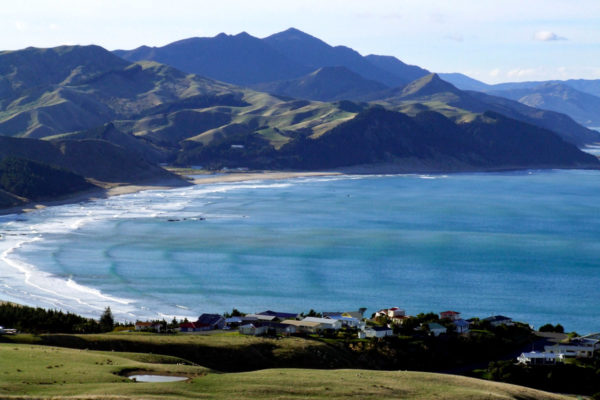
Drive to the end of the road, right into the bay, past the Castlepoint Store and public toilets. There are two ways to the top, we walked south along the lagoon edge and followed the track up through coastal grassland to meet the boundary track at the saddle.
Point 2: Deliverance Cove Track walk in Castlepoint - On the way up
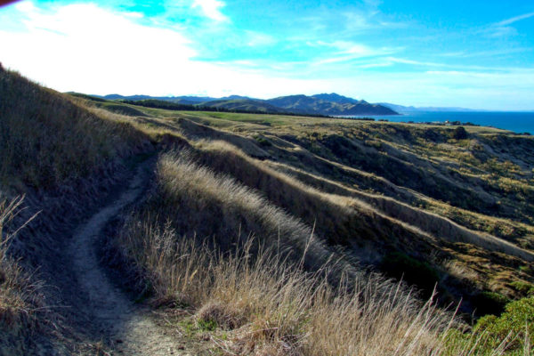
There is no playing around; the track goes straight up to the top. But you must thank the locals for building comfortable seats for you to rest your weary legs. At the top of the saddle, turn hard left. To the right will take you back to the car. From here the walk is more like a goat track. After a bit of rain, the track will be slippery underfoot. At the top of the first ridgeline, the track forks to the left and right. You don’t have to be a rocket scientist to work out which track to take.
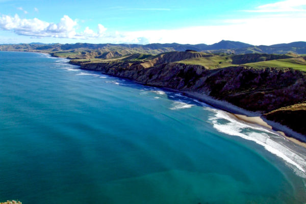
Point 3: Deliverance Cove Track walk in Castlepoint - At the top
Down in the bay, the weather might be warm and sunny, but at the top, it can be another story. The wind can be quite strong and a little cold. Don’t walk to close to the edge of the cliff face, it is a long way to the bottom. There are no safety rails or fences to hold on to. Keep the kids tied to you. At the top, (40 min) looking south on a fine day, you can see Riversdale Beach at 23k = 211° = 41°5’32.3″S, 176°4’15.9″E Looking north is Cape Turn again 57 Ks = 036°= 40°29’24.6″S, 176°37’10.3″E
Point 4: Deliverance Cove Track walk in Castlepoint - On the way back
On the way out, walk back to the saddle, then turn right and walk back the way you came, or take the track straight ahead and walk along the farmland. On this track, you will see the track you crawled up to reach the top of Castle Rock.
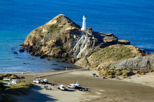
Point 5: Deliverance Cove Track walk in Castlepoint - Looking across to the lighthouse
Just before the built up area, you can look down onto Castle Point Lighthouse, a short walk you should look at before going home. Now follow the track around the built up area, then on to the beach. There is a shortcut just as you reach the built up area. The track cuts through an empty section (20m) and back on to a street that runs you down to the beach. This is a great opportunity to have a look at the beach baches in the area. ($500.000+) just for the view, no piped in water, only rain water – if it rains! The Castlepoint Store is only a few meters to the left when you walk out on to the main road.
