A 12 km loop from Raglan town out along the beach to Ngarunui, up to the clifftop, through Wainui Reserve, and back along the beach. Good views the whole way, a trig point, some interesting history along the route, and a proper half-day out. Route details courtesy of the Raglan Ramblers.
Quick Facts
| Distance | 12 km loop |
| Time | 3 hours |
| Difficulty | Easy |
| Start | Foot of Bow Street, Raglan |
| Parking | Raglan town centre |
| Dogs | Yes, on leash |
| Bikes | Yes |
| Wet Feet | Not at high tide |
| Elevation | 81 m |
| Toilets | At Rangipu and Ngarunui Beach |
| Mobile coverage | Yes |
| Cost | Free |
The Route
Start at the foot of Bow Street and follow the path left around the harbour. Cross the footbridge then turn right along the beach and continue about 5 km to the changing rooms at the foot of the cliff.
Take the sealed track up the hill to the surf club. Go up the steps to the right, cross a road, climb more steps to the 2002 sculptures, and follow the edge of the cliff to a car park. The sculptures represent the four compass points and were carved to provide work for unemployed people. Tai Meuli, who worked on them, has since become a well-known New Zealand stone carver.
Cross the stile and continue parallel with the coast. Follow the signs and stiles to the trig point at 81 m, with views towards Auckland on a clear day. Cross another stile into a pine forest and head down the hill to a sign on the left. Continue down, cross a valley, and keep to the top edge of the pine forest.
A gate on the left leads to a headland. Take the path right, down the hill to a stile. Don’t cross the stile, continue down the hill to reach the beach. Turn right and retrace the beach route back to Raglan.
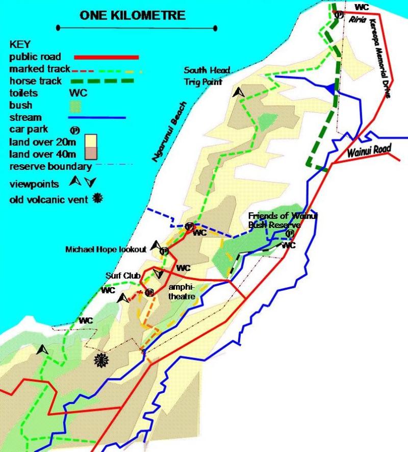
For a detailed map of Wainui Reserve tracks, click here.
Tide Warning
Don’t do this walk at high tide. The beach sections require low to mid tide to be passable. Check tide times before you go.
Photo gallery of the cliff to beach walk
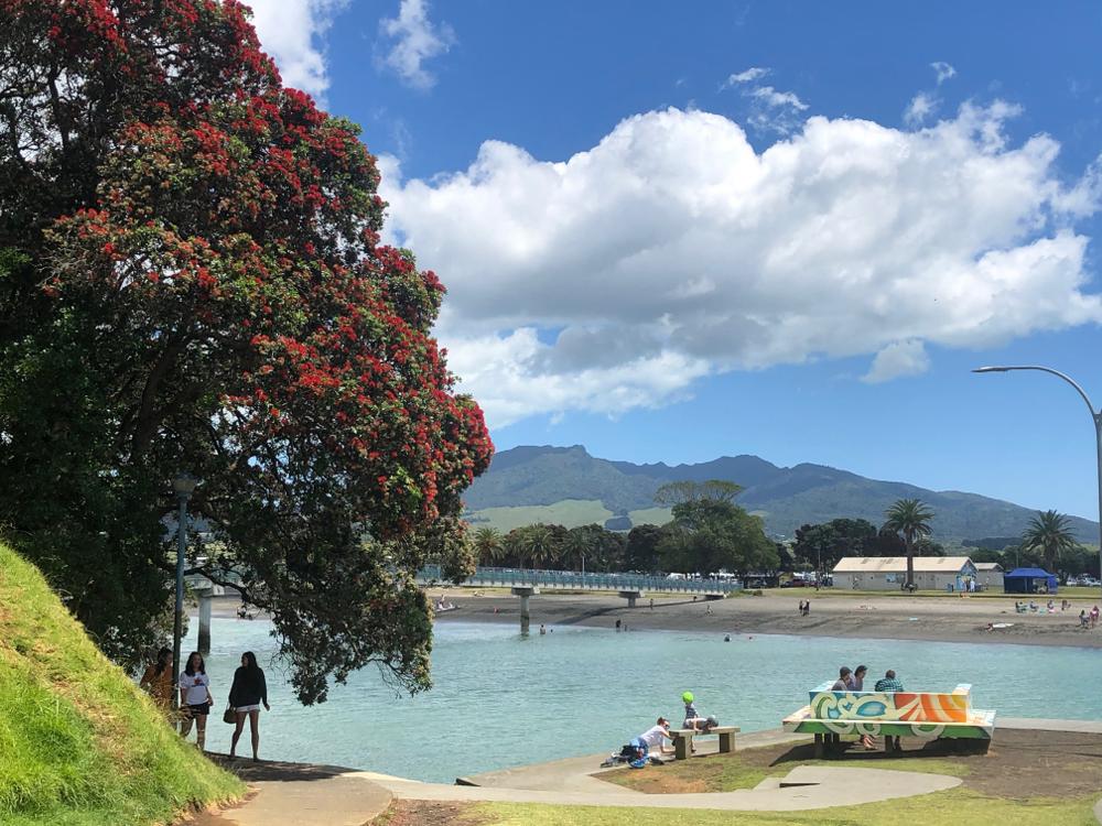
The start of the walk with 756m Mt Karioi in the background.
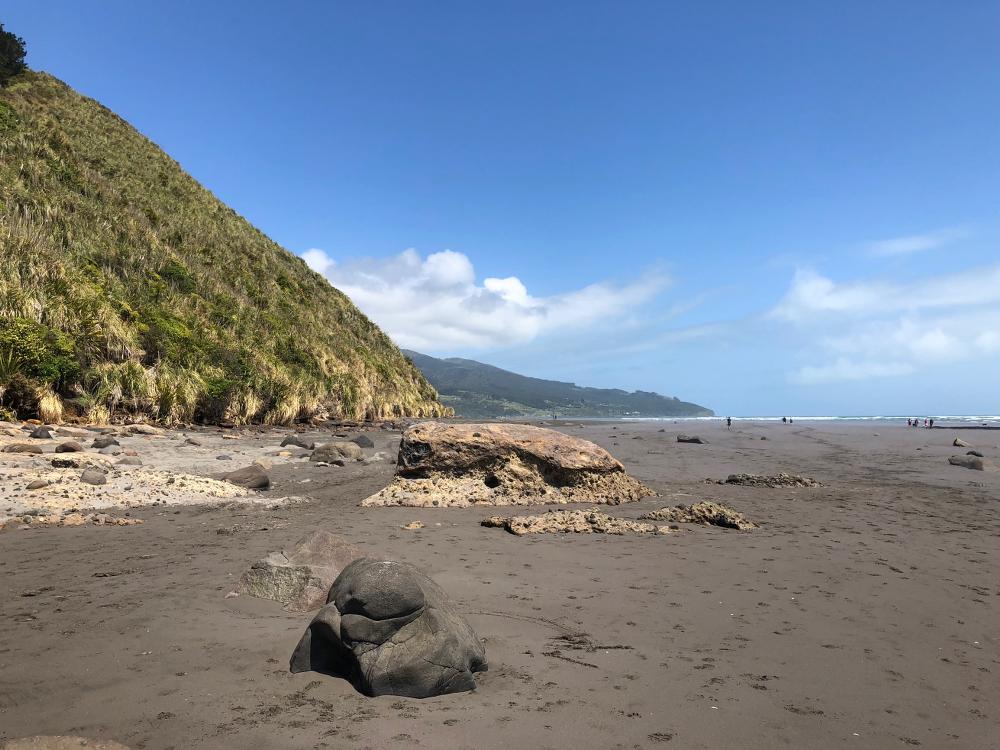
Elephant rock is sometimes hidden under the sand on the Cliff to Beach walk in Raglan
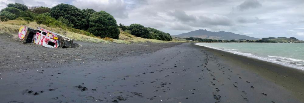
1942 pillbox Wainamu Beach and Karioi
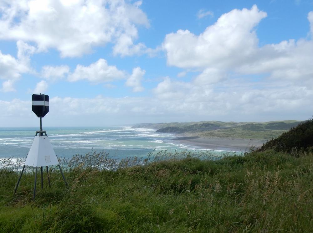
The 81m high trig point has views towards Auckland on the Cliff to Beach walk in Raglan
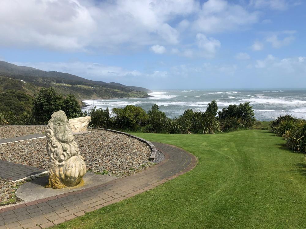
The 2002 sculptures on the Cliff to Beach walk
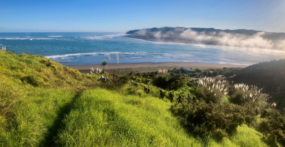
The track between the Reserve and the beach
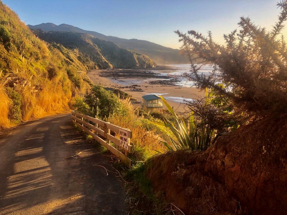
The track to the cliff top. Since this photo was taken the surf lookout has had to be removed before the sea took it
What You’ll See Along the Way
On the beach section keep an eye out for the Tattooed Rock about halfway along, and the 1942 Type 22 pillbox gradually sinking into the sand. A second pillbox further along is nearly hidden by sand. Both were built to protect gunners delaying a Japanese landing. The airfield further along was compulsorily purchased in 1941 and was at the centre of Maori land rights protests from the 1970s until part of it was returned in 1990.
The surf lookout that once sat on the clifftop has been removed before the sea took it.
A Bit of History
Whāingaroa existed long before a settler village was renamed Raglan in 1858. Some of the buildings on Bow Street date from the 1900s. The walkway to the footbridge was cut out of the cliff in 1915/16, and a footbridge replaced a ferry in 1929, replaced again in 1963 and 2011.
In 1883 it was expected Raglan would become a major port. The Reserve was set aside to house a Pilot Station to look out for ships and guide them in. Poor links to the rest of Waikato and a difficult sand bar stopped the port developing. The Reserve was sold for housing in 1990, but local protest and assistance from Councillor Michael Hope, whose name is on a lookout in the Reserve, caused 140 hectares to be repurchased as a recreation reserve. Road access through the Reserve opened in 1996.
The first tourists drowned in the dangerous rips in 1922. A Surf Lifeguard Patrol started in 1972 and moved to its current building in 2002.
Getting There by Bus
Bus 23 runs from Hamilton to Bow Street daily. In mid-summer and at weekends from Labour Day to Easter it continues to Manu Bay. You can shorten the walk by taking the Manu Bay bus to the Bible Camp and walking down to the beach from there, cutting the distance roughly in half. It’s also possible to boulder hop at low tide from Manu Bay, past the Tattooed Rock to the changing rooms and start the clifftop section from there.
Facilities
Drinking water is available at the start of the walk. Toilets at Rangipu and Ngarunui Beach. Plenty of cafés and restaurants in Raglan on Bow Street.
Other Walks Nearby
- Kaitoke Walkway — easy estuary walk right in Raglan town, good warm-up before or after
- Ngarunui Track — short bush track down to Ngarunui Beach from Wainui Road
- Wainui Reserve — bush walks and picnic area, connected to this route
- Raglan 3 Bridges Loop — flat town loop, good option if you want something easier
- Bridal Veil Falls — 15 minute drive south, easy to add on to the day
