| Walk Distance | Time | Difficulty | Dogs | Parking | Overnight |
|---|---|---|---|---|---|
| 3.2 km return | ~1 hour | Easy | Yes, on leash | Free | Self-contained only 3 nights max |
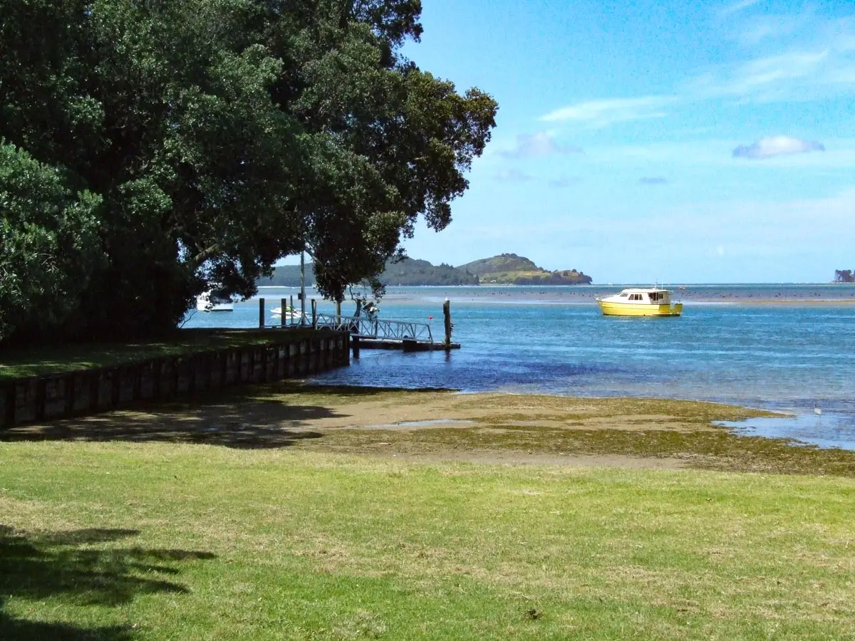
Tanners Point is a small settlement on a headland on the eastern side of Tauranga Harbour, about 2.1 km off State Highway 2 between Katikati and Waihi Beach. It sits right beside the Tuapiro Channel — the deep water channel that runs to the Katikati Entrance and out into the Bay of Plenty — which is what makes it such a popular spot for boaties and fishos.
The area takes its name from Thomas Tanner, a local farmer who arrived in New Zealand in 1875. It was originally known as Frazer’s Point. Today it’s a quiet residential enclave of about 200 people with a reserve, boat ramp, wharf, and a coastal walkway that loops around the pohutukawa-fringed headland.
Honest heads-up before you go: this is a harbour beach, not a surf beach. You’re looking at tidal mud flats and silt rather than sand, think more harbour estuary than Waihi Beach. The draw here is the boat ramp, the fishing off the jetty, and the coastal walk, not a swim. Come with the right expectations and it’s a lovely spot.
The Tanners Point boat ramp is one of the best-used ramps in the Western Bay of Plenty. It’s a concrete two-lane all-tide ramp, meaning you can launch at any time, which is a genuine advantage over the Beach Road ramp in Katikati itself, which is tidal.
The ramp sits right on the Tuapiro Channel, so you’ve got immediate deep-water access once you’re in the water. Popular with fishing boats, kayaks, and small pleasure craft. It does get very busy on summer weekends and public holidays, by late morning the carpark can be packed, and there can be a queue at the ramp. If you’re launching, come early.
The council has undertaken periodic dredging works to clear mud and silt buildup alongside the ramp. Worth checking the Western Bay of Plenty District Council website if you’re planning a trip and want to confirm no maintenance work is scheduled.
The small jetty at Tanners Point is one of the best spots for casual land-based fishing in the Katikati area, and it gets busy on Friday and Saturday nights with line fishers. Its position beside the Tuapiro Channel means the water is genuinely deep right off the end of the wharf, which is unusual for harbour fishing.
Snapper and kahawai are the main target species. You’ll also find gurnard further along the harbour. The jetty is usable at high tide, it’s relatively short so it’s not much use as a fishing platform when the tide is low and the harbour has dropped away.
Kayak fishing is also popular here. Launching from the boat ramp and paddling across to Matakana Island is a popular option, though be aware the current at the Katikati Entrance can be strong depending on tide state.
The coastal walkway is the other reason to visit, and it’s genuinely pleasant if you’re after a quiet leg-stretch. It’s about 1.6 km one way (3.2 km return, or about an hour) and follows the Tauranga Harbour coastline around the Tanners Point peninsula.
Starting point: The walk begins at Tanners Point Reserve at the end of the road, near the jetty.
The route: Head left from the carpark onto the pohutukawa-fringed track that follows the harbour’s edge. The track rises and falls, there are steps on the steeper sections, and passes through some recently planted native vegetation before eventually reaching a small sandy beach. There’s also a bench seat at the northern tip of the peninsula with views across to the Bowentown headland and, on a clear day, Tuahu/Mayor Island in the distance.
The track ends at a handwritten sign under an old pohutukawa, there’s no formal end. Turn around here and retrace your steps, or loop back via Moana Drive.
One section crosses private farmland — about 50 metres of open paddock near the highest point on the track where farm animals may be present. It’s clearly signposted.
Track surface: Mix of formed path, grass, and some rougher sections. Parts of the track are cut into the hillside and can be eroded in places. Wear proper footwear rather than jandals.
Dogs: Allowed on leash.
Views: Across Tauranga Harbour to Matakana Island, with Mauao/Mt Maunganui just visible in the distance. From the northern tip, you can see across to the Bowentown peninsula on the right and Mayor Island to the left on a clear day.
Let’s be real about this: Tanners Point is a tidal harbour beach, not a sandy swimming beach. At low tide you’re looking at silt and mud flats with thin patches of sea grass. At high tide it improves significantly — there’s a small sandy beach section that appears along the walkway route which is much more appealing when the water’s up.
It’s sheltered inside the harbour, which makes it good for kids paddling and launching small watercraft. Swimming is possible but this isn’t really a swimming destination. Save that for Waihi Beach, 15 minutes up the road.
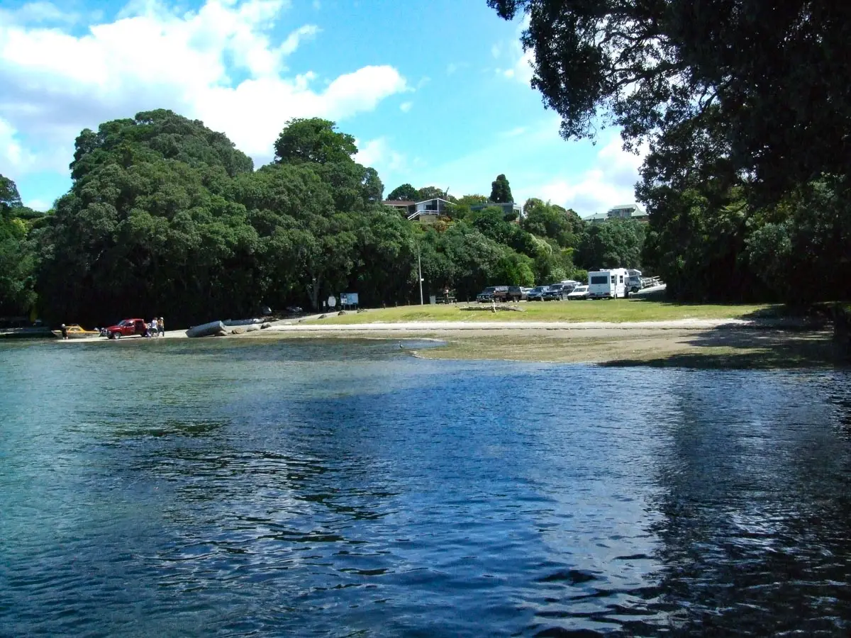
Tanners Point is a designated freedom camping site managed by Western Bay of Plenty District Council, and the carpark does allow overnight stays, but only for fully self-contained vehicles displaying a current self-containment certificate.
Important update: as of December 2024, the old blue self-containment sticker is no longer valid. You need the new green SCVS 2024 certification. Non-certified vehicles, tents, and cars are not permitted to stay overnight.
Maximum stay is three nights in any four-week consecutive period, counted from your first overnight. It’s first-come first-served with space for around four campervans. No booking system.
Facilities are basic: toilets at the reserve, no powered sites, no dump station. The council is also planning future changes to the nearby Tahawai Reserve which may affect the area — check the Western Bay of Plenty District Council freedom camping page for current rules before you go.
Tanners Point is not a destination walk — it’s a destination spot that also happens to have a walk. If you’re a boatie or a keen fisher, it’s excellent: a reliable all-tide ramp with immediate deep-water access and a wharf that actually produces fish. If you’re after a quiet coastal walk with good harbour views and old pohutukawa, the walkway is well worth an hour.
Don’t turn up expecting a beach. You’ll be disappointed. Turn up for the fishing, the boat ramp, or the peaceful harbour atmosphere — and the walk is a bonus on top.
If you do walk it, early morning on a weekday is the sweet spot. The light on the harbour at that time of day is lovely, and you’ll have the track to yourself.
