Quick Facts
| Detail | Info |
|---|---|
| Distance | 8.76 km return |
| Elevation Gain | ~330m |
| Time | 3 hrs 45 mins return walking (allow 4+ hours including breaks) |
| Difficulty | Moderate–Hard |
| Access | Boat only (dinghy landing at Kiwiriki Bay) |
| Dogs | No dogs or animals |
| Facilities | None |
| Track Surface | Mixed – overgrown near shore, then gravel and wooden steps |
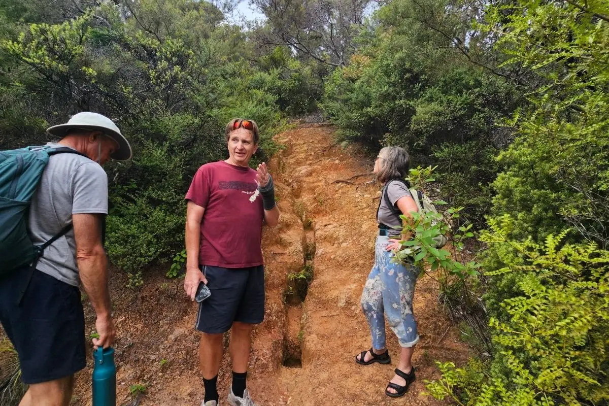
I did this walk yesterday (Feb 2026) with two friends, Steve and Susie, Steve organised the whole thing and brought us in on the dinghy. We had the track entirely to ourselves, which on a beautiful sunny day felt like a real privilege. It’s one of those walks that earns its views – you climb from sea level all the way up to 327m at Maungapiko, with some serious elevation to earn your seat at the top. And there is an actual seat waiting for you, which is a nice touch.
Getting There
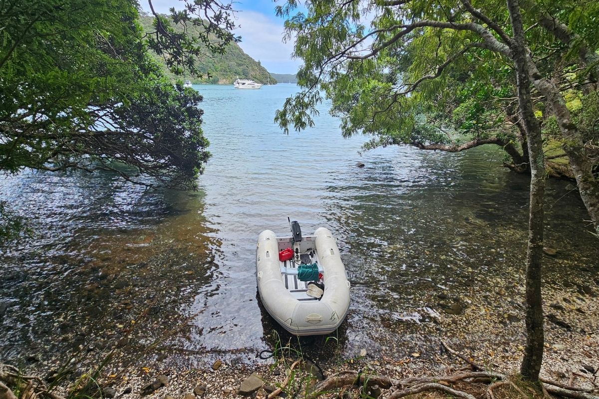
This is boat-access only. There’s no road to Kiwiriki Bay, so you’ll need your own vessel and a dinghy to get ashore. It’s a small bay on the east side of Great Barrier Island, roughly -36.205°, 175.357°.
Timing your arrival matters. Try to arrive close to high tide for a clean landing – at low tide you’ll be dragging the dinghy through a fair stretch of sticky mangrove mud, which nobody enjoys. We came in near high tide and it was easy.
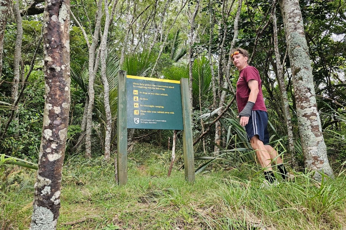
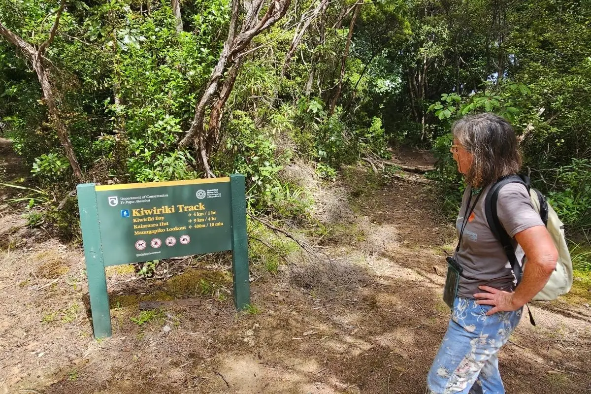
Finding the start is a bit of a mission. Look for the green DOC sign – but be warned, it’s partially overgrown and easy to miss. Have a careful look along the bush edge.
The Route – Step by Step
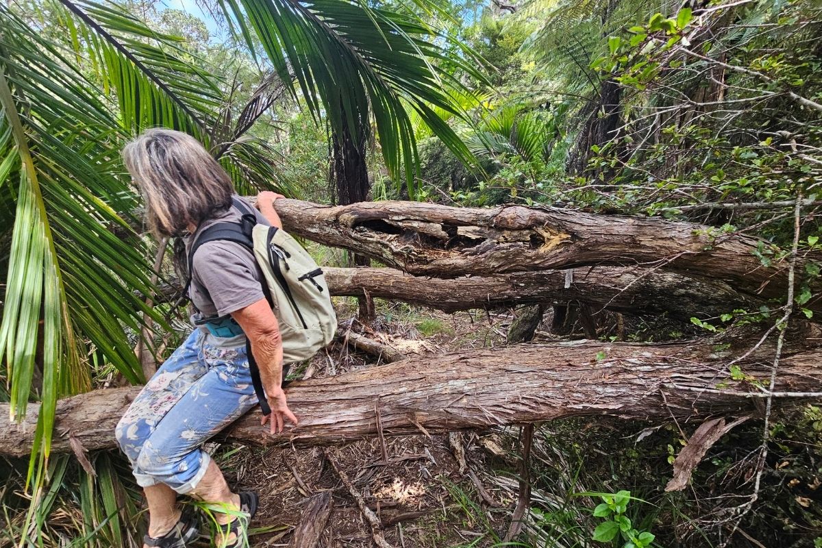
From the dinghy landing to the track junction (~1km)
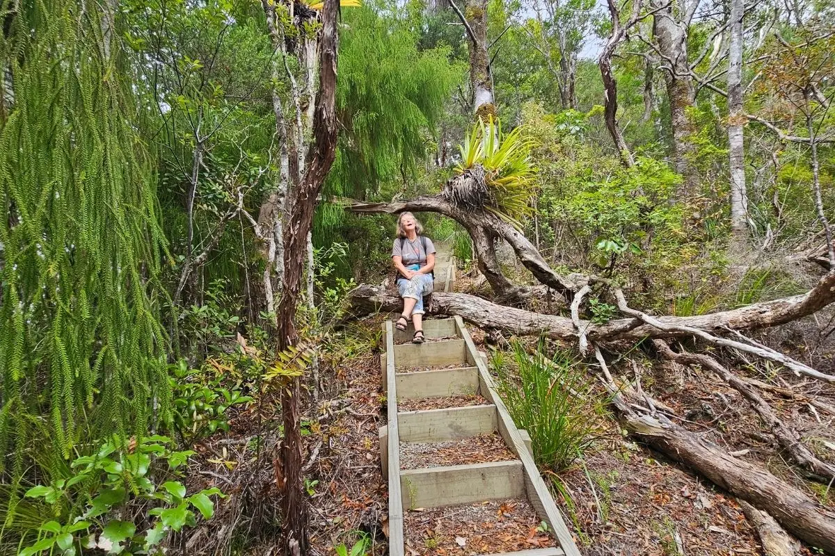
The first section from the landing to the point where the track splits is the roughest part of the whole walk. It’s a bit overgrown, and there are a couple of trees to clamber over. Take your time here. It’s not dangerous, just a bit scrappy.
At the junction, you have two options:
- Left fork – heads straight up to the Kiwiriki Bay lookout. A shorter option if that’s what you’re after (see the Kiwiriki Bay Lookout Walk).
- Right fork – this is your route for Maungapiko. Take this one.
Junction to the top (~3km)
Once you’re past the junction, the track quality improves noticeably. Nice wooden steps appear, the surface is good gravel, and the vegetation is well back. Someone’s put real effort into maintaining this section and it shows.
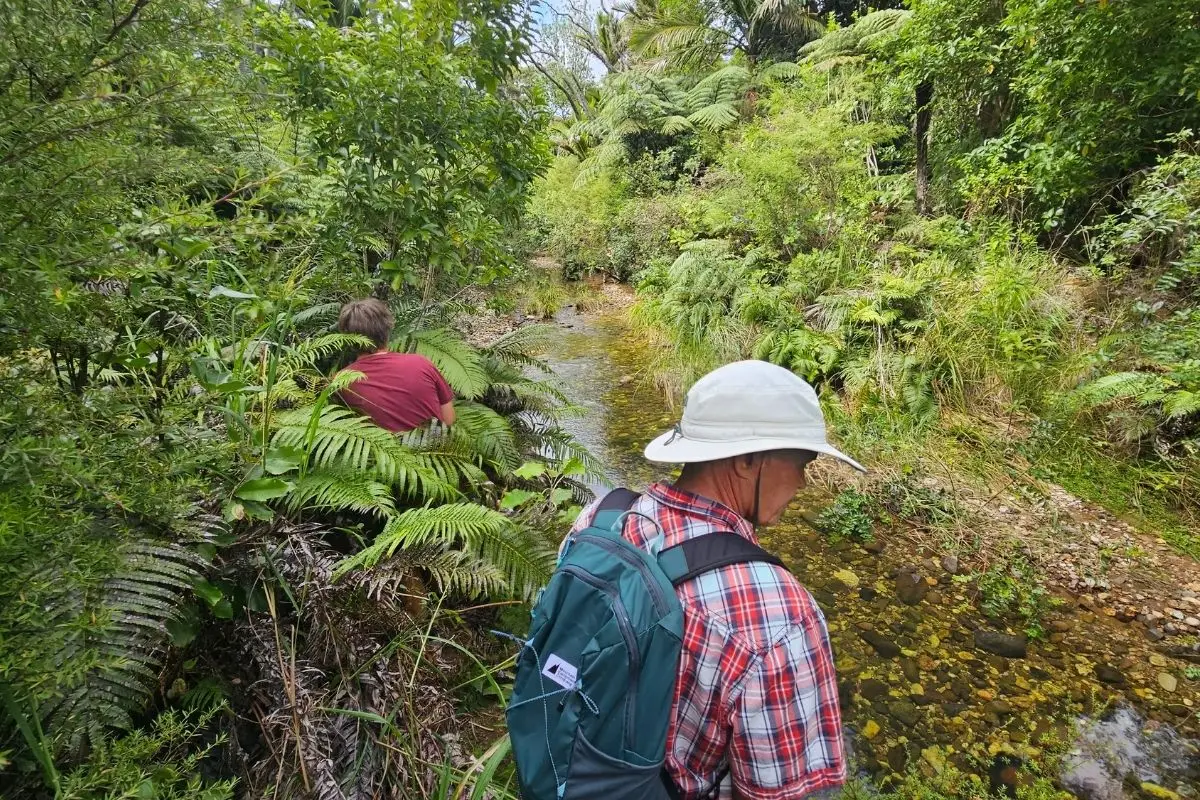
There’s one stream crossing before you start to climb. It’s small but you will get wet feet unless you take your shoes off – which is what we did. No big deal on a warm day.
About 10 minutes before the summit, you hit another junction where the track meets up with a 4WD road. The sign here points to Kaiaraara Hut – 9km, 4 hours – if you’re keen on a much longer day. We kept straight on for the lookout.
The summit
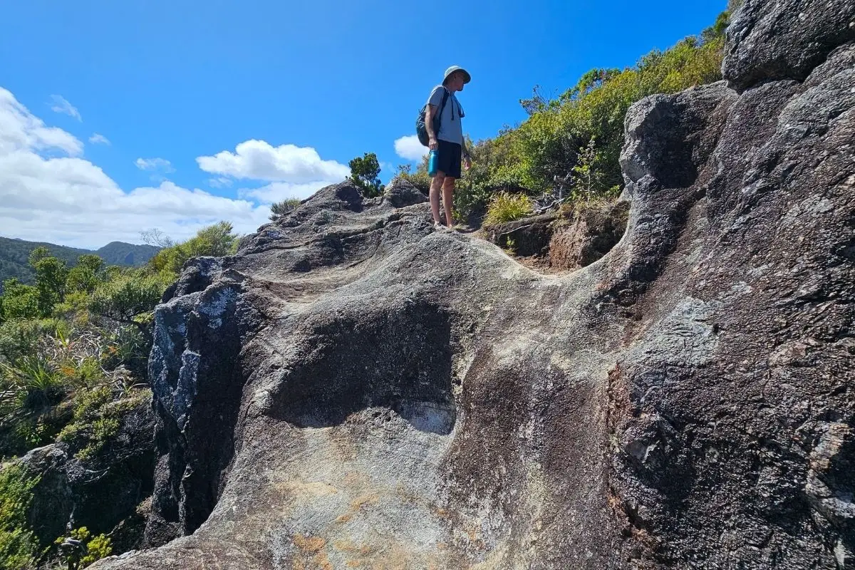
The last bit to the very top is a steep rocky section with no wooden stairs – you’re scrambling up bare rock. It’s not slippery even after rain, it’s solid rock, just steep. Take your time.
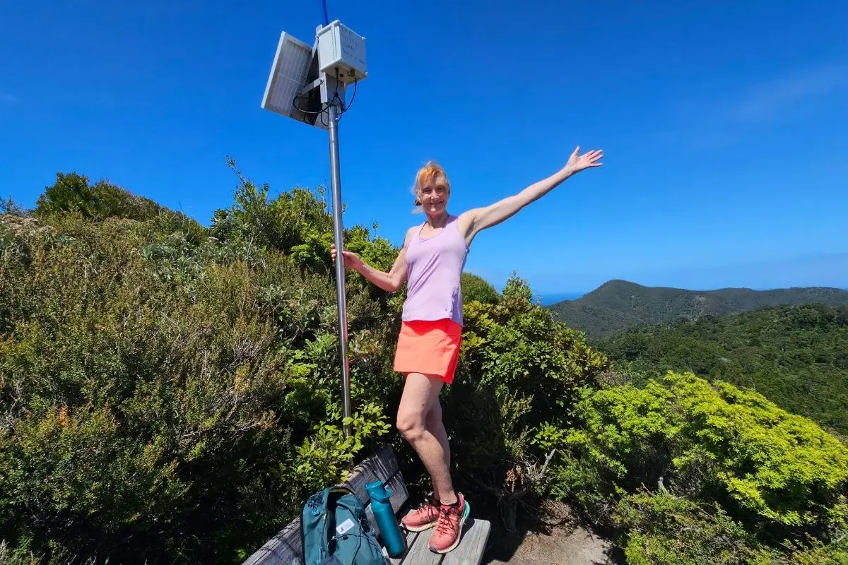
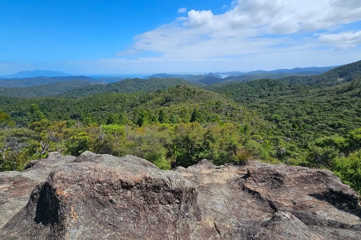
At the top there’s a solid wooden seat with 180° views across the island and out to sea. If you want the full 360°, squeeze through the bushes on the other side of the seat and you’ll get the other 180° view. Worth doing.
What You’ll See
The kauri trees on this track are beautiful. Combine that with nikau palms, fantails darting around your feet most of the way up, and we spotted a kererū (wood pigeon) sitting fatly in the canopy. The bush here is in good shape.
At the summit on a clear day you get sweeping views across Great Barrier – it’s the kind of view that makes the climb feel very much worth it.
A Word of Warning
Some parts of this track would be genuinely tough in wet conditions. The overgrown lower section gets muddy after rain. Don’t attempt this one after heavy rain unless you’re comfortable with those conditions.
Mobile coverage depends on your carrier. 2 Degrees works reasonably well on Great Barrier; Spark is hopeless but does work at the top. Download an offline map before you leave regardless.
Who It’s For
This suits walkers who are reasonably fit and comfortable with some elevation. The total climb is around 330m from sea level, which you feel. It’s not suitable for very young children given the rocky scramble at the top and the overgrown start. Fit teenagers would be fine.
The boat-access-only factor makes this a walk for people with their own vessel or who can join a boat trip from Port FitzRoy or Tryphena.
When to Go
A sunny, calm day is what this walk deserves – both for the summit views and for the dinghy landing. Time your arrival to near high tide to keep your feet dry getting ashore and getting back to the dinghy.
Summer and autumn are the ideal seasons. In winter the track will be wet and the rocks slippery.
My Honest Take
This is a cracking walk if you’ve got the access sorted. The views from Maungapiko are genuinely spectacular and the bush quality is excellent. The overgrown start and the low-tide mud are a bit of a faff, but they’re easily managed with the right timing.
I’d do it again next time we’re here. We like to come to Great Barrier every year now.
Other Walks Nearby on Great Barrier
- Kiwiriki Bay Lookout Walk – takes the left fork at the junction, shorter option
- Harataonga Loop Walk
- Whangapoua Lookouts Loop Walk
- Glenfern Loop Track
- Windy Canyon Lookout Walk
[← Back to Great Barrier Island Walks]
