- A loop between two of Auckland’s volcanoes, a small quarried cone and the large Orakei Basin crater
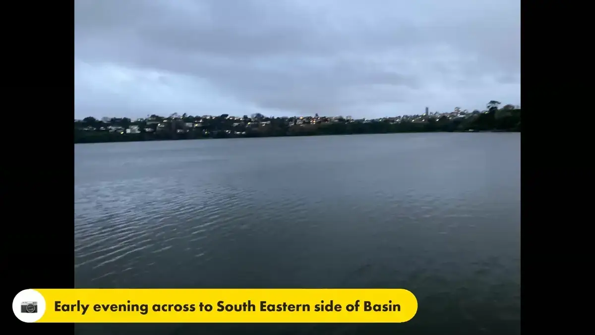
- Walk the boardwalk along the edge of Orakei Basin
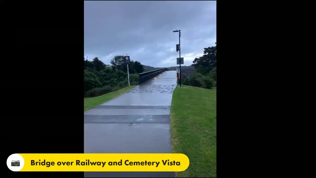
- Cross the bridge over the Eastern rail line for a wide view, then loop back the other way
- Pass the western end of historic Purewa Cemetery
- Easy access by bus or train, with the option to start or finish at Orakei or Meadowbank stations
Quick Facts
| Distance: | 7.1 km loop |
| Time: | About 2 hours |
| Difficulty: | Easy, with a few short hills |
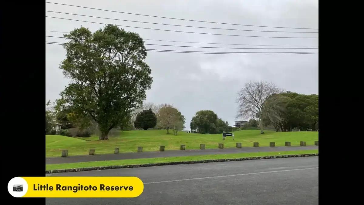
| Start point: | Little Rangitoto Reserve, Upland Road, Remuera |
| Parking: | On Upland Road beside the Reserve, and on Toto Street, the first left off Upland Road |
| Public transport: | Buses 755 and 781 to the Upland Road and Benson Road roundabout. Orakei and Meadowbank train stations both sit on the loop |
| Dogs: | Welcome. The grassy Basin edge is a popular dog exercise area. Check the Auckland Council website for current on lead and off lead rules |
| Toilets: | Meadowbank shopping centre, Orakei Village, and beside the Basin walkway |
| Refreshments: | Meadowbank shopping centre, Orakei Village, and two cafes at the Benson Road shops near the finish |
This loop links two of Auckland’s volcanoes. It begins on a small quarried cone under Little Rangitoto Reserve and finishes back there, with the much larger Orakei Basin crater about halfway round. In between it runs through the eastern streets of Remuera, drops down to the Tahapa East Reserve and the western edge of Purewa Cemetery, then follows the shared path beside the Eastern rail line and around the Basin on a boardwalk before climbing back to the start.
It is mostly easy walking on sealed paths, grass and footpaths, with a couple of short hills. Because it loops and tracks the rail line for part of the way, you can join or leave it at Orakei or Meadowbank stations, which is handy if you would rather not do the full circuit.
Walk route documented by Barry Stafford from Joy of Walking and Rotary Club of Maungakiekie.
Download the full walking map and step-by-step directions
The downloadable map includes:
- All 24 step-by-step walking directions
- The detailed route map
- Both route choices around the Basin at the finish
- Facility locations (toilets, parking, cafes)
- The full two-volcano history
- Transport options from Orakei and Meadowbank stations
Walk Highlights
- Two volcanoes: The start sits on a small cone that erupted about 30,000 years ago and was later quarried away. The Orakei Basin, about halfway round, is a much older explosion crater.
- Orakei Basin boardwalk: A section of the walk runs on wooden piles along the edge of the Basin, now used by water skiers, sea scouts and young mariners.
- The rail bridge view: A short bridge over the Eastern rail line gives a wide outlook, including the full extent of Purewa Cemetery, before you turn and head back.
- Purewa Cemetery: The path passes the western end of one of Auckland’s oldest and largest cemeteries, always well kept.
- City views: On the return towards Meadowbank and Orakei there are good long distance views of the city centre.
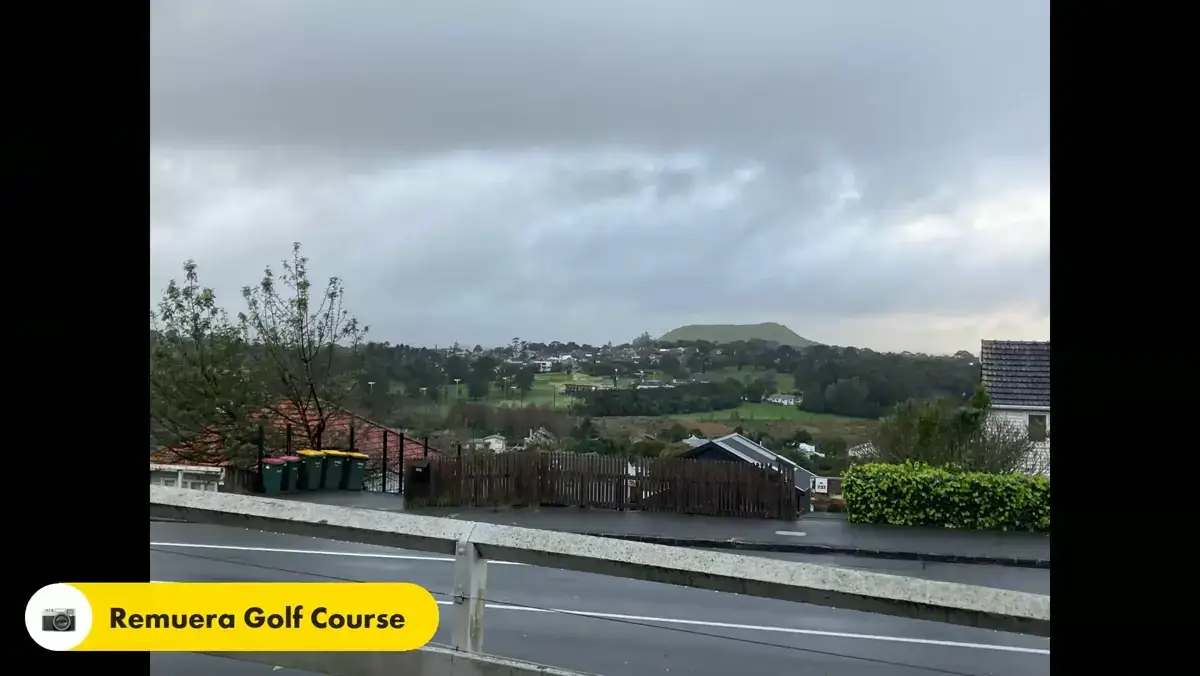
- Remuera Golf Course: From the high point on Remuera Road there is a view over the course, which borders the old bed of Lake Waiatarua, once a duck shooting spot.
Getting There
- By car: Little Rangitoto Reserve fronts Upland Road, on the right going down from Remuera Road, just after Ventnor Road. Park on Upland Road beside the Reserve, or on Toto Street, the first left off Upland Road.
- By bus: Buses 755 and 781 run through the Upland Road and Benson Road roundabout. Alight there and walk up Upland Road to the Reserve.
- By train: Because the walk loops along the Eastern rail line, you can also join it at Orakei or Meadowbank stations. See the downloadable map for where the loop meets each station.
The Two Volcanoes
The smaller volcano is under Little Rangitoto Reserve at the start. It was a 70 metre cone that erupted about 30,000 years ago and was farmed seasonally in pre European times. After Europeans arrived most of it was quarried away between the late 1800s and the 1950s. It was a rubbish dump for a while in the 1950s and 60s, then became a recreation reserve with a playground, skate park and flying fox.
The larger volcano is the Orakei Basin, an explosion crater that erupted about 85,000 years ago. Over more than 75,000 years the lake silted up with mud carried in by the Purewa Creek and became a freshwater swamp. Rising sea levels about 9,000 years ago turned it into a tidal basin, and by the time of human settlement it was intertidal sand flats.
In the mid 1920s the main trunk railway was built through the northern part of the crater, and the embankment across the flats turned the enclosed water into a shallow saltwater lake. Control gates under the railway are opened twice a month for part of the year to flush the Basin with fresh sea water. In 1929 a tunnel was built under Remuera Road to drain Lake Waiatarua into the Basin. The Basin is now home to Auckland Water Skiing, Orakei Sea Scouts and Akarana Young Mariners, and the grassy shore is a sheltered, sunny spot for dogs, walkers and the occasional model yacht.
Who It’s For
This is a good walk for anyone who likes an urban loop with a bit of history and some open water along the way. The mix of reserve, suburban streets, cemetery edge, rail line and Basin boardwalk makes for a varied route.
It is mostly easy going on good surfaces and suits families and most fitness levels, with a couple of short hills to manage. Dog walkers will find plenty of room on the grassy Basin edge.
When to Go
The walk works year round. The grassy areas around the Basin are sunny and sheltered, and the rail corridor is interesting at any time, with trains and works to watch. Weekdays are generally quieter than weekends. Rail activity will increase once the City Rail Link underground section opens later in 2026.
Important Stuff
- Surfaces: Sealed paths, grass and footpaths throughout. Comfortable walking shoes are fine. The Choice 1 exit near the end climbs quite steeply.
- The rail bridge: The bridge crosses the live Eastern line. Stay on the path and keep children close.
- Two finishes: Near the Basin road entrance the route gives you two choices for the last stretch back to Upland Road. Both are in the downloadable map.
- Unstable slopes: The steep ash slopes on the north eastern side of the Basin are prone to slumping in wet weather, which is why they are kept in bush and pasture.
My Honest Take
This is an easy half day loop that packs in more than you would expect from a walk through the suburbs. The two volcanoes bookend it nicely, and the stretch along the rail line and around the Basin boardwalk is the part that lifts it above an ordinary street walk.
It is not a wilderness walk, and some of it is on footpaths between houses, but the views from the rail bridge and back over the Basin make it worth the effort. Being able to bail out at Orakei or Meadowbank station is a real bonus if you run short of time.
Download the full walking map and step-by-step directions
Other Walks Nearby
- Orakei Basin Loop Path
- Remuera Hobson Bay Walkway
- Waiatarua Reserve
- Kepa Bush
- Mission Bay to Okahu Bay Loop
Back to East Auckland walks | Back to all Auckland walks
Walk route documented by Barry Stafford
